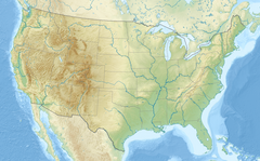
Sleepy Creek is a 44.0-mile-long (70.8 km)[2] tributary of the Potomac River in the United States, belonging to the Chesapeake Bay's watershed. The stream rises in Frederick County, Virginia, and flows through Morgan County, West Virginia before joining the Potomac near the community of Sleepy Creek.
| Sleepy Creek | |
|---|---|
| Location | |
| Country | United States |
| State | Virginia, West Virginia |
| Counties | Frederick, Morgan |
| Physical characteristics | |
| Source | |
| • location | Near Whitacre, Frederick County, Virginia |
| • coordinates | 39°21′17″N 78°20′39″W / 39.35472°N 78.34417°W[1] |
| Mouth | Potomac River |
• location | Sleepy Creek, Morgan County, West Virginia |
• coordinates | 39°40′14″N 78°05′04″W / 39.67056°N 78.08444°W[1] |
| Length | 44 mi (71 km) |
While Sleepy Creek Lake is a part of the Sleepy Creek watershed, it is an impoundment of its tributary, Meadow Branch, in Berkeley County, West Virginia and not of Sleepy Creek itself.
Course
editSleepy Creek's source lies north of State Route 127 in Frederick County, Virginia, near the Hampshire County, West Virginia border at Good. From Frederick County, Sleepy Creek flows north through Morgan County, West Virginia, where it drains into the Potomac at the community of Sleepy Creek on the old Baltimore and Ohio Railroad's mainline.
Tributaries
editTributary streams listed from south (source) to north (mouth).
- Bear Garden Run
- Hands Run
- Breakneck Run
- Indian Run
- South Fork Indian Run
- Middle Fork Indian Run
- North Fork Indian Run
- Rock Gap Run
- Middle Fork Sleepy Creek
- Iden Run
- South Fork Sleepy Creek
- Merchant Run
- Mountain Run
- Yellow Spring Run
- Meadow Branch
Bridges
edit| Bridge | Route | Location |
|---|---|---|
| CR 38/10 Bridge | Fish Hatchery Road (CR 38/10) | Ridge |
| Oakland Road Bridge | Oakland Road (CR 28) | Oakland |
| CR 13 Bridge | Winchester Grade Road (CR 13) | Smith Crossroads |
| Smith Crossroads Bridge | Spriggs Road (CR 13/1) | Smith Crossroads |
| Johnson's Mill Bridge | Johnson's Mill Road (CR 26) | Johnsons Mill |
| CR 8 Bridge | Highland Ridge Road (CR 8) | Johnsons Mill |
| WV 9 Sleepy Creek Bridge | Martinsburg Road (WV 9) | Spohrs Crossroads |
| Restricted Height Bridge | Burnt Mill Road (CR 1/3) | Spohrs Crossroads |
| River Road Bridge | River Road (CR 1) | Sleepy Creek |
| Sleepy Creek Railroad Bridge | Baltimore and Ohio Railroad | Sleepy Creek |
Cities and towns along Sleepy Creek
editSee also
editReferences
edit- ^ a b "Sleepy Creek". Geographic Names Information System. United States Geological Survey, United States Department of the Interior. Retrieved August 7, 2016.
- ^ U.S. Geological Survey. National Hydrography Dataset high-resolution flowline data. The National Map, accessed August 15, 2011

