This article needs additional citations for verification. (November 2011) |
Ludborough is a village and civil parish in the East Lindsey district of Lincolnshire, England. It is situated approximately 5 miles (8 km) north from Louth, and at the eastern end of the A18 road. Ludborough has a population of 191 people. The Prime Meridian passes to the east of the village.
| Ludborough | |
|---|---|
 St Mary’s Church, Ludborough | |
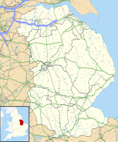
Location within Lincolnshire | |
| Population | 191 (2011)[1] |
| OS grid reference | TF296955 |
| • London | 135 mi (217 km) S |
| District | |
| Shire county | |
| Region | |
| Country | England |
| Sovereign state | United Kingdom |
| Post town | GRIMSBY |
| Postcode district | DN36 |
| Police | Lincolnshire |
| Fire | Lincolnshire |
| Ambulance | East Midlands |
History
editEvidence of Neolithic activity in the area was confirmed by a find, in the 1970s, of a stone axe believed to be of the Langdale type.[2] Aerial photographs in 2010 led to the identification of a rectangular enclosure dating to the Iron Age or Roman period from cropmarks.[3]
In A Dictionary of British Place Names, A.D. Mills interprets Ludborough's name to mean a 'fortified place' that may be associated in some way with the Lincolnshire town of Louth.[4]
In the Domesday Book of 1086, Ludborough had 38 freeman and was considered 'very large'.[5] Before the Norman Conquest, lordship was held by Thorgot Lag, and afterwards by Berengar of Tosny, with Robert of Tosny as tenant-in-chief and the head of the manor at Binbrook.[5]
On 4 May 1297, King Henry III granted the manor holders, Richard de Breuse and his wife Alic, the right to hold a market in the village.[6]
The parish church, dedicated to St Mary, retains elements from the 13th to the 15th century but was substantially renovated by James Fowler in 1858.[7] Following the lengthy closure for renovation the church was re-opened on 1 May 1860.[8]
In 1821, the parish had a population of 281, and had 45 homes. Around this time, part of the south aisle of St Mary's Church was used as a school.[9]
Geography
editWork started on the bypass on 3 February 1992, by Shepherd Hill of Chesterfield, the same day as the A16 Stickford bypass. It cost £1.2m, and was 1.4 miles, and took 11 months to construct.[10] The bypass opened on Sunday 25 October 1992, also the same day as Stickford.[11]
Community
editLudborough is noted for its railway station, the base for the heritage Lincolnshire Wolds Railway.
References
edit- ^ "Parish population 2011". Neighbourhood Statistics. Office for National Statistics. Retrieved 21 August 2015.
- ^ Historic England. "Monument No.893174 (893174)". Research records (formerly PastScape). Retrieved 16 November 2014.
- ^ Historic England. "Monument No.1581431 (1581431)". Research records (formerly PastScape). Retrieved 16 November 2014.
- ^ Mills, A.D. (2011). "Ludborough". A Dictionary of British Place Names. Oxford University Press. ISBN 978-0-19-960908-6. Retrieved 16 November 2014.
- ^ a b Ludborough in the Domesday Book
- ^ "Gazetteer of Market Towns in Lincolnshire". The Centre for Metropolitan History. Institute of Historical Research, University of London. 18 June 2003. Retrieved 16 November 2014.
- ^ Historic England. "St. Mary's Church (353241)". Research records (formerly PastScape). Retrieved 16 November 2014.
- ^ "Restoration and re-opening of Ludborough church". Louth and North Lincolnshire Advertiser. 5 May 1860. Retrieved 16 November 2014 – via British Newspaper Archive.
- ^ History of the County of Lincoln: From the Earliest Period to the Present Time. J. Saunders. 1834. p. 203.
- ^ Grimsby Evening Telegraph Tuesday 21 January 1992, page 3
- ^ Grimsby Evening Telegraph Saturday 24 October 1992, page 18
External links
edit- Media related to Ludborough at Wikimedia Commons
