This article needs additional citations for verification. (October 2024) |
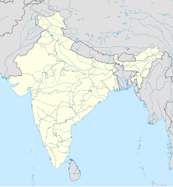
Sri Karanpur is a town and a municipality, just 55 km from Sri Ganganagar city in Sri Ganganagar district in the Indian state of Rajasthan.
Karanpur
Sri Karanpur | |
|---|---|
Town | |
| Coordinates: 29°50′29″N 73°27′17″E / 29.8414°N 73.4547°E | |
| Country | |
| State | Rajasthan |
| District | Sri Ganganagar |
| Elevation | 185 m (607 ft) |
| Population (2001) | |
| • Total | 20,694 |
| Languages | |
| • Official | Hindi, Rajasthani, Punjabi |
| Time zone | UTC+5:30 (IST) |
| PIN | 335073 |
Geography
editSri Karanpur is located at 29°50′29″N 73°27′17″E / 29.8414°N 73.4547°E.[1] It has an average elevation of 185 metres (606 feet).
Demographics
editAs of the 2001 Census of India[update],[2] Sri Karanpur had a population of 20,694. Males constitute 53% of the population and females constitute 47%. Karanpur has an average literacy rate of 64%, higher than the national average of 59.5%: male literacy is 71%, and female literacy is 56%. In Karanpur, 14% of the population is under 6 years of age. Major languages spoken there are Rajasthani and Bagri.[citation needed]
Economy
editSri Karanpur once produced high quality cotton in India and attracted Birlas to set up a mill which still exists today in the town.[citation needed] However, after 1995 people shifted to other cash crops. Today, the primary cash crop of the area is kinnow, which is exported to West Asia.[citation needed]
Sri Karanpur, also known as Mandi Karanpur, is famous for dealing various crops such as cotton, barley and wheat. The old Mandi is now a Bazaar for cloths, Bus Transporters, jewelers, restaurants, Retail plus Wholesale Medical Stores, Pharmaceutical Medicine Company and Sweet shops.[citation needed]
References
edit- ^ Falling Rain Genomics, Inc - Karanpur
- ^ "Census of India 2001: Data from the 2001 Census, including cities, villages and towns (Provisional)". Census Commission of India. Archived from the original on 16 June 2004. Retrieved 1 November 2008.

