Iselin (/ˈɪzˈlɪn/[9]) is an unincorporated community and census-designated place (CDP)[10] located within Woodbridge Township, in Middlesex County, in the U.S. state of New Jersey.[11][12][13] As of the 2020 United States census, Iselin's population was 20,088,[3] up from 18,695 in 2010.[14]
Iselin, New Jersey | |
|---|---|
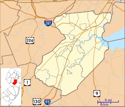
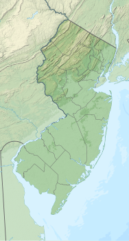
 Location of Iselin in Middlesex County highlighted in red (left). Inset map: Location of Middlesex County in New Jersey highlighted in orange (right). | |
| Coordinates: 40°34′09″N 74°19′16″W / 40.569295°N 74.321106°W | |
| Country | |
| State | |
| County | Middlesex |
| Township | Woodbridge |
| Named for | Adrian Iselin |
| Area | |
| • Total | 3.15 sq mi (8.17 km2) |
| • Land | 3.15 sq mi (8.16 km2) |
| • Water | 0.00 sq mi (0.00 km2) 0.03% |
| Elevation | 30 ft (9 m) |
| Population | |
| • Total | 20,088 |
| • Density | 6,373.1/sq mi (2,460.7/km2) |
| Time zone | UTC−05:00 (Eastern (EST)) |
| • Summer (DST) | UTC−04:00 (Eastern (EDT)) |
| ZIP Code | 08830[4] |
| Area code(s) | 732/848 |
| FIPS code | 34-34470[5][6][7] |
| GNIS feature ID | 2389973[5][8] |
Previously known as "Perrytown" and "Unionville", Iselin received its current name after New York City investment banker and philanthropist Adrian Iselin, who established a finishing school in the 1870s for girls from wealthy New York families there.[15] Iselin additionally subsidized the erection of a new train station, which was later replaced by a newer station to the south known as Metropark.[16][17]
Geography
editIselin is in northeastern Middlesex County, in the northwest part of Woodbridge Township. It is bordered by the Woodbridge communities of Colonia to the north, Avenel to the northeast, Woodbridge to the southeast, and Menlo Park Terrace to the south, while to the west it is bordered by Edison Township. It is 9 miles (14 km) northeast of New Brunswick, the Middlesex county seat, and 14 miles (23 km) southwest of Newark.
According to the U.S. Census Bureau, Iselin has a total area of 3.13 square miles (8.1 km2), including 0.001 square miles (0.0026 km2) of water (0.03%).[1] It is drained to the northeast by the South Branch of the Rahway River
Downtown area
editIselin's downtown is centered on Little India (also known as "Oak Tree Road"), bound by the Garden State Parkway to the west and Route 27 (Lincoln Highway) to the southeast. Once home to a wide array of shops, eateries, services, and complemented by a single-screen 1920s movie palace, the area was in obvious decline in the 1980s. An influx of Asian Indian immigration beginning in the early 1990s led to the area's revitalization. Formerly vacant stores were tenanted, and additional retail spaces built as the area became known for its high quality Indian food, sweets, clothing (particularly saris), jewelry, music, and other goods.
Metropark
editAn area known as Metropark, consisting primarily of office parks and large office buildings, lies in the southwestern corner of Iselin and spills over into neighboring Edison. NJ Transit and Amtrak's Metropark station is named for this area.
In addition to a Hilton Hotel (now known as "Hotel Woodbridge at Metropark") and the train station, Metropark features the headquarters of Ansell Limited, Engelhard (acquired by BASF in 2006) and Eaton Corporation's Filtration Division. Other corporate residents in the area include Siemens,[18] Tata Consultancy Services, Mott MacDonald,[19] Ernst & Young, Mizuho, Wells Fargo, JPMorgan Chase, Accenture, Level 3 Communications, BT Group, UBS, Elevance Health, and TIAA.
Demographics
edit| Census | Pop. | Note | %± |
|---|---|---|---|
| 1990 | 16,141 | — | |
| 2000 | 16,698 | 3.5% | |
| 2010 | 18,695 | 12.0% | |
| 2020 | 20,088 | 7.5% | |
| Population sources: 1990-2010[11] 2000[20] 2010[14] 2020[3] | |||
2010 census
editThe 2010 United States census counted 18,695 people, 6,445 households, and 4,892 families in the CDP. The population density was 5,861.5 people per square mile (2,263.1 people/km2). There were 6,718 housing units at an average density of 2,106.3 units per square mile (813.2 units/km2). The racial makeup was 41.47% (7,753) White, 6.72% (1,257) Black or African American, 0.33% (62) Native American, 46.12% (8,623) Asian, 0.00% (0) Pacific Islander, 2.26% (423) from other races, and 3.09% (577) from two or more races. Hispanic or Latino of any race were 7.12% (1,332) of the population.[14]
Of the 6,445 households, 33.2% had children under the age of 18; 62.4% were married couples living together; 9.4% had a female householder with no husband present and 24.1% were non-families. Of all households, 20.7% were made up of individuals and 10.1% had someone living alone who was 65 years of age or older. The average household size was 2.90 and the average family size was 3.39.[14]
21.0% of the population were under the age of 18, 8.0% from 18 to 24, 29.3% from 25 to 44, 27.7% from 45 to 64, and 14.0% who were 65 years of age or older. The median age was 38.5 years. For every 100 females, the population had 95.7 males. For every 100 females ages 18 and older there were 94.8 males.[14]
2000 census
editAs of the 2000 United States census[6] there were 16,698 people, 6,007 households, and 4,511 families residing in the CDP. The population density was 2,059.8 people/km2 (5,335 people/sq mi). There were 6,137 housing units at an average density of 757.0 units/km2 (1,961 units/sq mi). The racial makeup of the CDP was 64.65% White, 6.02% African American, 0.12% Native American, 25.16% Asian, 0.01% Pacific Islander, 1.75% from other races, and 2.28% from two or more races. Hispanic or Latino of any race were 5.47% of the population.[20]
There were 6,007 households, out of which 32.0% had children under the age of 18 living with them, 61.5% were married couples living together, 9.8% had a female householder with no husband present, and 24.9% were non-families. 20.8% of all households were made up of individuals, and 8.6% had someone living alone who was 65 years of age or older. The average household size was 2.78 and the average family size was 3.24.[20]
In the CDP the population was spread out, with 21.8% under the age of 18, 7.6% from 18 to 24, 33.9% from 25 to 44, 22.7% from 45 to 64, and 14.0% who were 65 years of age or older. The median age was 37 years. For every 100 females, there were 96.8 males. For every 100 females age 18 and over, there were 95.1 males.[20]
The median income for a household in the CDP was $65,424, and the median income for a family was $71,913. Males had a median income of $50,145 versus $36,131 for females. The per capita income for the CDP was $26,793. About 1.9% of families and 3.2% of the population were below the poverty line, including 2.8% of those under age 18 and 4.9% of those age 65 or over.[20]
South Asian community
editIselin hosts one of the region's main centers of Indian American cultural diversity.[21] The growing Little India is a South Asian-focused commercial strip in Middlesex County, the U.S. county with the highest concentration of Indian Americans.[22][23][24] The Oak Tree Road strip runs for about one-and-a-half miles through Iselin and neighboring Edison Township, near the area's sprawling Chinatown and Koreatown, running along New Jersey Route 27.[25] The zone is the largest and most diverse South Asian cultural hub in the United States.[26][27] In Middlesex County, election ballots are printed in English, Spanish, Gujarati, Hindi, and Punjabi.[28] According to the 2017 American Community Survey, 42.6% of Iselin residents identified themselves as being Indian American, the highest percentage for any census-designated place in the United States.[29]
Education
editIselin public school students attend the schools of the Woodbridge Township School District. Indiana Avenue School #18,[30] Kennedy Park School #24,[31] Robert Mascenik School #26,[32] and Oak Tree Road School #29[33] are located in Iselin as well as Iselin Middle School[34] and John F. Kennedy Memorial High School.
When it opened in 2018, Oak Tree Road School #29 was the first new public school in Woodbridge in nearly 50 years, although the building was formerly occupied by the St. Cecelia's Church parish school[35] (affiliated with the Roman Catholic Diocese of Metuchen).[36]
Notable people
editPeople who were born in, residents of, or otherwise closely associated with Iselin include:
- Tom DeSanto (born 1968), film producer and screenwriter best known for his work with long-time friend Bryan Singer, especially with his contributions to the first two X-Men movies[37]
- Robbie E (born 1983), professional wrestler with Impact Wrestling on POP TV[38]
- Chris Smith (born 1953), U.S. representative for New Jersey's 4th congressional district since 1981[39]
- James Swann (born 1964), serial killer whose random drive-by shotgun shootings in Washington, D.C. in 1993 earned him the nickname "The Shotgun Stalker" in the press[40]
See also
editReferences
edit- ^ a b "2023 U.S. Gazetteer Files: New Jersey". United States Census Bureau. Retrieved July 30, 2024.
- ^ U.S. Geological Survey Geographic Names Information System: Iselin Census Designated Place, Geographic Names Information System. Accessed June 23, 2012.
- ^ a b c QuickFacts Iselin CDP, New Jersey, United States Census Bureau. Accessed June 20, 2023.
- ^ Look Up a ZIP Code for Iselin, NJ, United States Postal Service. Accessed April 25, 2012.
- ^ a b Gazetteer of New Jersey Places, United States Census Bureau. Accessed July 21, 2016.
- ^ a b U.S. Census website, United States Census Bureau. Accessed September 4, 2014.
- ^ Geographic codes for New Jersey, Missouri Census Data Center. Accessed June 9, 2023.
- ^ US Board on Geographic Names, United States Geological Survey. Accessed September 4, 2014.
- ^ Melisurgo, Len. "Here's the right way to pronounce 25 N.J. town names everyone botches", NJ Advance Media for NJ.com, June 23, 2017. Accessed June 22, 2023. "Iselin (Middlesex County) Some outsiders think it's ICE-lin, but this section of Woodbridge Township is actually pronounced IZ-lin, with the 'iz' sounding like 'is.'"
- ^ State of New Jersey Census Designated Places - BVP20 - Data as of January 1, 2020, United States Census Bureau. Accessed December 1, 2022.
- ^ a b New Jersey: 2010 - Population and Housing Unit Counts - 2010 Census of Population and Housing (CPH-2-32), United States Census Bureau, August 2012. Accessed November 30, 2012.
- ^ GCT-PH1 - Population, Housing Units, Area, and Density: 2010 - County – County Subdivision and Place from the 2010 Census Summary File 1 for Middlesex County, New Jersey Archived 2020-02-12 at archive.today, United States Census Bureau. Accessed November 30, 2012.
- ^ Locality Search, State of New Jersey. Accessed April 18, 2015.
- ^ a b c d e DP-1 - Profile of General Population and Housing Characteristics: 2010 Demographic Profile Data for Iselin CDP, New Jersey Archived 2020-02-12 at archive.today, United States Census Bureau. Accessed November 30, 2012.
- ^ Lawlor, Julia (April 21, 2002). "If You're Thinking of Living In/Iselin, N.J.; Curry and Saris Spice a 'Typical' Suburb". The New York Times. ISSN 0362-4331. Retrieved February 26, 2019.
- ^ Lurie, Maxine N., and Mappen, Marc. "Iselin", p. 414. Encyclopedia of New Jersey, Rutgers University Press, 2004. ISBN 9780813533254. Accessed July 21, 2016.
- ^ Virginia Bergen Troeger, Robert J. McEwen (2002). Woodbridge: New Jersey's Oldest Township, p. 113
- ^ Garbarine, Rachelle. "Commercial Property/New Jersey; Siemens Plans $120 Million Redevelopment in Iselin", The New York Times, July 8, 2001. Accessed June 23, 2012.
- ^ "Mott MacDonald North America/New Jersey; Mott MacDonald North America",Mott MacDonald, January 9, 2019. Accessed Jan 9, 2019.
- ^ a b c d e DP-1 - Profile of General Demographic Characteristics: 2000 from the Census 2000 Summary File 1 (SF 1) 100-Percent Data for Iselin CDP, New Jersey Archived 2020-02-12 at archive.today, United States Census Bureau. Accessed November 30, 2012.
- ^ Andrew Jacobs. "The Census – A Region of Enclaves: Edison, N.J.; Amid Strip Malls, Indian Expansion", The New York Times, June 18, 2001. Accessed March 22, 2012. "Although Indians have settled in every part of the state, they have had a remarkable impact on Edison, a 32-square-mile township. The Asian population of Edison, most of it Indian, has grown to 29,000 from 2,200 in 1980. The adjacent hamlet of Iselin, part of Woodbridge Township, has had an even greater increase in its Asian population."
- ^ Genovese, Peter (November 16, 2012). "Big business in Little India: Commerce flourishes in vibrant ethnic neighborhood". nj.com.
- ^ "Eat Street: Oak Tree Road, Iselin, N.J." SAVEUR. March 31, 2011.
- ^ Joseph Berger (April 27, 2008). "A Place Where Indians, Now New Jerseyans, Thrive". The New York Times. Retrieved August 22, 2016.
- ^ Shaftel, David (March 9, 2017). "Indo-Chinese Food Is Hard to Find, Except in New Jersey". The New York Times.
- ^ King, Kate (September 25, 2017). "'Little India' Thrives in Central New Jersey". Wall Street Journal – via www.wsj.com.
- ^ Burke, Monte. "How Indo-Americans Created The Ultimate Neighborhood Bank". Forbes.
- ^ "State of New Jersey Department of State". State of New Jersey. Retrieved May 29, 2017.
- ^ [1] Archived 2020-02-13 at archive.today Accessed April 28, 2019.
- ^ Indiana Avenue School #18
- ^ Kennedy Park School #24
- ^ Robert Mascenik School #26
- ^ Oak Tree Rd School #29
- ^ Iselin Middle School
- ^ MAYOR JOHN E. McCORMAC & WOODBRIDGE TOWNSHIP BOARD OF EDUCATION WELCOMES OAK TREE ROAD SCHOOL #29, media advisory, Sep. 6, 2018
- ^ St. Cecelia's Church
- ^ Friedman, Josh. "Comic-book lover finds dream job; Producer Tom DeSanto has channeled his passion for superheroes and robots into movies such as Transformers.", Los Angeles Times, July 1, 2007. Accessed July 4, 2018. "One Saturday when he was a seventh-grader in Iselin, N.J., Tom DeSanto blew off a Pop Warner football game and spent the day at a comic book convention in nearby Somerset."
- ^ Staff. "Pro Wrestler Robbie E.", Living In Media, September 21, 2016. Accessed July 4, 2018. "Some people laughed because I was thin and only 160 pounds when I was at John F. Kennedy High School in Iselin."
- ^ Faherty, Emily. "Unsung Hero; By now, everyone is familiar with the David Goldman custody battle. But what everyone might not be aware of is the depth of Congressman Chris Smith's involvement in returning Sean to his father.", New Jersey Monthly, March 15, 2010. Accessed July 4, 2018. "'That's what my parents were all about,' says Smith, who was born in Rahway and grew up in Iselin."
- ^ Duggan, Paul. "Neighbors Say Suspect Was Troubled", The Washington Post, April 20, 1993. Accessed July 4, 2018. "Swann's address was listed as an apartment complex in Iselin, N.J., but Ritchie said he used to work as a security guard in this area.... According to New Jersey license information obtained from police sources, the plate is registered to Swann in Iselin, which is in Woodbridge Township."


