Category:Maps of Italy in the 19th century
Jump to navigation
Jump to search
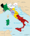
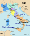
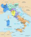
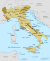
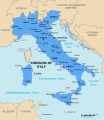
English: This category is about the subject of  Italy 1801-1900 CE: History maps showing all or a substantial part of the territory of Italy as it was in the 19th century.
Contemporary old maps belong into: Category:19th-century maps of Italy and its subcategories.
Contemporary old maps belong into: Category:19th-century maps of Italy and its subcategories.
Maps of the history of Italy by century: 1st century · 2nd century · 3rd century · 4th century · 5th century · 6th century · 7th century · 8th century · 9th century · 10th century · 11th century · 12th century · 13th century · 14th century · 15th century · 16th century · 17th century · 18th century · 19th century · 20th century · 21st century ·
Subcategories
This category has the following 5 subcategories, out of 5 total.
B
N
R
S
Media in category "Maps of Italy in the 19th century"
The following 109 files are in this category, out of 109 total.
-
Napoleonic Central Europe.jpg 3,937 × 2,855; 2.85 MB
-
Historical atlas of modern Europe 1903 (135895395).jpg 9,049 × 7,067; 61.72 MB
-
Italy 1803.jpg 600 × 460; 115 KB
-
Norditalien 1803.png 3,785 × 3,023; 1.41 MB
-
C. 1803 Central Europe.jpg 845 × 1,265; 1.2 MB
-
Atlas of European history (1909) (14597479107).jpg 3,632 × 2,166; 1.67 MB
-
Norditalien 1806.png 3,785 × 3,023; 1.31 MB
-
C. 1806 Central Europe at end of Holy Roman Empire.jpg 857 × 1,337; 1.24 MB
-
1807KingdomItaly.jpg 961 × 592; 748 KB
-
Historical atlas of modern Europe 1903 (135895397).jpg 9,049 × 7,060; 57 MB
-
Italia 1810.jpg 413 × 599; 125 KB
-
Italia 1810.svg 1,759 × 2,167; 2.46 MB
-
Italija 1810 Slovenscina.png 628 × 911; 171 KB
-
Italy 1810 heb.jpg 1,251 × 1,814; 888 KB
-
Italy c 1810-es.png 1,249 × 1,805; 320 KB
-
Italy c 1810.png 1,251 × 1,814; 90 KB
-
Italie 1812.png 556 × 642; 71 KB
-
Kingdom of Italy (Napoleonic).svg 450 × 456; 585 KB
-
C. 1815-1866 Central Europe (Southern).jpg 1,813 × 866; 1.44 MB
-
Völkerkarte von Mittel- und Südosteuropa. Italien 1815 bis zur Gegenwart (1905).jpg 1,574 × 1,886; 600 KB
-
Italy1816cs.png 1,541 × 1,729; 804 KB
-
Nice 1843.png 500 × 600; 136 KB
-
Granduchy of Tuscany (1920) location.svg 607 × 800; 830 KB
-
Guide to Italy and Sicily (1911) (14766013275).jpg 2,928 × 3,916; 2.31 MB
-
Italia di Plombières.jpg 821 × 1,085; 738 KB
-
Italy in 1859 (Johnston).jpg 1,509 × 1,763; 1.32 MB
-
Italy (March 1860).PNG 2,048 × 2,458; 263 KB
-
III guerra di Indipendenza.jpg 1,328 × 1,136; 186 KB
-
Papal States Map 1870.png 258 × 345; 66 KB
-
Third Italian War of Independence es.svg 1,264 × 1,071; 420 KB
-
Third Italian War of Independence It.svg 1,264 × 1,071; 803 KB
-
Attempted invasion of Savoy in 1834.png 821 × 584; 190 KB
-
C. 1801 Central Europe (1795-1801).jpg 3,937 × 2,855; 3.98 MB
-
C. 1809 Central Europe (1804-1809).jpg 3,932 × 2,892; 3.55 MB
-
Departements of French Empire South 1811-es.svg 1,020 × 880; 284 KB
-
Expédition des Mille.jpg 2,008 × 2,140; 669 KB
-
Garibaldi's defence of the Roman Republic (1907) (14742039046).jpg 1,848 × 2,748; 706 KB
-
Historical-map-of-Italy.png 1,024 × 1,355; 2.5 MB
-
Italia 1810 ca.svg 1,759 × 2,167; 2.07 MB
-
Italia 1843-ca.svg 3,500 × 4,200; 2.74 MB
-
Italia 1843-en.svg 3,500 × 4,200; 904 KB
-
Italia 1843-es.svg 3,500 × 4,200; 2.66 MB
-
Italia 1843-fr.png 885 × 909; 70 KB
-
Italia 1843-fr.svg 3,500 × 4,200; 900 KB
-
Italia 1843-hu.svg 3,500 × 4,200; 1.25 MB
-
Italia 1843.svg 3,500 × 4,200; 1.4 MB
-
Italia 1861 03 17.JPG 695 × 696; 49 KB
-
Italia 1861-ca.svg 3,534 × 4,256; 1.59 MB
-
Italia 1861-es.svg 3,534 × 4,256; 1.44 MB
-
Italia 1861-fr.svg 3,500 × 4,200; 780 KB
-
Italia 1861-hu.svg 3,534 × 4,256; 1.05 MB
-
Italia 1861-it.svg 3,534 × 4,256; 1.23 MB
-
Italia 1866-fr.svg 3,500 × 4,200; 755 KB
-
Italia 1870 09 20 Unificazione.JPG 695 × 696; 46 KB
-
Italia 1870-fr.svg 3,500 × 4,200; 715 KB
-
Italia al 1861.png 1,322 × 1,808; 3.52 MB
-
Italia mars 1860-es.svg 3,500 × 4,200; 772 KB
-
Italia mars 1860-fr.svg 3,500 × 4,200; 843 KB
-
Italia mars 1860-hu.svg 3,500 × 4,200; 844 KB
-
Italian unification.gif 499 × 599; 219 KB
-
ItaliaUnità.png 387 × 2,293; 60 KB
-
Italie 1859.jpg 1,990 × 2,202; 648 KB
-
Italien 1843–1870.png 924 × 953; 215 KB
-
Italy 1843-es.svg 3,500 × 4,200; 1.71 MB
-
Italy 1843-et.svg 3,500 × 4,200; 868 KB
-
Italy 1843.svg 3,500 × 4,200; 879 KB
-
Italy 1870-ar.svg 924 × 1,065; 1.47 MB
-
Italy 1870.svg 924 × 1,065; 895 KB
-
Italy 1871.svg 924 × 1,065; 887 KB
-
Italy c 1810 ar.jpg 413 × 599; 42 KB
-
Italy c 1810-ko.png 576 × 835; 201 KB
-
Italy Industry 1871.svg 1,200 × 1,500; 593 KB
-
Italy1861.png 512 × 520; 83 KB
-
Itàlia - Periòde francés.png 1,130 × 1,044; 315 KB
-
Itàlia - Unificacion.png 1,105 × 1,074; 341 KB
-
Kingdom of Italy - 1871.png 2,375 × 2,844; 1,021 KB
-
Kingdom of Italy 1861 map.png 3,360 × 3,950; 1.16 MB
-
Kingdom of Italy 1861.svg 450 × 456; 783 KB
-
Kingdom of Italy 1866 map.png 3,360 × 3,950; 1.23 MB
-
Kingdom of Italy 1870 map-ca.svg 3,360 × 3,950; 1.35 MB
-
Kingdom of Italy 1870 map-es.svg 3,360 × 3,950; 1.28 MB
-
Kingdom of Italy 1870 map.png 3,360 × 3,950; 1.23 MB
-
Kingdom of Italy 1870 map.svg 3,360 × 3,950; 1.29 MB
-
Kingdom of Italy 1870.svg 450 × 456; 725 KB
-
Kingdom of Sardinia 1815-1859 fr.png 2,048 × 2,458; 410 KB
-
Kingdom of Sardinia 1860.svg 450 × 456; 817 KB
-
Map Kingdom of Etruria.jpg 299 × 218; 32 KB
-
Map of Italy in 1861 - Touring Club Italiano CART-TRC-49 02.jpg 3,030 × 4,159; 1.53 MB
-
Mappa brigantaggio Italia (1860-1870).svg 907 × 908; 2.63 MB
-
Mappa della frontiera (1866-1919).jpg 3,507 × 2,480; 583 KB
-
Mappa sbarco Marsala fr.svg 1,100 × 1,210; 207 KB
-
Napoleonic northern Italy circa 1795–1801.jpg 861 × 635; 196 KB
-
Neapolitan War.jpg 937 × 1,453; 96 KB
-
Ortleralpen Baedeker 1878.jpg 1,230 × 851; 1.26 MB
-
Papal States 1849 map-es.svg 960 × 1,080; 379 KB
-
Papal States 1849 map-fr.svg 960 × 1,080; 397 KB
-
Papal states in 1849 ru.svg 960 × 1,080; 404 KB
-
Province Italia 1860.svg 1,200 × 1,500; 426 KB
-
Province Italia 1870.svg 1,200 × 1,500; 526 KB
-
Royaume de Haute Italie.svg 3,500 × 4,200; 570 KB
-
Spruner-Menke Handatlas 1880 Karte 28.jpg 10,473 × 8,734; 20.16 MB
-
Tirol 1808.png 2,063 × 2,242; 361 KB
-
Unificazione italiana - Italia di Plombières.jpg 1,052 × 1,148; 586 KB


