Category:Maps of Borneo
Jump to navigation
Jump to search
Wikimedia category | |||||
| Upload media | |||||
| Instance of | |||||
|---|---|---|---|---|---|
| Category combines topics | |||||
| Borneo | |||||
third largest island in the world by area, located in south-east Asia | |||||
| Instance of | |||||
| Part of | |||||
| Location | Southeast Asia | ||||
| Located in or next to body of water | |||||
| Width |
| ||||
| Length |
| ||||
| Highest point | |||||
| Population |
| ||||
| Area |
| ||||
| Elevation above sea level |
| ||||
| Different from | |||||
 | |||||
Subcategories
This category has the following 10 subcategories, out of 10 total.
Media in category "Maps of Borneo"
The following 65 files are in this category, out of 65 total.
-
17th century Western Borneo 5.png 654 × 523; 62 KB
-
17th century Western Borneo.png 654 × 523; 60 KB
-
1909 Atlas Sekolah Hindia-Nederland map of Kotawaringin.png 1,535 × 687; 1.55 MB
-
Administrative map of Borneo (Indonesian).png 1,200 × 1,335; 207 KB
-
Admiralty Chart No 1311 Singapore Strait to Borneo Northern Sheet, Published 1959.jpg 17,573 × 11,178; 49.14 MB
-
Ausstellung im Zoo Rostock über die BOS-Aktivitäten.JPG 3,018 × 4,329; 3.26 MB
-
Bay cat distribution map cs.png 1,063 × 1,183; 50 KB
-
Bay cat distribution map.png 1,063 × 1,183; 151 KB
-
Bornean Gibbon area.png 216 × 240; 8 KB
-
Bornean languages-en.svg 729 × 521; 533 KB
-
Bornean Orangutan area.png 216 × 240; 5 KB
-
Bornean Slow Loris area.png 644 × 452; 14 KB
-
Bornean White-bearded Gibbon area.png 216 × 240; 3 KB
-
Borneo - DPLA - 4f1a8d93f4945511c0e0359fac64344a.jpg 2,396 × 3,116; 5.84 MB
-
Borneo Gibbon Map v3 - Copy.jpg 1,519 × 1,832; 417 KB
-
Borneo Locator Topography.png 1,605 × 1,739; 2.61 MB
-
Borneo map (fr).png 1,795 × 1,998; 708 KB
-
Borneo map with borders.png 1,063 × 1,183; 33 KB
-
Borneo map.png 1,795 × 1,998; 680 KB
-
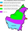
Borneo Origin of Basal crust.pdf 1,247 × 1,402; 45 KB
-
Borneo Topography Kutai basin.png 1,725 × 1,824; 2.53 MB
-
Borneo Topography.png 1,725 × 1,824; 2.52 MB
-
Borneo-H.jpg 1,848 × 1,880; 576 KB
-
Borneo2 map bg names.png 1,047 × 1,180; 54 KB
-
Borneo2 map english names.PNG 1,063 × 1,183; 236 KB
-
British Borneo - DPLA - d62457af0858a7b7027a19d7d2aea6d6.jpg 2,867 × 1,909; 1.26 MB
-
British Borneo - DPLA - d9e9d656b18b1d6d29e3b2e151fab96e.jpg 3,124 × 2,400; 1.38 MB
-
British Borneo and Dutch Borneo.png 2,000 × 2,226; 233 KB
-
Brunei Malay Spoken Area.png 175 × 213; 3 KB
-
Carte topo-administrative du Sarawak 1944-45.pdf 1,500 × 843; 3.12 MB
-
Control of the island of Borneo-zh.png 1,080 × 1,202; 200 KB
-
Control of the island of Borneo.png 1,080 × 1,202; 207 KB
-
Hose's Langur area.png 216 × 240; 3 KB
-
Hylobates abbotti distribution.png 1,012 × 940; 820 KB
-
Kalimantan2-FA.png 220 × 245; 29 KB
-
Kalimantan2.png 1,063 × 1,183; 100 KB
-
KalimantanUkr.png 1,063 × 1,183; 195 KB
-
Kongsi map.png 2,772 × 2,745; 1.19 MB
-
Major cities in towns of borneo.png 695 × 748; 72 KB
-
Mapa distribuicao pongo pygmaeus.png 400 × 163; 7 KB
-
Maroon Leaf Monkey area.png 216 × 240; 4 KB
-
Nepenthes boschiana distribution.gif 1,063 × 1,183; 24 KB
-
Nepenthes boschiana distribution.png 832 × 916; 789 KB
-
Nepenthes burbidgeae distribution.gif 1,063 × 1,183; 23 KB
-
Nepenthes campanulata distribution.gif 1,063 × 1,183; 24 KB
-
Nepenthes clipeata distribution.gif 1,063 × 1,183; 25 KB
-
Nepenthes clipeata distribution.png 832 × 916; 789 KB
-
Nepenthes ephippiata distribution.gif 1,063 × 1,183; 27 KB
-
Nepenthes glandulifera distribution.gif 1,063 × 1,183; 26 KB
-
Nepenthes lowii distribution.gif 1,063 × 1,183; 26 KB
-
Nepenthes macrophylla distribution.gif 1,063 × 1,183; 25 KB
-
Nepenthes mollis distribution.gif 1,063 × 1,183; 25 KB
-
Nepenthes muluensis distribution.gif 1,063 × 1,183; 25 KB
-
Nepenthes murudensis distribution.gif 1,063 × 1,183; 24 KB
-
Nepenthes northiana distribution.gif 1,063 × 1,183; 23 KB
-
Nepenthes villosa distribution.gif 1,063 × 1,183; 24 KB
-
Nepenthes villosa distribution.png 832 × 916; 789 KB
-
Nepenthes x alisaputrana distribution.png 832 × 916; 789 KB
-
Peta Gunung Tabur Dan Sambaliung 1810.png 2,560 × 1,440; 160 KB
-
Proboscis Monkey area.png 216 × 240; 4 KB
-
Relief Map of Borneo.png 800 × 867; 747 KB
-
Sarawak Surili area.png 216 × 240; 3 KB
-
White-fronted Surili area.png 216 × 240; 4 KB
-
Геополитическое деление Калимантана.png 640 × 712; 120 KB
-
Округа Калимантана.png 1,101 × 1,201; 283 KB


