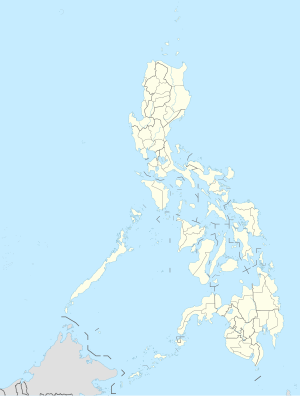
Tabogon, Sugbo


| Tuig | Kam. | ±% p.a. |
|---|---|---|
| 1990 | 24,664 | — |
| 1995 | 27,735 | +2.22% |
| 2000 | 27,827 | +0.07% |
| 2007 | 31,942 | +1.92% |
| 2010 | 33,024 | +1.22% |
Ang Tabogon usa ka ikaupat nga klase nga lungsod sa lalawigan sa Sugbo, Pilipinas. Sumala sa sensus sa tuig 2000, kini may populasyon nga 27,827 ka tawo sa 5,825 ka bubong.
Mga barangay
[usba | usba ang wikitext]Ang Tabogon may 25 ka mga barangay.
|
|
Kasaysayan
[usba | usba ang wikitext]The town bears the name in memory of the beleaguered times its settlers suffered untold difficulties during Moro pillages. Their settlement has first located near coastline where there were many Aguho trees. Consequently, the village became known as “Aguho”.
Time after time, pirate assaults forced the people to evacuate to safer places. Even as they thought they were already out of danger, marauders would still besiege their colony. The inhabitants had to move further inland and to the hills.
When the Spaniards came and secured the place, the inhabitants changed the name of their village to “Tabogon”, a vernacular, meaning, “to be driven away”. Tabogon was formally founded in 1827. In 1877, of fifty years later, the townsite was transferred to its current location. Thus, the village once known as “Aguho” and “Tabogon” was now called “Daantabogon”.
In time, a church, a convent, a school, abelfry and a watchtower were built in Daantabogon through free labor of inhabitants. Unfortunately, these were eventually destroyed, and only their ruins stand to storify the inhabitants’ challenging past.
The first “Capitan Municipal” was Gaspar Monteron, the root of the clan Monteron, Montellano, Hortellano and Garcia. Capitan Agustin Regis, chosen as the sixth municipal capitan, caused the transfer of the town where Tabogon is now located.
Turismo
[usba | usba ang wikitext]Mga inilang tawo nga lumad sa Tabogon
[usba | usba ang wikitext]- Ret. General Joel S. Manalili
- Mayor Manolo Lechido
- Mayor Jesusa N. Book
- Mayor Armando C. Serafin
- Mayor Roy Y. Ornopia
- Engineer Joel "Enteng" Manalili IV
- Professor Rodrigo "Digoy" P. Calapan
Mga reperensiya
[usba | usba ang wikitext]Mga sumpay sa gawas
[usba | usba ang wikitext]- Philippine Standard Geographic Code Archived 2012-04-13 at the Wayback Machine
- 2000 Philippines Census Information Archived 2010-01-30 at the Wayback Machine
- e-LGU Information on Tabogon
Paghimo ni bot Lsjbot. |
- Alang sa ubang mga dapit sa mao gihapon nga ngalan, tan-awa ang Tabogon.
| Tabogon | |
| Munisipyo | |
| Nasod | |
|---|---|
| Rehiyon | Central Visayas |
| Lalawigan | Province of Cebu |
| Gitas-on | 174 m (571 ft) |
| Tiganos | 10°56′00″N 123°59′00″E / 10.93333°N 123.98333°E |
| Population | 30,960 (2012-07-04) [1] |
| Timezone | PST (UTC+8) |
| GeoNames | 1684915 |
Munisipyo ang Tabogon sa Pilipinas.[1] Nahimutang ni sa lalawigan sa Province of Cebu ug rehiyon sa Central Visayas, sa habagatan-sidlakang bahin sa nasod, 500 km sa habagatan-sidlakan sa Dakbayan sa Manila ang ulohan sa nasod. Adunay 30,960 ka molupyo.[1] Ang Tabogon nahimutang sa pulo sa Pulo sa Sugbo.[saysay 1]
Hapit nalukop sa kaumahan ang palibot sa Tabogon.[3] Ang klima tropikal nga kasalupan. Ang kasarangang giiniton 24 °C. Ang kinainitan nga bulan Mayo, sa 28 °C, ug ang kinabugnawan Enero, sa 22 °C.[4] Ang kasarangang pag-ulan 3,809 milimetro matag tuig. Ang kinabasaan nga bulan Enero, sa 474 milimetro nga ulan, ug ang kinaugahan Abril, sa 159 milimetro.[5]
Saysay
[usba | usba ang wikitext]- ↑ Kalkulado gikan sa gitas-on data (DEM 3") gikan sa Viewfinder Panoramas.[2] Ang bug-os nga algoritmo anaa dinhi.
Ang mga gi basihan niini
[usba | usba ang wikitext]- ↑ 1.0 1.1 1.2 Tabogon at GeoNames.Org (cc-by); post updated 2012-07-04; database download sa 2015-11-25
- ↑ "Viewfinder Panoramas Digital elevation Model". 2015-06-21.
- ↑ "NASA Earth Observations: Land Cover Classification". NASA/MODIS. Retrieved 30 Enero 2016.
- ↑ "NASA Earth Observations Data Set Index". NASA. Retrieved 30 Enero 2016.
- ↑ "NASA Earth Observations: Rainfall (1 month - TRMM)". NASA/Tropical Rainfall Monitoring Mission. Retrieved 30 Enero 2016.

