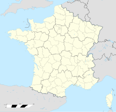
Auray
| Auray | |
 | |
| Verwàltung | |
|---|---|
| Land | |
| Region | |
| Département | Morbihan (56) |
| Arrondissement | Lorient |
| Kànton | Auray |
| Kommünàlverbànd | Auray Quiberon Terre Atlantique |
| Àmtliga Nàma | Auray |
| Maire | Claire Masson (2014-2020)[1] |
| Code Insee | 56007 |
| Poschtlaitzàhl | 56400 |
| Iiwohner | |
| Iiwohner | 14.222 |
| Flech | 6,91 km2 |
| Bevelkerungsdicht | 1.763,68 Iiw./km2 |
| Làg | |
| Koordinate | 47° 40′ 04″ N, 2° 58′ 57″ W / 47.667777777778°N,2.9825°WKoordinate: 47° 40′ 04″ N, 2° 58′ 57″ W / 47.667777777778°N,2.9825°W |
| Heche | 25 m |
| Website | |
| http://www.auray.fr | |
Auray (bretonisch An Alre) isch e franzesischi Gmai im Département Morbihan in dr Region Bretagne.
D Stadt ghert zum Kanton Auray un zum Arrondissement Lorient.
Geografi
[ändere | Quälltäxt bearbeite]Auray lyt am Fluss Loc'h, wu ab do Auray haißt, d Oberstadt am linke Stade, s Hafeviertel am rächte Stade. Bis uf Vannes sin s 17 km, bis uf Lorient 29 km.
Gschicht
[ändere | Quälltäxt bearbeite]Auray isch zum erschte Mol gnännt wore anne 1069 as catrum Alrae (1081: Alrae, 1129: Auray, 1136: Auraio, 1187: Alraycum, 1208: Alraium, 1233: Elrayo, 1241: Elraii, 1278: Olraium, 1282: Aurray, 1291: Aureio, 1309: Aurey, 1309: Elray, 1371: Aulrey, 1371: Aureyo, 1371: Auroy, 1371: Auroyo, 1371: Aurrayo, 1371: Aurroyo, 1437: Tenoualray, 1453: Alraii, 1561: Aulray, 1717: Auray evêché de Vennes).
Verwaltig
[ändere | Quälltäxt bearbeite]D Maire vu Auray isch d Claire Masson. Auray ghert zum Kommunalverband Auray Quiberon Terre Atlantique.
Bevelkerigsentwicklig
[ändere | Quälltäxt bearbeite]| Johr | 1962 | 1968 | 1975 | 1982 | 1990 | 1999 | 2008 |
| Yywohner | 8.118 | 8.449 | 10.256 | 9.892 | 10.323 | 10.911 | 12.536 |
Dialekt
[ändere | Quälltäxt bearbeite]Dr traditionell Dialäkt vu Auray ghert zum Bretonisch.
Kultur un Böuwärch
[ändere | Quälltäxt bearbeite]- Château d'Auray
- Église Saint-Charles-de-Blois
- Église Saint-Gildas
- Église Saint-Goustan
- Chapelle Capucins
- Chapelle Frères Congrégation Hommes Immaculée Conception
- Chapelle Madeleine
- Chapelle Notre-Dame-Bethleem
- Chapelle Notre-Dame-Lourde
- Chapelle Sainte-Anne Kerplouz
- Chapelle Saint-Esprit, puis caserne Duguesclin
- Chapelle Saintt-Fiacre
- Chapelle Sainte-Hélène
- Couvent cordelières Pere Eternel
- Menhir
-
Mairie -
Église Saint-Gildas -
Église Saint-Goustan -
Chapelle Notre-Dame-Lourde -
Chapelle Sainte-Hélène
Weblink
[ändere | Quälltäxt bearbeite]- https://web.archive.org/web/20191019162356/https://www.auray.fr/
- Auray uf geobreizh.com (Internet-Archive)
Fueßnote
[ändere | Quälltäxt bearbeite]- ↑ Liste des maires au 25 avril 2014 (data.gouv.fr)


