Model-based soil erosion studies have increased in number, given the availability of geodata and ... more Model-based soil erosion studies have increased in number, given the availability of geodata and the recent technological advances. However, their accuracy remains rather questionable since the scarcity of field records hinders the validation of simulated values. In this context, this study aims to present a method for measuring sediment deposition at a typical Mediterranean catchment (870 ha) in Greece through high spatial resolution field measurements acquired by an Unmanned Aerial Vehicle (UAV) survey. Three-dimensional modeling is considered to be an emerging technique for surface change detection. The UAV-derived point cloud comparison, applying the Structure-from-Motion (SfM) technique at the Platana sediment retention dam test site, quantified annual topsoil change in cm-scale accuracy (0.02–0.03 m), delivering mean sediment yield of 1620 m3 ± 180 m3 or 6.05 t ha−1yr−1 and 3500 m3 ± 194 m3 or 13 t ha−1yr−1 for the 2020–2021 and 2021–2022 estimation. Moreover, the widely appli...
Nature-based solutions (NBS) are being deployed around the world in order to address hydrometeoro... more Nature-based solutions (NBS) are being deployed around the world in order to address hydrometeorological hazards, including flooding, droughts, landslides and many others. The term refers to techniques inspired, supported and copied from nature, avoiding large constructions and other harmful interventions. In this work the development and evaluation of an NBS applied to the Spercheios river basin in Central Greece is presented. The river is susceptible to heavy rainfall and bank overflow, therefore the intervention selected is a natural water retention measure that aims to moderate the impact of flooding and drought in the area. After the deployment of the NBS, we examine the benefits under current and future climate conditions, using various climate change scenarios. Even though the NBS deployed is small compared to the rest of the river, its presence leads to a decrease in the maximum depth of flooding, maximum velocity and smaller flooded areas. Regarding the subsurface/groundwat...
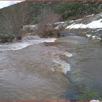
A number of Nature Based Solutions (NBS) are being used around the world in order to address vari... more A number of Nature Based Solutions (NBS) are being used around the world in order to address various hydrometeorological hazards as a more environmentally friendly alternative to hard structures. Such a solution has been created in the Spercheios river basin in Central Greece, which is susceptible to heavy rainfall and river bank overflow due to flood water from upstream, in order to mitigate flood and drought impacts under current and future climate conditions. Here a first attempt is made to use actual measurements taken from various sources in the river, including in-situ and satellite data, in order to establish early experimental evidence of the NBS efficiency in the area. The measurements include data from automated hydrological stations from the OpenHi network, satellite remote sensing data and field measurements performed along the Spercheios River basin. For each measurement used, different analysis has been performed based on data availability and pertinence to the NBS eff...
Advances in the Research of Aquatic Environment, 2011
The study of the Xynias basin is focused on the investigation of the water balance and surface wa... more The study of the Xynias basin is focused on the investigation of the water balance and surface water quality and their impacts due to anthropogenic and natural factors. The average annual precipitation within the study area amounted to 685 mm of which 139 mm (20.3%) is the total runoff, the 428 mm (62.5%) is estimated to be the actual evapotranspiration and 118 mm (17.2%) is the total infiltration. The chemical analyses showed that water flowing from upper reaches of River Enippeas is classified to the Ca-HCO3 hydrochemical type and it is associated with the presence of limestone’s and flysch formations, while water from the drainage ditch, is classified to the Mg-HCO3 hydrochemical type and is associated with the development of the ophiolites. The drainage ditch is found to be polluted mainly due to anthropogenic factors.
In the catchment area of Scopia, Central Greece, a lumped applied approach of water balance was a... more In the catchment area of Scopia, Central Greece, a lumped applied approach of water balance was accomplished, by applying the Zygos model, which delineates an essential water balance forms. The model is in view of Thornthwaite model, in its modified version. It can be adjusted automatically, with the evolutionary annealing-simplex technique for nonlinear optimization, or manually and the input data are precipitation and the potential evapotranspiration. In the present study, both programmed and manual calibration occurred. Programmed calibration took place, utilizing a specimen of measured runoff values from October 2009 to March 2011. Despite the fact that the Nash–Sutcliffe coefficient (NSC) value was high (0.87), the simulated parameters of water balance had abnormal significance for Scopia catchment area. On the contrary, manual calibration uncovered that the actual evapotranspiration constitutes 64.6% (450.1 mm) of the precipitation. Runoff and percolation represent 20.6% (143.6 mm) and 14.8% (102.9 mm) of the precipitation, respectively. The NSC (0.70) and the validation criteria exhibit an ideal adjustment of simulated to measured runoff, while the hydrological parameters appeared to have a physical significance for the study site. Zygos model connects the emergence of springs with the development of the karstification in the carbonate rocks of the region and affirms the predominance of runoff versus percolation due to the hydrolithological structure of the Scopia catchment. This is related to the presence of episodic floods in the area. The yearly precipitation values were found with an error of 0.2% and are viewed as insignificant.
<p><strong>Abstract</strong></p><p>Under climate change scenarios, ... more <p><strong>Abstract</strong></p><p>Under climate change scenarios, it is important to evaluate the changes in recent behavior of heavy precipitation events, the resulting flood risk, and the detrimental impacts of the peak flow of water on human well-being, properties, infrastructure, and the natural environment. Normally, flood risk is estimated using the stationary flood frequency analysis technique. However, a site&#8217;s hydroclimate can shift beyond the range of historical observations considering continuing global warming. Therefore, flood-like distributions capable of accounting for changes in the parameters over time should be considered. The main objective of this study is to apply non-stationary flood frequency models using the generalized extreme value (GEV) distribution to model the changes in flood risk under two scenarios: (1) without nature-based solutions (NBS) in place and; (2) with NBS i.e. wetlands, retention ponds and weir/low head dam implemented. In the GEV model, the first two moments i.e. location and scale parameters of the distribution were allowed to change as a function of time-variable covariates, estimated by maximum likelihood. The methodology is applied to OPEn-air laboRAtories for Nature baseD solUtions to Manage hydro-meteo risks, which is in Europe. The time-dependent 100-year design quantiles were estimated for both the scenarios. We obtained daily precipitation data of climate models from the EURO-CORDEX project dataset for 1951&#8211;2020 and 2022&#8211;2100 representing historical and future simulations, respectively. The hydrologic model, HEC-HMS was used to simulate discharges/flood hydrograph without and with NBS in place for these two periods: historical (1951-2020) and future (2022-2100). The results showed that the corresponding time-dependent 100-year floods were remarkably high for the without NBS scenario in both the periods. Particularly, the high emission scenario (RCP 8.5) resulted in dramatically increased flood risks in the future. The simulation without NBS also showed that flooded area is projected to increase by 25% and 40% for inundation depth between 1.5 and 3.5 m under RCP 4.5 and RCP 8.5 scenarios, respectively. For inundation depth above 3.5 m, the flooded area is anticipated to rise by 30% and 55% in both periods respectively. With the implementation of NBS, the flood risk was projected to decrease by 20% (2022&#8211;2050) and 45% (2071&#8211;2100) with a significant decrease under RCP 4.5 and RCP 8.5 scenarios. This study can help improve existing methods to adapt to the uncertainties in a changing environment, which is critical to develop climate-proof NBS and improve NBS planning, implementation, and effectiveness assessment.</p><p><strong>Keywords</strong>: Nature-based solutions; flood frequency analysis; climate change; wetlands; GEV model</p><p><strong>Acknowledgments</strong></p><p>This work has been carried out under the framework of OPERANDUM (OPEn-air laboRAtories for Nature baseD solUtions to Manage hydro-meteo risks) project, which is funded by the European Union's Horizon 2020 research and innovation programme under the Grant Agreement No: 776848.</p>
Morphometric analysis can be used to investigate catchment dynamics and tectonic processes respon... more Morphometric analysis can be used to investigate catchment dynamics and tectonic processes responsible for the development of drainage catchments and to support flood risk assessment. In this study, a comparative GIS-based morphometric analysis between the main southern and northern sub-catchments of the Sperchios River basin, Central Greece, was performed, using geospatial and remote sensing data. The goal was to investigate their correlation with the peculiar geotectonic activity and the frequent flash-flood events that occur in the river floodplain. All sub-catchments characteristics are linked with the geological formation types of the area, in combination with ongoing tectonic activity. The results indicate that drainage network development is significantly controlled by the region’s overall tectonic activity. The morphometric characteristics—i.e., bifurcation ratio, drainage density, circularity ratio, elongation ratio and water concentration–time values, reflect the flood-pro...
Model-based soil erosion studies have increased in number, given the availability of geodata and ... more Model-based soil erosion studies have increased in number, given the availability of geodata and the recent technological advances. However, their accuracy remains rather questionable since the scarcity of field records hinders the validation of simulated values. In this context, this study aims to present a method for measuring sediment deposition at a typical Mediterranean catchment (870 ha) in Greece through high spatial resolution field measurements acquired by an Unmanned Aerial Vehicle (UAV) survey. Three-dimensional modeling is considered to be an emerging technique for surface change detection. The UAV-derived point cloud comparison, applying the Structure-from-Motion (SfM) technique at the Platana sediment retention dam test site, quantified annual topsoil change in cm-scale accuracy (0.02–0.03 m), delivering mean sediment yield of 1620 m3 ± 180 m3 or 6.05 t ha−1yr−1 and 3500 m3 ± 194 m3 or 13 t ha−1yr−1 for the 2020–2021 and 2021–2022 estimation. Moreover, the widely appli...
Nature-based solutions (NBS) are being deployed around the world in order to address hydrometeoro... more Nature-based solutions (NBS) are being deployed around the world in order to address hydrometeorological hazards, including flooding, droughts, landslides and many others. The term refers to techniques inspired, supported and copied from nature, avoiding large constructions and other harmful interventions. In this work the development and evaluation of an NBS applied to the Spercheios river basin in Central Greece is presented. The river is susceptible to heavy rainfall and bank overflow, therefore the intervention selected is a natural water retention measure that aims to moderate the impact of flooding and drought in the area. After the deployment of the NBS, we examine the benefits under current and future climate conditions, using various climate change scenarios. Even though the NBS deployed is small compared to the rest of the river, its presence leads to a decrease in the maximum depth of flooding, maximum velocity and smaller flooded areas. Regarding the subsurface/groundwat...
A number of Nature Based Solutions (NBS) are being used around the world in order to address vari... more A number of Nature Based Solutions (NBS) are being used around the world in order to address various hydrometeorological hazards as a more environmentally friendly alternative to hard structures. Such a solution has been created in the Spercheios river basin in Central Greece, which is susceptible to heavy rainfall and river bank overflow due to flood water from upstream, in order to mitigate flood and drought impacts under current and future climate conditions. Here a first attempt is made to use actual measurements taken from various sources in the river, including in-situ and satellite data, in order to establish early experimental evidence of the NBS efficiency in the area. The measurements include data from automated hydrological stations from the OpenHi network, satellite remote sensing data and field measurements performed along the Spercheios River basin. For each measurement used, different analysis has been performed based on data availability and pertinence to the NBS eff...
Advances in the Research of Aquatic Environment, 2011
The study of the Xynias basin is focused on the investigation of the water balance and surface wa... more The study of the Xynias basin is focused on the investigation of the water balance and surface water quality and their impacts due to anthropogenic and natural factors. The average annual precipitation within the study area amounted to 685 mm of which 139 mm (20.3%) is the total runoff, the 428 mm (62.5%) is estimated to be the actual evapotranspiration and 118 mm (17.2%) is the total infiltration. The chemical analyses showed that water flowing from upper reaches of River Enippeas is classified to the Ca-HCO3 hydrochemical type and it is associated with the presence of limestone’s and flysch formations, while water from the drainage ditch, is classified to the Mg-HCO3 hydrochemical type and is associated with the development of the ophiolites. The drainage ditch is found to be polluted mainly due to anthropogenic factors.
In the catchment area of Scopia, Central Greece, a lumped applied approach of water balance was a... more In the catchment area of Scopia, Central Greece, a lumped applied approach of water balance was accomplished, by applying the Zygos model, which delineates an essential water balance forms. The model is in view of Thornthwaite model, in its modified version. It can be adjusted automatically, with the evolutionary annealing-simplex technique for nonlinear optimization, or manually and the input data are precipitation and the potential evapotranspiration. In the present study, both programmed and manual calibration occurred. Programmed calibration took place, utilizing a specimen of measured runoff values from October 2009 to March 2011. Despite the fact that the Nash–Sutcliffe coefficient (NSC) value was high (0.87), the simulated parameters of water balance had abnormal significance for Scopia catchment area. On the contrary, manual calibration uncovered that the actual evapotranspiration constitutes 64.6% (450.1 mm) of the precipitation. Runoff and percolation represent 20.6% (143.6 mm) and 14.8% (102.9 mm) of the precipitation, respectively. The NSC (0.70) and the validation criteria exhibit an ideal adjustment of simulated to measured runoff, while the hydrological parameters appeared to have a physical significance for the study site. Zygos model connects the emergence of springs with the development of the karstification in the carbonate rocks of the region and affirms the predominance of runoff versus percolation due to the hydrolithological structure of the Scopia catchment. This is related to the presence of episodic floods in the area. The yearly precipitation values were found with an error of 0.2% and are viewed as insignificant.
<p><strong>Abstract</strong></p><p>Under climate change scenarios, ... more <p><strong>Abstract</strong></p><p>Under climate change scenarios, it is important to evaluate the changes in recent behavior of heavy precipitation events, the resulting flood risk, and the detrimental impacts of the peak flow of water on human well-being, properties, infrastructure, and the natural environment. Normally, flood risk is estimated using the stationary flood frequency analysis technique. However, a site&#8217;s hydroclimate can shift beyond the range of historical observations considering continuing global warming. Therefore, flood-like distributions capable of accounting for changes in the parameters over time should be considered. The main objective of this study is to apply non-stationary flood frequency models using the generalized extreme value (GEV) distribution to model the changes in flood risk under two scenarios: (1) without nature-based solutions (NBS) in place and; (2) with NBS i.e. wetlands, retention ponds and weir/low head dam implemented. In the GEV model, the first two moments i.e. location and scale parameters of the distribution were allowed to change as a function of time-variable covariates, estimated by maximum likelihood. The methodology is applied to OPEn-air laboRAtories for Nature baseD solUtions to Manage hydro-meteo risks, which is in Europe. The time-dependent 100-year design quantiles were estimated for both the scenarios. We obtained daily precipitation data of climate models from the EURO-CORDEX project dataset for 1951&#8211;2020 and 2022&#8211;2100 representing historical and future simulations, respectively. The hydrologic model, HEC-HMS was used to simulate discharges/flood hydrograph without and with NBS in place for these two periods: historical (1951-2020) and future (2022-2100). The results showed that the corresponding time-dependent 100-year floods were remarkably high for the without NBS scenario in both the periods. Particularly, the high emission scenario (RCP 8.5) resulted in dramatically increased flood risks in the future. The simulation without NBS also showed that flooded area is projected to increase by 25% and 40% for inundation depth between 1.5 and 3.5 m under RCP 4.5 and RCP 8.5 scenarios, respectively. For inundation depth above 3.5 m, the flooded area is anticipated to rise by 30% and 55% in both periods respectively. With the implementation of NBS, the flood risk was projected to decrease by 20% (2022&#8211;2050) and 45% (2071&#8211;2100) with a significant decrease under RCP 4.5 and RCP 8.5 scenarios. This study can help improve existing methods to adapt to the uncertainties in a changing environment, which is critical to develop climate-proof NBS and improve NBS planning, implementation, and effectiveness assessment.</p><p><strong>Keywords</strong>: Nature-based solutions; flood frequency analysis; climate change; wetlands; GEV model</p><p><strong>Acknowledgments</strong></p><p>This work has been carried out under the framework of OPERANDUM (OPEn-air laboRAtories for Nature baseD solUtions to Manage hydro-meteo risks) project, which is funded by the European Union's Horizon 2020 research and innovation programme under the Grant Agreement No: 776848.</p>
Morphometric analysis can be used to investigate catchment dynamics and tectonic processes respon... more Morphometric analysis can be used to investigate catchment dynamics and tectonic processes responsible for the development of drainage catchments and to support flood risk assessment. In this study, a comparative GIS-based morphometric analysis between the main southern and northern sub-catchments of the Sperchios River basin, Central Greece, was performed, using geospatial and remote sensing data. The goal was to investigate their correlation with the peculiar geotectonic activity and the frequent flash-flood events that occur in the river floodplain. All sub-catchments characteristics are linked with the geological formation types of the area, in combination with ongoing tectonic activity. The results indicate that drainage network development is significantly controlled by the region’s overall tectonic activity. The morphometric characteristics—i.e., bifurcation ratio, drainage density, circularity ratio, elongation ratio and water concentration–time values, reflect the flood-pro...
Uploads
Papers