TA1028 : The Deep aquarium, Kingston upon Hull
taken 9 years ago, near to Kingston Upon Hull, England
The Humber Estuary or River Humber is a large tidal estuary on the east coast of Northern England. It is formed at Trent Falls by the confluence of the tidal rivers Ouse and Trent. From there to the North Sea, it forms part of the boundary between the East Riding of Yorkshire on the north bank and North Lincolnshire on the south bank.
Further information:
Wikipedia: Link
Humber Nature Partnership: Link
European Union: Link
Until the opening of The Dock in 1778, all trade by ship was conducted on the quays, wharfs or staithes on the River Hull, primarily between the Humber Estuary and the former North Bridge. Today, the old harbour is no longer used except for intermittent moorings for lighter craft. It has been allowed to silt up, and the remaining warehouses largely converted for dwellings. Further information in Wikipedia: Link
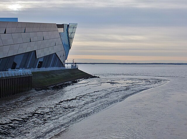
The Deep, a public aquarium, built 2000-01, designed by Sir Terry Farrell, opened to the public March 2002. Voted best family attraction in Kingston upon Hull in 2013.
Further reading:
The Deep: Link
Wikipedia: Link
Visit Hull: Link
- Grid Square
- TA1028, 3623 images (more nearby 🔍)
- Photographer
- Bernard Sharp (more nearby)
- Date Taken
- Friday, 11 December, 2015 (more nearby)
- Submitted
- Monday, 3 March, 2025
- Subject Location
-
OSGB36:
 TA 1018 2817 [10m precision]
WGS84: 53:44.2970N 0:19.8631W - Camera Location
-
OSGB36: TA 1012 2829
- View Direction
- South-southeast (about 157 degrees)