SE8538 : A filled in section of the Market Weighton Canal
taken 21 days ago, 3 km from North Cliffe, East Riding of Yorkshire, England
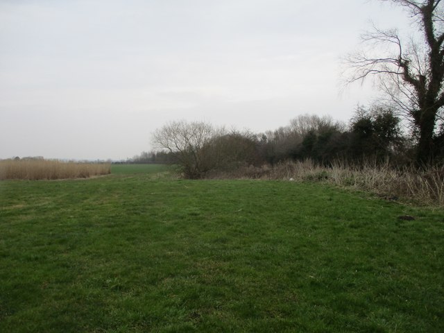
A filled in section of the Market Weighton Canal
I am stood near the former lock at Lock Farm, the canal went through the grass in the centre of this photo to the tree and vegetation. It then becomes a disused canal again, very overgrown and empty except for odd pools of stagnant water
TIP: Click the map for more Large scale mapping
- Grid Square
- SE8538, 27 images (more nearby 🔍)
- Photographer
- Martin Dawes (more nearby)
- Date Taken
- Wednesday, 19 February, 2025 (more nearby)
- Submitted
- Friday, 28 February, 2025
- Subject Location
-
OSGB36:
 SE 8509 3899 [10m precision]
WGS84: 53:50.4120N 0:42.5000W - Camera Location
-
OSGB36: SE 8508 3897
- View Direction
- North-northeast (about 22 degrees)