2024
SO9063 : Ordnance Survey Flush Bracket 479
taken 5 months ago, near to Droitwich Spa, Worcestershire, England
This is 1 of 2 images, with title starting with Ordnance Survey Flush Bracket in this square
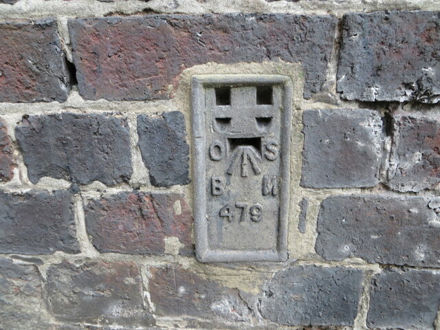
Ordnance Survey Flush Bracket 479
This bracket can be found on the buttress of the railway bridge in Bromsgrove Road, Droitwich Spa.
The recorded details give a height of 30.483 metres above sea level.
For more detail see : Link
The recorded details give a height of 30.483 metres above sea level.
For more detail see : Link
TIP: Click the map for more Large scale mapping
- Grid Square
- SO9063, 519 images (more nearby 🔍)
- Photographer
- Peter Wood (more nearby)
- Date Taken
- Sunday, 13 October, 2024 (more nearby)
- Submitted
- Monday, 25 November, 2024
- Subject Location
-
OSGB36:
 SO 9030 6354 [10m precision]
WGS84: 52:16.1957N 2:8.6141W