2023
NY5054 : Crossroads at south end of Faugh
taken 2 years ago, near to Faugh, Cumbria, England
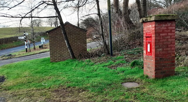
Crossroads at south end of Faugh
In the image are a Cumberland County Council finger signpost NY5054 : Cumberland County Council finger signpost at cross roads at south end of Faugh, a bus shelter and a brick letter box which has an Ordnance Survey benchmark NY5054 : EIIR post box with benchmark at bottom near crossroads south of Faugh at its base.
TIP: Click the map for more Large scale mapping
- Grid Square
- NY5054, 13 images (more nearby 🔍)
- Photographer
- Roger Templeman (more nearby)
- Date Taken
- Thursday, 26 January, 2023 (more nearby)
- Submitted
- Saturday, 28 January, 2023
- Subject Location
-
OSGB36:
 NY 5094 5463 [10m precision]
WGS84: 54:53.0400N 2:45.9749W - Camera Location
-
OSGB36: NY 5098 5461
- View Direction
- West-northwest (about 292 degrees)