2020
TQ6161 : Time for a rest near Fairseat
taken 5 years ago, near to Fairseat, Kent, England
Time for a rest near Fairseat
Large parts of the Kent Downs between the A2, the M20 and the River Medway consists of incredibly remote valleys, woods, shaws and farms. From the tops of the ridges though, distant views of the Queen Elizabeth II Bridge at Dartford, Shooters Hill, Canary Wharf and The Shard remind you how close you are to the edge of London.
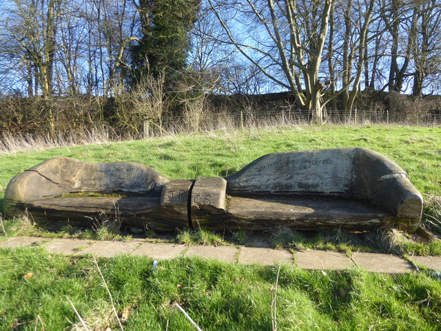
This is next to a footpath between Coldharbour and Fairseat where after a climb up a hill, this seat with its inscription offers a rest and a chance to look over the valley. The left hand seat has the inscription: "Does the road wind up hill all the way?" The initials J.R. and C.S are in the centre while the right hand seat has the inscription: "Yes, to the very end." The view from the seat can be seen at Link
This is next to a footpath between Coldharbour and Fairseat where after a climb up a hill, this seat with its inscription offers a rest and a chance to look over the valley. The left hand seat has the inscription: "Does the road wind up hill all the way?" The initials J.R. and C.S are in the centre while the right hand seat has the inscription: "Yes, to the very end." The view from the seat can be seen at Link
TIP: Click the map for more Large scale mapping
- Grid Square
- TQ6161, 28 images (more nearby 🔍)
- Photographer
- Marathon (more nearby)
- Date Taken
- Saturday, 8 February, 2020 (more nearby)
- Submitted
- Monday, 10 February, 2020
- Subject Location
-
OSGB36:
 TQ 6179 6131 [10m precision]
WGS84: 51:19.6727N 0:19.2473E - Camera Location
-
OSGB36: TQ 6178 6131
- View Direction
- EAST (about 90 degrees)