2018
J1860 : The River Lagan, Spencer's Bridge, near Moira - July 2018(1)
taken 7 years ago, 3 km from Maghaberry, Co Antrim, Northern Ireland
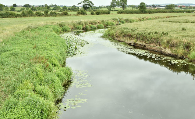
The River Lagan, Spencer's Bridge, near Moira - July 2018(1)
The River Lagan, looking downstream, from Spencers Bridge on the Lany Road, during the current long dry spell. There are water lilies growing on both sides. Note also the exposed and dry riverbank at middle right. For a seasonal comparison in water level see J1860 : The River Lagan, Spencer's Bridge near Moira (1) (June 2012).
Loading map... (JavaScript required)
- Grid Square
- J1860, 19 images (more nearby 🔍)
- Photographer
- Albert Bridge (more nearby)
- Date Taken
- Friday, 13 July, 2018 (more nearby)
- Submitted
- Friday, 13 July, 2018
- Subject Location
-
Irish:
 J 182 603 [100m precision]
WGS84: 54:28.6589N 6:10.5534W - Camera Location
-
Irish: J 182 603
- View Direction
- North-northeast (about 22 degrees)