SJ8990 : Roadworks on the A6
taken 7 years ago, near to Stockport, England
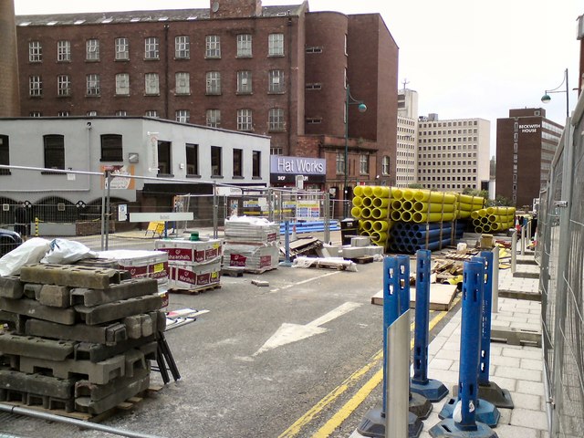
Wellington Road South is closed for major roadworks. Various pieces of equipment are being stored in a fenced off area near the Hat Works.
The A6 is Britain's fourth longest road and one of the main historic north-south roads in England. It currently runs for 299 miles from Luton in Bedfordshire to Carlisle in Cumbria, although it formerly started at a junction with the A1 at Barnet.
Running north west from Luton, the road travels through Bedford, bypasses Rushden, Kettering and Market Harborough, continues through Leicester, Loughborough, Derby and Matlock before going through the Peak District to Bakewell, Buxton, Stockport, Manchester, Salford, Pendleton, Irlams o' th' Height, Pendlebury, Swinton, Walkden, Little Hulton, Bolton, Chorley, Preston, Lancaster, Kendal and Penrith before reaching Carlisle.
See Link(Wikipedia) and Link
The Hat Works is a museum in Stockport. The museum opened in 2000.
The museum is located in the Wellington Mill, which was originally a cotton spinning mill built in 18301831 before becoming a hat works in the 1890s. It is a Grade II listed building (Link
Wikipedia: Link
Website: Link
- Grid Square
- SJ8990, 2349 images (more nearby 🔍)
- Photographer
- Gerald England (more nearby)
- Date Taken
- Saturday, 30 September, 2017 (more nearby)
- Submitted
- Monday, 12 February, 2018
- Subject Location
-
OSGB36:
 SJ 893 901 [100m precision]
WGS84: 53:24.4995N 2:9.7002W - Camera Location
-
OSGB36: SJ 893 901
- View Direction
- WEST (about 270 degrees)