2015
J3268 : The flooded Lagan towpath, Minnowburn, Belfast - December 2015(1)
taken 9 years ago, 3 km from Drumbeg, Co Down, Northern Ireland
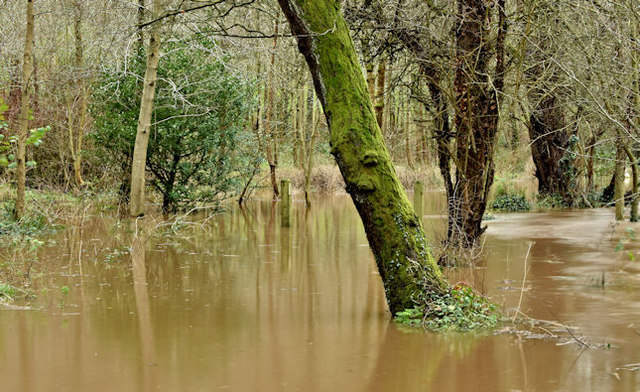
The flooded Lagan towpath, Minnowburn, Belfast - December 2015(1)
The Lagan towpath (left) hidden under the floodwaters of the very high and muddy Lagan. J3268 : The Lagan towpath near Minnowburn shows a dry view in April 2008. The Google map is not accurate.
The Lagan in flood, Shaw's Bridge, Belfast (Deceember 2015)
Some photographs, around Minnowburn and Shaws Bridge, showing the Lagan and Minnowburn in flood after recent rain. It was particularly heavy overnight on 29/30 December 2015.
Loading map... (JavaScript required)
- Grid Square
- J3268, 816 images (more nearby 🔍)
- Photographer
- Albert Bridge (more nearby)
- Date Taken
- Wednesday, 30 December, 2015 (more nearby)
- Submitted
- Wednesday, 30 December, 2015
- Subject Location
-
Irish:
 J 324 685 [100m precision]
WGS84: 54:32.8496N 5:57.2078W - Camera Location
-
Irish: J 324 685
- View Direction
- Southwest (about 225 degrees)