2014
SK0281 : Bridge (Brookside) over the A6 at Buxworth
taken 11 years ago, near to Whaley Bridge, Derbyshire, England
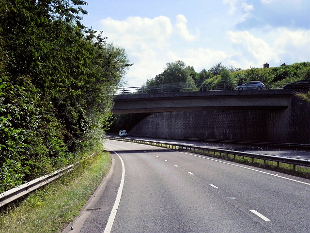
Bridge (Brookside) over the A6 at Buxworth
The Chapel-en-le-Frith /Whaley Bridge section of the A6 was bypassed in the 80s, with this four-mile long good dual carriageway which twists up the valley.
The A6
The A6 is Britain's fourth longest road and one of the main historic north-south roads in England. It currently runs for 299 miles from Luton in Bedfordshire to Carlisle in Cumbria, although it formerly started at a junction with the A1 at Barnet.
Running north west from Luton, the road travels through Bedford, bypasses Rushden, Kettering and Market Harborough, continues through Leicester, Loughborough, Derby and Matlock before going through the Peak District to Bakewell, Buxton, Stockport, Manchester, Salford, Pendleton, Irlams o' th' Height, Pendlebury, Swinton, Walkden, Little Hulton, Bolton, Chorley, Preston, Lancaster, Kendal and Penrith before reaching Carlisle.
See Link(Wikipedia) and Link
TIP: Click the map for more Large scale mapping
- Grid Square
- SK0281, 30 images (more nearby 🔍)
- Photographer
- David Dixon (more nearby)
- Date Taken
- Monday, 4 August, 2014 (more nearby)
- Submitted
- Sunday, 12 October, 2014
- Subject Location
-
OSGB36:
 SK 0210 8195 [10m precision]
WGS84: 53:20.0673N 1:58.1956W - Camera Location
-
OSGB36: SK 0204 8196
- View Direction
- EAST (about 90 degrees)