2011
J2766 : Canal overspill. Lambeg
taken 13 years ago, near to Lambeg, Co Antrim, Northern Ireland
Canal overspill. Lambeg
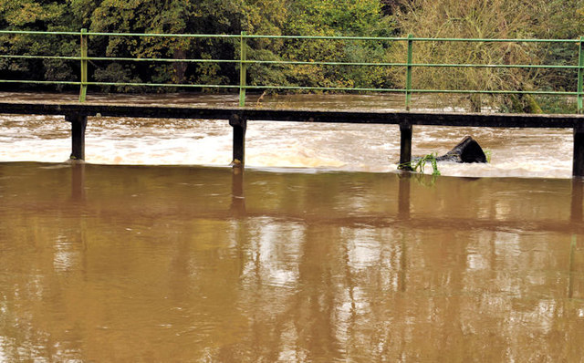
The River Lagan and the disused Lagan canal are very close on the Lisburn side of the Lambeg Bridge J2766 : The River Lagan, Lambeg (5). There was quite a flow on the canal (canals were built on the level and should not have flowing water) which, also, was much higher than usual resulting in a considerable overflow to the river. J2766 : The River Lagan at Lambeg (2) shows the overspill in drier conditions. J2765 : Canal overspill, Lambeg/Hilden (2011) shows the reason for the flow. J2766 : Canal overspill. Lambeg (2) (August 2012) shows the water at a much lower level.
Loading map... (JavaScript required)
- Grid Square
- J2766, 119 images (more nearby 🔍)
- Photographer
- Albert Bridge (more nearby)
- Date Taken
- Monday, 24 October, 2011 (more nearby)
- Submitted
- Monday, 24 October, 2011
- Subject Location
-
Irish:
 J 279 661 [100m precision]
WGS84: 54:31.6589N 6:1.4662W - Camera Location
-
Irish: J 279 661
- View Direction
- WEST (about 270 degrees)