2011
NT2477 : Foreshore of Wardie Bay
taken 13 years ago, near to Granton, Edinburgh, Scotland
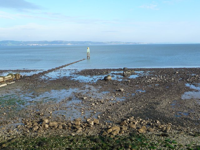
Foreshore of Wardie Bay
This is a photo of the foreshore of Wardie Bay at Trinity Bridge at 1031 on the 29th September, 2011, the lowest tide of the year. The tide was only 0.1 metre above datum. The pipe out to the beacon is a sewage overflow.
It was on this beach that the Earl of Hertford landed with his forces in 1544 when he sacked Leith.
It was on this beach that the Earl of Hertford landed with his forces in 1544 when he sacked Leith.
TIP: Click the map for more Large scale mapping
- Grid Square
- NT2477, 69 images (more nearby 🔍)
- Photographer
- ronnie leask (more nearby)
- Date Taken
- Thursday, 29 September, 2011 (more nearby)
- Submitted
- Friday, 30 September, 2011
- Subject Location
-
OSGB36:
 NT 248 771 [100m precision]
WGS84: 55:58.8579N 3:12.4040W - Camera Location
-
OSGB36: NT 2484 7701
- View Direction
- NORTH (about 0 degrees)