2011
NM2825 : Dun I
taken 13 years ago, near to Baile Mòr, Argyll And Bute, Great Britain
This is 1 of 7 images, with title Dun I in this square
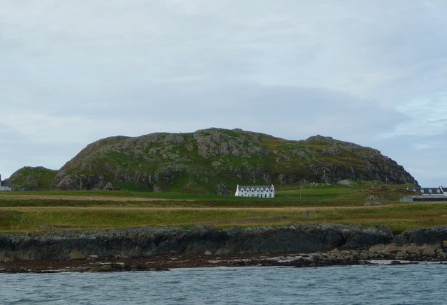
Dun I
At a height of 101 metres Dun I is the highest point on the island of Iona. It is an easy climb and from the summit affords a spectacular view in all directions.
TIP: Click the map for more Large scale mapping
- Grid Square
- NM2825, 77 images (more nearby 🔍)
- Photographer
- ronnie leask (more nearby)
- Date Taken
- Thursday, 15 September, 2011 (more nearby)
- Submitted
- Saturday, 24 September, 2011
- Subject Location
-
OSGB36:
 NM 283 252 [100m precision]
WGS84: 56:20.4563N 6:23.8990W - Camera Location
-
OSGB36: NM 293 249
- View Direction
- West-northwest (about 292 degrees)