2011
SP9307 : Browns Lane
taken 14 years ago, near to Cholesbury, Buckinghamshire, England
This is 1 of 5 images, with title starting with Browns in this square
Browns Lane
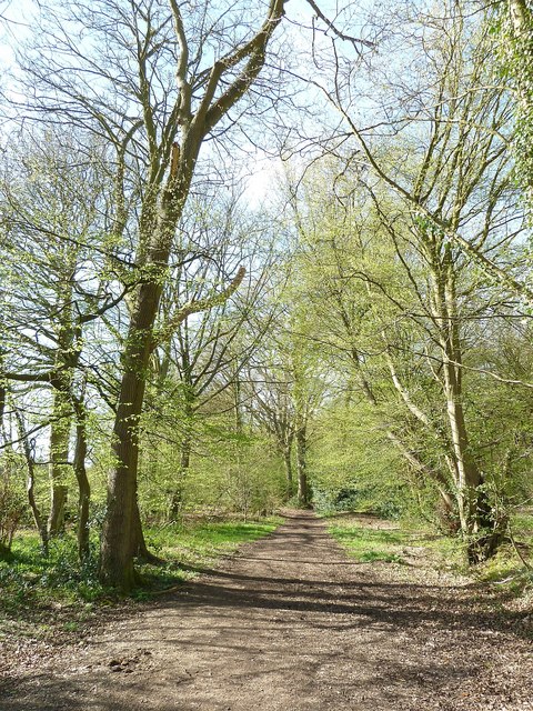
This leafy track is called Browns Lane and links Kiln Road near Cholesbury to SP9109 : Hastoe hamlet, this view being at its start on a bend on Kiln Road. Surprisingly perhaps this is a "Byway Open to All Traffic" (often abbreviated to BOAT) which means that motor vehicles can use it - but as a sign by the gate informs you, not between November and April. I don't think many cars use it even during the permitted months however - well not without a sumpguard anyway.
This is what it looks like in Spring (April) for the same view in Winter (January) see SP9307 : Browns Lane near its junction with Kiln Lane
This is what it looks like in Spring (April) for the same view in Winter (January) see SP9307 : Browns Lane near its junction with Kiln Lane
Browns Lane
Browns Lane is a public byway open to all traffic from March to October inclusive, but is effectively a bridleway from November to April.
It meanders in a roughly northwesterly direction from Kiln Lane north of Cholesbury at SP93310783 to the hamlet of Hastoe at SP91801937, rising 50m from 183m to 233m in the process. At its Hastoe end it has a number of houses.
For much of its length it passes through heavily wooded countryside with Haresgarden Wood to its left (SW) and first High Scrubs then Shrubb's Wood on its right (NE).
TIP: Click the map for more Large scale mapping
- Grid Square
- SP9307, 69 images (more nearby 🔍)
- Photographer
- Rob Farrow (more nearby)
- Date Taken
- Wednesday, 6 April, 2011 (more nearby)
- Submitted
- Thursday, 7 April, 2011
- Subject Location
-
OSGB36:
 SP 9330 0784 [10m precision]
WGS84: 51:45.6889N 0:38.9717W - Camera Location
-
OSGB36: SP 9331 0783
- View Direction
- Northwest (about 315 degrees)