near to Lockton, North Yorkshire, England
Coverage
We have
33 images
in grid square SE8690
Maps
TIP: Click the map for more Large scale mapping
Tip: Click the map to open the coverage map
Sample images
Breakdown list
A sample of 12 photos from 33
for SE8690
- View this square in the Browser >>>
|
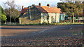
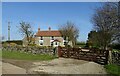
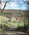
Low Pasture Farm
by Peter Church
The farm is just west of Dalby Forest, and this view is slightly south of east.
|
|
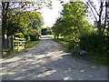
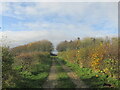
Farm Tracks |
|
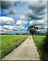
Dalby Forest Drive
by T Eyre
Near Longdale Howl.
|
|
Footpath to Whitethorn
by Martin Dawes
The footpath from High Pastures Farm runs through this dale to the stile in the centre of the photo.
|
|
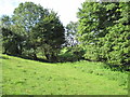
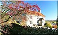
Whitethorn and Hawthorn
by Mick Garratt
Whitethorn is the name of the cottage.
|
|
Drive to Newstead Farm
The farm and driveway is not shown on the 2005 OS Explorer Map.
|
|
Whitethorn
by JThomas
|
|
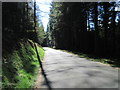
Low Staindale.
Just off the Dalby Forest drive.
|
|
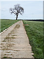
Solitary Tree, Low Pasture Farm |
|
Track to Low Staindale
Track leading down the hillside from Low Pasture farm to Low Staindale.
|
|
Track to Low Pasture farm
Lovely walking country.
|
|
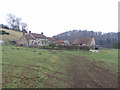
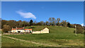
Low Staindale
by Mick Garratt
A delightful former farm-house situated in Staindale in the parish of Lockton. The farmstead is shown on the Thomas Jefferies map of 1775 and it is believed the farmhouse certainly dates from that time with later alterations and extensions.... (more)
|
Explore more images in this square: | View Filtering options | View all 33 images page by page >>> |
|