near to Easington, Northumberland, England
Coverage
We have
29 images
in grid square NU1335
Maps
TIP: Click the map for more Large scale mapping
Tip: Click the map to open the coverage map
Sample images
Breakdown list
A sample of 12 photos from 29
for NU1335
- View this square in the Browser >>>

|
Salt marsh, Budle Bay
by Richard Webb
Near a neap high water. The water is covering mud.
|

|
Hawthorn hedge with berries, Cockle Ridge
A short section of hawthorn hedge is laden with berries brightening up the autumnal hedgerow.
|

|
Pasture field
By a woodland strip at Cockle Ridge.
|

|
Bird watcher on permissive footpath
by Russel Wills
Returning from Budle Bay.
|

|
The sluice at Ross Low
by Oliver Dixon
The King Charles III England Coast Path crosses the stream at this point.
|

|
Looking towards Cockle Ridge
Looking across a recently sown arable field towards the woodland at Cockle Ridge.
|

|
Track in the wood at Cockle Ridge
by Russel Wills
A wind break between arable fields.
|

|
Head of Budle Bay
by Richard Webb
Far reaches inland with a neap high water covering mudflats. Drainage from fields is protected from tidal flooding by sluices.
|

|
Sluice on Ross Low
by Oliver Dixon
The King Charles III England Coast Path crosses Ross Low here.
|

|
Permissive Path towards Cockle Ridge Plantation
by Les Hull
|

|
Permissive footpath through woodland at Cockle Ridge
A permissive footpath allows access through the woodland at Cockle Ridge to Budle Bay at the woodlands eastern edge.
|
|
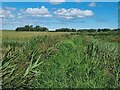
King Charles III Coast Path near Ross Low
by Oliver Dixon
Overgrown section of the newly-designated path. Because this length of path is only officially open for two months of the year, it is likely to suffer for lack of use.
|
Explore more images in this square: | View Filtering options | View all 29 images page by page >>> |
|