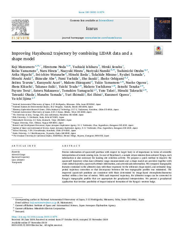
Icarus 338 (2020) 113574
Contents lists available at ScienceDirect
Icarus
journal homepage: www.elsevier.com/locate/icarus
Improving Hayabusa2 trajectory by combining LIDAR data and a
shape model
Koji Matsumoto a, m, *, Hirotomo Noda a, m, Yoshiaki Ishihara b, Hiroki Senshu c,
Keiko Yamamoto d, Naru Hirata e, Naoyuki Hirata f, Noriyuki Namiki d, m, Toshimichi Otsubo g, a,
Arika Higuchi d, Sei-ichiro Watanabe h, Hitoshi Ikeda i, Takahide Mizuno j, Ryuhei Yamada e,
Hiroshi Araki d, Shinsuke Abe k, Fumi Yoshida c, Sho Sasaki l, Shoko Oshigami d, 1,
Seiitsu Tsuruta a, Kazuyoshi Asari a, Makoto Shizugami d, Yukio Yamamoto j, m, Naoko Ogawa j,
Shota Kikuchi j, Takanao Saiki j, Yuichi Tsuda j, m, Makoto Yoshikawa j, m, Satoshi Tanaka j, m,
Fuyuto Terui j, Satoru Nakazawa j, Tomohiro Yamaguchi j, 2, Yuto Takei j, Hiroshi Takeuchi j, m,
Tatsuaki Okada j, Manabu Yamada c, Yuri Shimaki j, Kei Shirai j, Kazunori Ogawa f,
Yu-ichi Iijima j, 3
a
National Astronomical Observatory of Japan, 2-12 Hoshigaoka, Mizusawa, Oshu, Iwate 023-0861, Japan
National Institute for Environmental Studies, 16-2 Onogawa, Tsukuba, Ibaraki 305-8506, Japan
c
Planetary Exploration Research Center, Chiba Institute of Technology, 2-17-1, Tsudanuma, Narashino, Chiba 275-0016, Japan
d
National Astronomical Observatory of Japan, 2-21-1 Osawa, Mitaka, Tokyo 181-8588, Japan
e
The University of Aizu, Tsuruga, Ikki, Aizu-wakamatsu, Fukushima 965-8580, Japan
f
Kobe University, 1-1 Rokkodai, Nada, Kobe 657-8501, Japan
g
Hitotsubashi University, 2-1 Naka, Kunitachi, Tokyo 186-8601, Japan
h
Nagoya University, Furo, Chikusa, Nagoya 464-8601, Japan
i
Research and Development Directorate, Japan Aerospace Exploration Agency, 3-1-1 Yoshinodai, Chuo, Sagamihara, Kanagawa 252-5210, Japan
j
Institute of Space and Astronautical Science, Japan Aerospace Exploration Agency, 3-1-1 Yoshinodai, Chuo, Sagamihara, Kanagawa 252-5210, Japan
k
Nihon University, 7-24-1 Narashinodai, Funabashi, Chiba 274-8501, Japan
l
Osaka University, 1-1 Machikaneyama, Toyonaka, Osaka 560-0043, Japan
m
The Graduate University for Advanced Studies, SOKENDAI, Shonan Village, Hayama, Kanagawa 240-0193, Japan
b
A R T I C L E I N F O
A B S T R A C T
Keywords:
Asteroid Ryugu
Spacecraft trajectory
Laser altimeter
Topography
Precise information of spacecraft position with respect to target body is of importance in terms of scientific
interpretation of remote sensing data. In case of Hayabusa2, a sample return mission from asteroid Ryugu, such
information is also necessary for landing site selection activity. We propose a quick method to improve the
spacecraft trajectory when laser altimeter range measurements and a shape model are provided together with
crude initial trajectory, spacecraft attitude information, and asteroid spin information. We compared topographic
features contained in the altimeter data with those expressed by the reference shape model, and estimated longperiod trajectory correction so that discrepancy between the two topographic profiles was minimized. The
improved spacecraft positions are consistent with those determined by image-based stereophotoclinometry
method within a few tens of meters. With such improved trajectory, the altimeter ranges can be converted to
Ryugu’s topographic profiles that are appropriate for geophysical interpretation. We present a geophysical
application that invokes possibility of impact-induced formation of the Ryugu’s western bulge.
* Corresponding author at: National Astronomical Observatory of Japan, 2-12 Hoshigaoka, Mizusawa, Oshu, Iwate 023-0861, Japan.
E-mail address: koji.matsumoto@nao.ac.jp (K. Matsumoto).
1
Current affiliation: Institute of Space and Astronautical Science, Japan Aerospace Exploration Agency.
2
Current affiliation: Mitsubishi Electric Corporation.
3
Deceased.
https://doi.org/10.1016/j.icarus.2019.113574
Received 28 June 2019; Received in revised form 27 October 2019; Accepted 25 November 2019
Available online 27 November 2019
0019-1035/© 2019 Elsevier Inc. All rights reserved.
�K. Matsumoto et al.
Icarus 338 (2020) 113574
1. Introduction
Hayabusa2 spacecraft successfully arrived at the target C-type
asteroid 162173 Ryugu on 27 June 2018, with its “home position” being
about 20 km above the sub-Earth point. Soon after arrival, near-global
observations started with Hayabusa2’s remote sensing instruments, i.
e., Optical Navigation Camera (ONC) (Kameda et al., 2017), 3 μm NearInfrared Spectrometer (NIRS3) (Iwata et al., 2017), Thermal Infrared
Imager (TIR) (Okada et al., 2017), and laser Light Detection and Ranging
altimeter system (LIDAR) (Mizuno et al., 2017). Because Hayabusa2 is a
sample return mission, landing site selection (LSS) was performed based
on the observed data (Watanabe et al., 2019). The objective of the LSS is
to evaluate scientific value and touchdown safety, and to select and rank
possible landing sites, in which making characterization maps are of
importance. Because such map products depend on the spacecraft position with respect to the asteroid, it is necessary to provide precise
spacecraft trajectory in a timely manner. Note that the LSS schedule was
tight; the LSS team selected landing site candidates on 17 August 2018,
only 51 days after the arrival.
Hayabusa2 is not orbiting Ryugu but hovering near the asteroid
during the proximity phase (Tsuda et al., 2013), and the spacecraft occasionally performs control maneuvers to maintain its altitude with
respect to the asteroid. Scientific observations often take place when the
spacecraft is not visible from the tracking station in Japan (UDSC: Usuda
Deep Space Center). Because of this situation, initial spacecraft trajectory with respect to the asteroid, which is provided by the Hayabusa2
engineering team, can have error in the order of hundreds of meters
during the scientific observations. This level of position error is too large
to properly characterize the small asteroid of about 1 km in size by
remote sensing data. The spacecraft position can also be retrieved
through shape modeling procedure as camera position, but it is
restricted to period during which images are taken.
Here we propose a relatively simple and quick method to correct for
spacecraft trajectory error by using LIDAR data together with a shape
model constructed mainly from image data. This method is similar to
those presented by Abe et al. (2006) and Barnouin-Jha et al. (2008), but
differs in not using information on location of illuminated centroid of
the asteroid on image coordinate system. Once a shape model of certain
quality is developed, this method can be applied when certain duration
of LIDAR observations are available. The method makes use of Markov
chain Monte Carlo (MCMC) to find a solution that minimizes residual,
without requiring computation of partial derivatives that is necessary in
conventional orbit determination batch analysis. Such quick products of
improved spacecraft trajectory have been provided to the LSS team, and
for example, used for NIRS3 data analysis (Kitazato et al., 2019).
Fig. 1. Time series of LIDAR ranges for (a) Box-A observation made on 10 July
2018, and (b) Box-C observation on 20 July 2018. Time is in UT. Labels indicated in (a) are names of large craters in equatorial region.
movable region beyond the Box-A, which enables better observations of
higher latitudes or observations with different illumination angles. Lowaltitude observation is realized in the Box-C configuration, in which finescale topographic features can be retrieved by LIDAR with its smaller
footprints.
In this paper, we present one of Box-A observations made on 10 July
2018 and one of Box-C observations made on 20 July 2018, as examples.
Hereafter the former is referred to as Obs-1 and the latter as Obs-2,
respectively. Fig. 1a shows time series of LIDAR ranges of Obs-1. The
LIDAR points to near the Ryugu center, with its footprint located on near
equatorial region. In this configuration, the LIDAR footprints moves
westward with time and whole longitude is covered owing to the
asteroid rotation after one revolution (7.63 h). The undulations seen in
Fig. 1a contain topographic information of Ryugu surface, e.g., bumps
correspond to large craters and smaller-scale depressions correspond to
boulders. Names of four corresponding large craters are also indicated in
Fig. 1a; Brabo (229.7� E, 4.5� N), Kintaro (157.8� E, 0.4� N), Urashima
(92.9� E, 8.1� S), and Kolobok (333.5� E, 1.5� S). The spacecraft position
can be inferred by comparing these observed topographic features with
those predicted by an existing shape model that is constructed from
images. The second example, time series of LIDAR ranges of Obs-2, is
shown in Fig. 1b. The jumpy pattern of the time series is because of scan
observation in which spacecraft attitude, and hence LIDAR boresight
direction, is periodically changed. Such a scan observation enables
wider geographical sampling, which helps us estimate LIDAR boresight
direction (Section 3.3).
2. Inputs to trajectory analysis
2.1. LIDAR range observations
Hayabusa2 LIDAR is designed to enable observations from home
position (~20 km) down to 30 m altitude with range resolution of 0.5 m.
In order to realize the wide dynamic range, the LIDAR system has two
receiver optics (far and near). The near receiver is usually turned on at 1
km altitude during descent operation and takes over the far receiver at
an altitude about 300 m. The repetition rate is 1 Hz for scientific observations, simultaneous observation with Earth-based 2-way spacecraft
tracking, and critical descent operations, otherwise LIDAR operates at 1/
32 Hz for nominal navigation. The footprint size depends on altitude.
For example, for the far receiver whose FOV is 1.5 mrad, the footprint
size is 30 m in diameter at an altitude of 20 km. See Mizuno et al. (2017)
for detailed specification of the LIDAR system.
There are three configurations for Hayabusa2 remote sensing
observation during which there is no trajectory maintenance maneuvers
for one asteroid rotation; Box-A, -B and -C. The spacecraft stays around
the home position in the Box-A operation, while the Box-B extends the
2.2. Shape models
Global shape models were constructed from narrow angle ONC
(ONC-T) images using two independent methods; one is stereophotoclinometry (SPC) technique (Gaskell et al., 2008) and the other is
Structure-from-Motion (SfM) technique (Szeliski, 2010). Shape models
2
�K. Matsumoto et al.
Icarus 338 (2020) 113574
where F is footprint position vector, S is spacecraft position vector, bl is
LIDAR pointing unit vector (satellite attitude plus LIDAR alignment),
and R is observed LIDAR range. All the vectors are described in Ryugucentered body-fixed rotating frame.
If all information in Eq. (1) was perfect, the collective footprints
would delineate the shape of the asteroid. In reality, however, there are
various errors affecting the footprint positions, among which the largest
is generally the trajectory error, making the resultant LIDAR footprints
deviate from the shape model. We regard this deviation as residual for
which two possible definitions are described in Fig. 2. It is more
straightforward to employ residual definition A, because LIDAR observes line-of-sight ranges from the spacecraft to the asteroid surface,
but definition B is more appropriate when high latitude regions are
observed by a scan operation (Section 4.3). The other advantage of
definition B is that it is always definable, which is helpful when spacecraft position error is too large for the extension of the LIDAR pointing
vector to intersect at the asteroid surface, making definition A
undefinable.
The reason why we get the footprint position in the body-fixed frame
in Eq. (1) is because the shape model itself, that is used to calculate the
residual, is defined in such a frame. Here we neglect the LIDAR footprint
size, and for simplicity, assume that the LIDAR footprint is point-wise
when calculating the residual. We also assume that the spacecraft attitude as determined by the onboard star-tracker is correct. LIDAR measurement bias has been corrected for based on pre-launch ground test
result. The reference of LIDAR range observation is the instrument’s
mounting plane, having an offset from spacecraft center of mass, which
is ignored in this study because the offset is smaller than the size of the
spacecraft main body (~1.6 m).
Fig. 2. A schematic view of residual definition. Residual A is used for nominal
analysis, while residual B is used for latitudinal scan observation for near-global
coverage. The surface intersecting points are different between two definitions.
by these two techniques show good agreement with each other (Watanabe et al., 2019). The SPC method also provides the asteroid spin parameters and camera positions; the former includes spin axis orientation
and spin period which are necessary to define asteroid-fixed coordinate
system, and the latter information is regarded as SPC-based spacecraft
positions to be compared with LIDAR-based trajectory of this study
(Sections 4.2 and 4.3). The shape models have been continuously
updated as of this writing, while the results presented in this paper are
based on the SPC model version 20181109 with 3,145,728 facets unless
otherwise indicated.
2.3. Initial trajectory
The initial trajectory is called as HPK (Home Position Keeping) trajectory for which “Home Position (HP) coordinate system” is used as a
quasi-inertial coordinate system (Terui et al., 2016). This is an asteroidcentered coordinate system, with the Z-axis directs toward Earth, the Yaxis being perpendicular to both the asteroid-Earth and asteroid-Sun
vectors, and the X-axis completes the right-hand coordinate system.
The radiometric and optical hybrid navigation technique named
“HPNAV (Home Position Navigation)” is used to estimate the initial
trajectory for which RARR (range and rage rate) data and centroid direction information derived from ONC are used. In the HP coordinate
system, a Z-component of distance and velocity can be obtained by
differentiating RARR data between the spacecraft (i.e., observation
data) and asteroid (i.e., calculated value based on ephemeris). The
advantage of this method is that the spacecraft altitude can be calculated
without incorporating LIDAR data, making operation load very low
because the altitude can be obtained immediately after the 2-way RARR
data are acquired at a ground station. The HPK trajectory is adequate for
station keeping objective, but its accuracy is not high enough for scientific observations, partly because the error in asteroid’s ephemeris
affects the altitude calculation.
3.2. MCMC formulation
We make use of MCMC algorithm to find LIDAR boresight direction
(Section 3.3) and to improve spacecraft trajectory (Section 3.4). For
every LIDAR measurement the residual is calculated as a function of
boresight or trajectory parameters. The likelihood function L, which is a
measure of misfit between the model predictions and the observations, is
written as
!
Nobs
X
½Rn �2
L∝exp
2σ 2
n¼1
where Nobs is the number of LIDAR range observations contained in the
arc, Rn is the residual for n-th observation, and σ is uncertainty of the
observation. Although specified LIDAR range accuracy is �5.5 m at 25
km altitude (Mizuno et al., 2017), we chose a larger value of 10 m for σ,
because shape model error also contributes to the residual. The solutions
of the parameters and their uncertainties are obtained from posterior
distribution that is sampled by the MCMC algorithm. We have corrected
>10,000 samples from 10 chains after the first 30% of the samples are
thrown away for each chain as a burn-in period. Parameter uncertainty
is evaluated as the 95% upper and lower credible intervals of the posterior distribution, corresponding to 2σ . We employed CosmoMC package (Lewis, 2013) as a generic sampler.
3. Method
3.1. LIDAR-derived topography and residual
Because LIDAR provides a direct measure of the spacecraft altitude
with respect to surface of the target, its time-series data can be used to
improve target-relative trajectory of the spacecraft. The basic idea is to
find a correction term which makes “LIDAR-derived topography” fit to
the chosen reference shape model. The LIDAR-derived topography is, in
other words, a sequence of LIDAR footprint positions expressed in
asteroid-centered body-fixed rotating frame. Given the positions of
Hayabusa2 and Ryugu, the spacecraft attitude, LIDAR alignment, LIDAR
range, and rotational information of the asteroid (orientation and spin
period), the footprint positions can be computed as follows;
FðtÞ ¼ SðtÞ þ blðtÞRðtÞ
3.3. LIDAR boresight estimation using SPC trajectory
Alignment of LIDAR with respect to the spacecraft body affects the
calculation of footprint positions. It is difficult to simultaneously estimate both alignment and trajectory by minimizing the residual
mentioned above, because these two correlates with each other.
Therefore we need independent information of the spacecraft position in
order to estimate LIDAR alignment. For this purpose, we used SPCderived trajectory on July 20, 2018, where ONC-T images were obtained every 5 min, which makes the trajectory reliable enough. In
(1)
3
�K. Matsumoto et al.
Icarus 338 (2020) 113574
3.4. Trajectory correction
We follow two-step procedures to obtain trajectory correction; (step1) simple polynomial fit and (step-2) MCMC parameter search. The first
step is to fit polynomial functions to the residual time series. For this
purpose, the residual vectors obtained in the body-fixed frame (Section
3.1) are rotated to J2000 inertial frame. We assume that long-term
variation in the residual time series is due to error in the given (or
initial) trajectory, and get correction time series by fitting a polynomial
function for each of X, Y, Z component. The degree of polynomial is
usually two with the number of parameters being 9 (3 coefficients of
quadratic functions for 3 components), but four is sometimes better with
the number of parameters being 15 when altitude is changing (i.e.,
during decent or ascent operation) during the arc. Because no orbit
maintenance maneuver is performed during scientific observation of
about 8 h, arc length can generally be set longer than the rotation period
of Ryugu (7.63 h), by which topographic features from all the longitudes
can be taken into the analysis, providing geometrical strength.
In general, the simple polynomial fit still leaves residuals of several
tens of meters, part of which come from imperfect shape model, but
trajectory error is still more dominant. As the second step of the analysis,
we make use of MCMC algorithm to explore fine-tuning parameters of
additional correction which further reduce the residuals. The additional
correction is expressed by quadratic functions with 9 parameters,
regardless of the degree of polynomial in step-1. After seeing convergence, one set of additional correction parameters that minimize the
residual are found, by which improved spacecraft positions are reconstructed throughout the given arc.
4. Results and discussion
Fig. 3. Residual time series for (a) Box-A observation on 10 July 2018, and (b)
Box-C scan observation on 20 July 2018, respectively. Time is in UT. Residuals
calculated with three trajectories, i.e., initial trajectory, trajectory after simple
polynomial fit (step-1), and trajectory after MCMC search (step-2), are indicated by light-blue, blue, and red. Inlet in (b) is a close-up in terms of y-axis for
better comparison between step-1 and -2. (For interpretation of the references
to color in this figure legend, the reader is referred to the web version of
this article.)
4.1. Residual and footprints
Shown in Fig. 3 is how residuals are reduced by this study, where the
results with three trajectories, i.e., initial, step-1 (simple polynomial fit),
and step-2 (MCMC) are compared. Mean and RMS of the residuals are
summarized in Table 1. For Obs-1, the initial trajectory has a mean bias
of about 80 m with respect to the asteroid, while it is >400 m for Obs-2.
The step-1 trajectory reduces standard deviation to about 6 m for both
the Obs-1 and -2 cases, and the MCMC procedure successfully makes the
residual level down to about 2 m to find more appropriate solution of the
spacecraft positions.
Fig. 4a and b show LIDAR footprints for Obs-1 and -2, respectively.
Footprints calculated with initial, step-1, and step-2 trajectories are
indicated by light-blue, blue, and red dots, respectively. Because both
the initial trajectories are too close to Ryugu, their footprints (light-blue)
shrink inside the asteroid body. On the other hand, the step-1 solution
(blue) is roughly aligned with the shape model (gray), and step-2 solution (red) is further fine-tuned which is also reflected on the smaller
residual (Table 1 and Fig. 3).
addition, we performed a scan observation on this day, which enabled
LIDAR to sample various topographic features on Ryugu surface between �10� latitude.
The unit vector of LIDAR boresight direction with respect to spacecraft
coordinate
system
is
expressed
as
�
qffiffiffiffiffiffiffiffiffiffiffiffiffiffiffiffiffiffiffiffiffiffiffiffiffiffiffiffiffiffiffiffiffiffiffiffiffiffiffi �
2
2
Xbs ; Ybs ;
. Note that the LIDAR instrument is
1 ðXbs Þ
ðYbs Þ
installed on –Z plane. Given the SPC shape model and accompanying
trajectory of version 20180810, we estimated the parameters Xbs and Ybs
which minimize the residual by MCMC method. We got solution as (Xbs,
Ybs) ¼ (0.00435 � 0.0001, 0.00007 � 0.00007), which is compared with
(Xbs, Ybs) ¼ (0.00365, 0.00015) estimated by laser link experiment
(Noda et al., 2017). Angular separation between the two estimates is
0.73 mrad, which is within the suggested error in the latter estimate of
about 1 mrad (Noda et al., 2017). All the analyses described below
employ this MCMC-derived boresight direction as a fixed value.
4.2. Trajectory comparison
The camera positions are determined through SPC shape modeling,
which provides independent estimate of the spacecraft positions.
Although it is difficult to precisely assess the absolute accuracy of the
LIDAR-based trajectory, a comparison with the SPC-based spacecraft
Table 1
Comparison of residual statistics among three trajectories, i.e., initial trajectory, trajectory after simple polynomial fit (step-1), and trajectory after MCMC search (step2). Mean and root mean square (RMS) are shown. Unit is in meter. Also listed are number of LIDAR observations and number of parameters solved for by MCMC.
Obs-1 (Box-A July 10 2018)
Obs-2 (Box-C July 20 2018)
Initial trajectory
Step-1 trajectory
Step-2 trajectory
Mean
RMS
Mean
RMS
Mean
RMS
83.4
430.9
9.2
20.9
6.0
6.1
5.6
5.6
2.2
2.0
2.4
1.9
4
Number of LIDAR observations
Number of parameters solved for
24,250
35,343
9
9
�K. Matsumoto et al.
Icarus 338 (2020) 113574
Fig. 4. LIDAR footprints for (a) Box-A observation on
10 July 2018, and (b) Box-C scan observation on 20
July 2018, respectively. Footprints calculated with
three trajectories, i.e., initial trajectory, trajectory
after simple polynomial fit (step-1), and trajectory
after MCMC search (step-2), are indicated by lightblue, blue, and red. Gray dots indicate the reference
SPC shape model (with reduced vertices for better
visibility). (For interpretation of the references to
color in this figure legend, the reader is referred to
the web version of this article.)
Fig. 5. Position differences between SPC-based and LIDAR-based spacecraft
positions for (a) Box-A observation on 10 July 2018 and (b) Box-C scan
observation on 20 July 2018. Vector components in Home Position (HP) frame
and its norm are shown.
position gives us an idea on relative consistency between the two
methods. Fig. 5 shows vector differences between SPC- and LIDAR-based
spacecraft positions, together with decomposed differences in the HP
coordinate system. The data points correspond to the timing when images are taken by ONC-T. High-frequency oscillations of about 1-m
amplitude come from the SPC solution. The Z-component is dominant
for both Obs-1 and -2 when expressed in the HP coordinate system. The
position differences are up to 42 m and 18 m for Obs-1 and -2, respectively. Possible reasons for the better agreement for Obs-2 are (1)
stronger image constraint is brought by multiple viewing angles owing
to the scan observation, (2) the scan observation also makes LIDAR
observation geometry stronger with two-dimensional ground tracks on
the asteroid surface, and (3) the lower altitude for Obs-2 makes the
LIDAR footprint smaller and the image resolution better (by a factor of
about 3), providing better sensitivity for smaller topographic features.
Fig. 6. Geographical distribution of residual for near-global scan observation
on 19 July 2018, during a decent operation from 12.5 to 10.5 km altitude. From
top to bottom; (a) with original time tag and residual definition A, (b) with
corrected time tag and residual definition A, and (c) with corrected time tag and
residual definition B. See Fig. 2 for the residual definitions. The geographical
position is calculated as surface intersecting point, not LIDAR footprint position. Color map peaks at 100 m and residuals exceeding 100 m are also indicated as yellow. (For interpretation of the references to color in this figure
legend, the reader is referred to the web version of this article.)
5
�K. Matsumoto et al.
Icarus 338 (2020) 113574
Fig. 7. Vector differences between SPC-based and LIDAR-based spacecraft
positions for near-global scan observation on 19 July 2018. Results with residual definitions A and B are indicated by green and blue, respectively. (For
interpretation of the references to color in this figure legend, the reader is
referred to the web version of this article.)
4.3. Some particularities of scan observation
On 19 July 2018, one day before Obs-2 (Box-C), we made near-global
observation with altitudes descending from 12.5 km to 10.5 km, where
the scan width was larger than that for Obs-2, covering high-latitude
regions. For this continuous arc of about 9 h, we followed the similar
analysis procedure described above and found two problems for this
observation. The first problem is that the LIDAR time tags are shifted by
1 s that results in larger residual. Unfortunately, the 1 s ambiguity in the
time tags is unavoidable because of the uncertainty in packet retrieving
timing. This is not critical for nominal observations because ground
speed of LIDAR footprint due to asteroid rotation is only about 11 cm/s,
but is brought into sight when the spacecraft attitude is rapidly scanned.
Fig. 6a and b respectively show the residual before and after correcting
for the time tag error, showing that the error is detectable by checking
the residual. All the scan observations are subjected to this check. As of
this writing, the case on 19 July 2018 is the only one that is found to
contain the time tag error.
The second problem is that the residual can become very large
exceeding 100 m (Fig. 6b) with definition A. Such large residuals may be
caused by the assumption of point-wise LIDAR footprint (neglecting
footprint extent part of which may intersect with Ryugu surface) and/or
error of the reference shape model. However, most of these unnatural
large residuals are suppressed, as shown in Fig. 6c, by taking the definition as B (Fig. 2). We still observe larger residuals near Otohime
boulder, the largest boulder of 160 m in size centered at (274.4� E,
69.8� S), where the imaging condition is not good enough for shape
modeling at high latitude. A part of the boulder has vertically-cut shape,
which also causes the large residuals there with the definition B. Plotted
in Fig. 7 is the consistency relative to the SPC-based spacecraft positions
for two trajectories that are constructed using the residual definitions A
and B. The trajectory with definition B is more consistent with the SPC
results. Therefore, for such a scan observation extending to high latitudes, we first derive LIDAR-based trajectory with the residual definition
A, which is then used as the initial trajectory to be improved by succeeding iterative analysis with the residual definition B.
Fig. 8. (a) A representation of Ryugu’s shape in terms of even zonal harmonics
up to degree 180, (b) LIDAR-derived topography with respect to a sphere of
which radius is 447.7 m, and (c) LIDAR-derived topography with respect to the
zonal harmonics representation. Note that different color scales are used for (b)
and (c). The LIDAR data are acquired by near-global scan observation on 19
July 2018 and mid-latitude scan observation on 30 October 2018.
region (Ryujin Dorsum) and low in mid-latitude regions. The equatorial
ridge is considered to be formed by initial spin rate higher than that of
present day (Watanabe et al., 2019).
In order to make regional and local topographic features more
visible, here we represent a reference shape by even zonal harmonics.
The SPC shape model version 20181109 is expanded into spherical
harmonics up to degree 180, and the reference shape is reconstructed
from the zonal coefficients of even degree only. The resultant reference
shape (Fig. 8a) is flat in longitudinal direction and symmetric with
respect to the equator, which is convenient to detect non-symmetric
regional features. Smaller scale local topographies are also enhanced
by subtracting this reference shape. Shown in Fig. 8c is the LIDARderived topography with respect to the zonal harmonics
4.4. Reference shape and local topography
Near global topography of Ryugu can be depicted by LIDAR observations scanning in latitudinal direction. We present data from two scan
operations on 19 July 2018 and 30 October 2018. While the former
extends to high latitudes, the latter provides us spatially denser data
between about 15� N and 40� S (but with a longitudinal gap between
120� E and 170� E). Because of Ryugu’s top shape, a sphere with mean
radius is too simple to be used as a reference. As show in Fig. 8b, with
such a reference sphere Ryugu exhibits topographic high in equatorial
6
�K. Matsumoto et al.
Icarus 338 (2020) 113574
Fig. 9. LIDAR-derived topography with respect to the zonal reference shape plotted on an orthographic projection; (a) western bulge centered at (225� E, 10� S), and
(b) antipode of (a) centered at (45� E, 10� N). The centers are indicated by yellow circles. The circle in light-blue indicates the deepest point at (36� E, 10� N). (For
interpretation of the references to color in this figure legend, the reader is referred to the web version of this article.)
representation. Craters and boulders are more distinctly visible in Fig. 8c
than in Fig. 8b. Some large craters exhibit raised rims, e.g., Urashima,
Kolobok, and Brabo. They are likely of impact origin, because raised
rims are not expected by release of large boulders due to centrifugal
force of fast-spinning asteroid (Sugita et al., 2019).
asymmetry (e.g., Wilhelms, 1987). Petero and Pieters (2008) estimated
distribution of ejecta from South Pole-Aitken basin and found that significant amount of ejecta can be deposited near the basin rim and antipode. Their calculation, however, is under the assumptions of vertical
impact, symmetrical distribution of ejecta, and no lunar rotation. The
antipode deposition may not explain the Ryugu’s western bulge either,
because the suggested oblique impact would have made the ejecta distribution asymmetric, and because of suggested initial spin period as
short as 3.5 h (Watanabe et al., 2019). Nevertheless, the impact ejecta
might have formed part of equatorial topographic high on the east of the
impact site (Fig. 8c).
Third, Hirabayashi et al. (2019) argued that the western bulge was
developed due to rotationally induced deformation process. They
analyzed the locations that experience structural failure using a finite
element model technique within the present shape of Ryugu, and found
that the western bulge is structurally more relaxed and that the bulge
would have been formed at a short spin period <3.5 h in the past. The
putative impact might have triggered such a deformation process.
Rotation speed of Ryugu might have been increased by the west-to-east
impact. The mass deficit in the low-latitude region would also have
resulted in reduced polar moment of inertia and then spin-up.
4.5. Possible origin of western bulge
Sugita et al. (2019) found a west/east dichotomy that western side
(160� E – 290� E) surrounded by troughs is characterized by higher vband (0.55 μm) albedo and lower number density of large boulders. Two
troughs on the southern hemisphere are named as Tokoyo Fossa (near
160� E) and Horai Fossa (near 290� E). The western topographic high
(hereafter referred to as western bulge) is also bounded by an unnamed
topographic depression on the northern hemisphere (Fig. 8c). When the
LIDAR-derived topography with respect to the zonal reference shape is
plotted (Fig. 9a) on an orthographic projection centered at (225� E,
10� S), these topographic lows almost align along a circle, having similar
separation angle from the center. Interestingly, Fig. 9b shows that there
is a depression with minimum depth of 55 m at (36� E, 10� N) near the
antipode (45� E, 10� N) of the western bulge center.
The above fact invokes the possibility of impact-induced formation
of the western bulge. Undulation of the equatorial ridge seen in Fig. 8b,
i.e., southward offset (0� E – 90� E) and slight northward offset (120� E –
180� E) of the crest, could also be explained by the impact. If the large
and deep depression in Fig. 9b was impact origin, judging from its
elongated shape, it should have been an oblique impact from west to east
direction. We leave detailed analyses for future studies, but discuss the
following three possible scenarios for the western bulge formation; (1)
seismic focusing, (2) impact ejecta, and (3) rotationally induced
deformation.
First, grooved and hilly terrains are found near the antipode of major
basins on the Moon and Mercury, which is linked with antipodal seismic
focusing effects (e.g., Schultz and Gault, 1975). The similar idea may
apply to Ryugu. However, as examined by Meschede et al. (2011) for
terrestrial meteorite impact case, lateral heterogeneity and ellipticity of
the targeted body dramatically reduce the peak antipodal displacements. Because Ryugu’s shape far deviates from spherical symmetry, the
seismic focusing effect may not be so effective.
Second, ejecta from large impact basins are thought to have played
an important role in the geologic evolution of the lunar crust and its
5. Summary
We improved Hayabusa2 spacecraft trajectory by comparing the
LIDAR-observed topographic features with those expressed by a shape
model that is constructed from image data. Development of this method
was motivated by landing site selection process for which precise trajectory of the hovering spacecraft was needed in a timely manner. The
method is used, on a regular basis even after the LSS finished, to convert
the observed LIDAR ranges to topography expressed in the asteroidfixed frame. The improved spacecraft positions are consistent with
those determined by image-based SPC method within a few tens of
meters. By using LIDAR scan observations and the improved spacecraft
trajectory, Ryugu’s topography is delineated with respect to a reference
shape expressed by even zonal harmonics. We found that the deepest
topographic low is located near the antipode of the western bulge center,
which invokes the possibility of impact-induced formation of the western bulge.
7
�K. Matsumoto et al.
Icarus 338 (2020) 113574
Acknowledgements
Lewis, A., 2013. Efficient sampling of fast and slow cosmological parameters. Phys. Rev.
D: Part. Fields 87, 103529. https://doi.org/10.1103/PhysRevD.87.103529.
Meschede, M.A., Myhrvold, C.L., Tromp, J., 2011. Antipodal focusing of seismic waves
due to large meteorite impacts on Earth. Geophys. J. Int. 187, 529–537. https://doi.
org/10.1111/j.1365-246X.2011.05170.x.
Mizuno, T., Kase, T., Shiina, T., Mita, M., Namiki, N., Senshu, H., Yamada, R., Noda, H.,
Kunimori, H., Hirata, N., Terui, F., Mimasu, Y., 2017. Development of the laser
altimeter (LIDAR) for Hayabusa2. Space Sci. Rev. 208, 33–47. https://doi.org/
10.1007/s11214-015-0231-2.
Noda, H., Kunimori, H., Mizuno, T., Senshu, H., Ogawa, N., Takeuchi, H., Moore, C.,
Pollard, A., Yamaguchi, T., Namiki, N., Kase, T., Saiki, T., Tsuda, Y., 2017. Laser link
experiment with the Hayabusa2 laser altimeter for in-flight alignment measurement.
Earth Planets Space 69 (2). https://doi.org/10.1186/s40623-016-0589-8.
Okada, T., Fukuhara, T., Tanaka, S., Taguchi, M., Imamura, T., Arai, T., Senshu, H.,
Ogawa, Y., Demura, H., Kitazato, K., Nakamura, R., Kouyama, T., Sekiguchi, T.,
Hasegawa, S., Matsunaga, T., Wada, T., Takita, J., Sakatani, N., Horikawa, Y.,
Endo, K., Helbert, J., Müller, T.G., Hagermann, A., 2017. Thermal infrared imaging
experiments of C-type asteroid 162173 Ryugu on Hayabusa2. Space Sci. Rev. 208,
255–286. https://doi.org/10.1007/s11214-016-0286-8.
Petero, N. E. and C. M. Pieters (2008), The lunar-wide effects of basin ejecta distribution
on the early megaregolith, Meteorit. Planet. Sci., 43, Nr 8, 1517–1529, doi:
https://doi.org/10.1111/j.1945-5100.2008.tb01025.x.
Schultz, P.H., Gault, D.E., 1975. Seismic effects from major basin formations of the Moon
and Mercury. Moon 12, 159–177.
Sugita, S., et al., 2019. The geomorphology, color, and thermal properties of Ryugu:
implications for parent-body processes. Science 364, 268–272. https://doi.org/
10.1126/science.aaw0422.
Szeliski, R., 2010. Computer Vision: Algorithms and Applications. Science & Business
Media, Springer, New York.
Terui, F., Ogawa, N., Mimasu, Y., Ono, G., Ueda, S., Yamamoto, T., Yamaguchi, T.,
Saiki, T., Tsuda, Y., 2016. GN&C of Hayabusa2 in “cruising phase” and “asteroid
proximity phase”, AAS 16-106. In: Proceedings of the 39th Annual AAS Rocky
Mountain Section Guidance and Control Conference, February 5–10, Breckenridge,
Colorado.
Tsuda, Y., Yoshikawa, M., Abe, M., Minamino, H., Nakazawa, S., 2013. System design of
the Hayabusa 2 – asteroid sample return mission to 1999 JU3. ActaAstronautica 90,
356–362. https://doi.org/10.1016/j.actaastro.2013.06.028.
Watanabe, S., et al., 2019. Hayabusa2 arrives at the carbonaceous asteroid 162173
Ryugu - a spinning top-shaped rubble pile. Science 364, 268–272. https://doi.org/
10.1126/science.aav8032.
Wessel, P., Smith, W.H.F., 1991. Free software helps map and display data. Eos. Trans.
AGU 72, 441.
Wilhelms, D.E., 1987. The Geologic History of the Moon, 1st ed. United States Geological
Survey, Washington, D.C. (327 p).
We used NASA’s SPICE ancillary information system (Acton, 1996)
and the Generic Mapping Tools (GMT) software (Wessel and Smith,
1991) for this study. We thank two anonymous reviewers for their
constructive comments.
References
Abe, S., Mukai, T., Hirata, N., Barnouin-Jha, O., Cheng, A., Demura, H., Gaskell, R.,
Hashimoto, T., Hiraoka, K., Honda, T., Kubota, T., Matsuoka, M., Mizuno, T.,
Nakamura, R., Scheeres, D., Yoshikawa, M., 2006. Mass and local topography
measurements of Itokawa by Hayabusa. Science 312 (5778), 1344–1347. https://
doi.org/10.1126/science.1126272.
Acton, C.H., 1996. Ancillary data services of NASA’s navigation and ancillary
information facility. Planet. Space Sci. 44 (1), 65–70.
Barnouin-Jha, O.S., Cheng, A.F., Mukai, T., Abe, S., Hirata, N., Nakamura, R., Gaskell, R.
W., Saito, J., Clark, B.E., 2008. Small-scale topography of 25143 Itokawa from the
Hayabusa laser altimeter. Icarus 198, 108–124. https://doi.org/10.1016/j.
icarus.2008.05.026.
Gaskell, R.W., Barnouin-Jha, O.S., Scheeres, D.J., Konopliv, A.S., Mukai, T., Abe, S.,
Saito, J., Ishiguro, M., Kubota, T., Hashimoto, T., Kawaguchi, J., Yoshikawa, M.,
Shirakawa, K., Kominato, T., Hirata, N., Demura, H., 2008. Characterizing and
navigating small bodies with imaging data. Meteorit. Planet. Sci. 43, 1049–1061.
https://doi.org/10.1111/j.1945-5100.2008.tb00692.x.
Hirabayashi, M., et al., 2019. The western bulge of 162173 Ryugu formed as a result of a
rotationally driven deformation process. The Astrophysical Journal Letters 874 (1).
https://doi.org/10.3847/2041-8213/ab0e8b.
Iwata, T., Kitazato, K., Abe, M., Ohtake, M., Arai, T., Arai, T., Hirata, N., Hiroi, T.,
Honda, C., Imae, N., Komatsu, M., Matsunaga, T., Matsuoka, M., Matsuura, S.,
Nakamura, T., Nakato, A., Nakauchi, Y., Osawa, T., Senshu, H., Takagi, Y.,
Tsumura, K., Takato, N., Watanabe, S., Barucci, M., Palomba, E., Ozaki, M., 2017.
NIRS3: the near infrared spectrometer on Hayabusa2. Space Sci. Rev. 208, 317–337.
https://doi.org/10.1007/s11214-017-0341-0.
Kameda, S., Suzuki, H., Takamatsu, T., Cho, Y., Yasuda, T., Yamada, M., Sawada, H.,
Honda, R., Morota, T., Honda, C., Sato, M., Okumura, Y., Shibasaki, K., Ikezawa, S.,
Sugita, S., 2017. Preflight calibration test results for optical navigation camera
telescope (ONC-T) onboard the Hayabusa2 spacecraft. Space Sci. Rev. 208, 17–31.
https://doi.org/10.1007/s11214-015-0227-y.
Kitazato, K., et al., 2019. The surface composition of asteroid 162173 Ryugu from
Hayabusa2 near-infrared spectroscopy. Science 364, 262–275. https://doi.org/
10.1126/science.aav7432.
8
�
 Fumi Yoshida