19th International Congress
of Classical Archaeology
Cologne/Bonn
22–26 May 2018
Archaeology and Economy
in the Ancient World
44
Judaea/Palaestina and Arabia: Cities and Hinterlands
in Roman and Byzantine Times
Panel 8.6
Achim Lichtenberger
Oren Tal
Zeev Weiss (Eds.)
��Proceedings of the
19th International Congress of Classical Archaeology
Volume 44: Judaea/Palaestina and Arabia
�Proceedings of the
19th International Congress of Classical Archaeology
Cologne/Bonn, 22 – 26 May 2018
Archaeology and Economy in the Ancient World
Edited by
Martin Bentz and Michael Heinzelmann
Volume 44
�Edited by
Achim Lichtenberger – Oren Tal – Zeev Weiss
Judaea/Palaestina and Arabia:
Cities and Hinterlands in Roman and Byzantine Times
Panel 8.6
�Bibliographic information published by the Deutsche Nationalbibliothek:
The Deutsche Nationalbibliothek lists this publication in the Deutsche Nationalbibliografie;
detailed bibliographic data are available on the Internet at http://dnb.dnb.de.
This work is published under the Creative Commons License 4.0 (CC BY-SA 4.0).
The cover is subject to the Creative Commons License CC BY-ND 4.0.
Published at Propylaeum,
Heidelberg University Library 2019.
This publication is freely available under https://www.propylaeum.de (Open Access).
urn:
urn:nbn:de:bsz:16-propylaeum-ebook-552-5
DOI:
https://doi.org/10.11588/propylaeum.552
Text © 2019 the authors.
Editorial Coordination: Ina Borkenstein, Christian Schöne
Editorial Staff: Katharina Zerzeropulos, Jonas Zweifel
Layout: Torsten Zimmer, Zwiebelfisch@quarium
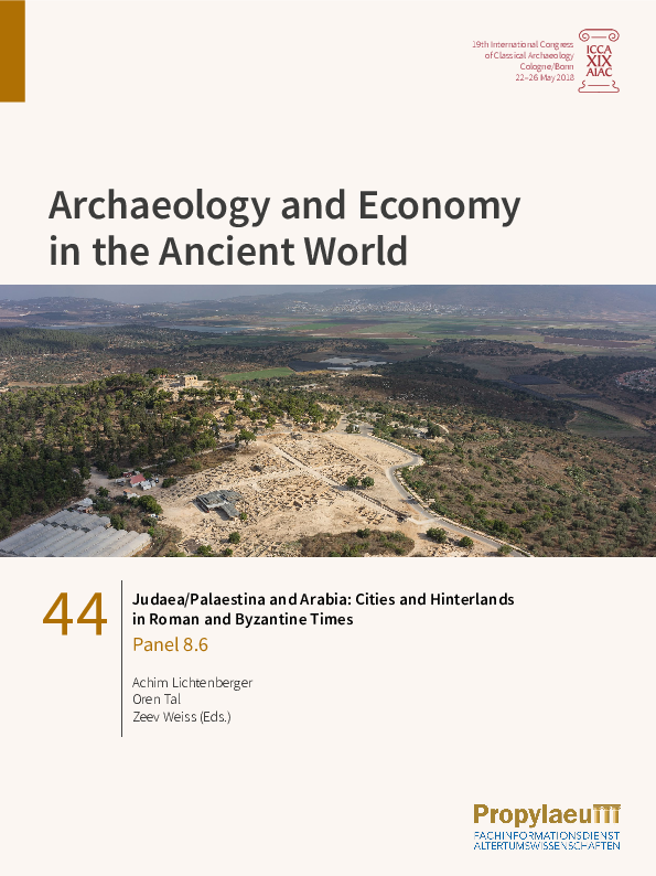
Cover illustration: Sepphoris and its hinterland, looking north (The Sepphoris Excavations, Hebrew
University of Jerusalem; photo by G. Laron)
ISBN: 978-3-947450-78-7
e-ISBN: 978-3-947450-77-0
�CONTENTS
Achim Lichtenberger – Oren Tal – Zeev Weiss
Judaea/Palaestina and Arabia: Cities and Hinterland in Roman and Byzantine
Times: Introductory Notes.
1
Nicolò Pini
Semi-urban or Semi-rural Settlements: A New Definition of Urban Centers
Required?
5
Peter Gendelman – Uzi ‘Ad
Caesarea Maritima − A View from Outside: The Periphery of the Roman and
Byzantine Metropolis.
19
Joseph Patrich
The City and Its Territory – A Digital Archaeological-Cartographical
Approach: The Case of Caesarea Maritima.
39
Rivka Gersht – Peter Gendelman
Architectural Decoration in Roman and Late Antique Caesarea Maritima and
Its Periphery: Production, Importation and Reuse.
53
Oren Tal
Apollonia/Sozousa: Its Immediate Hinterland in Byzantine Times.
67
Shlomit Weksler-Bdolah
Aelia Capitolina: The Roman Colony and Its Periphery.
81
Zeev Weiss
Sepphoris: The City and Its Hinterland in Roman Times.
95
Achim Lichtenberger – Rubina Raja
The Chora of Gerasa/Jerash.
109
Will M. Kennedy
A Cultural Landscape Characterization of the Petraean Hinterland in
Nabataean-Roman Times: An Overview.
125
Christian A. Schöne – Michael Heinzelmann – Tali Erickson-Gini –
Diana Wozniok
Elusa – Urban Development and Economy of a City in the Desert.
141
�Sepphoris:
The City and Its Hinterland in Roman Times
Zeev Weiss
In the heart of Lower Galilee, 5 km west of Nazareth, lie the remains of Sepphoris,
capital of Galilee for long periods in antiquity. The city was originally built on a hill
rising 289 m above sea level and overlooking the entire area. North of the hill lies the
fertile Bet Netofa Valley, and to its south flows Naḥal Zippori. Excavations conducted in
the city over the last three decades, mainly by the Hebrew University team, suggest that
Sepphoris in the 1st centuries BCE and CE stretched across its hill and slopes, when the
city had a rural appearance lacking most of the typical Roman-style public buildings.1
The reshaping of Sepphoris and its newly acquired status as a Roman polis, replete with
civic institutions, changed the face of this Galilean city after the Great Revolt against Rome
and in subsequent eras. Owing to its newfound wealth and prosperous economy, Sepphoris
grew significantly and its population reached a peak of 15 to 20 thousand inhabitants.
Excavations conducted on the plateau east of the hill indicate that by the end of the 1st or
early 2nd century the city had expanded eastward, boasting an impressive street network
arranged in a grid, with a colonnaded cardo and decumanus intersecting at its center.2
Designed according to Roman guidelines, public buildings and private dwellings sprung up
throughout the city, including a temple, forum, bathhouses, a theater, a library or archive,
and another building possibly to be identified as a basilica.
Salvage excavations and surveys in the areas outside the perimeters of the city yield
important information about its hinterland, however the entire corpus of data has yet
to be studied together with the rich material pertaining to Roman Sepphoris. This paper
will piece together the data coming from both the city and the regions beyond its borders,
and will offer some preliminary thoughts regarding Sepphoris’s urban infrastructure
and the relationship between the two.
Sepphoris urban infrastructure and the interurban roads
Located on a hilltop and overlooking the entire area, three main intercity roads,
marked by inscribed milestones along their routes, brought traffic to and from Sepphoris.
One road, running from Ptolemais (or Akko) to Sepphoris from the northwest, was
apparently constructed during the Great Revolt; a second, built in 120 CE, ran from
Legio (or Megiddo), the site of the Roman camp of Legio VI Ferrata, toward Sepphoris;
and the third ran westward, from Tiberias to Sepphoris.3 Only a few segments of
these roads have been detected, but at some distance from Sepphoris itself, making
it impossible to know where exactly these roads entered the city limits or how they
converged with the main arteries passing through the densely built-up areas leading to
�96
Zeev Weiss
Fig. 1: Sepphoris street network indicating various traffic routes within the city.
the city’s center. Theoretically, one may assume that these interurban roads connected
with the two main colonnaded streets – the cardo and decumanus – and glorified Lower
Sepphoris, where one could conceivably cross the city, from gate to gate – either from
south to north or from east to west (and vice versa), as was the case in Scythopolis,
for example.4 An analysis of the street network in Lower Sepphoris and the probable
traffic flow to and from the city may suggest that the link between Sepphoris and the
interurban roads in Lower Galilee was slightly different than what transpired in other
cities of Roman Palestine.
The impressive street network in the lower city, with the cardo and decumanus
(measuring about 13 meters wide) intersecting at its center, includes five parallel streets
on a north-south axis, and four streets on an east-west axis (fig. 1).5 The orthogonal
street network deviates by about 25 degrees in all four directions, but for our purposes
I will refer to absolute directions.
The 300-or-so meters of the decumanus uncovered to date run from east to west
across the lower city, reaching its western end at the foot of the hill. This street
�Sepphoris: The City and Its Hinterland in Roman Times
97
may be associated with the main road mentioned in Rabbinic sources that ran from
Tiberias through Sepphoris’s fertile fields and eastern necropolis, and into the city.6 In
contrast, the 180 meter-long cardo exposed to date ran from south to north, and may
well have connected with the road coming from Legio via Naḥal Zippori in the south,
into Sepphoris’ center.7 The cardo, like the decumanus, did not extend much beyond the
main intersection in the lower city. The northernmost section, beyond the forum, was
covered with several plaster layers and not stone pavers, as elsewhere on the cardo,
however the pottery collected in the course of our excavations suggests that this section
of the street was most probably added in the Byzantine period. Furthermore, even if it
could be argued that the later section was an earlier route, topographically the natural
slope beyond this point descends sharply northward, so the cardo by no means could
have run in this direction.
The streets running parallel and perpendicular to the cardo and decumanus
have no colonnades or sidewalks. The street south of the decumanus seems to have
crossed the breadth of the city, from east to west – in other words, from the fields
beyond the saddle and past the dwellings on the southern edge of the hill. The two
streets running east of and parallel to the cardo and from south to north up to the
decumanus do not continue northward beyond this point.8 In contrast, the street
running west of and parallel to the cardo appears to have spanned the length of the
city from south to north. Its southern section has not yet been excavated but seems
to have continued into the valley south of the city, and its northern section, from
the civic center to the synagogue, continued its path over a mild slope beyond the
city limits.9 Vestiges of this route can be seen in aerial photographs of the site that
seem to continue northward in a straight line, beyond the synagogue and toward
the ancient road in the Bet Netofa Valley. It is quite possible that a 50-meter section
of a Roman road, ca. 1 kilometer north of the city, at the bottom of the hill and on
the western edge of modern-day Hoshaya, is yet another branch of this route.10 This
road, or at least part of it, continued to be used by the villagers long after the decline
of Sepphoris and probably until the village was abandoned in the mid-20th century,
as attested by the stone walls and cacti lining both sides of the street leading to the
synagogue.
A wider examination of the street network known to date in Roman Sepphoris
and its possible connection with the interurban roads running to and from the city
suggests that access to the built-up areas was possible from all four directions,
but that the bulk of traffic seems to have used the eastern and southern routes
(fig. 1). The colonnaded streets most probably connected with the far end of these
interurban roads, somewhere on the outskirts of the city – the decumanus on the
east and the cardo on the south – yet traffic into the city on both these routes was
possible only up to the civic center. Access from the north was via one route only,
whereas the other streets flanking the cardo and decumanus were open to traffic
from the east and south, and flowed into various parts of the lower city. Most of
�98
Zeev Weiss
these streets probably connected with local roads leading to the farms, villas, and
nearby villages in the fields outside the city. It is these secondary streets, not the
colonnaded ones that crossed the city from north to south and from east to west.
What becomes evident from exposing these streets in the lower city is that most of
them were directed either to the east or south, indicating the direction of traffic and
the interregional connections in antiquity.
Facilities and other structural elements beyond the city limits
In light of what is now known about the street network and its relationship to the
hinterland and other connecting roads, mention should be made of other important finds
that were found around Sepphoris within a radius of 1 or 2 km from the hilltop. Largescale excavations were never conducted in the Sepphoris necropolis, however an analysis of
the material available from salvage excavations, surveys, and random finds emerging from
the site is ample for drawing some preliminary conclusions about the nature of the urban
necropolis, it location, and relationship to the road infrastructure.
Clusters of several dozens of burial caves were found around the city, although only
a few of them have been excavated and minimally published (fig. 2). Several caves and a
mausoleum were discovered in the northwestern necropolis, however most of them were
detected east, southeast, south, and southwest of the site.11
Burial in Sepphoris was carried out primarily in hewn caves containing either loculi
or arcosolia, or both, and was less prevalent in mausolea.12 Tombs with loculi, some
of which were executed in very high quality, were found in several places around the
site. Arcosolia hewn on two or three sides of a small room are recorded in the city’s
southeastern necropolis, but they take a variety of forms in a larger catacomb in the
eastern necropolis, where the chambers appear to have been hewn in a row (fig. 3).
The number of trough graves varies from place to place: some arcosolia are simple and
contain only one trough grave, and other, expanded, arcosolia contain three to five such
graves. Kukhim were added here as well, at times hewn beneath the arcosolium or into
its back wall, behind the trough graves.
In most places, isolated tombs were either excavated or surveyed, so there is no way
of knowing if they were part of a larger multi-chambered catacomb.13 However, following
the recent activity of antiquities robbers in the southwestern necropolis, the existence of
larger catacombs has now come to light. Three burial chambers were detected around a
square courtyard, and, by what we know today the entrance to the southern chamber had a
doorframe with jambs and a decorated lintel (fig. 4).14
Burial in stone or clay sarcophagi is also evident in Sepphoris, as are ample remains
of bones collected in stone or clay ossuaries after the 2nd century CE.15 These were found
inside several excavated tombs or scattered throughout the necropolis, and sometimes
even embedded in the walls of the Crusader citadel.16
�Sepphoris: The City and Its Hinterland in Roman Times
99
Fig. 2: Aerial photograph designating the cluster of tombs around Sepphoris and the
connecting roads running to and from the city that passed through the necropoleis.
Sixteen burial inscriptions dated to the 3rd and 4th centuries CE mention the names
of the interred in Sepphoris’s ancient necropolis.17 These inscriptions – either painted
or carved on tomb walls and stone or marble plaques – are in Aramaic, Hebrew, and
Greek, and some are even bilingual. Each mentions the burial place of an individual
or a group of family members, and several also provide personal information about
the deceased. Other finds attest to how the Sepphoreans decorated their burial
places. The small open courtyard surrounded by burial chambers in the eastern
necropolis seems to have a mosaic floor decorated with floral designs.18 Various
�100
Zeev Weiss
Fig. 3: Chamber with arcosolia containing several trough graves inside a larger
catacomb in the eastern necropolis at Sepphoris.
elements executed in low relief adorn the interior of some tombs or decorate several
sarcophagi, and two marble tombstones feature a Jewish symbol, either a palm tree
or a menorah.19
Although the finds from the Sepphoris necropolis are sparse, they nevertheless
suggest, as I have argued elsewhere, that this cemetery is no less impressive
and monumental than the one at Bet She‘arim, perhaps even surpassing it.20 It is
characterized by quarried burial tombs and a mausoleum, decorated sarcophagi, clay
coffins, ossuaries, and funerary inscriptions denoting the name of the interred, his
title, and occupation in Hebrew, Aramaic, and Greek or a combination thereof. The
necropolis stretches over an area extending east, south, and southwest of the city,
and it is probable that the above-mentioned roads running to and from Sepphoris
passed through it (fig. 2). One may assume that some tombs, especially the more
elaborate ones owned by the urban elite, were located close to these roads, as was
customary elsewhere in Galilee and at other sites in the region.21 This is the case, for
example, in the eastern necropolis, where some tombs were discovered close to the
road leading westward, toward the city.
Other facilities were found around the site, near the necropolis or beyond it.
Limestone, the most common building material in Roman Sepphoris, was locally
�Sepphoris: The City and Its Hinterland in Roman Times
101
Fig. 4: Large catacomb with three burial chambers around a square courtyard in
Sepphorisʼs southwestern necropolis.
quarried. In fact, one quarry was detected in the excavations conducted west of the
summit, but it seems that most of the quarries used in Roman times were located
outside the built-up areas and close to the necropolis.22 One such quarry lies east
of the site and north of the road leading into the city, more or less opposite the
subterranean reservoir, and two others were uncovered in the southern necropolis
located in the center of Moshav Zippori.23
Sepphoris received its water supply from two aqueducts originating in the springs
of the villages of er-Reina and Mash’had, some 10 km east of the city.24 These aqueducts
converged into a single conduit and, once close to the city, again diverged on the eastern
side of the saddle – the northern one flowed toward the Arches Reservoirs and the
pool, both located north of the road leading into the city, while the southern one ran
southward, to the subterranean reservoir.
The spring of ʽEn Zippori, located 2.4 km south of the site, was another water
source, but its low location in Naḥal Zippori prevented the city from getting a steady
water supply. A vaulted pool and several walls diverted water to the nearby fields
�102
Zeev Weiss
Fig. 5: Overview of the eastern rooms of the farmhouse located east of the site and
south of the road running westward into the Lower City.
along Naḥal Zippori, some distance from the spring, and were indeed associated
with the extensive agriculture that was once an important source of livelihood for
the city.25
In addition to the agricultural activities conducted in Roman Sepphoris, there were
two farmhouses on the outskirts of the city. One partially excavated unit, constructed
in the 3rd century and destroyed in the fourth, is located 550 meters east of the site and
south of the road running westward into the lower city.26 It contains five rooms lying
north and east of an open courtyard, as well as a nearby agricultural installation, most
probably a wine press; various agricultural tools were also found in the debris of the
farmhouse (fig. 5). The other unit, surveyed only a few years ago, lies approximately
1.5 km southwest of the site.27 Traces of a white mosaic floor and some rock-cuttings are
discernible beyond the wine press (fig. 6).
Other installations, including water pools, a columbarium, wine presses, a lime kiln,
and rock-hewn ovens, were uncovered primarily south of the site, inside Moshav Zippori
and along Naḥal Zippori.28 These were used by the city’s inhabitants, but theoretically
could point to the existence of additional farmhouses scattered around Sepphoris’s
hinterland in antiquity.
�Sepphoris: The City and Its Hinterland in Roman Times
103
Fig. 6: A winepress in the farmhouse located southwest of Sepphoris.
Conclusion
The finds presented above indicate a link between the road network running to
and from Roman Sepphoris and the location of the city’s necropoleis, pools, water
systems, farmhouses, and other installations located east, south, and southwest of the
city. The distribution of the roads and landmarks around the city is comparable to the
evidence found in other cities and towns in Roman Palestine, where the roads leading
to them passed through the necropoleis or ran close to quarries, reservoirs, and other
installations. At Sepphoris, however, they seem to have been concentrated largely to the
south and east.
It is difficult to know what dictated this reality. Did it begin with the early history
of Sepphoris’s settlement, and is it possible that some of the roads reflect routes in
the region predating Roman times? Did it develop with the expansion of the city to
the saddle east of the summit and the construction of the civic center there? Did the
topographical differences between the north (having a slightly steep slope) and the
south (having a moderate gradient) dictate the location of the access roads into the
�104
Zeev Weiss
city? Or did the type and quality of the rock in the area determine the location of
the tombs and quarries? Alternatively, did the existence of fertile fields owned by the
city’s inhabitants dictate the location of the roads to and from the city? Whether one or
more, or all, of these factors influenced the configuration of the city and its hinterland,
Roman Sepphoris undoubtedly succeeded in maintaining its socio-religious, economic,
and cultural ties with communities in its immediate vicinity, including those in the
Bet Netofa Valley to its north such as Shiḥin. Judging by the city’s street network, the
conjectured roads running to and from it and the various facilities located in its vicinity,
the interurban connections to and from Roman Sepphoris were directed primarily to the
south and east. It is hoped that future excavations, surveys, and random finds will shed
further light on Roman Sepphoris and its hinterland, and will either confirm, reject, or
offer an alternative to our above analysis.
Notes
1
Weiss 2007b, 392–407.
Weiss 2015 and Weiss 2017, with references to earlier publications regarding this site.
3
Roll 2009, 12*–13*.
4
Tsafrir – Foerster 1997, 93–95; Weiss 2002, 223–230. The connection between the interurban roads and
the street network is well attested in other cities of the Roman east and beyond; see Macdonald 1986, 5–31.
5
Weiss 2015, 61–62.
6
See, e.g., Leviticus Rabbah 16, 1 (Margulies 2003, 348). Traces of the road were detected in several
places; see Shenhav 1984; Roll 1994, 39–40.
7
Hecker 1961; Roll 2009, 12*–13*.
8
Weiss 2007a, 225–229.
9
Weiss 2005, 9–11.
10
Covello-Paran – Tepper 2011.
11
Aviam – Amitai 2014, 4–12; Weiss forthcoming.
12
Weiss – Netzer 1996, 35–36.
13
See, e.g., Druks 2005.
14
The cave was visited in July 2016 with Michal Peleg, inspector of the Israel Antiquities Authority.
15
Gal et al. 2002, 147–149.
16
Waterman 1937, 5 pl. III, 2.
17
Naveh 2005; Aviam – Amitai 2014, 9–12.
18
Tsuk 1995, 75–76.
19
Weiss and Netzer 1996, 35 fig. 13; Waterman 1937, 5 pl. III; Sukenik 1945–1946; Naveh 2005, 113*.
20
Weiss unpublished.
21
Weiss 1994, 237–240.
22
Meyers – Meyers – Gordon 2018, 18.
23
Porath 2010; Gur 2014; Raban – Shemesh 2016, site no. 15.
2
�Sepphoris: The City and Its Hinterland in Roman Times
105
24
Tsuk 2002; Tsuk 2011.
Zidan 2014.
26
Weiss 2003.
27
Unpublished. The site was visited in July 2010.
28
Porath 2009; Porath 2010; Tepper 2013; Zidan 2015.
25
Image Credits
Fig. 1: by A. Iamim. – Fig. 2: All Rights Reserved by the Survey of Israel 2018 © Printed with Survey of
Israel permission. Additional drawing by A. Iamim. – Fig. 3: by the author. – Fig. 4: by the author. – Fig. 5:
by G. Laron. – Fig. 6: by the author.
References
Aviam – Amitai 2014
M. Aviam – A. Amitai, The Necropolis of Sepphoris: The Results of Field Survey, in: D. A. Warner –
D. D. Binder (eds.), A City Set on a Hill: Essays in Honor of James F. Strange (Mountain Home, AR
2014) 4–16.
Covello-Paran – Tepper 2011
K. Covello-Paran – Y. Tepper, Zippori North, ExcIsr123, 2011, [http://www.hadashot-esi.org.il/
Report_Detail_Eng.aspx?id=1674&mag_id=118].
Druks 2005
A. Druks, Late Roman-Period Burial Complexes at Ẓippori, AtiqotHeb49, 2005, 105*–106*.
Gal et al. 2002
Z. Gal et al., A burial cave at Zippori, in: Z. Gal (ed.), Eretz zafon: Studies in Galilean Archaeology
(Jerusalem 2002) 147–153. (Hebrew)
Gur 2014
Y. Gur, Zippori (Southeast), ExcIsr 126, 2014, [http://www.hadashot-esi.org.il/Report_Detail_Eng.
aspx?id=12638&mag_id=121].
Hecker 1961
M. Hecker, The Roman Road Legio-Zippori, Bulletin of the Israel Exploration Society 25, 1961,
175–186. (Hebrew)
MacDonald 1986
W. L. MacDonald, The Architecture of the Roman Empire II (New Haven 1986).
Margulies 2003
M. Margulies (ed.), Leviticus Rabbah, 5 vols. (Jerusalem 2003).
Meyers – Meyers – Gordon 2018
E. M. Meyers – C. L. Meyers – B. D. Gordon (eds.), The Architecture, Stratigraphy, and Artifacts of
the Western Summit of Sepphoris I (University Park, PA 2018).
�106
Zeev Weiss
Naveh 2005
J. Naveh, Hebrew and Aramaic inscriptions from Sepphoris, AtiqotHeb 49, 2005, 113*–115*.
Porath 2009
L. Porath, Zippori, ExcIsr 121, 2009, [http://www.hadashot-esi.org.il/Report_Detail_Eng.
aspx?id=1046&mag_id=115].
Porath 2010
L. Porath, Zippori (Southeast), ExcIsr 122, 2010, [http://www.hadashot-esi.org.il/Report_Detail_Eng.
aspx?id=1403&mag_id=117].
Raban – Shemesh 2016
A. Raban – N. Shemesh, The Archaeological Survey of Israel, 2016, Map 29, [http://survey.
antiquities.org.il/index_Eng.html#/MapSurvey/2154].
Roll 1994
I. Roll, Survey of Roman Roads in Lower Galilee, ExcIsr 14, 1994, 38–40.
Roll 2009
I. Roll, Between Damascus and Megiddo: Roads and Transportation in Antiquity Across the Northeastern Approaches to the Holy Land, in: L. Di Segni – Y. Hirschfeld – R. Talgam – J. Patrich (eds.),
Man Near a Roman Arch: Studies Presented to Professor Yoram Tsafrir (Jerusalem 2009) 1*–20*.
Shenhav 1984
E. Shenhav, Ya‘ar Lavi, Survey, Hadashot Arkheologiot 84, 1984, 18. (Hebrew)
Sukenik 1945–1946
E. L. Sukenik, Two Jewish Tombstones from Sepphoris, Bulletin of the Jewish Palestine Exploration
Society 12, 1945–1946, 62–64. (Hebrew)
Tepper 2013
Y. Tepper, Zippori, Survey, ExcIsr 125, 2013, [http://www.hadashot-esi.org.il/Report_Detail_Eng.
aspx?id=4373&mag_id=120].
Tsafrir – Foerster 1997
Y. Tsafrir – G. Foerster, Urbanism at Scythopolis-Beth Shean in the Fourth to Seventh Centuries,
DOP 51, 1997, 85–146.
Tsuk 1995
T. Tsuk, Zippori and Its Surroundings, Ariel 109, 1995.
Tsuk 2002
T. Tsuk, The Aqueducts to Sepphoris, in: D. Amit et al. (eds.), The Aqueducts of Israel (Portsmouth
2002) 278–294.
Tsuk 2011
T. Tsuk, Water at the End of the Tunnel: Touring Israel’s Ancient Water Systems (Jerusalem 2011).
(Hebrew)
Waterman 1937
L. Waterman, Preliminary Report of the University of Michigan Excavations at Sepphoris (Ann
Arbor 1937).
Weiss 1994
Z. Weiss, The Location of Jewish Cemeteries in Galilee in the Mishnaic and Talmudic Periods, in:
�Sepphoris: The City and Its Hinterland in Roman Times
107
I. Singer (ed.), Graves and Burial Practices in Israel in the Ancient Period (Jerusalem 1994) 230–240.
(Hebrew)
Weiss 2002
Z. Weiss, New Light on the Rehov Inscription: Identifying “The Gate of Campon” at Bet Shean,” in:
L. V. Rutgers (ed.), What Athens Has to Do With Jerusalem. Essays on Classical, Jewish, and Early
Christian Art and Archaeology in Honor of Gideon Foerster (Leuven 2002) 211–233.
Weiss 2003
Z. Weiss, Ẓippori – 2002, ExcIsr 115, 2002, 25*–26*.
Weiss 2005
Z. Weiss, The Sepphoris Synagogue. Deciphering an Ancient Message in Its Archaeological and
Socio-Historical Contexts (Jerusalem 2005).
Weiss 2007a
Z. Weiss, Sepphoris (Sippori) 2007, IEJ 57, 2007, 215–229.
Weiss 2007b
Z. Weiss, Josephus and Archaeology on the Cities of Galilee, in: Z. Rodgers (ed.), Making History:
Josephus and Historical Method (Leiden 2007) 385–414.
Weiss 2015
Z. Weiss, Sepphoris: From Galilean Town to Roman City, 100 BCE–200 CE, in: D. A. Fiensy – J. R.
Strange (eds.), Galilee in the Late Second Temple and Mishnaic Periods (Minneapolis. MN 2015)
53–75.
Weiss 2017
Z. Weiss, Sepphoris, in: T. Whitmarsh (ed.), Oxford Classical Dictionary (Oxford 2017),
[http://classics.oxfordre.com/view/10.1093/acrefore/9780199381135.001.0001/acrefore9780199381135-e-8039].
Weiss forthcoming
Z. Weiss, Sepphoris: A Mosaic of Cultures, Jerusalem, forthcoming.
Weiss unpublished
Z. Weiss, Beth She‘arim and Beyond: Urban Necropoleis in Roman and Late Antique Galilee,
Unpublished Paper Presented at the American Schools of Oriental Research (ASOR), Boston,
November 2017.
Weiss – Netzer 1996
Z. Weiss – E. Netzer, Hellenistic and Roman Sepphoris. The Archaeological Evidence, in: R. M. Nagy
et al. (eds.), Sepphoris in Galilee: Crosscurrents of Culture (Raleigh 1996) 29–37.
Zidan 2014
O. Zidan, ‘En Zippori, ExcIsr 126, 2014, [http://www.hadashot-esi.org.il/Report_Detail_Eng.
aspx?id=9570&mag_id=121].
Zidan 2015
O. Zidan, Zippori (Southwest), ExcIsr 127, 2015, [http://www.hadashot-esi.org.il/Report_Detail_Eng.
aspx?id=15727&mag_id=122].
�
 Zeev Weiss