J. Geogr. Sci. 2010, 20(3): 406-416
DOI: 10.1007/s11442-010-0406-4
© 2010
Science China Press
Springer-Verlag
Impact of economic development on wetlands in
Hangzhou Bay Industrial Belt
REN Liyan1, *YUE Wenze2, LI Jialin1, WU Cifang2
1. Faculty of Architectural Civil Engineering and Environment, Ningbo University, Ningbo 315211, Zhejiang,
China;
2. College of Public Administration, Zhejiang University, Hangzhou 310029, China
Abstract: Based on Landsat TM images in 2005 and urban planning data of 2005–2020 in
Hangzhou Bay Industrial Belt, this paper studied the potential risk of the planned urban construction land extension to the wetlands by employing a GIS spatial analysis method. The
results show that: (1) The wetland resources are widely distributed and diverse, with a
proximal distribution to present urban construction lands spatially. (2) From 2005 to 2020, the
urban construction lands will expand vastly and rapidly, and will take over large areas of
wetlands that are mostly the ponds and the aquiculture water areas in the reclamation areas
of Hangzhou Bay south coast. Moreover, this change will be spatially uneven obviously, e.g.,
the most serious recessions of the wetlands are concentrated in Ningbo city, Hangzhou city
and Cixi city. (3) Overall, the potential risk to wetlands is very high, and will keep increasing
with the trend of urbanization. (4) The quantity and spatial pattern of the planning urban construction land have substantial impacts on the wetland loss. Therefore, some policies and
regulations are suggested to coordinate the relationship between urban economic development and wetland resource protection such as adjusting the construction land planning,
compensating for wetland occupation as well as constructing wetland parks.
Keywords: wetlands; change prediction; risk analysis; urban planning; Hangzhou Bay Industrial Belt (HBIB)
1
Introduction
Wetland is an ecological landscape with the richest biodiversities in nature, and one of the
most important living environments for human beings (Chen, 1995). As one of the three
greatest ecosystems (the other two are forest and ocean), it has many benefit functions, e.g.,
climate regulation, water regulation, waste treatment, habitat, food production, recreation
and research and education (Cui, 2004; Lu, 2002). However, at the same time wetland has
been dramatically destroyed with the development of human society. Wetland area decreasing, ecological function deteriorating and biodiversity reducing have produced a series of
Received: 2009-12-31 Accepted: 2010-02-26
Foundation: Key Project of Zhejiang Provincial Science and Technology Programs, No.2005C23059; National Key Technology R&D Program of China, No.2006BAJ11B03; National Natural Science Foundation of China,
No.40701177
Author: Ren Liyan (1976–), Ph.D, specialized in land management and wetland protection. E-mail: renliyan@nbu.edu.cn
*Corresponding author: Yue Wenze, E-mail: yuewenze@gmail.com
www.scichina.com
www.springerlink.com
�REN Liyan et al.: Impact of economic development on wetlands in Hangzhou Bay Industrial Belt
407
adverse environmental effects, e.g., frequent flood disaster and serious losing of water and
soil (Herath, 2004; Hook, 1993; Jones et al., 1995; SFA et al., 2000).
Wetland changes with area shrinking and pattern dynamic have drawn many attentions of
research. One common mode is to feature wetland dynamics by employing landscape pattern
and the land use change models, based on the information derived from remote sensing data
(Bai et al., 2004; Bounlom et al., 2005; Ding and Liang, 2004; Guo, 2005; Huang et al.,
2006; Li et al., 2006; Liu et al., 2002; Ning et al., 2005; Wang et al., 2006; Wang et al.,
2006; Zhao et al., 2006; Zhou et al., 2006). Many studies discovered that the process of
wetland evolution is co-determined by both the physical factors and the socio-economic
factors. Among these factors, human development activity apparently is predominant (Guo
et al., 2004; Hou et al., 2005; Li et al., 2003; Xu and Jiang, 2003; Zhang and Dong, 2002;
Zhang et al., 2005). As one of the most important human development activities, urban
planning definitely will have impact on the wetland evolution directly through guiding the
future development direction and setting up the boundary of urban spatial expansion. Therefore, in such a high-speed urbanized area with dense wetlands, it is significant to study the
impact of the urban planning scheme on wetlands, rationalize planning scheme and ultimately protect the wetland resources.
We observed that little effort has been made to unravel the impact of urban planning on
wetland at home and abroad. This paper will analyze the potential risk of the planned construction to the wetlands during 2005–2020, based on the data of wetland investigation and
urban planning in Hangzhou Bay Industrial Belt (HBIB). This work aims to provide a more
constructive decision-making for adjusting the layout of construction land to prevent the
wetland loss.
2
2.1
Data and methods
Study area
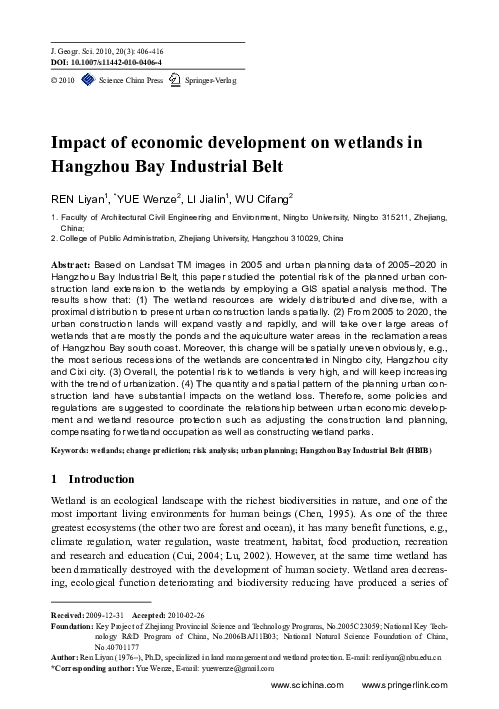
The study area is a part of the HBIB in Zhejiang Province, including Jiashan county, Jiaxing
city, Tongxiang city, Pinghu city, Haiyan county, Haining city, Hangzhou city, Shaoxing
county, Shaoxing city, Shangyu city, Yuyao city, Cixi city, Ningbo city, Zhoushan city(partly)
and Daishan county(partly). This area extends from 29°37′–31°01′N to 119°45′–122°26′E
(Figure 1). As an important part of the Yangtze River Delta, this area has rapid development
of economy with high level urbanization and industrialization. In 2005, the population and
the land area are respectively 14.23million and 16,268 km2, accounting for 29% and 16% of
the province’s totals. The GDP, the per capital GDP and the financial revenue are respectively 663 billion yuan, 46.585 thousand yuan and 113.714 billion yuan, accounting for 49%,
168% and 54% of the province’s totals. Meanwhile, the study area has abundant wetland
resources, including densely distributed rivers, lakes and tidal flats. However, the wetlands
are obviously decreasing with the development of society and economy. From 1949 to 1997,
the total reclaimed area of tidal flats was up to 1.27×10⁴ hm2 in Cixi city (Gao, 2006), and
the cultivated land increased by 1/4–1/3 from the tidal flats reclamation in Shangyu city and
Xiaoshan city (Dong et al., 1996). Since 1986, the bank of Hangzhou Bay has evolved continuously due to the reclamation and aquiculture on the tidal flats (Zhang et al., 2005). Furthermore, the conflicts between the economic development and the wetland protection will
�408
Journal of Geographical Sciences
Figure 1
Range of Hangzhou Bay Industrial Belt (HBIB)
be more drastic with the implementation of the development plan of HBIB.
2.2
Data
The Data used in this work includes two Landsat TM images of the study area in 2005
(118P39R and 119P39R) and the urban planning maps (2005–2020) of 15 districts. We also
used the district map and the social and economic statistic data of the study area.
Data processing included the Landsat TM images processing, the generation of the
planned construction land map and the extraction of the land use/cover in the boundary of
the planned construction.
2.2.1
Landsat TM images processing
According to the spatial resolution of the images and our study aim, we classified the land
use/cover into four types, i.e., cultivated land, forestland, construction land and wetland.
Wetland included river, lake, reservoir and pond, aquiculture water area, tidal flat, etc. We
intersected the geometrically corrected satellite images with the district map using the
ERDAS IMAGINE software, and then interpreted the images using the unsupervised classification function. After mosaicing them into the land use/cover map of HBIB in 2005, we
extracted the wetlands and calculated their areas by zonal statistic.
2.2.2
The generation of the planned construction land map
We collected the urban planning data of 2005–2020 of the 15 districts, including maps in
vector format and grid format. Firstly, the high resolution planning pictures in grid format
were corrected in GIS, based on the remote sensing images which were geometrically corrected and projection transformed. Secondly, the patches of planned construction land on the
planning pictures were drafted to create the vector map. Thirdly, the collected planning maps
in vector format were transformed and projected to match the created vector map. Finally, all
the vector maps were united to form the planned construction land map of HBIB, namely the
boundary of the construction lands in 2020.
�REN Liyan et al.: Impact of economic development on wetlands in Hangzhou Bay Industrial Belt
2.2.3
409
The extraction of the land use/cover in the boundary of the planned construction
The planned construction land map was intersected with the land use/cover map in 2005, so
the land use/cover in the construction boundary of 2020 was extracted. It included present
construction lands and non construction lands such as wetlands, and the latter will be converted to new construction lands during the urban planning period.
2.3
Analysis of construction land and wetland changes
Land use dynamic degree models and regional difference model were used to analyze the
intensity and rate of wetland and construction land changes (Liu and Buheaosier, 2000;
Wang and Bao, 1999; Wang et al., 2006). The dynamic degree models describe the decreasing extent and rate of wetland or the increasing extent and rate of construction land. The
regional difference model expresses the degree of regional change with respect to the total
change of the study area. The higher the value is, the greater the influence of the regional
change on the total change. The region with high value is regarded as a hot spot of change.
(1) Dynamic degree models represent the change extent Pk and the change rate Rk of the
land use/cover in region k. Let U kt1 and U kt0 represent the area of a certain land use/cover
type in region k at the beginning time t0 and the ending time t1 of the study period; then Pk
and Rk can be calculated as follows:
Pk = U kt1 − U kt0 / U kt0 × 100% = ΔU k / U kt0 × 100%
Rk = U kt1 − U kt0 / U kt0 /(t1 − t0 ) × 100% = ΔU k / U kt0 /(t1 − t0 ) × 100% = Pk /(t1 − t0 )
(1)
(2)
where ΔUk stands for the increasing area or decreasing area of the land use/cover type in
region k in the study period.
(2) Regional difference model elaborates the relative change extent Ck, which is calculated by
Ck = U kt1 − U kt0
∑ U kt1 − U kt0 ×100% = ΔU k
m
k =1
∑ ΔU
m
k =1
k
× 100%
(3)
where m is the total number of the regions.
2.4
Analysis of the potential risk to wetlands
With the spatial analysis function of GIS, the occupation of the construction land to the wetland in the urban planning period was analyzed, and the potential risk of wetland shrinkage
was ranked. Data processing was as follows. First, the present construction lands were extracted from the land use/cover in the construction boundary of 2020. Starting from the
boundary of the construction lands, four buffers were created. The width of the first three
buffers is 200 m, and the last is 400 m. Then, the present wetlands were extracted from the
land use/cover in the construction boundary of 2020, and overlaid with the buffers to get the
wetlands distributed in each buffer. Since the wetlands in the inner buffer will be probably
occupied first with the construction land expansion, they are evaluated as Rank-1. The wetlands in the other three buffers have decreasing occupation risk, so they are respectively
evaluated as Rank-2, Rank-3, and Rank-4 from inside to outside.
�410
3
3.1
Journal of Geographical Sciences
Results and analysis
Wetland and construction land distribution in 2005
The main wetland types in HBIB are tidal flat, river, reservoir and pond, lake and aquiculture water area. The wetland area is about 1.78×10⁵ hm2 in 2005, accounting for 1/10 of the
total area of the region. There is obvious regional difference in wetland area proportion, e.g.,
the highest proportion is over 20% in Haining city and Daishan county, and the next is over
10% in Shangyu city, Hangzhou city, Shaoxing city, Cixi city and Jiashan county. Besides,
the wetlands are distributed unevenly. Large area of wetlands distributes in Hangzhou city,
Shangyu city, Haining city, Ningbo city, Cixi city and Shaoxing county, accounting for 3/4
of the total area of wetlands in HBIB. The wetlands mostly concentrate on the coasts of the
Qiantangjiang River (Figure 2).
Note: The Qiantangjiang River in the west of the boundary of Haining city and Shangyu city belonged to the wetland,
and that in the east belonged to the sea
Figure 2
Wetlands and construction lands in the study area in 2005
According to the urban planning, the total area of present construction lands in the construction boundary of 2020 is about 1.2×10⁵ hm2. Present urban construction lands are
mostly distributed beside the rivers and coasts in the plain area, and they are close to the
wetlands spatially. From Figure 2 we can see that, there are densely distributed rivers and
lakes in the urban center of Shaoxing city, Shaoxing county, Jiaxing city and Pinghu city.
The urban center of Shangyu city lies beside Caoejiang River. Ningbo city develops from
the intersect of the three rivers, namely Yaojiang River, Fenghuajiang River and Yongjiang
River, and the new development zones are distributed along the estuary and coast belt.
Zhoushan city and Daishan county develop along the coastlines around the islands.
�REN Liyan et al.: Impact of economic development on wetlands in Hangzhou Bay Industrial Belt
3.2
411
Planned construction land expansion in HBIB during 2005–2020
According to present urban planning, the area of construction lands in HBIB will be
2.85×10⁵ hm2 in 2020. The construction lands will expand rapidly at a rate of 1×10⁴ hm2
every year, and the newly expanded lands will be 1.65×10⁵ hm2 in 2020. From Table 1 we
can find that, the increasing extent of the construction lands in each district is very large,
mostly over 100%. The annual increasing rate is about 10% on the average, the biggest of
which is Pinghu city, Haiyan county and Shangyu city. Moreover, the relative change extent
is spatially uneven obviously. The largest is Hangzhou city and Ningbo city despite of their
low increasing rates, and the second is Jiaxing city and Cixi city. They are the hot spots of
construction land expansion. Furthermore, the spatial characters of construction land expansion are different. For example, Pinghu city will expand slightly based on the old city zone,
while the building of the new development zone along Hangzhou Bay will increase the construction land area. Shangyu city will extend to the northwest along the banks of Caoejiang
River. Hangzhou city will expand to the east and south over Qiantangjiang River. Ningbo
city and Cixi city will develop in the development zones along Hangzhou Bay.
Table 1
Expansion of the construction lands in the study area in 2005–2020 (%)
Region
Cixi city
Daishan county
Change
extent Pk
Change rate Relative change
Rk
extent Ck
168
11.19
11.2
71
4.76
0.2
Change
extent Pk
Change
rate Rk
Relative change
extent Ck
Pinghu city
257
17.10
6.9
Shangyu city
218
14.55
2.9
Region
Haining city
173
11.56
4.0
Shaoxing city
48
3.22
1.7
Haiyan county
241
16.07
3.0
Shaoxing county
90
6.02
3.2
Hangzhou city
121
8.06
21.5
Jiashan county
139
9.26
2.7
Jiaxing city
190
12.65
11.7
Ningbo city
117
7.82
19.4
3.3
Tongxiang city
Yuyao city
Zhoushan city
96
6.43
3.3
177
11.80
6.8
98
6.55
1.6
Wetland shrinkage caused by the planned construction land expansion
During the planned period of 2005–2020, the wetlands in HBIB will shrink remarkably due
to the construction land expansion. About 1.2×10⁴ hm2 wetlands will change to construction
lands, i.e., about 7% of the wetlands in 2005 will disappear. It can be seen that the extent and
rate of wetland decreasing are different in each district (Table 2). The biggest decreasing
extent is that of Ningbo city with over 20% in 15 years, which is three times bigger than the
average level of the study area. The following is Cixi city and Pinghu city. Jiaxing city and
Hangzhou city is also near the average level. The annual decreasing rate of wetland in
Ningbo city, Pinghu city and Cixi city is over 1%. In the relative change extent, the biggest
is Ningbo city, Hangzhou city and Cixi city, the wetland decreasing area of which occupies
3/4 of the total decreasing area in HBIB. In the spatial characters (Figure 3), the wetland
patches that are to be transformed into construction land are small and scattered. The relative
concentrated distribution area lies in the reclamation areas in Hangzhou Bay south coast,
such as the reclamation area in Xiaoshan city and Cixi city, and the island and coastline in
Beilun. These areas are mostly ponds and aquiculture water areas at present.
�412
Journal of Geographical Sciences
Table 2
Decrease of the wetlands in the study area in 2005–2020 (%)
Region
Change extent Pk
Change rate Rk
15.5
1.04
Daishan county
2.6
Haining city
0.8
Haiyan county
2.9
Hangzhou city
6.3
Jiashan county
Jiaxing city
Cixi city
Relative change extent Ck
Wetland proportion to the land
use/cover occupied
18.5
12.5
0.18
1.1
36.4
0.06
1.3
2.4
0.19
0.7
1.7
0.42
24.9
8.7
3.3
0.22
1.4
4.0
8.5
0.57
4.1
2.6
Ningbo city
24.3
1.62
32.0
12.4
Pinghu city
16.2
1.08
2.4
2.6
1.1
0.07
1.9
5.0
Shangyu city
Shaoxing city
4.0
0.26
1.6
6.9
Shaoxing county
3.3
0.22
3.3
7.9
Tongxiang city
2.2
0.15
0.3
0.6
Yuyao city
5.9
0.39
3.0
3.3
Zhoushan city
4.6
0.31
3.5
16.8
Figure 3
The expanded urban construction lands and the occupied wetlands in 2005–2020
Wetland decreasing is not only affected by the quantity of construction land increasing,
but also affected by the spatial pattern of it. In the rapid development regions of Ningbo city,
Hangzhou city and Cixi city, the construction lands will increase greatly with population
growth, economic development and urbanization. Especially in Hangzhou city and Ningbo
city, the most important cities of HBIB in Zhejiang Province, the amount of wetland de-
�REN Liyan et al.: Impact of economic development on wetlands in Hangzhou Bay Industrial Belt
413
creasing is relatively large owing to the large amount of planned construction land. But in
Hangzhou city, where present wetland area and the planned construction land increasing
area are the biggest, the amount of occupied wetland isn’t the biggest. It is because that the
strategy of urban development to the east and the south avoids the distributing center of the
wetlands in the west and the north. It is clear that rational layout of construction land in urban planning can reduce wetland losing, so the proportion of wetland to the land use/cover
occupied by construction will not be high. While in Ningbo city and Cixi city, the building
of the development zones along Hangzhou Bay uses the tidal flat as land resources in support of construction, and results in wetland losing largely.
In the total area of the land use/cover occupied by the planned construction in HBIB, the
average area proportion of wetland is relatively low, about 7.5% (Table 2). It shows that
wetland isn’t the main land use/cover type occupied by construction, and the layout of urban
planning construction land is rather rational. But in some regions such as Daishan county
and Zhoushan city, the proportion is high and the construction land expansion is mainly at
the cost of wetland. Although the tidal flat resources are rich in these regions, and the
amount of construction land increasing and wetland decreasing are small, the wetlands will
lose gradually. It goes against the sustainable development of society, economy and ecology.
3.4
Potential risk to wetlands in the planned 15 years
According to the distance from the wetlands to the present construction lands, the potential
risk to wetlands was ranked (Figure 4). The wetlands of Rank-1 are about 8000 hm2, being
69% of the total decreased area (Figure 5). These wetlands are within the distance of 200 m
to the present construction lands, and will be occupied most possibly with the urban expansion. The wetlands of Rank-2 are about 2000 hm2, occupying 19% of the total decreased
area. These wetlands are distributed in the distance of 200–400 m to the present construction
Figure 4
The potential risk to the wetlands in the study area
�414
Journal of Geographical Sciences
Figure 5
Proportion of the wetlands of each potential risk rank
lands, and will be occupied with further expansion of the city. The wetlands of Rank-3 and
Rank-4 are both about 700 hm2 or 6% of the total decreased area. These wetlands lie in the
distance of 400–600 m or further to the present construction lands, and may be occupied
when the city expands to some extent. The wetlands of each risk rank are distributed unevenly among the districts, and the biggest area of each rank is in Hangzhou city, Ningbo
city and Cixi city.
In the four risk ranks, Rank-1 has the most proportion of wetland and the lower risk ranks
have the less. It shows that the potential risk to wetlands is very high on the whole. The reason is that the present construction lands are close to the wetlands spatially, and their
ring-like expansion will inevitably occupy the wetlands nearby. The wetlands of low risk
rank are situated in the newly developed area, such as the newly developed area on the sea
shore of Pinghu city, Hangzhou Bay newly developed area in Cixi city and Meishan Island
in Ningbo city. Besides, the proportion of wetland to the total area of the occupied land
use/cover increases in the distance of more than 400 m to the present construction lands,
although the wetland area of Rank-3 and Rank-4 reduces. It implies that the trend of occupation to wetland won’t decline from 2005 to 2020.
4
Conclusions and discussion
Based on the remote sensing images and urban planning data in HBIB of Zhejiang Province,
this paper analyzed the potential risk to wetlands by the planned urban expansion during
2005–2020. Conclusions are as follows:
(1) The wetland resources in HBIB are widely spread with diverse types, most of which
lies in the banks of the Qiantangjiang River. The present urban construction lands are closely
distributed to the wetlands spatially.
(2) According to present urban planning, the construction lands will expand vastly and
rapidly during 2005–2020 in HBIB, and the biggest expanded area is that of Hangzhou city
and Ningbo city. Large areas of wetlands will be taken over by the planned construction
lands, mostly the ponds and aquiculture water areas in the reclamation areas of Hangzhou
Bay south coast. The most serious recession of wetlands will occur in Ningbo city, Hangzhou city and Cixi city. And the layout of the planned construction lands has great effect on
�REN Liyan et al.: Impact of economic development on wetlands in Hangzhou Bay Industrial Belt
415
wetlands in Daishan county and Zhoushan city.
(3) The analysis of the potential risk to wetlands implies that the risk is high on the whole
in HBIB. Rank-1 is about 8000 hm2, being 69% of the total decreased area. Rank-2, Rank-3
and Rank-4 are about 2000 hm2, 700 hm2 and 700 hm2, occupying 19%, 6% and 6% of the
total decreased area, respectively. Besides, the tendency of urban construction lands occupation to wetlands won’t decline from 2005 to 2020.
(4) Analysis of the trend of wetland change based on urban planning data shows that the
quantity and spatial pattern of planning construction lands have substantial effect on wetlands. The wetlands shrink remarkably in Ningbo city and Cixi city, and the proportion of
wetlands to the total area of the land use/cover occupied is high in Daishan county and
Zhoushan city. Compared among all areas, the urban planning in Hangzhou city tried to
avoid more wetland loss, which indicated an advanced and harmonious urban planning philosophy. Since the destruct of construction to wetland is irreversible, it is significant to protect wetland through adjusting the urban planning from the view of eco-environmental protection. It is also suggested that measures such as compensating for wetland occupation and
constructing wetland parks should be adopted to strengthen wetland protection. In addition,
since the potential risk to wetlands is high and will keep increasing, we should adjust the
planning of the construction lands used in the far future to reduce wetland losing.
Acknowledgements
The authors thank Prof. Liu Xinguo from Zhejiang University for his modification of language.
References
Bai Junhong, Ouyang Hua, Deng Wei et al., 2004. Modification process of land use/land cover type of wetlands in
Huolin River catchment. Journal of Soil and Water Conservation, 18(1): 172–174. (in Chinese)
Bounlom V, Bian Jianmin, Lin Nianfeng, 2005. Application of the 3S technology on the landscape evolution in
the wetland of lower reach of Huolin River Basin. Journal of Jilin University (Earth Science Edition), 35(2):
221–225. (in Chinese)
Chen Yiyu, 1995. China Wetlands Research. Changchun: Jilin Science & Technology Publishing House. (in Chinese)
Cui Lijuan, 2004. Study on functions of Poyang Lake wetland ecosystem. Journal of Soil and Water Conservation,
18(2): 109–113. (in Chinese)
Ding Shengyan, Liang Guofu, 2004. Landscape pattern change of regional wetland along the Yellow River in
Henan Province in the last two decades. Acta Geographica Sinica, 59(5): 653–661. (in Chinese)
Dong Bingrong, Zhu Huatan, Li Yingfa, 1996. Compositive development and utilization of the newly reclaimed
tidal flats in Zhejiang Province. Journal of Agrotechnical Economics, (1): 59–61. (in Chinese)
Gao Xin, 2006. Biodiversity and conservation of wetland of Hangzhou Bay. Journal of Shenyang Normal University (Natural Science), 24(1): 92–95. (in Chinese)
Guo Dufa, 2005. Land cover and landscape pattern changes of costal wetland in Yellow River Delta. Chinese
Journal of Ecology, 24(8): 907–912. (in Chinese)
Guo Yuedong, He Yan, Zhang Mingxiang et al., 2004. Characteristics and driving forces of wetland changes in
middle-lower reaches of Taoer River. Journal of Soil and Water Conservation, 18(2): 118–121. (in Chinese)
Herath G, 2004. Incorporating community objectives in improved wetland management: The use of the analytic
hierarchy process. Journal of Environmental Management, 70: 263–273.
�416
Journal of Geographical Sciences
Hook D D, 1993. Wetlands: History, current status, and future. Environmental Toxicology and Chemistry, 12:
2147–2166.
Hou Wei, Zhang Shuwen, Bu Kun et al., 2005. Analysis on the shrinkage of wetlands in Nongjiang and Bielahong
region Sanjiang Plain and the causes. Geographical Research, 24(4): 507–512. (in Chinese)
Huang Fang, Zhang Shuwen, Jan de Leeuw et al., 2006. Wetland changes in the middle and lower Wuyuer River,
Songnen Plain since the 1970s. Journal of Natural Resources, 21(6): 949–956. (in Chinese)
Jones D, Cocklin C, Cutting M, 1995. Institutional and landowner perspectives on wetland management in New
Zealand. Journal of Environmental Management, 45: 143–161.
Li Xiang, Wang Xinyuan, Hu Wei et al., 2006. Study on changes of wetland landscape pattern based on GIS in
Wuchang Lake, Anqing. Soil and Water Conservation in China, (5): 44–46. (in Chinese)
Li Ying, Tian Zhujun, Ye Baoying et al., 2003. Driving forces analysis of mire wetland change in lower Nenjiang
watershed. Scientia Geographica Sinica, 23(6): 686–691. (in Chinese)
Liu Hongyu, Zhang Shikui, Lu Xianguo, 2002. Processes of wetland landscape changes in Naoli River Basin
since 1980s. Journal of Natural Resources, 17(6): 698–705. (in Chinese)
Liu Jiyuan, Buheaosier, 2000. Study on spatial-temporal feature of modern landuse change in China: Using remote sensing techniques. Quaternary Sciences, 20(3): 229–239. (in Chinese)
Lu Xianguo, 2002. A review and prospect for wetland science. Bulletin of the Chinese Academy of Sciences, (3):
170–172. (in Chinese)
Ning Longmei, Wang Xuelei, Wu Houjian, 2005. On changes of wetland ecology landscape pattern of Wuhan city
by RS and GIS. Resources and Environment in the Yangtze Basin, 14(1): 44–49. (in Chinese)
State Forestry Administration, P. R. China (SFA) et al., 2000. China National Wetland Conservation Action Plan.
Beijing: China Forestry Publishing House. (in Chinese)
Wang Dandan, Wang Zhiqiang, Chen Ming et al., 2006. Dynamic change of marsh landscape patterns in the west
Songnen plain. Arid Land Geography, 29(1): 94–100. (in Chinese)
Wang Genxu, Liu Jinqi, Chen Ling, 2006. Comparison of spatial diversity of land use changes and the impacts on
two typical areas of Heihe River basin. Acta Geographica Sinica, 61(4): 339–348. (in Chinese)
Wang Xiulan, Bao Yuhai, 1999. Study on the methods of land use dynamic change research. Progress in Geography, 18(1): 81–87. (in Chinese)
Wang Zhiqiang, Zhang Bai, Zhang Shuqing et al., 2006. Wetland dynamics and ecological and environmental
impacts in west Jilin province. Resources Science, 28(2): 125–131. (in Chinese)
Xu Linshu, Jiang Ming, 2003. Study on perturbation factors and their influence on Zhalong wetland. Scientia
Geographica Sinica, 23(6): 692–698. (in Chinese)
Zhang Hongyan, Long En, Cheng Weiming, 2005. Research on dynamic change and effect factors of Xianghai
wetland. Journal of Natural Resources, 20(4): 613–620. (in Chinese)
Zhang Huaguo, Guo Yanxia, Huang Weigen et al., 2005. A remote sensing investigation of inning and silting in
Hangzhou Bay since 1986. Remote Sensing for Land & Resources, (2): 50–54. (in Chinese)
Zhang Mingxiang, Dong Yu, 2002. Study on changes of coastal wetland landscape in Shuangtaihekou nature reserve and its management measures. Scientia Geographica Sinica, 22(1): 119–122. (in Chinese)
Zhao Ruifeng, Zhou Huarong, Xiao Duning et al., 2006. Changes of wetland landscape pattern in the middle and
lower reaches of the Tarim River. Acta Ecologica Sinica, 26(10): 3470–3478. (in Chinese)
Zhou Lianyi, Jiang Nan, Lu Heng et al., 2006. Wetland landscape pattern changes along the Yangtze River in
Nanjing city. Resources Science, 28(5): 24–29. (in Chinese)
View publication stats
�