CHAPTER 4
The Early Component at Ts'ishaa, an
Outer Coast Site on Western Vancouver
Island
Alan D. McMillan
Introduction
This paper presents recent results of the Tseshaht Archaeological Project, in Barkley Sound,
western Vancouver Island. In particular, I report
the findings from the early component, located
on a raised Jandform at the back of the large
outer-coast ancestral Nuu-chah-nulth village of
Ts' ishaa. This research, co-directed by Denis St.
Claire and myself, has been a cooperative venture with the Tseshaht First Nation and Parks
Canada. As the analysis of recovered materials is
at an early stage, the results reported here are
preliminary.
"Early" in this paper is used in a relative
sense. Elsewhere on the Northwest Coast the
term generally implies an age greater than 5000
years (Carlson 1996). No such "early" dates
have been reported previously for western Vancouver Island, a fact that reflects sea level history
in this region and the restriction of previous
archaeological attention to sites associated with
modern tides. The recent work at Ts'ishaa,
however, extends our knowledge slightly beyond this chronological barrier.
The site of Yuquot (DjSp 1), near the outer
coast of Nootka Sound, has long held claim to
the oldest radiocarbon dates in ethnographic
Nuu-chah-nulth territory. The earliest, a date of
4230±90, is based on charcoal from sand and
pebbles at the base of the cultural deposits and
ーイセウオュ。「ャケ@
refers to the initial occupation of
this large village site (Dewhirst 1980:37). Caliセイゥッョ@
of this date (at two sigma) extends the
tmtial occupation back to between 4530 and
4990 BP (Hutchinson 1992:14). Dewhirst
(1980) argues for continuity throughout the
cultural sequence at Yuquot, leading directly to
the historic Nuu-chah-nulth of Nootka Sound.
tセ・@
Yuquot data featured prominently in
Mitchell's (1990) definition of the West Coast
culture type and shaped his view that this was a
stable adaptation with little change over the last
5000 years.
More recent research in Barkley Sound,
however, has provided dates that rival Yuquot
and has yielded assemblages that challenge the
prevailing view of long-term continuity
(McMillan 1998). At the western edge of the
sound, at Ucluelet, the Little Beach site (DfSj
100) provided two basal dates of 4000 radiocarbon years (calibrated 4240 to 4820 BP). A small
sample of stone artifacts suggested markedly
different cultural affiliations than the lower
deposits at Yuquot (Areas Consulting Archeologists 1991). Nearby, the large village site of
Ch'uumat'a (DfSi 4) provided equally early
dates from the deep back portion of the site, and
yielded a larger sample of chipped stone and
other artifacts that resembled those from Little
Beach (McMillanand St. Claire 1996; McMillan
1999). At all three sites, the basal dates came
from beach sands with water-rolled shell and
artifacts now well above the high tide line, indicating that sea levels were significantly higher at
the time of initial occupation.
Ts'ishaa Excavations
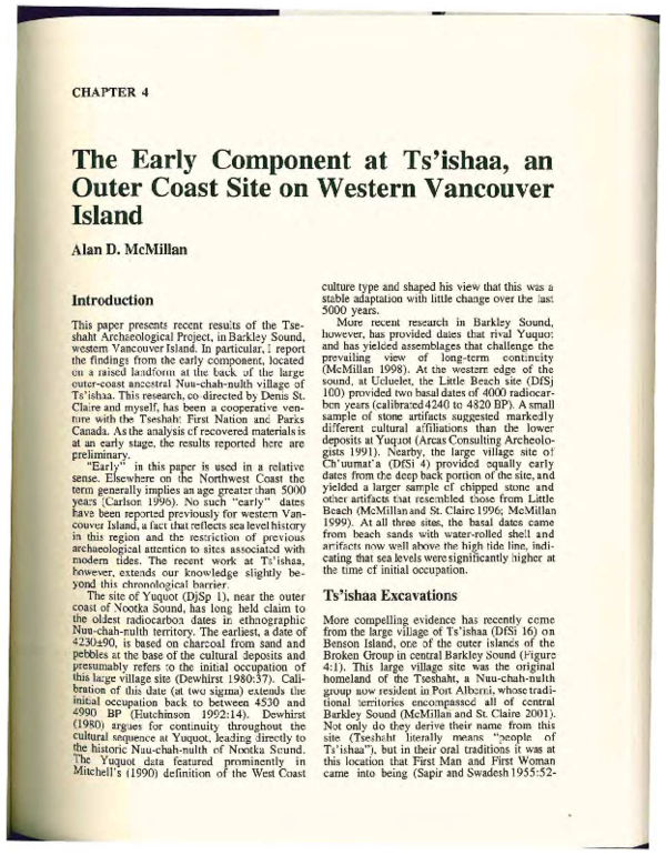
More compelling evidence has recently come
from the large village of Ts'ishaa (DfSi 16) on
Benson Island, one of the outer islands of the
Broken Group in central Barkley Sound (Figure
4: 1). This large village site was the original
homeland of the Tseshaht, a Nuu-chah-nulth
group now resident in Port Alberni, whose traditional territories encompassed all of central
Barkley Sound (McMillan and St. Claire 2001).
Not only do they derive their name from this
site (Tseshaht literally means "people of
Ts' ishaa"), but in their oral traditions it was at
this location that First Man and First Woman
came into being (Sapir and Swadesh 1955:52-
�40 Archaeology of Coastal British Columbia
Figure 4:1. Map of Barkley Sound, western Vancouver Island, showing location of Ts'ishaa on
Benson Island.
53). Early in the 20'h century knowledgeable
Tseshaht individuals provided the anthropologist
Edward Sapir with extensive accounts of the
history and social groups associated with this
site. Over three seasons, from 1999 to 2001 , we
excavated in three widely separated portions of
the site, in extensive shell midden deposits up to
3.7 m in depth (McMillan and St. Claire 2000,
2001). The artifact assemblage, dominated by
small bone implements such as points and
bipoints, falls within the West Coast culture type .
A series of radiocarbon dates from across the
site places its history within the last two millennia.
One small area of the site, however, provided
evidence of earlier occupation and yielded a
distinctly different artifact assemblage. Probing
detected midden deposit on a relatively flat
elevated area behind the main village, separated
from it by a gully for most of its length. This
back ridge portion of the site stands about four
metres above the main village area. When the
cultural deposits are removed from consideration, however, the base of the back portion of
the site stands six to seven metres above the
original beach at the base of the main village
area. We interpreted this area as representing an
earlier occupation at a time of higher sea levels
and began test excavation there in 2000 and
larger scale excavation in 2001 (Figure 4:2).
Friele (1991), Hutchinson (1992), and others
(Friele and Hutchinson 1993; Boxwell et al.
2000) have examined Holocene relative sea level
history on central western Vancouver Island.
They have proposed a sea level curve that is
based primarily on Clayoquot Sound data, although it incorporates some information from
Barkley Sound and is believed to reflect sea
level history for the entire region (Figure 4:3).
Hebda' s work at several locations in the Broken
Group islands of Barkley Sound, for example,
indicates that early Holocene sea levels stood at
least 10 metres below present levels (Hutchinson
1992:37). From these early Holocene lows, the
relative sea level rose rapidly to intersect the
modem beach just prior to about 7000 cal BP.
In Barkley Sound this sea level rise is marked by
freshwater peats in island bogs that are overlain
�The Early Component at Ts 'ishaa 41
Figure 4:2. Excavation along the Back Ridge Portion of the Ts'ishaa Site.
Table 4:1. Radiocarbon dates from the Ts'ishaa early component.
セ・エ。MQUXWT@
Lt.iii No.
Lab Date
Beta-158739
430+/-46
Calibratea range (2 Intercept
sigma)
Date
BP 500BP 540 to 32U
Beta-15K740
Beta-158745
Beta-158747
3000+/-70
3050+/-70
3330+/-70
3580+/-80
4080+/-70
4160+/-70
BP
BP
BP
BP
BP
BP
Beta-158743
443U+/--80
BP 5310 to 4840
Beta-158741
4470+/-7ff
BP 5310 to 4860
Beta-147073
5050+/-60
BP 5920 to 5640
Beta-158742
セ・エ。MQTWP@
3360
3390
3710
4090
4830
4850
to
to
to
to
to
to
2960
3050
3390
3670
4410
4440
by marine deposits dating to around that time
(Hutchinson 1992:37). The relative sea level
continued to rise and reached three to four
metres above present, where it remained from
about 6000 to 4800 cal BP, a period termed the
Ahous Bay Stillstand by Friele (1991). Subse-
Comments
Upper silt layer - date
rejected
Shell layer
BP 3210
Upper sheIT layer
BP 3260
BP 3570
Shell layer
Base of shell layer
BP 3870
Brown silt-cTay
BP 4540
4720 Near base of shell layer
BP
(average)
5010 Red-brown clay at base
BP
(average)
Surface of red-brown clay,
BP 5050
with cultural materials
BP
5810 From reef-brown clay at
(average)
base
uent
radual
emer
q
g
gence oT the Tand relative to
the sea through the late Holocene is attributed to
tectonic uplift (Friele 1991; Friele and
Hutchi'iison 1993; Boxwell et al. 2000).
This research indicates that the area that later
became the village of Ts'ishaa would have been
an active beach during the period of mid-
�4 2 Archaeology of Coastal British Columbia
-
4
E
2
c
0
<t3
0
en
<t3
セ@
I
I
I
>
Q) -2
I
I
w
I
I
I
-4
I
I
I
MウQセLN@
8
6
Age (cal
4
14C
2
0
years BP x 1000)
Figure 4:3. ReconstructedHolocene Sea Level
History for central western Vancouver Island
(based on Friele 1991, Friele and Hutchinson
1993, Boxwell et al. 2000).
Holocene higher sea levels, with highest tides
coming right to the rise below what is now the
back ridge. Radiocarbon dates from this portion
of the site provide supporting evidence. Our
oldest date, from the clay at the base of the
deposit, is 5920 to 5640 cal BP. Two other dates,
from similar contexts, are roughly 5300 to 4800
cal BP. These correspond very closely to the
proposed period of higher sea levels, the Ahaus
Bay Stillstand.
Radiocarbon dates from throughout the
deposits (Table 4: 1) demonstrate that this back
area of the site had been in use for over 2000
years. The upper stratum, consisting of black silt
and rocks, contained a number of highly distinctive artifacts, including a large biface of
obsidian from Glass Buttes in Oregon, several
large stemmed and faceted ground slate points
(Figure. 4:4 ), and large bone points with barbs
produced by shallow notches. All were found
clustered in a small area and may be mortuary
offerings as several burials were encountered
nearby. In addition, crudely chipped stone
objects were abundant throughout this layer.
These consist of schist knives, choppers based
on cobbles or large cortex spalls, large retouched flake scrapers, and numerous smaller
flakes and split pebbles, many showing evidence
of a bipolar flaking technology (Figure 4:5).
Chert and vein quartz microliths are particularly
common. Although this layer is undated, its age
is estimated at 2500 to 3200 BP, based on dates
from the underlying stratum and the close simi. larity of several distinct artifact types with the
['セᄋ ᄋ セ@
I
Figure 4:4. Ground Slate Points from the Upper Layer of the Ts'ishaa Back Ridge.
Locarno Beach stage in the Strait of Georgia.
These include the large stemmed and faceted
ground slate points and the large bone points
with shallow enclosed barbs, both of which have
close counterparts in Locarno Beach assemblages (Matson and Coupland 1995:158-9).
A shell layer underlies this upper stratum
along the eastern portion of the back ridge. It is
most extensive at its eastern end, which would
have been a point extending out over the former
high tide line. Here it reaches over two metres in
depth, with bracketing dates of 3260 cal BP at
the top and 4720 cal BP near the base. Along
the back of the site the shell layer is much less
extensive, with two dates of 3210 cal BP and
3570 cal BP. Another date of 3870 cal BP was
obtained from a silt and shell stratum just above
the basal clay.
�The Early Component at Ts 'ishaa 43
I
Figure 4:5. Chipped Stone from the Ts'ishaa Back Ridge (upper row: bipolar cores and flakes;
lower row: chert and vein quartz microliths).
The shell disappears completely or is restricted to a few isolated pockets along the
.northern and western portions of the back ridge.
In these areas a brown silty-clay directly underlies the black silt of the uppermost stratum.
Stone flakes, split pebbles, and choppers were
relatively common. Abrasive stones were also
numerous, including several decorated examples. A particularly finely-made sandstone
abrader, with an incised triangular design
around its raised outer surface, was found directly below a charcoal sample dated to 4540 cal
BP, the only date available from this layer.
At the base of the deposit is reddish-brown
clay, which sits directly on bedrock at the back
of the site although it is of considerable depth
c_loser to the slope down to the later village. It is
ィ セ ・ャNy@
marine, or possibly glacio-marine, in
ongm. Crushed shell and charcoal extend into
surface, likely as a result of trampling
its セー・イ@
durmg the earliest occupation of this landforrn.
One sample from this type of context yielded a
result of 5050 cal BP, which may date the initial
occupation. The earliest date obtained from the
site, 5920 to 5640 cal BP, came from charcoal
within the clay matrix, but cannot be conclusively shown to refer to a cultural event. No .
artifacts, shell, or other cultural materials were in
direct association, although the charcoal was
collected a very short distance below the base of
the lowest shell layer.
Faunal remains have not yet been analyzed.
Bone is poorly preserved in the non-shell layers .
Nevertheless, sea mammal bones, most large
enough to be identified as whale, were relatively
commonly encountered. A fully maritime way
of life seems to date to the earliest occupation, as
would be expected for this outer island location.
Comparisons and Conclusions
The lithic materials from the Ts'ishaa back
ridge resemble those from Ch'uumat'a, Little
Beach, and the Hoko River site on the Olympic
Peninsula. Traits such as quartz microliths and
bipolar split pebbles, chipped schist knives, and
large faceted ground slate points seem particularly akin to Hoko River (see Croes 1995). All
�44 Archaeology of Coastal British Columbia
resemble Locamo Beach assemblages in the
Strait of Georgia, with which they are contemp'.)raneous. The earliest Ts'ishaa materials, along
with those from the lowest levels at Ch' u umat' a,
also overlap with the Charles culture in the Strait
of Georgia. All are markedly dissimilar to contemporaneous materials from the earliest levels
at Yuquot, where stone tools (with the exception
of abraders) are relatively rare and chipped
stone almost absent (Dewhirst 1980).
The predominance of stone in the Ts'ishaa
back ridge assemblage (68 .8% of the total),
particularly chipped stone (43.4%, including
unmodified flakes), also makes this area markedly dissimilar to the later village at Ts'ishaa,
where stone makes up only 10.6% of the total
and chipped stone objects are rare (0.7%). One
possible explanation for this apparent discontinuity involves ethnic replacement, with a relatively late arrival of Nuu-chah-nulth culture in
the Barkley Sound area (McMillan 1998). On
the other hand, Croes (1989; 1995:227-8) interprets changes in the stone and bone artifact
assemblages as reflecting sequential economic
stages, while viewing styles of basketry preserved
at Hoko River as indicating ethnic continuity to
the historic inhabitants of the area.
Ts'ishaa, now with the oldest radiocarbon
dates for a site in ethnographic Nuu-chah-nulth
territory, extends the known history of this
region back in time to just over 5000 cal BP. It
also serves as one more reminder that the complex sea level history of this region needs to be
better understood and taken into account in
regional archaeological studies. Although evidence of early Holocene occupation may have
been lost to rising sea levels, additional midHolocene sites should be sought at higher elevations than the large village locations of later
times. Although we now have considerable
information on late Holocene Nuu-chah-nulth
culture from a number of sites, the earlier history of this region remains largely unknown.
Acknowledgements
In this tribute volume, I would like to acknowledge
Phil Hobler' s early interest in the relationship between
archaeological sites and sea levels, as well as his work
with early lithic assemblages at several locations on the
coast. The research reported here was cooperatively
funded and supported in various ways by Parks Canada
and the Tseshaht First Nation. Denis St. Claire codirected the project with the author. Ian Sumpter participated in the project as a Parks Canada representative
and Jim Stafford served as field supervisor on this
portion of the site.
��Copyright 2003
the editor and individual authors
All rights reserved. No part of this publication
may be reproduced, stored in a retrieval system, or transmitted in any form without prior
written consent of the publisher.
Printed and bound in Canada
ISBN 0-86491-270-6
Publication No. 30
Archaeology Press
Department of Archaeology
Simon Fraser University
Burnaby, B.C. V5A 1S6
ii
�..
Frontispiece: Philip Hobler with the Nuxalk Elders and the Sisiutl Transformation Mask presented to him by his Friends and Colleagues at his Retirement in September, 2002. The Sisiutl
Mask was designed and carved by Alvin Mack. From left to right: Andy Siwallace, Lillian Siwallace, Annie Schooner, Chief Anfinn Siwallace, Pearl Snow, Kitty Moody, Grace Hans,
Hazel Hans, Mercy Snow. Photo: I. Dahm.
iii
�Frontispiece: Philip Hobler with the Nuxalk Elders and the Sisiutl Transformation Mask presented to him by his Friends and Colleagues at his Retirement in September, 2002. The Sisiutl
Mask was designed and carved by Alvin Mack. From left to right: Andy Siwallace, Lillian Siwallace, Annie Schooner, Chief Anfinn Siwallace, Pearl Snow, Kitty Moody, Grace Hans,
Hazel Hans, Mercy Snow. Photo: I. Dahm.
iii
�
 Alan McMillan