Academia.edu no longer supports Internet Explorer.
To browse Academia.edu and the wider internet faster and more securely, please take a few seconds to upgrade your browser.
2015
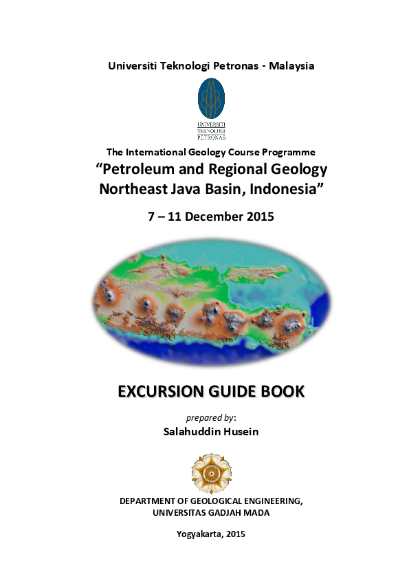
This geologic excursion is crossing several physiographic zone of Java, perpendicular to major east-west structural trends of the island. Therefore, studying physiographic expression is a transient approach to understand geological formation of a particular region and its tectonic history. This excursion starts at the northern fringe of Southern Mountains Zone, a peneplained Eocene-Miocene volcanic belt. Successively the excursion runs to the north, crosses the Solo Zone, a low land formed by modern volcanic belt of Java Island, on to Kendeng Zone, a rolling and hilly area composed of inverted deeper marine sediments. To the north, the journey continues to Randublatung Zone, a narrow depression formed at the edge of Sundaland continental platform, which is dotted by astonishing mud volcanism. The excursion will be concluded in the Rembang Zone, an inverted continental platform which hosts the Northeast Java Basin, a prolific basin in the Java Island.
Pegunungan Selatan - Zona Solo - Zona Kendeng - Zona Randublatung - Zona Rembang Jawa Tengah - Jawa Timur
Mata kuliah Ekskursi Geologi Regional/EGR (TKG 3122) merupakan mata kuliah wajib bagi mahasiswa program strata satu (S1) di Departemen Teknik Geologi FT UGM. Mata kuliah ini bersifat kegiatan lapangan, dengan bertujuan untuk mengenal zonasi fisiografi, urutan stratigrafi, pola struktur, kaitannya terhadap sejarah geologi regional, potensi sumber daya geologi, dan aspek bencana geologi.
A major wrench zone, left-lateral slip in nature, strongly deformed a series of Late Oligocene to Pleistocene rocks in the northern coastal line of East Java and its eastern islands and offshore areas. The fault zone trends west – east forming a deformed zone of 15 to 40 km wide and 675 km long from Rembang area in the west through Madura Island and Kangean Islands to Sakala offshore area in the east. The deformed zone is called the Rembang- Madura-Kangean-Sakala (RMKS) Fault Zone. Based on the regional setting of East- and Southeast Sundaland, it is known that the RMKS Fault Zone occurred at the hinge belt or shelf edge to slope area of a geologic transition from the stable Eastern Sunda Shelf to the north (the Northern Platform) to the deep-water area to the south. There is a contrast of sedimentary facies to the north and south of the RMKS Fault Zone. Tectonically, the stable Eastern Sunda Shelf is considered to overlie the expected micro-continent called the Paternoster-Kangean. Therefore, the RMKS Fault Zone is located at the southern margin of the micro-continent. Basement lithology and configuration to the north and south of the RMKS Fault Zone are different. A number of mechanisms are considered to origin the RMKS Fault Zone. These include : the westward stress driven by the collision of the Buton-Tukang Besi and Banggai-Sula to the east of Sulawesi, westward stress due to the collision of Australia with Timor and anticlockwise bending of the Banda Arc, and northward stress due to the subduction of the Indian oceanic crust beneath Java. The initiation of the RMKS Fault Zone was in the upper Early Miocene in Sakala area and younger westward until the Middle Miocene in Rembang area. Along the RMKS Fault Zone, flower structures are definitely identified on seismic sections, showing basement-involved, deeply-rooted vertical master faults with upward diverging splays/strands that have mostly reverse separations. In map view, these splays are mapped as fold and fault belts trending west-east and west northwest-east southeast. Extensional component of the wrench zone subsided the Paleogene rifted blocks such as the Central Deep and formed a number of normal faults. Tectonic inversion related with both pure and simple shear deformations is observed along the fault zone. Shale diapirism commonly occurs to the south of the fault zone and its occurrence is related to wrench tectonism in thick shale sequences deposited rapidly to the south of the RMKS Fault Zone.
2019 •
The subsurface temperature has many impacts on geological phenomena such as hydrocarbon generation , geothermal energy, mineralization, and geological hazards. The Northeast Java Basin has various interesting phenomena, such as many oil fields, active faults, mud eruptions, and some active and dormant volcanoes. We measured temperature data from tens of wells along a 130 km survey line with an average spacing of 5 km. We also measured the thermal conductivity of rocks of various lithologies along the survey line to provide geother-mal heat flow data. We propose integrated modeling for profiling the subsurface temperature beneath the survey line from Mt. Lawu to Mt. Muriah in the Northeast Java Basin. The modeling of subsurface temperature integrates various input data such as a thermal conductivity model, surface temperature, gradient temperature, a geological model, and geothermal heat flow. The thermal conductivity model considers the subsurface geological model. The temperature modeling uses the finite difference of Fourier's law, with an input subsurface thermal conductivity model, geothermal heat flow, and surface temperature. The subsurface temperature profile along with survey line shows some interesting anomalies which correlate with either subsurface volcanic activity or the impact of fault activity .
Semburan gunung lumpur telah menarik perhatian orang sejak dulu dan dikaitkan dengan legenda yang berkembang di masyarakat. Di daerah Purwodadi dan sekitarnya keberadaan gunung lumpur banyak ditemukan. Secara fisiografi daerah ini termasuk ke dalam Zona Fisiografi Randublatung yang dibatasi di bagian utara oleh Zona Rembang dan di bagian selatan oleh Zona Kendeng. Penelitian dilakukan pada Gunung lumpur (bledug) Kesongo yang terletak di Desa Kesongo dengan koordinat 7o9’ 19,93” LS – 111o 15’ 14,82” BT dan Gunung lumpur Crewek yang terletak di Desa Crewek dengan koordinat 7o 9’ 4,62” LS – 111o 6’ 47,00” BT. Beberapa contoh lumpur, batuan dan fragmen batuan seperti foraminiferal grainstone, batupasir karbonatan, fosil tulang invertebrata serta koral diambil dari kedua tempat tersebut untuk dilakukan analisa paleontologi. Kedua gunung lumpur ini mempunyai posisi dan kenampakan morfologi yang berbeda. Gunung lumpur Kesongo berada di dataran bergelombang, berbentuk kubah berdiameter 1,3 km yang terletak di Antiklin Gabus dan menerobos satuan batunapal yang tersingkap di permukaan sekitar gunung lumpur tersebut. Gunung lumpur Crewek berada di dataran, berbentuk bukit kecil dengan diameter kurang dari 100 m dan dikelilingi oleh endapan limpah banjir. Hasil analisa paleontologi pada lumpur dari Kesongo menunjukkan kumpulan fosil foraminifera planktonik yang mempunyai dua kisaran umur yaitu N18-19, N14 dan N7-N9, sedangkan analisa foraminifera besar dari fragmen batuannya menunjukkan umur Miosen Awal – Tengah. Kumpulan fosil dari batunapal menunjukkan kisaran N17-19. Lumpur Crewek menunjukkan kisaran N18, N12 dan N7-8. Dari kumpulan fosil tertua yang terdapat pada masing-masing gunung lumpur maka diperkirakan lumpur di Gunung lumpur Kesongo berasal dari Formasi Tawun bagian bawah dengan fragmen batuan yang diterobos berasal dari Formasi Wonocolo dan Ngrayong, sementara batunapal yang berada di sekitarnya termasuk ke dalam Formasi Mundu. Lumpur pada Gunung lumpur Crewek berasal dari Formasi Tawun.
2017 •
The early Middle Miocene Ngrayong Formation is famous reservoir in north-east Java, mainly composed of very loose clean sandstone. The study area is situated near Tempuran Village, Rembang Zone, and that area is still need to confirm the reservoir quality. Ngrayong sandstones are well exposed along the southern flank of Pakel Anticline with east-west trending direction. Seven samples from four different facies from five outcrops conducted for petrophysical (porosity & permeability) and granulometry analysis (grain size & sorting) .The highlight of this research is to determine the reservoir quality of Ngrayong sandstone. Ngrayong Formation consists of laminated to thin bedded sandstone facies (facies 1), thick bedded to massive sandstone facies (facies 2), calcareous sandstone facies (facies 3) and cross bedded sandstone facies (facies 4). According to results of each analysis, facies 1 is very fine to fine grained, well sorted to very well sorted sandstone and, it has porosity (23 ...
Merapi - Selogiri - Cepu - Ungaran (Yogyakarta - Central Java)
ITB INTERNATIONAL GEOTHERMAL WORKSHOP
TECTONIC CONTROL TO GEOTHERMAL MANIFESTATION ON NON-RELATED YOUNG VOLCANIC SETTING IN SUMENEP-MADURA, EAST JAVA2018 •
In Sumenep-Madura there are 3 spot of geothermal manifestation such a hot springs. The generally pattern of appearance the manifestation is located at the end of the anticline limb which is the axis direction of folds relative East-West. The Physiographic of Sumenep-Madura area is a part of Rembang zone. Based on lithological association of the research area is composed of sedimentary rocks from the foreland basin or a part of the North East Java Basin. From the background by tectonic setting and geologic conditions developed from Paleogene-Recent in the research area, the Geothermal System manifested is not influence by volcanic activity. North East Java Basin is a basin formed by the extension regime that produces Rifting Basin. The accumulates sediment material continuously resulting loading to produce a geopressured system of the basin. Therefore, the fluid contained in the rock formations be warm up due to the system. Based on geological data of surface deformation occurring in research area are included in the Rembang anticlinorium zone where the folding pattern is influenced by the positive flower structure deformation pattern, which is a structure that develops above the basement fault based on the observation of the subsurface seismic. Then, by surface (morphology) ridge folds pattern distribution that's showing east-west trend or called as the RMKS (Rembang-Madura-Kangean-Sakala) fault zone by subsurface data. The mechanism and kinematics of the positive flower structure pattern becomes the plane of accommodates the migration of geothermal fluid based on geometry of structure that through to the basement. Therefore, by existing mechanism the control a formation of geothermal manifestation is influenced by the pressure gradient where is associated with the sedimentary basin. Then, the positive flower structure pattern becomes the controller of the migration path and fluid transfer to the reservoir rock (Madura formation) in near surface.
Jurnal Geologi dan Sumberdaya Mineral
Geology of the Eastern Part of the Volcanic-Kendeng Zone of East Java: Stratigraphy, Structures and Sedimentation Review from Besuki and Situbondo Areas2019 •
The Tertiary stratigraphy of Situbondo was constructed by a series of volcanoclastic-carbonate turbidite facies of Menuran Formation with Pacalan limestone Member, and Leprak Formation. These formations formed a regional east-west trending circular anticlinorium. The Tertiary formations were covered by Quaternary volcano-clastic Ringgit Formation and subsequent younger Bagor volcanic products. The oldest Tertiary rock units are the Late Miocene-Pliocene Menuran Formation, with Pacalan Limestone Member. Formation is mainly composed of foram-rich marls and calcareous, sometimes tuffaceous sandstones, with conglomerate intercalations. Sedimentation of this formation is interpreted as to be a mixing, from proximal to distal turbidite, involving volcaniclastic and carbonate sources, in a bathyal open marine environment. The Early Pliocene Leprak Formation overlies conformably the Menuran Formation, which consists of alternating calcareous sandstones and tuff sandstones deposited in a ba...
AAPG International Conference & Exhibition Poster Presentation
Sedimentology and Characteristics of Pliocene Shallow Marine Carbonate as Reservoir Alternative Based on Outcrop Analogue in Madura and Puteran Island, Northeast Java Basi2015 •
Seminar Nasional Kebumian
Prosiding Seminar Nasional Kebumian ke-62013 •
PETRO:Jurnal Ilmiah Teknik Perminyakan
Geomechanical Stress Profile at Gundih Field: Stress Quantification and Analysis in Reservoir for CO2 InjectionJurnal Mineral, Energi dan Lingkungan
Magmatism and Geothermal Potential in Pandan Volcano East Java IndonesiaPROCEEDINGS, INDONESIAN PETROLEUM ASSOCIATION Forty-Second Annual Convention & Exhibition
CHARACTERS OF SEDIMENTOLOGY, ROCK PROPERTY AND GEOCHEMISTRY OF THE NGRAYONG AND TUBAN FORMATIONS IN THE PATI TROUGH, ONSHORE NORTH EAST JAVA BASIN2018 •
Special Paper 436: Formation and Applications of the Sedimentary Record in Arc Collision Zones
Basin formation by volcanic arc loading2008 •
Proceedings of FOSI 2nd Regional Seminar
Deep-water Sedimentation of Southeast Asia2001 •
2019 •
Sedimentary Geology
Cenozoic carbonates in Southeast Asia: implications for equatorial carbonate development2002 •
Global Colloquium on GeoSciences and Engineering LIPI 2017
Paleofacies of Eocene Lower Ngimbang Source Rocks in Cepu Area, East Java Basin based on Biomarkers and Carbon-13 Isotopes (Devi_2018_IOP_Conf._Ser.%3A_Earth_Environ._Sci._118_012009.pdf)2018 •
Journal of Geoscience, Engineering, Environment, and Technology
The Morphotectono-Volcanic of Menoreh-Gajah-Ijo Volcanic Rock In Western Side of Yogyakarta-Indonesia2015 •
 Salahuddin Husein