Seeps, Springs and Wetlands:
SAN JUAN BASIN, COLORADO
SOCIAL-ECOLOGICAL CLIMATE RESILIENCE PROJECT
�Report Prepared for:
North Centeral Climate Adaptation Science Center
Recommended Citation:
Rondeau, R., M. Bidwell, B. Neely, I. Rangwala, L. Yung, and C. Wyborn. 2020. Seeps, Springs and
Wetlands: San Juan Basin, Colorado. Social-Ecological Climate Resilience Project. North Central
Climate Adaptation Science Center, Colorado.
Front Cover Photo: Fewkes Canyon Spring, Mesa Verde (George San Miguel)
�Seeps, Springs and Wetlands: San Juan Basin,
Colorado. Social-Ecological Climate Resilience
Project
��EXECUTIVE SUMMARY
Climate change is already having impacts on nature, ecosystem services and people in
southwestern Colorado and is likely to further alter our natural landscapes in the coming decades.
Understanding the potential changes and developing adaptation strategies can help ensure that
natural landscapes and human communities remain healthy in the face of a changing climate.
An interdisciplinary team consisting of social, ecological and climate scientists developed an
innovative climate planning framework and worked with the Social-Ecological Climate Resilience
Project (SECR) and other stakeholders in the Colorado’s San Juan River Basin to develop adaptation
strategies for two large landscapes, pinyon juniper woodlands and seeps, springs and wetland
resources under three climate scenarios between2035 and 2050. This report summarizes the
planning framework and results for the seeps, springs and wetland resources (the pinyon-juniper
woodlands results are provided in a separate report). This framework can be utilized to develop
strategies for other landscapes at local, state, and national scales.
Diagrams, narrative scenarios, and maps that depict climate scenarios and the social-ecological
responses help us portray the climate story in the face of an uncertain future.
Interviews and focus group workshops with agency staff and stakeholders who are users of public
lands identified several important opportunities to improve the adaptation planning process for
developing strategies that meet both social and ecological needs. Planning techniques that include
or directly relate to specific resources, such as water and forage, or to activities, such as recreation
or grazing, provide avenues for engaging diverse stakeholders into the process.
Utilizing the stories to understand the impacts to our social and ecological landscapes, three
overarching landscape-scale adaptation strategies were developed. Each of these strategies has a
suite of potential actions required to reach a desired future condition.
The three key strategies are: 1) identify and protect persistent ecosystems as refugia, 2) proactively
manage for resilience, and 3) accept, assist, and allow for transformation in non-climate refugia
sites.
If the framework and strategies developed from this project are adopted by the local community,
including land managers, landowners, and users, the risk of adverse climate change impacts can be
reduced, allowing for a more sustainable healthy human and natural landscape.
Seeps, Springs and Wetlands: San Juan Basin, Colorado
i
�ACKNOWLEDGEMENTS
This project would not have been possible without the participation of the San Juan Climate
Initiative, an informal public-private partnership that has been working since 2006 to prepare for
change in the San Juan Mountain region, including the San Juan Basin in Colorado.
We thank the many stakeholders, agencies, consultants and representatives of the academic
community who participated in a series of workshops, interviews, and focus groups over the past
three years. Additionally, we offer a special thanks to George San Miguel, Mesa Verde National Park,
and Gretchen Fitzgerald and Kelly Palmer, San Juan National Forest, who also provided agency
insight and reviewed many products and reports to make the project more relevant to our partners.
Their years of leadership within their agencies and communities to initiate climate conversations
provided an opening for this project to take root and flourish.
We greatly appreciate funding, programmatic and technical support from the Department of
Interior’s (DOI) North Central Climate Science Center in Fort Collins, Colorado. We are equally
grateful for the funding provided by Bureau of Land Management Tres Rios Field Office and San
Juan National Forest to support the vulnerability assessments that provided an initial foundation.
In addition, we thank the Rocky Mountain Research station for providing additional support for the
social scientist interviews and focus groups.
We also appreciate the technical support of cooperators on this project from the University of
Colorado, Wildlife Conservation Society, Western Water Assessment/NOAA, Colorado State
University, and US Geological Survey, specifically Nina Burkardt and Rudy Schuster, who graciously
guided the project. We want to thank Betsy Neely, The Nature Conservancy and the Gunnison
Climate Working Group for sharing this initiative with the San Juan group, as we learned a lot from
working in concert with the two watersheds. The exchange of ideas and experiences greatly
enriched our project in the San Juan watershed.
Special thanks to Karin Decker, Colorado Natural Heritage Program, for formatting this report. The
chain of consequences and results chains methods were initiated by Kristen Ludwig and Teresa
Stoepler, US Geological Survey, and Terri Schulz of The Nature Conservancy. Special thanks to Chris
Rasmussen, Ecosystem Mainstream Consultants, Stephen Monroe, National Park Service Inventory
and Monitoring Program, Nicole Barger, University of Colorado, Kris Johnson, University of New
Mexico, and Lynn Wickersham, Animas Biologic for technical contributions. Thanks to San Juan
National Forest and Mesa Verde National Park for providing meeting space and reviewing this
document. Finally, thanks to Jeff Morisette and his staff at North Central Climate Science Center, for
helping to assemble the great team that it took to accomplish this project.
ii
Social Ecological Climate Resilience Project - 2016
�TABLE OF CONTENTS
Executive Summary .................................................................................................................................................................. i
Acknowledgements ................................................................................................................................................................ ii
Acronyms .................................................................................................................................................................................... 1
Introduction ............................................................................................................................................................................... 2
Project Objectives ............................................................................................................................................................... 3
Deliverables .......................................................................................................................................................................... 3
Overview of Planning Framework and Process .......................................................................................................... 4
Planning Framework Key Steps.................................................................................................................................... 4
Three Climate Scenarios for the Future ......................................................................................................................... 9
Climate Scenario Summaries ......................................................................................................................................... 9
Social-Ecological Vulnerabilities ..................................................................................................................................... 12
Key Findings ....................................................................................................................................................................... 12
Conclusions ......................................................................................................................................................................... 13
Seeps, Springs and Wetlands and their Ecosystem Services ............................................................................... 15
Climate Change Impacts and Response Models ........................................................................................................ 16
Response Models .............................................................................................................................................................. 16
Impacts and Interventions................................................................................................................................................. 21
Questions.............................................................................................................................................................................. 21
Methods ................................................................................................................................................................................ 21
Goals and Objectives for Seeps, Springs, and Wetlands......................................................................................... 23
Goals ....................................................................................................................................................................................... 23
Objectives ............................................................................................................................................................................. 23
Adaptation Strategies, Outcomes and Actions for Seeps, Springs, and Wetlands....................................... 25
Three Priority Adaptation Strategies ....................................................................................................................... 25
Strategy 1: Identify and Protect Persistent Ecosystems................................................................................... 26
Strategy 2. Proactive Management for Resilience............................................................................................... 28
Strategy 3: Grazing Management ............................................................................................................................... 31
Next steps ................................................................................................................................................................................. 33
Conclusions and lessons learned .................................................................................................................................... 33
Lessons Learned................................................................................................................................................................ 34
References ................................................................................................................................................................................ 35
Seeps, Springs and Wetlands: San Juan Basin, Colorado
iii
�Appendix A. Glossary ........................................................................................................................................................... 39
Appendix B. Workshop Participants, Seeps, Springs, and Wetlands................................................................ 44
Appendix C. Climate Scenarios......................................................................................................................................... 46
Seasonal Temperature and Precipitation Graphs ............................................................................................... 48
Appendix D: Three Narrative Scenarios....................................................................................................................... 52
Scenario 1: Hot and Dry (“Some Like it Hot”) ....................................................................................................... 52
Scenario 2: Warm and Wet (“The Seasons, They are a Changing”) ............................................................. 53
Scenario 3: Moderately Hot (“Feast or Famine”)................................................................................................. 54
Appendix E. Ecological Response Model...................................................................................................................... 56
Appendix F. Social Science Interviews.......................................................................................................................... 57
I. Key Findings .................................................................................................................................................................... 57
II. Background .................................................................................................................................................................... 58
III. Methods ......................................................................................................................................................................... 58
IV. Findings .......................................................................................................................................................................... 59
V. Conclusions .................................................................................................................................................................... 69
Appendix G. Social Ecological Response Models Methods Overview .............................................................. 71
Situation Analysis and Diagram: Method Overview........................................................................................... 71
Appendix H. Situation Analysis Diagram ..................................................................................................................... 74
Appendix I. Chain Of Consequences ............................................................................................................................... 75
Method Overview ............................................................................................................................................................. 75
Appendix J. Impacts and Actions (Interventions) Associated with Three Climate Adaptation
Strategies .................................................................................................................................................................................. 78
TABLE OF FIGURES
Figure 1. Generalized depiction of change in annual precipitation and temperature for three
climate scenarios (Hot and Dry, Feast and Famine and Warm and Wet). ....................................................... 9
Figure 2. Major ecosystems of the San Juan Basin, CO (SWReGAP, USGS 2004). ...................................... 16
Figure 3. Results chain describing outcomes and actions to identify and protect persistent areas
strategy. ..................................................................................................................................................................................... 27
Figure 4. Results chain describing outcomes and actions for proactive treatment for resilience
strategy. ..................................................................................................................................................................................... 30
Figure 5. Results chain describing outcomes and actions for grazing management strategy ............. 32
Figure B-1. Models selected for the three climate scenarios used in the project. ..................................... 46
iv
Social Ecological Climate Resilience Project - 2016
�Figure I-1. Example Chains of Consequences developed by the SSG Hurricane Sandy crisis science
team: Changes in coastal geomorphology as a result of Hurricane Sandy. Credit: Department of the
Interior, 2013. .......................................................................................................................................................................... 76
Figure I-2. Seeps, Springs, and Wetlands, decrease in shallow groundwater. ............................................ 77
Figure I-3. Seeps, Springs, and Wetlands, wildfire. ................................................................................................ 77
TABLE OF TABLES
Table 1. Projected change in precipitation under three climate scenarios and ecological impacts
associated with reduced groundwater recharge relative to 1971-2000 baseline. .................................... 17
Table 2. Climate and non-climate drivers for seeps, springs, and wetlands comparing scenarios.
Color of cells indicates the severity of change (key below table)...................................................................... 19
Table 3. Top impacts to seeps, springs, and wetlands across the three climate scenarios. The higher
the score, the greater the scope and severity of the impact across all three climate scenarios. .......... 21
Table 4. Intervention categories with total score and landscape scale. The total score is a sum of the
intervention and impact scores. Generally there were multiple impacts and interventions
associated with an intervention category, thus we took the average. The total score, coupled with
scale, was used to define which intervention categories would be the focus of our adaptation
strategy workshop. The bolded intervention categories became our strategies. Cross-cutting
denotes the need to subsume these interventions into all strategies. ............................................................ 22
Seeps, Springs and Wetlands: San Juan Basin, Colorado
v
��ACRONYMS
ACT
BLM
CNHP
CSU
CU
DOI
FLC
MEVE
MSI
NCCSC
NOAA
NPS
PJ
RCP
SECR
SJCI
SJNF
SSW
SUIT
SUIT BIA
TNC
UM
UMUT
USFS
USFS RMRS
USGS
US
WCS
WWA
Adaptation for Conservation Targets planning framework
Bureau of Land Management
Colorado Natural Heritage Program
Colorado State University
University of Colorado- Boulder
Department of Interior
Fort Lewis College
Mesa Verde National Park
Mountain Studies Institute
North Central Climate Science Center
National Oceanic and Atmospheric Administration
National Park Service
Pinyon-Juniper
Reflective Concentration Pathways
Social-Ecological Climate Resilience Project
San Juan Climate Initiative
San Juan National Forest
Seeps, springs and wetlands, a landscape target system of this project
Southern Ute Indian Tribe
Southern Ute Bureau of Indian Affairs
The Nature Conservancy
University of Montana
Ute Mountain Ute Tribe
United States Forest Service
United States Forest Service Rocky Mountain Research Station
United States Geologic Survey
United States
Wildlife Conservation Society
Western Water Assessment
Seeps, Springs and Wetlands: San Juan Basin, Colorado
1
�INTRODUCTION
Environmental change is a constant feature of land management within the US Intermountain West.
Fire, drought, insect infestations, and invasive species present pervasive challenges to the
conservation and management of western lands. Southwestern Colorado is already experiencing
higher temperatures, more frequent and prolonged drought, earlier snowmelt, larger and more
intense fires, more extreme storms, and spread of invasive species (Saunders et al. 2008). These are
all changes that are expected to intensify as a result of climate change putting livelihoods,
ecosystems, public lands, and species at risk.
Climate change poses significant challenges for both ecological systems and human communities in
southwestern Colorado. Resource managers need to consider climate change in management
decisions and long term planning. Yet, while they are increasingly being tasked to incorporate
climate change, many barriers and challenges exist that complicate integrating climate information
and producing robust adaptation strategies. Climate change information is often at the global scale
and projected over long time periods, which makes it difficult for managers to integrate it into local
management plans with shorter timescales. Furthermore, the uncertainty of how climate will
change, especially in hard-to-model mountainous landscapes, increases the difficulty of this task
and the risk of taking any particular approach.
The Social-Ecological Climate Resilience Project (SECR) was formed to address these challenges.
Over three years, a team of social, natural and climate scientists and planners worked with the San
Juan Climate Initiative, a public-private partnership working to prepare for change in Colorado’s
portion of the San Juan River and Dolores River watersheds (referred to in this report as the San
Juan Basin), natural resource management agencies and other stakeholders. This collaborative
effort has developed practical adaptation strategies for selected systems in the San Juan Basin. The
team was led by Colorado Natural Heritage Program (CNHP), Mountain Studies Institute (MSI),
University of Montana (UM), and U.S. Geological Survey (USGS). Another team led by The Nature
Conservancy (TNC) and CNHP led a similar effort in the Gunnison Basin for spruce-fir forest and
sagebrush scrub landscapes.
The goal of the SECR project is to facilitate climate change adaptation that contributes to socialecological resilience, ecosystem and species conservation, and sustainable human communities in
southwestern Colorado. This project has developed and piloted an integrated adaptation planning
framework, consisting of tools and principles that merge the strengths of the iterative scenario
process, the Adaptation for Conservation Targets (ACT) planning framework, institutional analysis,
and climate change modeling.
The framework was used to generate practical strategies and scientific knowledge to advance
climate change adaptation in the Gunnison and San Juan Basins and, potentially, other landscapes. A
key objective of this project is to work with decision-makers to develop social-ecological adaptation
strategies and coordinate actions to reduce the impacts of a changing climate on nature and society.
In order to accomplish this, SECR blends science from biophysical and social disciplines with
participatory approaches to integrate expert knowledge, land management decision making, and
2
Social Ecological Climate Resilience Project - 2016
�local needs.
An adaptation target is a feature (livelihood, species, ecological system, or ecological process) of
concern that sits at the intersection of climate, social, and ecological systems (adapted from Cross et
al 2012). Resilience is the capacity of a system to absorb disturbance and still retain its basic
function and structure. Resilience strategies may include managing for the persistence of current
conditions, accommodating change, or managing towards desired new conditions (Department of
Interior NPS 2016). These and other terms are defined in the glossary (Appendix A).
Intended implementers of the adaptation strategies are the stakeholders and participants who
participated in the project process over the past two years: natural resource managers, local
landowners, non-profit organizations, local government officials, etc.
Project Objectives
1. Build knowledge of social-ecological vulnerabilities to inform adaptation planning.
2. Create social-ecological scenarios and models to facilitate decision-making under uncertainty.
3. Develop a detailed set of actionable and prioritized adaptation strategies designed to conserve
key species, ecosystems, and resources, and to address the needs of local communities and
natural resource managers.
4. Identify the adaptive capacities and the institutional arrangements needed to advance these
strategies into decision-making arenas.
5. Document best practices for effectively bringing climate science into decision-making.
Deliverables
1. Innovative, effective, integrated social-ecological adaptation planning tools and principles
that can be applied in other landscapes.
2. Narrative scenarios of landscape change in southwestern Colorado and conceptual
ecological models (ecological response models) that can be used in adaptation planning.
3. Summary reports on interview and focus group results.
4. An institutional analysis.
5. A set of actionable adaptation strategies for priority ecosystems that include specific
conservation/adaptation targets and action steps/paths to implementation.
6. Manuscripts focused on adaptation decision-making and adaptive capacity, institutional
analysis, and results and lessons learned from integrated adaptation framework.
7. Guidelines and a toolkit for practitioners to employ integrated adaptation planning in other
landscapes.
Funding
This project was funded by the Department of Interior’s (DOI) North Central Climate Science Center
(NCCSC), Fort Collins, Colorado. Matching funds from Bureau of Land Management (BLM) Tres Rios
Field Office and the San Juan National Forest (SJNF) supported the vulnerability assessments for
ecosystems, vulnerable species, and rare plants that complimented this effort. Rocky Mountain
Seeps, Springs and Wetlands: San Juan Basin, Colorado
3
�Research Station provided additional support for the social science.
Project Team
The project team consists of representatives of CNHP, MSI, TNC, UM, U.S. Geological Survey (USGS),
Western Water Assessment (WWA)/ National Oceanic and Atmospheric Administration, Colorado
State University (CSU), Rocky Mountain Research Station, US Forest Service Rocky Mountain
Research Station (RMRS), University of Colorado (CU), and University of Cincinnati.
San Juan Basin Partners
Key partners and stakeholders participating in this project include the San Juan Climate Initiative,
an informal public-private partnership working to prepare for change in the Colorado portion of
the San Juan Basin consisting of the Mesa Verde National Park (MEVE), SJNF, BLM-Tres Rios Field
Office, Ute Mountain Ute Tribe (UMUT), and Southern Ute Indian Tribe (SUIT) and Bureau of Indian
Affairs (SUIT BIA). See Appendix B for full list of participants at the workshops.
OVERVIEW OF PLANNING FRAMEWORK AND PROCESS
Planning Framework Key Steps
1. Select socio-ecological landscapes to be the focus of the project and conduct literature search
regarding natural processes, climate impacts
2. Develop three plausible climate scenarios
3. Develop ecological response models to help understand impacts under three climate scenarios
to help inform development of robust adaptation strategies for the targeted landscapes
4. Develop three narrative scenarios
5. Conduct social science research through interviews and focus groups
6. Develop social ecological response models to identify impacts and interventions using Situation
Analysis and Chain of Consequences
7. Hold a series of workshops to develop and refine adaptation strategies to address current and
future climate vulnerabilities
Landscape Selection
In December of 2013, the SECR partners selected the pinyon-juniper landscape and seeps, springs
and wetlands as the focus of this project because of their social, economic, and ecological
importance to the San Juan Basin. Criteria considered included: vulnerability rank from San
Juan/Tres Rios Climate Change Ecosystem Vulnerability Assessment (Decker and Rondeau 2014),
nested species and rank from Sensitive Species Assessment of Vulnerability to Climate Change on
San Juan Public Lands (Rhea et al. 2013), opportunity for success in building resilience, social
concerns and livelihoods that benefit from the ecosystem services, relevance to decision makers
regarding upcoming management decisions, available data, biodiversity values, and wildlife values.
Three Climate Scenarios
Uncertainties in the future climate present managers with challenges and opportunities. To help in
4
Social Ecological Climate Resilience Project - 2016
�decision-making for a range of future conditions, Imtiaz Rangwala, Western Water Assessment,
University of Colorado, developed attributes associated with three climate scenarios for
southwestern Colorado and the Gunnison Basin for the year 2035. He used a base of 72 models and
2 Representative Concentration Pathways (RCPs 8.5 and 4.5) and then identified three potential
clusters that represented different future pathways for the project. The scenario clusters
represented three different plausible futures – a hotter drier future, a warmer future where annual
precipitation increases, and a future with high inter-annual variability between hot dry years
followed by cold wet years. The climate scenarios are named respectively: 1) Hot and Dry; 2) Warm
and Wet; and 3) Feast and Famine (Appendix C). The Feast and Famine climate scenario predicts
more frequent and intermittent severe-drought conditions, large year-to-year fluctuations that
range from “hot and dry” to “warm and wet” conditions, and a doubling in the frequency of
alternating extreme dry and wet conditions relative to the present (Appendix D).
Renée Rondeau, CNHP, researched the potential ecological impacts of the three climate scenarios to
the targeted landscapes. This information was used to develop a set of ecological response models
and narrative scenarios to assist managers in developing social-ecological adaptation strategies
under the three climate scenarios.
Ecological Response Models
The team, working closely with natural resource managers, developed reference condition and
ecological response models for the pinyon-juniper landscape in the San Juan Basin. The purpose of
ecological response models was to help evaluate potential impacts of the three climate scenarios on
the two landscapes in the San Juan Basin. The team held a series of small group work sessions
between January and March, 2015 to develop draft preliminary reference models and ecological
response models for the landscapes. Participants included representatives from SJNF, MEVE, BLM
Tres Rios Field Office, Southern Ute Indian Tribe (SUIT) and Bureau of Indian Affairs (SUIT BIA),
Ute Mountain Ute Tribe (UMUT), and private ecological consultants. Ecological response models are
in Appendix E.
Narrative Scenarios
Renée Rondeau (CNHP) and Imtiaz Rangwala (WWA) drafted three narrative scenarios for the San
Juan Basin that described plausible landscape changes that could take place over the next 20 years.
The scenarios were descriptive stories that depicted potential changes in the landscape based upon
the climate scenarios that are referred to as “Hot & Dry,” “Warm & Wet,” and “Feast & Famine.” The
narrative scenarios were developed for use during the focus group workshops for the social science
research. They were reviewed by the SECR team and subject experts familiar with the ecology and
local systems. The experts’ comments were incorporated into the final narrative tool that was used
in workshops led by our social scientists (see Appendix F).
Social Science Research
Carina Wyborn, College of Forestry and Conservation, UM, and Marcie Bidwell, MSI, reached out to
agencies, partners and members of the ranching community to conduct in-depth semi-structured
interviews to understand their perspectives on landscape changes in the San Juan Basin (Wyborn et
al. 2015). The interviews queried stakeholder’s perceptions of current conditions and impacts,
Seeps, Springs and Wetlands: San Juan Basin, Colorado
5
�future conditions as envisaged under a changing climate, management approaches, capacity to
realize goals, and decision making in the face of uncertainty.
Fieldwork was conducted from April through July 2014. Dr. Wyborn conducted 34 in-depth, semistructured interviews with ranchers and public land managers at three agencies1. Results were
audio-recorded and transcribed verbatim to assist in analysis. Transcripts were then coded using
Nvivo software. Coding was used to identify themes and facilitate analysis. The results were
summarized in a separate report (Appendix F).
Narrative Scenario Workshops
Two workshops were conducted between June 24th and July 10th, 2014. The goal of the workshops
was to explore possible future changes that might take place in the San Juan Basin over the next 20
years and to understand the impact of those changes on land management in the region. SJNF
hosted the first workshop, which focused on the Glade Landscape, an area being evaluated through
a grazing landscape analysis. This workshop was attended by 17 USFS employees and 11
permittees from the Glade Landscape. The second workshop was hosted by MEVE to discuss the
intersection of pinyon-juniper woodlands within a national park management setting. This
workshop was attended by 12 NPS employees. A secondary goal of the workshops was to introduce
participants to a process that can be used to support decisions in the context of uncertainty. Each
workshop was centered on the three narrative scenarios described above (Hot and Dry, Warm and
Wet, and Feast and Famine; Appendix C). Scenarios were presented individually and then followed
by a series of questions regarding anticipated impacts, management needs, conflicts, compromises
and potential strategies.
Socio-Ecological Response Models
The team worked with stakeholders to integrate social and ecological responses of climate change
on wetlands, seeps and springs using two different approaches: Situation Analysis and Chain of
Consequences.
The Situation Analysis approach defines the context within which a project is operating and, in
particular, the major forces influencing the biodiversity of concern at a site, including the direct and
indirect threats, opportunities, and scope (Foundations of Success, 2009). The process of
developing a Situation Diagram helps teams create a common understanding of the biological,
environmental, social, economic, and political systems that affect targeted landscapes. This method
has been used around the world by the Conservation Measures Partnership, TNC, and others.
The DOI Strategic Sciences Group developed the Chains of Consequences method for teams of
scientists to identify the potential short- and long-term environmental, social, and economic
cascading consequences of an environmental crisis and to determine intervention points to aid
decision-making. The method has been used to identify the consequences and potential
interventions of the Deep Water Horizon oil spill in the Gulf of Mexico and Hurricane Sandy (DOI
Strategic Sciences Working Group 2010, 2012; Department of the Interior, 2013).
See Appendix H for the Situation Analysis and Appendix I for Chain of Consequences results.
6
Social Ecological Climate Resilience Project - 2016
�Stakeholder Workshops
The Team hosted a series of workshops with the San Juan Climate Initiative and other stakeholders
from March 2015 through May 2016 to identify climate impacts to the landscapes under climate
scenarios, identify interventions (preliminary adaptation strategies), develop social-ecological
models, and develop adaptation strategies. These workshops are summarized below.
May 2015 Climate Adaptation Strategy Workshops
To prepare participants for the workshops, the team held a series of pre-workshop webinars on the
following topics: 1) three climate scenarios; 2) ecological response models for pinyon-juniper
woodlands and seeps, springs and wetland resources; 3) methods for identifying preliminary
interventions; and 4) preliminary results of social science interviews and focus groups. The team
also developed a participant packet of materials including an agenda, materials produced to date,
description of methods, and the approach for facilitating discussion focused on climate change.
The team hosted a workshop on May 4th, 2015 in Durango to develop social-ecological climate
response models for pinyon-juniper woodlands and seeps, springs and wetland resources; identify
a suite of preliminary intervention points and potential high-level adaptation strategies for one
climate scenario; and prepare for fall workshop to develop in-depth adaptation strategies (from
Phase I). This workshop focused only on one climate scenario, Feast and Famine, due to time
constraints, with the intention of addressing the two other scenarios at future workshops. The
workshop provided an opportunity to compare two methods (Situation Analysis and Chain of
Consequences) for developing interventions and identifying preliminary adaptation strategies.
The May 2015 workshop was the first of several workshops to develop social-ecological adaptation
strategies for the pinyon-juniper landscape for three climate scenarios in the San Juan Basin. The
outcomes included: 1) integrated findings from climate models, ecological response models and
social science to produce social-ecological response models for the Feast and Famine climate
scenario (one of three climate scenarios); 2) comprehensive list of preliminary interventions that
provide a foundation for developing more in-depth adaptation strategies for the targeted
landscapes under three climate scenarios; and 3) improved stakeholder buy-in for developing and
implementing local and regional interventions and adaptation strategies. Methods for each process
are detailed in Appendix G and I. Products of the meeting can be found in Appendix H and I.
March 2016 Climate Adaptation Workshop
At the March 1st 2016 workshop, stakeholders reviewed the management goals and interventions
that were developed for the different scenarios at the 2015 workshops. The interventions were
reviewed for a set of three climate adaptation strategies for seeps, springs, and wetlands. The
participants helped to prioritize the intervention points to inform the development of strategies at
the next meeting.
April 2016 Climate Adaptation Workshops
The April workshop developed draft adaptation strategies. We utilized the results of the
intervention points to create Results Chains or diagrams for three overarching strategies that depict
causal linkages between strategies and desired outcomes needed to reduce climate change impacts
and other threats. The process creates a logic diagram by describing a sequential series of expected
Seeps, Springs and Wetlands: San Juan Basin, Colorado
7
�intermediate outcomes and actions necessary to achieve the desired outcomes (Margoluis 2013).
This process helped to build a common understanding of the outcomes and actions needed to
reduce the impacts of climate change for each strategy.
The objectives of the final workshops held in April 2016 were to: 1) review and refine
goals/objectives for seeps, springs and wetlands; 2) refine social-ecological climate-smart
strategies to prepare the landscapes and the people who depend on them for increased drought,
wildfire, and other associated climate impacts; and 3) identify challenges and opportunities to
ensure successful implementation of strategies. Following the workshop, the team revised the
Results Chains based on the feedback at the meeting and turned the diagrams into bulleted text to
summarize each of the strategies, including desired outcome, intermediate outcomes, and actions.
Workshop Participants
Workshops included participants from federal, state and local government agencies, academia, nonprofit organizations, and the private sector. Participants included land and water managers, wildlife
biologists, ecologists, foresters, researchers, planners, professors, social scientists, county officials,
and other stakeholders. Participants included representatives from BLM, CNHP, Colorado Parks and
Wildlife, Colorado State Forest Service, MEVE, National Park Service, TNC, MSI, Natural Resources
Conservation Service, New Mexico Heritage Program, SUIT, SUIT BIA, CU, New Mexico Forest
Service, SJNF, and private consultants.
8
Social Ecological Climate Resilience Project - 2016
�THREE CLIMATE SCENARIOS FOR THE FUTURE
Climate Scenario Summaries
Projected changes in temperature and precipitation by 2035 for the three climate scenarios are
shown in Figure 1, and the consequences of these changes summarized by scenario below. See
Appendix C for table comparing the three climate scenarios.
Figure 1. Generalized depiction of change in annual precipitation and temperature for three climate scenarios (Hot
and Dry, Feast and Famine, and Warm and Wet).
Hot and Dry (hadgem2-es.1.rcp85)
Average annual temperatures are projected to be 5°F higher than now, combined with a decrease in
annual precipitation of 10%, produces drier conditions year-round. Summers at lower elevations
are expected to have 30 additional days with temperatures above 77°F (25°C), and many nights
with lows of 68°F or above. Heat wave conditions are severe and long lasting. Rain events are likely
to be less frequent, but more intense, and summer monsoon rains decrease (20% less than recent
historic). Droughts comparable to 2002 or 2012 occur on average every five years.
Seeps, Springs and Wetlands: San Juan Basin, Colorado
9
�Hot and dry conditions lead to:
Longer growing season (+3 weeks), reduced soil moisture, increased heat stress
Higher elevation of permanent snowline (+1200 ft)
Frequent extreme spring dust-on-snow events
Earlier snowmelt and peak runoff (+3 weeks, earlier with dust events). Decreased runoff (-20%)
Longer fire season (+1 month) greater fire frequency (12x) and extent (16x) in high elevation forest
Feast and Famine (Moderately Hot/No Net Change in Precipitation, cesm1-bgc.1.rcp85)
Average annual temperatures are 3°F higher than now and increased magnitude of inter-annual
fluctuations in precipitation levels produce generally drier conditions, especially during the
growing season, but some years with strong El Niño patterns may be quite wet. Summers at lower
elevations are expected to have 14 additional days with temperatures above 77°F (25°C) and many
nights with lows of 68°F or above. Heat wave conditions are common every few years. Strong El
Niño events can be expected every seven years on average, while droughts comparable to 2002 or
2012 occur on average every decade. During wetter years, increased temperatures lead to
increased vegetation growth and subsequent greater fuel loads for wildfire.
A “feast or famine” pattern fluctuating between hot/dry and warm/wet conditions leads to:
Longer growing season (+2 weeks)
Higher elevation of permanent snowline (+900 ft)
Increased extreme spring dust events in dry years
Earlier snowmelt and peak runoff (+2 weeks, earlier with dust events). Decreased runoff (-10%)
Very high fire risk during dry years after wet years, greater fire frequency (8x) and extent (11x)
Warm and Wet (cnrm-cm5.1.rcp45)
Average annual temperatures 2°F higher than now combined with an increase in net annual
precipitation of 10% produce generally warmer but not effectively wetter conditions in comparison
with recent historic levels. Summers at lower elevations are expected to have 7 additional days
with temperatures above 77°F (25°C). Heat wave conditions may occur once a decade. Droughts
may be more intense, but with fewer instances of extended drought.
10
Social Ecological Climate Resilience Project - 2016
�Warmer and slightly wetter conditions lead to:
Extended growing season (+1 week)
Higher elevation of permanent snowline (+600 ft)
Occasional extreme spring dust events in dry years, comparable to current conditions
Earlier snowmelt and peak runoff (+1 week). No net change in runoff volume
Increased fire frequency (4x) and extent (6x)
Seeps, Springs and Wetlands: San Juan Basin, Colorado
11
�SOCIAL-ECOLOGICAL VULNERABILITIES
As part of the SECR Project, twenty-six agency staff from three agencies and eight grazing
permittees were interviewed about landscape changes in the San Juan Basin. Interviews focused on
changes to pinyon-juniper woodlands and seeps, springs, and wetlands as the resource targets.
Questions also explored climate change, adaptation, and uncertainty in land management. See
Appendix F for the full report summarizing the interviews.
Key Findings
Both agency staff and permittees envisioned changes to these systems in terms of impacts to
specific resources (e.g. water and forage) and activities (e.g. recreation). For agency staff from the
BLM and USFS in particular, pinyon-juniper was the location for key management activities (e.g.
gazing, oil and gas, and recreation) and not managed for specific ecosystem features. Similarly,
permittees focused on rangeland conditions and the management of grazing permits in pinyonjuniper. For most of the NPS interviewees, the management of pinyon-juniper revolves in part
around questions about appropriate fire management and different views on how to best conserve
the human infrastructure of the park (both contemporary and historic dwellings) and less often to
conserve the ecosystem itself. Like some from MEVE, BLM and USFS participants suggested that
they were unsure of the “natural” state of pinyon-juniper, questioned what the management goals
for the system should be and wondered whether pinyon-juniper is a “climax” community or one
that is encroaching on other communities that are valued more highly (i.e. sagebrush). For all
participants, changes to seeps, springs, and wetlands were seen as important and raised concerns
about water availability for a range of human uses, including grazing and recreation. Permitees also
expressed concerns about long-term drought, the timing of their on-off dates, staff turnover within
the agencies, communication with the agencies, and the length of time taken to receive permission
to undertake actions related to their permits.
Participants had different views of what climate adaptation might mean in the San Juan Basin. Both
agency staff and permittees conveyed that they had a limited capacity to extend beyond current
activities. For the agency staff, this meant that they were unsure of the extent to which they could
take on extra climate adaptation activities. Limited capacity for adaptation was linked to budget
and staffing constraints. In particular, inadequate resources for monitoring translated into a lack of
understanding of how the system and resources are changing over time, depriving the process of
knowledge necessary to assess the efficacy of adaptation efforts. In the context of uncertainty and
incomplete knowledge, agency staff discussed drawing on a broad, interdisciplinary group of
specialists to form a more complete picture to inform decision-making. Uncertainty was believed to
promote a risk-averse, conservative approach to decision-making within the agencies.
Given these findings, effective climate adaptation on federal lands in the San Juan Basin may benefit
from incorporating climate impacts into future management decisions, thereby benefiting people
and nature.
12
Social Ecological Climate Resilience Project - 2016
�Conclusions
Based on interviews with 34 agency staff and permittees, we found the following:
•
There was widespread awareness about climate change and recognition that climate change
would impact target systems and that these impacts needed to be addressed. However,
most participants felt challenged to effectively deal with climate impacts due to uncertainty
and limited knowledge and resources.
•
The focus on ecological targets enabled in-depth discussion of particular systems and
insights into how management agencies and permittees think about and manage these
systems. However, this focus did not produce detailed understanding of broader social
vulnerabilities as they relate to climate change.
•
The focus on ecological targets did enable us to uncover a critical disconnect between the
adaptation literature and the way agencies actually manage public lands. In short, most
agency managers address specific short-term activities that occur on an individual site (e.g.
grazing, recreation, forestry, fire management) rather than specific long-term ecological
targets within those systems.
•
Thus, for adaptation within seeps, springs and wetlands and pinyon-juniper woodlands in
the San Juan Basin to be effective, decision makers need to understand how on-the-ground
activities impact the ecological values. One way to do so is to integrate climate impacts and
adaptation strategies into management decisions. Such an approach would:
•
o
Leverage existing resources. All participants expressed concerns about their lack of
capacity to pursue additional management activities related to climate adaptation.
Integrating adaptation into existing management activities (e.g. range management,
silviculture, etc.) might provide a mechanism to leverage existing resources and
increase overall capacity for adaptation action.
o
Integrating vulnerable species and ecosystems into on-the-ground management and
monitoring would likely improve the knowledge of the ecological value and
ecosystem services. There was widespread agreement that agencies do not manage
for the ecological values of pinyon-juniper or seeps, springs, and wetlands per se,
but rather focus on specific management activities within these systems, with an
understanding that these activities influence ecological processes and individual
species. Further, improved monitoring was seen as critical for effective adaptive
management.
o
Resonate with the public and key stakeholders. Federal agencies will likely find
more support for adaptation actions if these actions are meaningful to local
community members. A focus on the uses and values of the landscape that people
care about may help build support for adaptation.
Efforts to prepare federal land management agencies for climate adaptation may also need
to consider the following:
o
Effective responses to climate change may require that the concept of climate
adaptation be well-defined and mainstreamed in the agencies. We found that agency
staff had very different definitions of climate adaptation and many participants
were uncertain about the relationship between adaptation and land management.
o
Adaptation efforts need to be cognizant of the ways that uncertainty influences
agency decision-making. Agency staff are accustomed to dealing with uncertainty,
Seeps, Springs and Wetlands: San Juan Basin, Colorado
13
�but tend more toward conservative, risk-averse strategies and longer decisionmaking processes as uncertainty increases.
14
o
Climate change may drive system transformations in some places, but many agency
staff are just beginning to consider the possibility of transformative change and the
social and technical challenges that this presents to management.
o
The notion of managing for a range of climate impacts is not yet well-established in
agency decision-making. It is important to provide useful information about how
scenarios and other tools can be used to consider different possible futures and
integrate uncertainty into management decisions. At the same time, efforts to
integrate new processes, such as scenarios into decision-making need to consider
the increased analysis burden.
o
More work is needed to determine how to adapt decision-making processes to
enable more nimble management. In particular, lengthy decision timeframes and
NEPA processes may present barriers to effective climate adaptation.
o
Agencies and different stakeholder groups, such as permittees, may benefit from
dialogue regarding the knowledge that would assist in decision making.
o
Dialogue processes that enable managers and stakeholders to share knowledge
might also help address disagreements regarding the value and vulnerability of
pinyon-juniper. Building a common understanding of the ways that climate change
potentially impacts pinyon-juniper may be important to enable adaptation efforts in
response to changes in this system.
Social Ecological Climate Resilience Project - 2016
�SEEPS, SPRINGS AND WETLANDS AND THEIR ECOSYSTEM SERVICES
Photo: Mesa Verde National Park, wildlife camera captures three chipmunks drinking at the seep at Spring House Ruin.
Seeps, springs, and other groundwater-dependent wetlands within the San Juan Basin (Figure 2)
occur throughout every elevation band and major vegetation type. In general, the seeps, springs,
and wetlands above 8,500 feet are considered less vulnerable to climate change, primarily due to
the amount of winter precipitation that is likely to fall as snow. The lower elevations (4,500-8,500
ft) seeps, springs, and wetlands are considered highly vulnerable to future climate, and are the
focus of this document. The most important (primary) driver is groundwater recharge. Winter and
spring moisture are the most critical months for recharge as most of the precipitation events will
percolate down into deeper depths, including the aquifer. Snow is generally better at recharging an
aquifer than rain, thus monsoonal rains generally are not as critical for recharging the aquifer.
We consider the following wetland types within the 4,500-8,500 ft. elevation band as our focus for
developing adaptation strategies: slope wetlands, depressional wetlands, mineral and soil wetlands,
riverine wetlands, springs, and seeps. At the lower elevation bands these wetlands will most often
be associated with desert shrublands/grasslands, and pinyon-juniper, sagebrush, or mountain
shrubland ecosystems. Ponderosa pine and oak shrublands are the most common ecosystem type
within the upper elevation band. These wetland types occur across multiple ownership types,
including tribal, federal, state, and private lands.
Numerous species and human communities in the San Juan Basin rely on functioning seeps, springs,
and wetlands. In spite of their small footprint on the landscape, they are critically important for
human livelihoods, wildlife, and rare species. Generally speaking, many of the lower elevation
wetlands have been altered and may be even more vulnerable to climate stressors. Uncertainties in
future climate scenarios present managers with both challenges and opportunities. In order to plan
and adapt to future climates, we present three plausible climate scenarios for the year 2035 (Table
Seeps, Springs and Wetlands: San Juan Basin, Colorado
15
�1) and their potential ecological impacts to the focal wetlands (Table 2). This information forms the
basis of an ecological response model which can assist managers in developing social-ecological
adaptation strategies under future climate scenarios.
Figure 2. Mapped wetlands, seeps and springs in the San Juan-Tres Rios area. Note that many of these features
remain unmapped.
CLIMATE CHANGE IMPACTS AND RESPONSE MODELS
Response Models
Response models are conceptual tools to describe how the landscape operates and provides a
context for evaluating potential impacts of different climate scenarios. The models help identify
outside environmental influences or drivers. They help visualize the relationships among the main
contributing factors that drive one or more of the direct threats that, in turn, impact the landscape.
The purpose of assessing the resources under three different climate scenarios is to provide a
foundation of scientific understanding and to inform the development of robust social-ecological
adaptation strategies for seeps, springs and wetlands in the face of an uncertain future. The
ecological response model is presented in Appendix E, which serves as an ecological framework for
the Situation Analysis Diagram (Appendix H).
16
Social Ecological Climate Resilience Project - 2016
�Primary and secondary ecological drivers for these wetlands, based on literature review, local
knowledge and expert opinion are summarized in Table 2. The process of groundwater recharge
and movement is considered to be the primary driver for these systems. Projected changes in
seasonal precipitation are shown in Table 1. The later table provides a context for evaluating
potential impacts of the two climate scenarios most likely to impact the ecosystems. The purpose of
assessing the landscape under different climate scenarios is to provide a foundation of scientific
understanding and inform the development of robust social-ecological adaptation strategies for
seeps, springs, and wetlands in the face of an uncertain future.
Table 1. Projected change in precipitation under three climate scenarios and ecological impacts associated with
reduced groundwater recharge relative to 1971-2000 baseline.
Scenario
Winter
Spring Summer
Hot and Dry
+19%
-10%
-19%
Fall
-16%
Impacts to
Seeps
& Springs
Annual
19% increase in
winter/spring recharge;
19% decrease in
monsoon recharge.
-10%
Feast and
Famine
+6%
0
+3%
-9%
0
Warm and
Wet
+13%
+6%
+8%
+10%
+9%
Comments
The increased winter/spring
recharge is likely to be
beneficial however warmer
temperature are likely to
negate part of the increase;
the decrease monsoon is
likely to have less impact
than the winter moisture,
however indirect impacts
will exist.
This scenario has the least
amount of groundwater
recharge of the three
scenarios. It is likely to be
the worst case scenario.
The increased winter
precipitation is likely
offset by increased
temperature, thus
leading to neutral or a
small increase; summer
recharge will be
negative due to
increased temperature
10% increase in
Best case scenario with
winter/spring recharge; recharge seasons having
9% increase in monsoon increased precipitation.
recharge.
Reference Condition Model
The Reference Condition Model is based on our expert reviewers and stakeholder workshops.
Seeps, springs, and other wetlands are primarily associated with groundwater in the San Juan /
Tres Rios area. The primary climate variables driving groundwater recharge in this system are
annual average temperature and winter moisture. Winter moisture, in the form of snow, has the
highest recharge value as moisture penetrates into the deeper soils and the aquifer. Winter
moisture, even in the form of rain is better at recharging groundwater than growing season
moisture, due to minimal transpiration. While late summer/early fall moisture is often plentiful,
groundwater recharge during this period is low due to several factors: high intensity rainfall often
Seeps, Springs and Wetlands: San Juan Basin, Colorado
17
�leads to more surface runoff than infiltration (exceptions exist) and evapotranspiration rates are
extremely high, resulting in much of the precipitation used or lost before reaching groundwater.
In addition to the important climate variables, the geomorphological and vegetation attributes of
the basin can also drive seeps, springs, and wetlands. Geology, slope and aspect, soil water
retention capacity, and vegetation structure and cover can all influence the hydrology of seeps,
springs, and other groundwater-dependent wetlands.
Hot and Dry Climate Scenario
In the Hot and Dry scenario, winter precipitation increases by nearly 20% while spring
precipitation is reduced by 10%. Consequently, there is an overall increase in the capacity for
groundwater recharge, associated with these two seasons. Conversely, this scenario projects an
increase in the growing season by 3 weeks, which will increase the evapotranspiration, leading to
less recharge. An 18% decrease in monsoonal precipitation will further exasperate recharge. In
general, the increased winter/spring recharge is likely to be more beneficial than the other negative
impacts, however a growing season that begins earlier due to warmer temperatures may have
ramifications.
Feast and Famine (Moderately Hot) Climate Scenario
The feast and famine scenario may have the most negative impact to the seeps, springs, and
wetlands, primarily due to the winter recharge season. In this scenario the increase in winter
precipitation is 6% but because of the 3 F increase in temperature the overall recharge value will be
low to none, especially if much of the precipitation is in the form of rain. While monsoon rains are
less critical to groundwater recharge than winter/spring recharge, this is still an important
parameter. The feast and famine scenario is likely to have more monsoonal precipitation but
probably not enough to offset the important winter recharge season.
Warm and Wet Climate Scenario
In this scenario there is an approximate 10% increase in soil moisture recharge during
winter/spring seasons. Monsoon recharge would increase by 9%. This is the best-case scenario for
seeps, springs and wetlands because both recharge seasons are projected to see an increase in
precipitation.
18
Social Ecological Climate Resilience Project - 2016
�Table 2. Climate and non-climate drivers for seeps, springs, and wetlands comparing scenarios. Color of cells indicates the severity of change (key below table).
Primary Drivers
Hot and Dry
Change
Feast and Famine
Change
Winter snowpack
+19% increase in
precipitation and +4°F
temperature increase;
much of the snow
becomes rain
+6% increase in
precipitation and +3°F;
much of the snow
becomes rain
Spring precipitation
-9% precipitation + 4°F
temperature increase
0% change in
precipitation and + 2°F
Summary of
winter/spring
recharge
Moderate
to High
High to Moderate
Summer/Fall rain
-17% precipitation and +
+5-6 °F temperature
increase
-3% precipitation (small
increase in summer and
9% decrease in fall); +3°F
temperature increase
Vegetation amount
and type in basin
Drought years like 2002
occur every 5th year and
negatively impact basin
vegetation
Runoff generation
and infiltration
Less frequent but more
intense individual rain
events. Flooding could
scour the basin and
reduce recharge
Drought years like 2002
occur every 10th year.
Vegetation receives
beneficial wet years in
between
No change in frequency
of rain events, but
increase in more intense
events
Seeps, Springs and Wetlands: San Juan Basin, Colorado
Comment
Winter temperatures would go up in all three scenarios, ranging from 3.25-4F
increase; thus, the difference in impact between scenarios is due to winter
moisture, which is highest in the Hot and Dry and Warm and Wet, while the
Feast and Famine has only a slight increase in winter precipitation and the
lowest increase in winter temperature. However, note that the winter
temperature is still high enough to cause much of the snow to fall as rain. There
is probably a gradient, with the upper end of this elevation band being less
impacted and the lower end being more impacted.
The loss of spring precipitation in the Hot and Dry scenario would pose some
loss of moisture and recharge for wetlands.
The changes in the winter snowpack was evaluated as a higher concern than
spring precipitation because snow recharges the groundwater better than
rain.and plants are not growing (transpiring) in the winter. Currently our spring
moisture comes as a mix of snow and rain. Further, the spring temperatures do
not rise as much as winter temperatures, except in the Hot and Dry scenario.
Plant growth often peaks in the spring and early summer season, thus more
water use.
While monsoon rains are less critical to groundwater recharge than
winter/spring recharge, this is still an important parameter. For the Hot and Dry
scenario, the loss of the monsoon coupled with increased temperatures is likely
to result in a large change to the landscape-scale vegetation that leads to many
unknowns in terms of groundwater recharge.
If cover and composition of vegetation changes significantly basin-wide, the
process of groundwater recharge can be negatively impacted. Reduced canopy
cover can reduce evapotranspiration, but also increase the chance of surface
runoff without infiltration. The Hot and Dry and Feast and Famine scenarios are
more likely to cause large changes in vegetation.
Increased runoff due to reduced vegetation cover may damage and erode soils,
with a negative impact on groundwater recharge. In the Hot and Dry and Feast
and Famine scenarios the landscape-level changes in vegetation are likely to
negatively impact the infiltration capability.
19
�Table 2, continued. Climate and non-climate secondary drivers for seeps, springs, and wetlands. Color of cells indicates severity of change (key
below table).
Secondary Drivers
Evapotranspiration
Hydrophobic soils
Hot and Dry
Change
Increased
evapotransipiration
intensifies the lack of
precipitation
Depends upon the
cycle of wildfires and
changes in vegetation
Feast and Famine
Change
Comment
Not quite as high as Hot
and Dry
In general, for every 2°F increase in temperature, evapotransportation increases
about 5%, although other factors may offset the effect of temperature.
Soils that are not naturally hydrophobic may become so after an intense fire.
The effect can last for several years, but is not usually a long-term change.
Due to the cycle of dry years and wet years, invasive plants will out compete
other vegetation by surviving in dry years and thriving in wet years.
Landscape level
wildfire
Fire season widens by 1
month, coupled with
increased drought
length and severity
Faunal
concentration
Faunal concentration
goes up due to overall
decrease in moisture
Erosion is a high concern
with the cycle of
droughts alternating
with intensive storms in
wet years
Fire season increases by
2 weeks; the Feast and
Famine scenario could
increase fire risk due to
higher biomass during
Feast years
More year to year
variation than Hot and
Dry scenario
Invasives
Areas of bare soils
develop with lack of
moisture
Good summer moisture
enables weeds to out
compete other plants
In all scenarios, wildfire is anticipated to play an increasing role in disturbance in
the landscape, altering basin-wide vegetation cover, changing the water
balance, and altering soil water retention capabilities.
Due to the lack of options for finding water on the landscape, reliable sources of
water will see increased, concentrated use by wildlife.
Severity of Change
high
moderate
low to moderate
low
20
Social Ecological Climate Resilience Project - 2016
�IMPACTS AND INTERVENTIONS
In order to focus our attention on the most robust and large-scale adaptation strategies for the
seeps, springs and wetlands, we refined, categorized, and filtered the list of impacts and
intervention points developed at the previous workshops (Appendix J). These priority intervention
points were used as starting points for strategy development to address the three climate scenarios.
Questions
To assist us with filtering and prioritizing the impacts and interventions, we asked three primary
questions:
1. Which impacts are most likely to be significant across all climate scenarios?
2. Which intervention points are most likely to work across all three climate scenarios?
3. Which intervention points are likely to work at a landscape-level scale?
Methods
In order to answer the above questions, we organized the interventions by the impacts that they
addressed. We devised a process to score and prioritize the impacts and their interventions by their
anticipated significance, likelihood across all scenarios, and landscape scale (Large, medium, or
small). Impacts and interventions with a high score denoted a significant potential for addressing
climate change. Thus, the higher ranking interventions would be the focus of our adaptation
strategies workshop. We devised a ranking spreadsheet to determine the scores, summarized in
Tables 3-4. The strategies on which we focused were considered: 1) likely to be effective in
reducing climate impacts at a large landscape-level scale and 2) likely to be effective across the
range of the three potential climate scenarios.
Table 3. Top impacts to seeps, springs, and wetlands across the three climate scenarios. The higher the score, the
greater the scope and severity of the impact across all three climate scenarios.
Impact
Score
Altered fire regime
6
Altered groundwater recharge
4
Altered species and soil composition in watershed
6
Altered water regime
7
Decreased soil health and function
6
Forest mortality
6
Wetland habitat loss
6
Trampling of SSW from grazing
6
Seeps, Springs and Wetlands: San Juan Basin, Colorado
21
�Table 4 presents the Intervention Category total score as a sum of the intervention and impact
scores. Generally, there were multiple impacts and interventions associated with an intervention
category, thus we took the average. The total score, coupled with scale, was used to define which
intervention categories would be the focus of our adaptation strategy workshop. The bolded
intervention categories were selected for additional development as our initial strategies. Crosscutting denotes the need to subsume these interventions into all strategies.
Table 4. Intervention categories with total score and landscape scale. The total score is a sum of the intervention
and impact scores. Generally there were multiple impacts and interventions associated with an intervention
category, thus we took the average. The total score, coupled with scale, was used to define which intervention
categories would be the focus of our adaptation strategy workshop. The bolded intervention categories became
our strategies. Cross-cutting denotes the need to subsume these interventions into all strategies.
Intervention Category
Assist/ allow transformation
Cross boundary coordination
Manage wetland grazing for
resilience
Identify and protect refugia
Proactive fire management
Proactive management for resilience
Average of
Total score
10.0
12.7
13.0
14.0
10.0
11.0
Average of
Intervention
Score
6.0
6.3
Average of
Impact Score
4.0
6.3
7.0
7.0
4.0
5.9
6.0
7.0
6.0
5.1
Scale
Lower zones
Cross-cutting
All zones
All zones
Cross-cutting
All zones
The final three strategies identified for further development include:
1. Identify and protect refugia: protection, management and restoration are much more
likely to succeed if these activities occur within a climate refugia
2. Proactive management for resilience: this strategy had numerous interventions and
generally mirrors much of what managers are already doing. It is most likely to succeed in
areas that are considered “refugia”
3. Manage grazing for resilience: as wetlands are valuable and sought after resources,
grazing by domestic and wild animals can dramatically impact their viability and long-term
resilience.
22
Social Ecological Climate Resilience Project - 2016
�GOALS AND OBJECTIVES FOR SEEPS, SPRINGS, AND WETLANDS
Goals
In the face of a changing climate, protect, enhance, connect, and maintain seeps, springs, and
wetland resources to support native biodiversity of viable populations of target plant and animal
species of concern* (or spring/wetland obligates) while suppling human communities with a suite
of human values and ecosystem services, e.g., clean and abundant water, recreation opportunities,
hunting, food and shelter, and cultural or spiritual values.
*Animals of Concern: Boreal toad, Northern leopard frog, Canyon tree frog, Bighorn sheep,
amphibians, Nokomis fritillary butterfly, Black swallowtail butterfly, Gunnison Sage Grouse
*Plants of Concern: Parish’s alkali grass, Giant helleborine, Slender rock-brake, ferns, Kachina daisy,
Russet cottongrass, Eastwood monkey-flower
•
•
•
•
•
•
•
•
Enhance resiliency of seeps, springs and wetland ecosystems to climate change by
maintaining hydrological connections and processes, restoring or improving the condition
of these ecosystems to support a variety of wildlife species, and ecosystem services
including livestock grazing and recreation.
Manage human uses on the landscape in ways that benefit the hydrologic connections and
health of the native species, e.g., recreation, residential development, grazing, ranching,
energy development, water systems, mining, roads, research.
Reduce stressors that will be exacerbated in a changing climate.
Maintain a diverse composition of desirable hydrophytic plants, trees, and shrubs sufficient
to be vigorous and self-perpetuating.
Maintain vegetation cover sufficient to catch sediment, dissipate energy, prevent erosion
and enhance aquatic and terrestrial habitats.
Seeps, springs and wetlands are resilient to change from disturbances from floods, fire,
drought, and other changes in climate.
Composition of seeps and hanging gardens are intact, including native plant species, organic
soils, and hydrology.
Water quantity, flows, and hydrologic systems are sufficient to support and sustain these
communities.
Objectives
Utilize the following zones when considering the objectives: infiltration zones, ground-water
recharge zone at a watershed level, and the immediate wet zone. Emphasis is placed on seeps,
springs, and wetlands that are most likely to persist under extreme long-term droughts, i.e., climate
refugia sites.
Within 5-20 years:
Seeps, Springs and Wetlands: San Juan Basin, Colorado
23
�•
•
•
•
•
•
•
24
Restore the ecological integrity of deciduous wetland sites, increasing the canopy cover of
native hydrophytic shrubs.
Determine the functional condition of wetland communities using appropriate assessment
methodology.
Eradicate tamarisk, Russian olive, and other noxious invasives, (e.g., Canada thistle, oxeye
daisy) from infested areas within refugia; and if needed, conduct follow-up treatment to
prevent the establishment or spread of other invasive species.
Maintain native seeps, springs, wetlands and upland communities that have been treated to
control non-native species on stream reaches over the next 20 years.
Protect springs and wetland vegetation and soils from non-climate stressors, such as
managing grazing by stock or feral animals to protect wetland refugia.
Protect springs and wetlands from contamination and groundwater depletion and nonclimate stressors.
Restore and reconnect groundwater supplies.
Social Ecological Climate Resilience Project - 2016
�ADAPTATION STRATEGIES, OUTCOMES AND ACTIONS FOR SEEPS,
SPRINGS, AND WETLANDS
The climate adaptation strategies for seeps, springs, and wetlands are presented below in both
table format and results chains. These strategies incorporate all of the information gathered over
the course of this project, e.g., climate scenarios, ecological response models, situation analyses,
chain of consequences, identification of interventions and impacts, and social science research
findings.
Three Priority Adaptation Strategies
Adaptation strategy
Identify and Protect Refugia (persistent areas)
We can identify and manage the areas that are most likely to persist under our future climate. Conservation,
management, and restoration are much more likely to succeed if within a climate refugia.
Proactive Management for Resilience
These strategies allow us to develop management and/or restoration plans that will improve the resiliency of
seeps, springs, and wetlands, especially within those areas that are likely to be persistent.
Proactive Grazing Management for Resilience
It is important to recognize the important role of seeps, springs and wetlands for livestock and wildlife
and to manage for the persistence and resilience of these resources
Strategies are summarized and depicted in results chains below.
Seeps, Springs and Wetlands: San Juan Basin, Colorado
25
�Strategy 1: Identify and Protect Persistent Ecosystems
Identifying, protecting, and managing
communities that are likely to persist in
the face of climate change will assist in
maintaining resilient seeps, springs, and
wetlands that support viable populations
of species of concern and supplies our
human communities with a suite of
ecosystem services.
Desired Outcome
Seeps, springs, and wetlands have improved
hydrologic functioning even in the face of
drought. Loss of seeps, springs, and wetlands
is reduced.
►Intermediate outcomes (objectives) Actions to achieve outcome
► Biophysical attributes that are in persistent seeps, springs, and
wetlands are identified
Refugia are persistent
Gather available data (location, trend, soils, etc.)
communities that are likely
Determine physical characteristics for seeps, springs and
to support current
wetland persistence, such as: soils, geology, aquifers
communities into the
Identify watershed catchments and depressions
future.
Use soil conservation district information to determine
soil characteristics likely to support seeps, springs, and wetlands
Gap analysis to determine where geomorphology and water characteristics are likely to
support seeps, springs, and wetlands
Use water chemistry to identify deep to shallow aquifers
Use NDVI 2002 and 2012 to identify areas that remain wet in dry periods
► Linkages are identified between persistent areas that support SSW ecosystems and viable
populations of obligate SSW species
Identify fragmentation patterns for current and future uses: roads, infrastructure, etc.
Review NRCS soil maps
Develop a regeneration plan for each species for refugia, based on the life history and
structure of each wetland community
Identify existing species management areas that support refugia
Identify edges of pinyon-juniper woodlands
Identify cultural values and sites related to seeps, springs, and wetlands
Create map of potential refugia and linkages (identify attributes: patch size)
► Private land support is secured for persistent seeps, springs, and wetlands identified and
preserved through conservation easements
► Viable livelihoods are maintained
Ranching livelihoods
Cultural tourism: Consult tribal members regarding sensitive areas / refugia
26
Social Ecological Climate Resilience Project - 2016
�Figure 3. Results chain describing outcomes and actions to identify and protect persistent areas strategy.
Seeps, Springs and Wetlands: Upper Gunnison River Basin, Colorado
27
�Strategy 2. Proactive Management for Resilience
Desired Outcome
Watershed health, soil health and water holding
capacity, and groundwater health are improved.
Condition of seeps, springs, and wetlands is
improved. The loss of seeps, springs, and
wetlands is reduced.
Maintaining ecological processes,
restoring and improving the natural
conditions, and reducing climate
stressors may increase the resiliency
of seeps, springs, and wetlands and
thereby sustain traditional, aesthetic,
and ecosystem values and services.
►Intermediate outcomes (objectives) Actions to achieve outcome
► Additional partners, regulations, and funding with mutual goals, such as migratory birds, are
identified
► Constituency for water law reform is built
Lobby lawmakers to appropriate flexibility
► Alternative water exchanges are developed
Sponsoring Colorado Water Conservation Board-supported flows to support seeps,
springs, and wetland systems to obtain a bigger water right to maintain wetlands and
floodplains
Secure recreation in-stream flow
File more water rights for wildlife
Educate landowners about water rights options
► Water law renegotiated to support wetlands
New development encourages rain catchment
Change rural rain barrel law
► Incentives for efficiency developed in municipal and county policy
Discourage development with wells near seeps, springs, and wetlands buffer
► Degraded historic wetlands are restored
Develop tax incentives for restoration
► Efficiency and infiltration of irrigation systems are improved
Incentivize water efficiency
► Infrastructure for infiltration is improved and maintained
Design gravel mines and develop projects to infiltrate
Promote the use of retention ponds
► Degraded streams are restored
Restore incised/degraded surface water systems to restore groundwater tables
► Groundwater recharge areas are protected
Improve/slow stream channel flow to improve infiltration
Identify recharge areas and methods to protect them
► Floodplain oxbows are reactivated
Secure water rights
Revegetate riparian buffers and encourage beavers
► Watershed vegetation is restored to hold water and facilitate recharge
Prevent and suppress fires in pinyon-juniper
28
Social Ecological Climate Resilience Project - 2016
�
Focus post-burn revegetation (climate-smart seed mixes)
Manage grazing
Silviculture techniques for snow retention
Remove invasives such as tamarisk and Russian olive
► Erosion is reduced
Prevent and suppress fires in pinyon-juniper
Manage/utilize and restore buffers
Expand existing buffers
► Groundwater holding capacity is increased
Protect infiltration
Improve irrigation efficiency
Reduce demand for groundwater
Limit impervious surfaces
Inject water into aquifers
► Water re-use innovations are developed
Promote water reclamation techniques and science
Seeps, Springs and Wetlands: San Juan Basin, Colorado
29
�Figure 4. Results chain describing outcomes and actions for proactive treatment for resilience strategy.
30
Social Ecological Climate Resilience Project - 2016
�Strategy 3: Grazing Management
Desired Outcome
Condition of seeps, springs, and wetlands is
improved. Loss of seeps, springs, and
wetlands is reduced.
►Intermediate outcomes (objectives)
Actions to achieve outcome
► Water available to animals is placed outside seeps, springs, and wetlands
Provide drinkers outside wetlands
Exclude grazing from sensitive zones
Remove feral animals from sensitive seeps, springs, and wetlands
► Watershed and catchment are managed for healthy forbs, shrubs, and soils
► Wetland vegetation biodiversity within seeps, springs, and wetlands is improved
► Water retention is improved
► Buffers and setbacks associated with seeps, springs, and wetlands are utilized
► Proactive climate-smart restoration plan for encouraging emergent species is developed
► Think tank / extension programs for innovating best management practices are developed
Work with ranchers
► Policy incentives for municipal and state tax structures for private grazing BMPs are developed
► Variable age classes are maintained for seed production by large cone-producing trees
Focus on ecosystem services
Ensure that appropriate agricultural practices receive tax credit
► Permit flexibility for managers is increased
Develop in-season flexible terms and conditions that address seasonal variability and
drought years
Use seasonal forecasts to determine measures
Develop adaptable on/off dates for grazing permits
Permittees develop drought management plans
Adjust grazing in seeps, springs and wetland areas during productive seasons
Pre-approve NEPA to offer alternative water resources to augment during drought
Build support with permittees to protect seeps, springs, and wetlands and connection to
human livelihoods
Seeps, Springs and Wetlands: San Juan Basin, Colorado
31
�Figure 5. Results chain describing outcomes and actions for grazing management strategy
32
Social Ecological Climate Resilience Project - 2016
�NEXT STEPS
1. Share project results and seek feedback from upper level managers of USFS, BLM, NRCS,
NPS, etc.
2. Develop an outreach plan for the key strategies; initiate research and monitoring; and
design workshops.
3. Further develop the strategies, particularly the grazing resilience strategy, to help clarify
the desired outcomes and audience.
4. Develop strong partnerships with the grazing community who also depend upon the
ecological resources of seeps, springs, and wetlands.
5. Develop a clearinghouse for sharing maps, GIS data, charts, graphs, bio-climate models, and
other products that are accessible to managers, participants and stakeholders.
6. Apply and refine the social-ecological framework to additional conservation targets and in
other regions.
7. Publish a concept paper.
8. Develop diverse and creative communication packets that can be utilized by various
audiences.
9. Develop a streamlined template of the framework that can be applied to other conservation
projects across the state and to other states.
CONCLUSIONS AND LESSONS LEARNED
The planning framework used for this project consisted of assessing ecological vulnerabilities; selecting
multiple social-ecological landscapes; developing climate scenarios; developing narrative scenarios and
ecological response models; conducting social science interviews/focus groups, developing socialecological response models; identifying impacts and interventions, and developing adaptation strategies.
The framework was applied using a stakeholder-driven process with natural resource managers and
researchers to develop robust climate adaptation strategies for the pinyon-juniper landscape in the San
Juan Basin.
The project team worked with the San Juan Climate Initative and other stakeholders to apply the planning
framework to two targeted landscapes (pinyon-juniper woodlands and seeps, springs and wetlands) in the
San Juan Basin in Colorado. At the same time, another group of stakeholders focused on spruce-fir forests
and sagebrush in the Gunnison Basin (described in a separate report). The two groups ended up with
similar themes of adaptation strategies: conserve climate refugia, proactively treat for resilience, and
assist and allow transformation within emergent and threatened zones.
Important next steps include developing an adaptation strategy plan, implementing actions, and designing
a monitoring plan to detect trends, and evaluate the efficacy of actions. This framework could be applied
in other landscapes and inform on-the-ground work to prepare for change.
Seeps, Springs and Wetlands: San Juan Basin, Colorado
33
�Lessons Learned
Climate Scenarios and Bio-Climatic Models
Developing im pacts and interventions for one clim ate scenario (Feast and Fam ine) first and
then evaluating how well those strategies addressed the other two scenarios helped to
stream line the process. A num ber of workshop participants com m ented about the utility of the
bio-clim atic models to help visualize geographically opportunities for implem enting strategies.
One participant suggested the need for m ore consideration of extrem e events in all scenarios,
interventions and strategies.
Situation Analysis and Chain of Consequences Methods
Workshop participants suggested using Situation Analysis first to brainstorm and explore a broad
range of impacts followed by the Chain of Consequences to drill down into more specific
consequences and interventions. Some participants found it challenging to follow the use of sticky
notes for developing the Situation Analysis and suggesting using sideboards to help guide the
process and outcomes. It is important to allow enough time to develop comprehensive chains and
interventions, potentially up to one-half day per impact. Additional preparation may improve
efficiency given the time constraints, e.g., having a “pre-loaded” list of primary consequences from
which to react to and build from may have saved time at the workshop.
Opportunity to compare results developed by different groups
Different participant groups produced different results at the 2015 workshop using the two
different methods, Situation Analyses and Chain of Consequences. While the primary consequences
were similar among groups, the choice of which chains to further develop, chain length, and the
focus on ecological versus socioeconomic consequences differed among groups. Some results
clearly reflected the composition of the group (e.g., groups with more social scientists explored
more social and economic issues). Therefore, in order to have a balanced outcome that integrates
social and ecological interests requires careful attention to recruiting participation from the full
suite of stakeholders within a system of interest.
Social Science
The social science research can help ecologists, climate scientists, and stakeholders understand
how decision makers view and currently address climate change, which leads to more robust
strategies. The use of narrative scenarios in a participatory workshop allowed natural resource
manager and permittes to discuss climate impacts and their responses to impacts in a facilitated
group setting. Coupling the results of the social science interviews and participatory narrative
scenarios workshops provided an initial set of responses and challenges that decision makers are
faced with. One example of an important result is that the mangers view a feast and famine
scenario as extremely challenging even though the ecological impacts were not as severe as the hot
and dry scenario. The social scientist were not able to attend all of the additional workshops that
were held, e.g. developing impacts and interventions workshop and building strategies workshop.
In an ideal world, social scientist would have been at all of the workshops, thus ensuring a fully
integrated social-ecological project.
34
Social Ecological Climate Resilience Project - 2016
�Results Chains
Workshop participants noted that walking through the Results Chains step by step, discussing gaps
or redundancies, was useful in developing the strategies and stimulating discussion and refinement.
The Results Chains provided a structure to develop actions, but due to time constraints we were not
able to develop more detailed and measurable action items. Having workshop participants present
the results chains was informative and it was helpful to link them to the goals and objectives.
Workshops
The workshops provided an opportunity for thought-provoking discussion, interaction and learning
for an interdisciplinary group of stakeholders, managers, and academics with different
perspectives. The process of discussing goals and outcomes with state and regional stakeholders
enabled participants to put their work into the larger perspective. Engaging participants to present
results of breakout group work, goals/objectives or strategies helped with understanding and buyin and stimulated good discussion. Participants noted the importance of providing all materials
developed through this project for reference at each workshop. The workshops provided a
wonderful opportunity for managers, tribal staff, scientists, and resource specialists to engage with
others from different agencies, tribes, and districts. After the earlier workshops, several
participants commented that it would have been useful to have more diverse user groups, e.g., nongovernmental stakeholders. The team worked to broaden representation for later workshops.
Approach and Duration
This project applied multiple methods to identify impacts of climate change on the pinyon-juniper
landscape and to develop social-ecological adaptation strategies, e.g., ecological response models,
Chain of Consequences, Situation Analysis, social science, and Results Chains. This stakeholderdriven process took over three years to conclude. Application of different methods resulted in
similar adaptation strategies- for instance, the basic strategies of protect refugia rose to the top for
all of the landscape targets. Thus, in the future, to increase efficiency in developing adaptation
strategies for other landscapes or ecosystems, teams may utilize only one or two methods to
develop robust strategies. Developing the products over a shorter time period might help with
ensuring consistent participation at workshops.
REFERENCES
Bachelet, D., R. P. Neilson, J.M. Lenihan, and R. J. Drapek. 2001. Climate change effects on vegetation
distribution and cabon budget in the United States. Ecosystems 4: 164-185.
Conservation Measures Partnership. 2013. Open Standards for the Practice of Conservation Version
3.0. http://www.conservationmeasures.org/wp-content/uploads/2013/05/CMP-OS-V3-0Final.pdf
Cross M.S., Zavaleta E.S., Bachelet D., et al. 2012. The Adaptation for Conservation Targets (ACT)
framework: a tool for incorporating climate change into natural resource management.
Environmental Management 50: 341–51.
Seeps, Springs and Wetlands: San Juan Basin, Colorado
35
�Cross, M. 2015. Resilience to a Changing Climate, Presentation at TNC’s Colorado Chapter. Wildlife
Conservation Society. October 13, 2015.
Decker, K. and R. Rondeau. 2014. San Juan / Tres Rios Climate Change Ecosystem Vulnerability
Assessment. Colorado Natural Heritage Program, Colorado State University, Fort Collins, Colorado.
Department of the Interior Strategic Sciences Working Group. 2010. Mississippi Canyon
252/Deepwater Horizon Oil Spill Progress Report. Department of the Interior, Washington, D.C., 58
p. Available online at: http://www.doi.gov/strategicsciences/publications/index.cfm
Department of the Interior Strategic Sciences Working Group. 2012. Mississippi Canyon
252/Deepwater Horizon Oil Spill Progress Report. Department of the Interior, Washington, D.C., 58
p. Available online at: http://www.doi.gov/strategicsciences/publications/index.cfm
Department of the Interior. 2013, Operational Group Sandy Technical Progress Report: Department
of the Interior, Washington, D.C., 75 p. Available online at:
http://coastal.er.usgs.gov/hurricanes/sandy/sandy_tech_122413.pdf
Foundations of Success. 2009. Using Conceptual Models to Document a Situation Analysis: An FOS
How-To Guide. Foundations of Success, Bethesda, Maryland, USA.
Glick, P., B.A. Stein, and N.A. Edelson, editors. 2011. Scanning the Conservation Horizon: A Guide to
Climate Change Vulnerability Assessment. National Wildlife Federation, Washington, D.C.
ScanningtheConservationHorizon.ashx.pdf (open link)
Littell, J.S., D. McKenzie, D. L. Peterson, and A.L. Westerling. 2009. Climate and wildfire area burned
in western U.S. ecoprovinces, 1916-2003. Ecological Applications, 1003-1021.
Lukas, J., Barsugli, J., Doesken, N., Rangwala, I., and K. Wolter. 2014. Climate Change in Colorado: A
synthesis to Support Water Resources Management and Adaptation. A Report for the Colorado
Water Conservation Board. Western Water Assessment.
Oliver, T., R. Smithers, S. Bailey, C. Walmsley and K. Watts. 2012. A decision framework for
considering climate change adaptation in biodiversity conservation planning. J. of Applied Ecology
(49) 1247-1255
Margoluis, R., C. Stem, V. Swaminathan, M. Brown, A. Johnson, G. Placci, N. Salafsky, and I.
Tilders.2013. Results chains: a tool for conservation action design, management, and evaluation.
Ecology and Society 18(3): 22. http://dx.doi.org/10.5751/ES-05610-180322
Rangwala, I. 2015. Three Climate Scenarios for the San Juan Basin Region by 2035. NOAA, CIRES,
CU. Boulder, CO.
Rhea, B., Bidwell, M., and C. Livensperger. 2013. Sensitive Species Assessment of Vulnerability to
Climate Change on San Juan Public Lands, Colorado. Prepared in cooperation with the Bureau of
Land Management and San Juan National Forest, L10AC20417. Durango, CO.
https://static1.squarespace.com/static/53bc5871e4b095b6a42949b4/t/5519982ee4b040381089
7f05/1427740718087/BLM+CC+Vulnernerability+Assmt+FINAL.pdf.
Saunders, S., C. Montgomery, T. Easley, and T. Spencer. 2008. Hotter and Drier: The West’s Changed
Climate. Rocky Mountain Climate Organization and the Natural Resources Defense Council.
https://www.nrdc.org/sites/default/files/west.pdf
36
Social Ecological Climate Resilience Project - 2016
�Stein, B.A., P. Glick, N. Edelson, and A. Staudt (eds.). 2014. Climate-Smart Conservation: Putting
Adaptation Principles into Practice. National Wildlife Federation, Washington, D.C.
https://tnc.box.com/s/lmzhey2dch61xpy55ztspol5ggwj8hgc
Stoepler, T. and K. Ludwig. 2015. Strategic science: new frameworks to bring scientific expertise to
environmental disaster response. Limnology & Oceanography Bulletin.
US Fish and Wildlife Service. 2015. Climate Smart Conservation Course. Jan. 27-29, 2015, US Fish
and Wildlife Service and National Conservation Training Center. Santa Fe. NM.
Westerling, A.L., H.G. Hidalgo, D.R. Cayan, and T.W. Swetnam. 2006. Warming and earlier spring
increase Western U.S. forest wildfire activity. Science 313: 940-943.
White House Executive Order 13653. Preparing the United States for the Impacts of Climate
Change: https://sftool.gov/learn/annotation/427/executive-order-13653-preparing-united-statesimpacts-climate-change
Wildlife Conservation Society. 2015. Climate Adaptation for Conservation Training and Coaching
Session. Dec. 9-10, 2015. US Geological Survey. Ft. Collins, CO.
Seeps, Springs and Wetlands: San Juan Basin, Colorado
37
�APPENDICES: SEEPS, SPRINGS, AND WETLANDS
Appendix A. Glossary ........................................................................................................................................................... 39
Appendix B. Workshop Participants, Seeps, Springs, and Wetlands................................................................ 44
Appendix C. Climate Scenarios......................................................................................................................................... 46
Seasonal Temperature and Precipitation Graphs ............................................................................................... 48
Appendix D: Three Narrative Scenarios....................................................................................................................... 52
Scenario 1: Hot and Dry (“Some Like it Hot”) ....................................................................................................... 52
Scenario 2: Warm and Wet (“The Seasons, They are a Changing”) ............................................................. 53
Scenario 3: Moderately Hot (“Feast or Famine”)................................................................................................. 54
Appendix E. Ecological Response Model...................................................................................................................... 56
Appendix F. Social Science Interviews.......................................................................................................................... 57
I. Key Findings .................................................................................................................................................................... 57
II. Background .................................................................................................................................................................... 58
III. Methods ......................................................................................................................................................................... 58
IV. Findings .......................................................................................................................................................................... 59
V. Conclusions .................................................................................................................................................................... 69
Appendix G. Social Ecological Response Models Methods Overview .............................................................. 71
Situation Analysis and Diagram: Method Overview........................................................................................... 71
Appendix H. Situation Analysis Diagram ..................................................................................................................... 74
Appendix I. Chain Of Consequences ............................................................................................................................... 75
Method Overview ............................................................................................................................................................. 75
Appendix J. Impacts and Actions (Interventions) Associated with Three Climate Adaptation
Strategies .................................................................................................................................................................................. 78
38
Social Ecological Climate Resilience Project - 2016
�APPENDIX A. GLOSSARY
Adaptation
Climate change adaptation for natural systems is a management strategy that involves identifying,
preparing for, and responding to expected climate changes in order to promote ecological
resilience, maintain ecological function, and provide the necessary elements to support biodiversity
and sustainable ecosystem services.
Adaptation Actions
Specific on-the-ground management or conservation actions associated with adaptation strategies
that will strengthen the resistance and resilience of sites, habitats, and species under a changing
climate. Designed specifically to address the impacts of climate change.
Example: Plant riparian vegetation along target streams in areas that have been denuded to
provide stream shading and buffer floods.
Adaptation Strategies
Management efforts designed to help nature and people prepare for and adjust to climatic changes
and associated impacts. Strategies are focused on reducing impacts of climate change on nature and
people, reducing non-climate stressors, protect ecosystem features, ensure connectivity and restore
ecosystem structure and function a large scale.
In-depth strategies have nested actions and articulate what you are trying to do, how, when and
where you will implement actions to meet goals and objectives. Ideally, they are robust across
different climate scenarios. They are not intended to be decision making, rather for informing
decision-making.
Example of a high-level adaptation strategy for the Gunnison sage-grouse brood-rearing habitat:
Retain water in most-vulnerable brood-rearing habitats through water management: restore wet
meadows across the Gunnison Basin to build ecosystem resilience and help the Gunnison sagegrouse and other wildlife species adapt to drought and intense precipitation events associated
with climate change.
Example: Shift the age class distribution of conifer forest in 10 locations across the basin, by
planting diverse species of trees, followings best practices.
Chain of Consequence
Identifies the potential short- and long-term environmental, social, and economic cascading
consequences of an event or disturbance, and determines intervention points. Methods developed
by the Department of the Interior (US Geological Survey). Method used at the April 2015 climate
adaptation workshop.
Climate Scenarios
To aid in decision-making in the face of uncertainty, climate scientist Imtiaz Rangwala (PSD/NOAA;
WWA/CIRES, University of Colorado) developed three climate change scenarios for southwestern
Appendices. Seeps, Springs, and Wetlands: San Juan Basin, Colorado
39
�Colorado based on a range of temperature and precipitation projections by 2035 from 72 global
climate models that considered 2 RCPs-representative concentration pathways (8.5 and 4.5). These
scenarios represent three plausible but divergent future climate pathways for southwestern
Colorado during the 21st century (Rangwala, 2015).
Climate scenarios for this project are: 1) Hot and Dry, 2) Warm and Wet; and 3) Feast and Famine
(moderately hot, no change in precipitation, increased climate variability).
Conservation Target
For the purposes of this project, a conservation target consists of a large-scale landscape, consisting
of both natural and human systems, that is targeted for conservation and adaptation strategy
development. The targeted landscapes for the San Juan Basin include pinyon-juniper woodlands
and seeps, springs, and wetlands. Numerous animal species, plant species and human communities
in the San Juan rely on functioning sagebrush and spruce-fir landscapes that are at risk of a
changing climate.
The pinyon-juniper landscape consists of a mosaic of ecosystems dominated by a mix of pinyon
(Pinus edulis) and Utah juniper (Juniperus osteosperma), and at upper elevations Rocky Mountain
juniper (J. scopulorum). Smaller patches of oak, mountain shrubland and grassland ecosystems are
scattered throughout the landscape. It is the core habitat for Pinyon jay. Pinyon-juniper obligate
birds species are Pinyon Jay, Gray vireo, and Juniper titmouse. Other animals of concern include
Gunnison Prairie dog, Fringed myotis, Hoary bat, Spotted bat, and Merriam’s turkey. These
woodlands are also important habitat for larger game animals including mule deer and elk.. This
landscape ranges in elevation from 5,400 and 7,650 feet.
Seeps, springs, and wetlands within the San Juan Basin are found throughout every elevation band
and major vegetation type. In general the seeps, springs, and wetlands above 8,500 feet are
considered less vulnerable to climate change, primarily due to the amount of winter precipitation
that is likely to fall as snow. The lower elevations (4,500-8,500 ft) types (slope wetlands,
depressional wetlands, mineral and soil wetlands, riverine wetlands, springs, and seeps) are
considered highly vulnerable to future climate change, and will be the focus of adaptation strategy
development. At the lower elevations these wetlands will most often be associated with desert
shrublands/grasslands, and pinyon-juniper, sagebrush, or mountain shrubland ecosystems.
Ponderosa pine and oak shrublands are the most common ecosystem type within the upper
elevation areas. The most important (primary) driver is groundwater recharge. Winter and spring
moisture are the most critical months for recharge as most of the precipitation events will percolate
down into deeper depths, including the aquifer. Snow is generally better at recharging an aquifer
than rain, thus monsoonal rains generally are not as critical for recharging the aquifer.
Ecological Response Models
Ecological response models, based on literature review and expert opinion, describe how the
landscape operates and provides a context for evaluating potential impacts of different climate
scenarios. Models help identify outside environmental influences or drivers, and show the
relationships among the main contributing factors that drive one or more of the direct threats that,
in turn, impact the landscape. The purpose of assessing the model under 3 different climate
40
Social Ecological Climate Resilience Project - 2016
�scenarios is to provide a foundation of scientific understanding and inform the development of
robust social-ecological adaptation strategies in the face of an uncertain future.
Goals
Broad aspiration or overarching vision for focal features. Should be forward looking rather than
retrospective.
Example: Maintain forest cover of sufficient structural and compositional complexity that it can
sustain key ecosystem functions, particularly providing habitat for forest-dependent songbirds and
other wildlife.
Intervention Points
Elements in the system that can be manipulated or influenced through management and/or
conservation actions; starting points for developing in-depth adaptation strategies, policies and
actions. For this project, interventions were identified through situation analyses and chain of
consequences for the Feast and Famine scenario at the May 2015 workshop. Interventions were
then evaluated to see how well they work for the other two scenarios.
Examples for managing altered fire regime: create fire breaks; suppress fires; control cheatgrass
spread
Linkages
Also known as corridors. Any space, usually linear in shape, that improves the ability of organisms
move among patches of their habitat. What serves a corridor for one species may not serve as a
corridor for other species. Corridors can be natural features of a landscape or can be created by
humans. Connectivity is a measure of the ability of organisms to move among separate patches of
suitable habitat and can be viewed at various spatial scales (Hilty et al. 2006)
Objectives
Specific, measurable aims towards achieving goals. Ideally, defines the what, when, why and where.
Examples: By 2035, increase abundance of historically dominate boreal conifers, e.g., white spruce,
white pine, tamarack, by 5 % with 80% confidence; Increase native fish populations to viable
numbers, restore 1200 acres of salt marsh habitat with 90% confidence.
Refugia
Physical environments that are less affected by climate change than other areas (e.g., due to
geographic location) and are thus a “refuge” from climate change for organisms. Protection,
management and restoration are much more likely to succeed if within a climate refugia.
Representative Concentration Pathway (RCPs)
Representative concentration pathways (RCPs) are climate scenarios implemented in the IPCC Fifth
Assessment Report. Each RCP (2.6, 4.5, 6.0, and 8.5) provides projections of atmospheric
greenhouse gas concentrations over time, based on assumptions about economic activity, energy
Appendices. Seeps, Springs, and Wetlands: San Juan Basin, Colorado
41
�sources, population growth and other socio-economic factors. RCPs have generally replaced the
emissions scenarios (A1, A2, B1, B2, etc.) used in previous climate projection efforts.
For each category of emissions, an RCP contains a set of starting values and the estimated emissions
up to 2100, based on. (The data also contain historic, real-world information). While socioeconomic projections were drawn from the literature in order to develop the emission pathways,
the database does not include socio-economic data.
Resilience
Traditionally, resilience refers to actions designed to improve the capacity of a system to return to
desired conditions after disturbance, or as a means to maintain some level of functionality in an
altered state. In the adaptation literature, resilience is considered part of a continuum of strategies,
from resistance, to resilience and transformation. Recently, the concept of resilience has been used
more expansively to embrace the potential for continued functionality and self-organization in the
process of ecological transitions. Managing for resilience can be considered a way to enhance the
natural adaptive capacity of systems by increasing their ability to self-organize in response to
change (Stein et al. 2014).
Because the term has multiple meanings, it is important to clearly state the context in which it is
being used, e.g., resilience of what (e.g., ecosystems, livelihoods), to what changes (floods, drought)
and how much of what kinds of changes (in structure or function).
Example: Resilience of North Woods Forests to negative effects of warming, drying of forest
vegetation; keep system a forest, prevent conversion to shrub/grassland, but accept changes in
composition.
Resistance
The ability of an organism, population, community, or ecosystem to withstand a change or
disturbance without significant loss of structure or function. From a management perspective,
resistance includes both (1) the concept of taking advantage of/boosting the inherent (biological)
degree to which species are able to resist change and (2) manipulation of the physical environment
to counteract/ resist physical/biological change.
Results Chain
A diagram that depicts the assumed causal linkage between a strategy and desired outcomes
needed to reduce climate impacts (and other threats) through a series of expected intermediate
outcomes and actions (modified from Margoluis 2013). Results chains are important tools for
helping teams clearly specify their theory of change behind the strategies/actions they are
implementing. Results chains can help teams to make assumptions behind strategies/actions and
develop relevant indicators to monitor and evaluate whether their actions will have the intended
impact.
Situation Analysis
Identifies specific connections between people and nature and allows exploration and
understanding of the political, socioeconomic, cultural, institutional and ecological context of a
42
Social Ecological Climate Resilience Project - 2016
�landscape. This analysis describes the current understanding of a project's ecological status and
trends, and the human context; and is used to identify intervention points for developing strategies.
Methods were developed by the Conservation Measures Partnership and used at the April 2015
climate adaptation workshop.
Transformation
The expectation and acceptance that a conversion to a new ecosystem type is likely to occur, i.e., a
transformation from one ecosystem type to a new ecosystem type. Transformation strategies
support and facilitate system changes to an altered state based on predicted future climate. The
altered state is unlikely to support the climate processes necessary for regeneration of the
dominant species that the system is known for.
Example: Due to a new climate, a low-elevation sagebrush stand is unlikely to support sagebrush
and is likely to transform into a new ecosystem type such as a desert grassland or a grassland
dominated by cheatgrass.
Example: A low-elevation montane aspen stand is killed due to a drought and mountain sagebrush
moves into the area, and the climate no longer supports aspen regrowth.
Appendices. Seeps, Springs, and Wetlands: San Juan Basin, Colorado
43
�APPENDIX B. WORKSHOP PARTICIPANTS, SEEPS, SPRINGS, AND
WETLANDS
Participants of Seeps, Springs, and Wetlands Climate Adaptation Workshops:
NAME
Organization
Aaron Kimple
Allan Loy
Andrew Straub
Austin Mathes
Barb Sharrow
Ben Martinez
Bill Baker
Bill Neligan
Bill Zimmerman
Bruce Rittenhouse
Cara Chadwick
Cara Gilder
Carina Wyborn
Carol Sperling
Celene Hawkins
Chris Rasmussen
Cliff Spencer
Curtis Hartenstein
Cynthia Dott
Daniel Long
Duncan Rose
Emily Olson
Esme Cadiente
George San Miguel
Gretchen Fitzgerald
Heidi Steltzer
Imtiaz Rangwala
Isaac Cadiente
Jeff Morrisette
Jesse Ramerez
Jessie Farias
Jim Friedley
John Toolen
Kelly Palmer
Lindsey Eoff
Marcie Bidwell
Marty Moses
Marybeth Garmoe
Matt Azhocar
Nina Burkhardt
Paul Morey
Pauline Ellis
Mountain Studies Institute
Mesa Verde National Park
San Juan National Forest
Mesa Verde National Park
Bureau of Land Management
San Juan National Forest
Scientist
Mesa Verde National Park
44
2 Dec.
2013
27 July
2014
1 Mar
2015
4 May
2015
15 Mar
2016
1
7 Apr
2016
1
1
1
1
1
1
1
1
1
1
Colorado Bureau of Land Management
San Juan National Forest
San Juan National Forest
University of Montana
Mesa Verde National Park
The Nature Conservancy
Scientist
Mesa Verde National Park
Southern Ute Indian Tribe
Fort Lewis College
Mesa Verde National Park
Trout Unlimited
Chama Peak Land Alliance, MSI
Mountain Studies Institute
Mesa Verde National Park
San Juan National Forest
Fort Lewis College
NOAA, North Central Climate Science Center
San Juan National Forest
North Central Climate Science Center
Southern Ute Indian Tribe
Mesa Verde National Park
Southern Ute Tribe BIA
BLM
San Juan National Forest
Tres Rios FO Bureau of Land Management
Mountain Studies Institute
NRCS, Bird Observatory of the Rockies
Mesa Verde National Park
Colorado Bureau of Land Management
USGS Fort Collins Science Center
Mesa Verde National Park
San Juan National Forest
1
1
1
1
1
1
1
1
1
1
1
1
1
1
1
1
1
1
1
1
1
1
1
1
1
1
1
1
1
1
1
1
1
1
1
1
1
1
1
1
1
1
1
1
1
1
1
1
1
1
1
1
1
1
1
1
1
1
1
1
1
1
Social Ecological Climate Resilience Project - 2016
1
1
�NAME
Organization
Renee Rondeau
Scott Travis
Shannon McNeally
Shauna Jensen
Steve Monroe
Steve Underwood
Steve Whiteman
Tim Cutter
Tim Hovezak
Tomoe Natori
Tova Spector
Colorado Natural Heritage Program
Mesa Verde National Park
North Central Climate Science Center
San Juan National Forest
Scientist, National Park Service
Mesa Verde National Park
Southern Ute Indian Tribe
Mountain Studies Institute
Mesa Verde National Park
Ute Mountain Ute Tribe
Mesa Verde National Park
2 Dec.
2013
27 July
2014
1 Mar
2015
4 May
2015
15 Mar
2016
7 Apr
2016
1
1
1
1
1
1
1
1
1
1
1
1
1
1
Appendices. Seeps, Springs, and Wetlands: San Juan Basin, Colorado
1
1
1
1
1
1
1
1
1
1
45
�APPENDIX C. CLIMATE SCENARIOS
Figure B-1. Models selected for the three climate scenarios used in the project.
46
Social Ecological Climate Resilience Project - 2016
�Table B-1. Three Climate Scenarios for the San Juan Basin Region by 2035. The following summary was compiled from three climate scenarios and a review of
literature. The Hot and Dry scenario is from hadgem2-es.1.rcp85; the Moderately Hot and No Net Change in Precipitation is from cesm1-bgc.1.rcp85; and the
Warm and Wet is from cnrm-cm5.1.rcp45. Imtiaz Rangwala, Western Water Assessment and NOAA.
Hot and Dry
Temperature
Precipitation
Runoff
Heat Wave
Annual temperature increases by 5°F; At
lower elevations: summer days with
temperature above 77°F (25°C) increases by 1
month, and nights with temperature above
68°F = 10
Annual precipitation decreases by 10%; less
frequent and more intense individual rain
events; summer monsoon rains decrease by
20%
Runoff decreases by 20% and peak runoff
occurs 3 weeks earlier
Severe and long lasting; every summer is
warmer compared to 2002 or 2012 (5°F above
normal)
Moderately Hot/No Net Change in
Precipitation
Warm and Wet
Annual temperature increases by 3°F; At lower
elevations: summer days with temperature
above 77°F (25C) increases by 2 weeks, and
nights with temperature above 68°F = 20
Annual precipitation does not change but much
greater fluctuations year to year (leading to
more frequent feast or famine conditions); El
Nino of 1982/83 strength occurs every 7 years
Runoff decreases by 10% and peak runoff
occurs 2 weeks earlier
Hot summers like 2002 and 2012 occur once
every 3 years
Annual temperature increases by 2°F; At
lower elevations: summer days with
temperature above 77°F (25°C) increases
by 1 week
Annual precipitation increases by 10%;
more intense individual rain events;
summer monsoon rains increase by 10%
Runoff volume does not change but peak
runoff earlier by 1 week
Hot summers like 2002 and 2012 occur
once every decade
Drought
More frequent drought years like 2002/2012 - Drought years like 2002/2012 occur once every
every 5 years
decade
No change in frequency but moderate
increases in intensity; fewer cases of
multi-year drought
Snowline
Snowline moves up by 1200ft
Snowline moves up by 900ft
Snowline moves up by 600ft
Wildfire
Fire season widens by 1 month; greater fire
frequency (12x) and extent (16x) in high
elevation forest
Fire risk during dry years is very high at all
elevations b/c of large fuel build up from wet
years; on average fire frequency increases 8x,
and area burnt increases 11x
Increases in fire frequency (4x) and extent
(6x)
Dust Storms
Extreme spring dust events like 2009 every
Frequency of extreme dust events increases
other year; causing snowmelt and peak runoff
from current but tied to extreme dry years
to be six weeks earlier
Growing Season Increases by 3 weeks
Same as current
Increases by 2 weeks
Appendices. Seeps, Springs, and Wetlands: San Juan Basin, Colorado
Increases by 1 week
47
�Seasonal Temperature and Precipitation Graphs
Winter
mean temperature
avg minimum temperature
avg maximum temperature
mean precipitation
Summer
mean temperature
avg minimum temperature
avg maximum temperature
mean precipitation
Appendices. Seeps, Springs, and Wetlands: San Juan Basin, Colorado
48
�Difference in winter (Dec-Jan-Feb) temperatures compared to 1971-2000 normals.
49
Social Ecological Climate Resilience Project - 2016
�Difference in summer (Jun-Jul-Aug) temperatures compared to 1971-2000 normals.
Appendices. Seeps, Springs, and Wetlands: San Juan Basin, Colorado
50
�Difference in winter (Dec-Jan-Feb) and summer (Jun-Jul-Aug) precipitation compared to 1971-2000 normals.
51
Social Ecological Climate Resilience Project - 2016
�APPENDIX D: THREE NARRATIVE SCENARIOS
Scenario 1: Hot and Dry (“Some Like it Hot”)
In this scenario annual temperature increases approximately 5 F by 2035. To put that in
perspective, Durango’s temperature becomes similar to the current climate of Grand Junction or
Delta, CO. By 2035, every summer will be warmer than 2002 and 2012 – years when we
experienced excessive heat waves. At elevations below 7,000 ft, for at least two weeks during the
summer, nighttime lows will not dip below 68 F (a typical tropical night), and summer will expand
by a month. Annual precipitation will decline by 10% and there will be more frequent
drought years. Roughly every fifth year, we experience droughts similar to 2002 and 2012 (in
these years, precipitation was 40% below average).
Fire: The average fire season will lengthen by one month and the average total area burned in any
given year will increase 16 times. Not every year will be an exceptional fire season but average fire
frequency, intensity, and size will increase. Fires in the San Juan region have been larger and more
intense since 2000, with the 2002 Missionary Ridge fire burning 70,000 acres, destroying 56
homes, and with the 2013 West Complex Fire burning nearly 110,000 acres. Nearly 50% of Mesa
Verde National Park has burned since 2000. These fires occurred in drought years similar to what
we might expect every five years under this scenario. Under these conditions, pinyon-juniper in
some places will not regenerate post-fire and will transition to a shrub dominated system. The
largest burns will be in coniferous forests, including spruce-fir, mixed-conifer, ponderosa pine, and
pinyon-juniper. These areas are likely to transform into aspen, mountain shrublands, or grasslands.
While the growing season increases by three weeks, with less precipitation, understory herbaceous
growth (fine fuels) does not necessarily increase.
Drought: In this scenario we have less annual precipitation and increased evapotranspiration. This
decreases available water by nearly 20% (from today’s baseline), as every 1.8 F of temperature
increase effectively causes another 5% decrease due to evapotranspiration increasing. Thus,
Durango’s annual precipitation becomes similar to the current precipitation that Ignacio receives.
Spring snowpack will decline, although the 20% decrease in monsoon precipitation will have as
large, if not larger, impact on vegetation. Snowline shifts up by 1200 feet; note the bottom of
Durango Mt ski resort is at 9000 feet and very near snowline today. In addition, the average timing
of snowmelt will shift a full three weeks earlier, due to temperature changes and more frequent
dust-on-snow events (which will occur every year). Higher than average peak spring flows followed
by reduced summer flows will reduce the amount of water available for fish, riparian vegetation,
migratory birds, and grazing animals, especially during summer. Endangered fish may suffer from
lower in-stream flow and increased stream temperature. Less precipitation in winter and summer
will significantly decrease surface water and shallow ground water. Seeps and springs associated
with shallow groundwater will decline and species composition will be greatly altered. For
example, cottonwood trees will dieback, invasive species will increase, and associated fauna will
decline. Annually, a water deficit will occur at all elevations and will be most pronounced in
summer and fall.
Appendices. Seeps, Springs, and Wetlands: San Juan Basin, Colorado
52
�Insects: Tree mortality due to insect and disease outbreaks will greatly increase with a hot and dry
climate, more so than in any other scenario. For example, in 2002-2003, due in part to drought, SW
Colorado experienced a 53% pinyon pine die-off due to ips beetle. In some pinyon-juniper forests,
the species composition will change to nearly all juniper. Species that rely on pinyon pine (e.g.,
Pinyon-jay, Gray vireo, and Mexican spotted owl) and spruce-fir (e.g., Lynx, boreal owl, and
snowshoe hare) will decline due to lack of food or shelter. Aspen trees at lower elevations will
experience die-back associated with increased temperatures and decreased soil moisture.
However, aspen stands at upper elevations may increase as coniferous trees decline due to fire and
beetle kill. Heat and moisture stress will make it challenging for coniferous forests and wetlands to
maintain their current condition, function, and species composition at their present locations.
Shrubland ecosystems will likely expand.
Scenario 2: Warm and Wet (“The Seasons, They are a Changing”)
In this scenario, annual temperature increases 20 F by 2035. To put this in perspective,
temperatures in Durango will resemble current temperatures in Cortez and Wolf Creek
Pass will resemble Silverton. Summer will expand by a week. Annual precipitation will increase
by 10% (in terms of soil moisture and stream flows a 5% increase in precipitation is needed to
offset a 20 F increase in temperature with its associated higher rate of evapotranspiration). Drought
years, such as 2002, will occur every 15th year, similar to today’s frequency. However, the intensity
and severity of droughts will increase because of higher temperatures.
Change: While a 2 F temperature increase with negligible change in precipitation sounds close to
business as usual, ecosystems will change in subtle ways. For example, the ratio of warm season to
cool season grasses will change, and we will likely see declines in western wheat grass, needle and
thread grass, while blue grama and galleta grass will expand. The snowline will shift upwards by
600 feet. As a result, the current vegetation in the 8,500-9,000 ft band will begin to shift from
mixed conifer or aspen towards a ponderosa pine forests. Due to increased snowfall, overall runoff
will increase by 10%, while warmer temperatures will mean that runoff will occur a week earlier.
In this scenario, warmer summers similar to 2002 (5 F above normal) will occur once every decade.
Fire risk in this scenario is the lowest of any scenario but fires will be present, and intermittent dry
conditions may cause severe fire hazards because of high fuel loads. These high fuel loads are a
result of increased winter, spring, and summer precipitation producing more foliage. A 2 F increase
in temperature will increase the annual area burned by 3-4 times. Pinyon pine nut production will
be reduced 50% with a 2 F increase in summer temperatures. While pinyon pine seedlings may
have the ability to sprout at higher elevations, it is important to note that pinyon pines need 75
years or more to become good seed producers. Numerous species rely on pinyon pine seed crop
production; therefore, this decline will reduce the populations of birds and small mammals that rely
on pinyon pine nuts.
Weeds: We will have greater than normal winter snowpack above 10,000 feet and spring, summer,
and fall precipitation will increase at all elevations. The increase in year-round moisture coupled
with a moderate increase in temperature will promote invasive species (more so than any other
scenario). Current invasive species such as leafy spurge, knapweed, and yellow toadflax will expand
53
Social Ecological Climate Resilience Project - 2016
�into low to montane elevations and new invasive species such as Japanese brome or purple
loosestrife will likely move into the area. Rangelands will become degraded by invasives, and
knapweeds and leafy spurge expand into rangelands that have never had a serious weed problem.
Further, invasive species will out-compete the native vegetation and create a high density of fine
fuels for fires, especially at the lower elevations.
Water: We will still experience droughts; however, they will be less frequent than in the other
scenarios. In this scenario, disease and insect outbreaks are less likely than the other scenarios,
however, insect outbreaks will still increase, as the droughts that do occur will be more intense
than droughts experienced during the 20th century. When we do experience a beetle outbreak, the
recovery time may be quicker than in the other scenarios. Seeps, springs, and other groundwater
dependent wetlands will increase or experience very little change in this scenario. There will be
some drought years that impact low elevation wetlands but for the most part wetlands will benefit
from the years of increased annual precipitation. The upper elevation wetlands will do
exceptionally well and possibly expand due to the greater snowpack above 10,000 ft. Higher soil
moisture will likely eliminate or reduce wetland invasive species. Cottonwoods will likely
experience good years where expansion is possible.
Scenario 3: Moderately Hot (“Feast or Famine”)
In this scenario, annual temperature will increase approximately 30 F by 2035. To put that in
perspective, Pagosa Springs’ temperature will be similar to the current temperature of Ignacio.
Average annual precipitation does not change; however, we will experience larger year to year
fluctuations in precipitation, with some very wet years and some intense drought years, as
compared to our current climate. Winter precipitation will increase, but precipitation will decline in
the other seasons. When droughts occur, they will be more intense than present but generally less
than two years long. Once every decade we will experience a drought similar to the 2002 and 2012
droughts (years when precipitation was 40% below average).
Feast: The growing season will expand by 2 weeks and during wet years vegetation growth will be
exceptional with trees, shrubs, and ground cover greatly increasing. The frequency of severe El
Nino and La Nina events will double to an average of once every seven years. We experienced
severe El Nino years in this region in 1982/83 and 1997/98 with annual precipitation at roughly
20% above average. Invasive species will do well under El Nino conditions but decline in La Nina
conditions (drought years). The annual fire risk is lower in this scenario than the hot and dry
scenario. Large fluctuations between wet and dry years will increase fuel growth during wet years.
This means that when a fire does occur, the severity, intensity, and size could be very high, and in a
bad fire year the average fire frequency will increase up to 8 times and the area burned will
increase 11 times1. Year to year, summer monsoons will be more variable than they are currently.
Large spring floods will be more likely as earlier rain on snow events will cause abrupt snowmelt.
Dust-on-snow events, coupled with warmer spring temperatures, will also increase the chance of
spring flooding, especially during El Nino years. The largest flooding events will generally occur
from heavy monsoon precipitation. During these floods, there will be severe erosion in small
streams as water runs over banks and culverts.
Appendices. Seeps, Springs, and Wetlands: San Juan Basin, Colorado
54
�Famine: Intense droughts will more frequently follow extreme wet years. Bark beetles will expand
during these drought years, causing extensive conifer mortality. The difference between this
scenario and the hot and dry scenario is that multi-year droughts will be less likely, thus the bark
beetle dieback may not be as severe as in the hot and dry scenario. It is important to note that most
conifer forests can regenerate more easily following beetle outbreaks than fires because bark
beetles do not kill the young trees. However, insect kill in mature trees will diminish seed
production. This reduction in seed crop will hurt the animals that rely on conifer seeds. In the
event that a fire occurs after a beetle outbreak, tree regeneration is nearly impossible. The large
fires associated with drought years will result in younger forests, more open structure, more early
successional species, and more invasive species. Large landscape scale disturbances, such as fire
and insect outbreaks, will fragment coniferous forests and negatively impact species such as lynx,
snowshoe hares, pinyon jays, and other species that rely on large intact functioning forests.
Seeps, springs, and other groundwater dependent wetlands may experience a moderate decline,
especially below 9,500 feet, where precipitation will fall as rain rather than snow. Increased
evapotranspiration, driven by higher temperatures, will reduce soil and stream moisture.
Consequently, species that can handle drier soil conditions, for example sagebrush and shrubby
cinquefoil, will flourish; invasive species such as cheatgrass and knapweed will likely increase,
55
Social Ecological Climate Resilience Project - 2016
�APPENDIX E. ECOLOGICAL RESPONSE MODEL
The ecological response model above represents the basic hydrologic and ecological processes and influences for seeps, springs, and other
groundwater dependent wetlands in the area.
Appendices. Pinyon-Juniper Landscape: San Juan Basin, Colorado
56
�APPENDIX F. SOCIAL SCIENCE INTERVIEWS
Climate Adaptation in the San Juan Basin: Interviews
on Pinyon-Juniper and Seeps, Springs, and Wetlands
By Carina Wyborn, Laurie Yung, Marcie Bidwell, and Renee Rondeau
I. Key Findings
As part of the Southwestern Colorado Social-Ecological Resilience Project, twenty-six agency staff
from three agencies and eight grazing permittees were interviewed about landscape changes in the
San Juan Basin. Interviews focused on changes to pinyon-juniper woodlands (PJ) and seeps, springs,
and wetlands (SSW), and on climate change, adaptation and uncertainty in land management. Both
agency staff and permittees envisioned changes to these systems in terms of impacts to specific
resources (e.g. water and forage) and activities (e.g. recreation). For agency staff from the BLM and
USFS in particular, pinyon-juniper was the location for key management activities (e.g. gazing, oil
and gas, and recreation) and not managed for specific ecosystem features. Similarly, permittees
focused on rangeland conditions and the management of grazing permits in pinyon-juniper. For
most of the NPS interviewees, the management of PJ revolves in part around questions about
appropriate fire management and different views on how to best conserve the human
infrastructure of the park (both contemporary and historic dwellings) and less often to conserve
the ecosystem itself. Similarly, BLM and USFS participants suggested that they were unsure of the
“natural” state of PJ, questioned what the management goals for the system should be and
wondered whether PJ is a “climax” community or one that is encroaching on other communities
that are valued more highly (i.e. sagebrush). For all participants, changes to seeps, springs, and
wetlands were seen as important and raised concerns about water availability for a range of human
uses, including grazing and recreation. Permitees also expressed concerns about long-term drought,
the timing of their on-off dates, staff turnover within the agencies, communication with the
agencies, and the length of time taken to receive permission to undertake actions related to their
permits.
Participants had different views of what climate adaptation might mean in the San Juan Basin. Both
agency staff and permittees conveyed that they had a limited capacity to extend beyond current
activities and undertake climate adaptation. Limited capacity for adaptation was linked to budget
and staffing constraints. In particular, inadequate resources for monitoring translated into a lack of
understanding of how the system/resource is changing over time, knowledge necessary to assess
the efficacy of adaptation efforts. In the context of uncertainty and incomplete knowledge, agency
staff discussed drawing on a broad, interdisciplinary group of specialists to form a more complete
picture to inform decision-making. Uncertainty was believed to promote a risk-averse, conservative
approach to decision-making within the agencies.
57
Social Ecological Climate Resilience Project - 2016
�Given these findings, effective climate adaptation on federal lands in the San Juan Basin may benefit
from a focus on current management activities that incorporates the need to improve current
conditions that will benefit people and wildlife in the face of climate uncertainties.
II. Background
Environmental change is a constant feature of land management within the US Interior West. Fire,
drought, insect infestations, and invasive species present pervasive challenges to the management
of western lands. Southwestern Colorado is already experiencing higher temperatures, more
frequent and prolonged drought, earlier snowmelt, larger and more intense fires, more extreme
storms, and spread of invasive species, changes expected to intensify as a result of climate change.
These changes put livelihoods, ecosystems, and species at risk.
The interviews described in this report are part of the larger Southwestern Colorado SocialEcological Resilience Project (hereafter referred to as the SWCO Project). The SWCO Project is a
three-year effort funded by the Department of Interior’s North Central Climate Science Center, an
agency office that provides climate science, information and tools to land and natural resource
managers to anticipate, monitor, and adapt to climate change. In the San Juan and Gunnison basins,
the SWCO Project works with scientists, land managers, and stakeholders to facilitate the
development of adaptation strategies that contribute to community and ecosystem resilience and
species conservation, and reduce the negative impacts of climate change.
A diverse group of stakeholders involved with the larger SWCO Project selected adaptation targets
for the San Juan Basin in early 2014. An adaptation target is a feature (livelihood, species, ecological
system, or ecological process) of concern that sits at the intersection of climate, social, and
ecological systems (adapted from Cross et al 2012). SWCO stakeholders chose to focus on two
systems, pinyon-juniper woodlands (PJ) and seeps, springs, and wetlands (SSW). Thus, the
interviews described below focus specifically on these target systems.
III. Methods
This report is based on 34 in-depth semi-structured interviews with line-officers and specialists
from the San Juan National Forest, Bureau of Land Management Tres Rios Field Office, and Mesa
Verde National Park, and ranchers with cattle grazing permits on the San Juan National Forest
(referred to here as permitees) (see Appendix A for a detailed description of the sample).
Interviewees are referred to below as participants. Interviews were conducted in April and May
2014. The interviews were conducted to:
(1) gather information on current use, importance, and status of the targets,
(2) provide insight into current agency decision-making related to the targets and agency
approaches to uncertainty, and
(3) identify human communities living within the San Juan Basin that are likely to be impacted
by climate induced impacts to the targets.
Appendices. Seeps, Springs, and Wetlands: San Juan Basin, Colorado
58
�Interview questions for the agency participants were organized in three sections: current
conditions and impacts, future conditions as envisaged under a changing climate, management
approaches, capacity to realize goals, and decision making in the face of uncertainty. Agency
participants were asked to select one of the two adaptation targets upon which to focus, pinyonjuniper and seeps, springs, and wetlands. Permittee interviews followed a parallel but modified set
of questions focused on their operation and allotment, their experiences of changes to the two
targets, and their relationship with and expectations of the agencies in the context of change and
uncertainty. Below we report the views and perceptions of the interviewees on these topics.
IV. Findings
Perceptions of the Targets and Current Conditions
The two targets present very different adaptation challenges for the agencies. SSW are small, sitespecific resources that provide critical water for vegetation, wildlife, livestock, and people in an arid
environment. Because water is a limited but highly valued resource, there is significant conflict
surrounding the status and use of SSW. In addition, baseline understandings of surfacegroundwater connections are lacking, which means knowledge of how SSW will be impacted by
climate change is limited. In contrast, PJ is a ubiquitous habitat that covers 19% of the basin and
serves as the ‘stage’ or place where many of the management activities occur, including mining and
grazing on BLM and USFS lands, and recreation and cultural resource management on all federal
lands. While PJ is widespread, it is not often highly valued for its ecological qualities. PJ also is not
typically viewed as vulnerable to climate change. Interestingly, most participants discussed the
targets in terms of what they provide (e.g. water, forage, recreational experiences). Few participants
focused on the value of SSW and PJ in and of themselves.
Responses regarding the importance of PJ were complex.
I just don’t think we really focus
While people recognized the value of PJ for wildlife habitat
on that PJ community in the direct
and as a component of the region’s biological diversity, they
[way] that you’re focusing on it.
were somewhat confused about the “value” of PJ itself. This
We’ve really never had to ask
these questions from that
confusion stemmed from the ongoing debate about whether
perspective. We operate, at least
PJ is a desirable “climax” community or a problematic
in BLM’s world, on an extensive
“invasive” community that is encroaching on the landscape.
pinyon juniper habitat, and we
Lack of concern over changes and impacts to PJ were
never really look at the specifics of
connected to many participants’ ideas about its resilience and
that declining habitat.
role in the landscape. Many participants suggested that PJ was
(USFS/BLM)
quite resilient to change. However, a small minority of
participants argued that PJ was in fact vulnerable to climate change, citing recent scientific studies
demonstrating how changes to PJ impact PJ-dependent species. To the extent that participants saw
PJ as “invasive,” they were less concerned over impacts to or declines in the PJ ecosystem. At the
same time, some participants mentioned that the recent Ips beetle outbreak had made them see
that PJ may not be as resilient as they had once thought. Agency staff were spilt as to whether or not
their constituents would ‘notice’ if PJ changed, with some agency staff wondering whether grazing
permittees would prefer less PJ (due to a perception that forage would increase if PJ decreased) or
59
Social Ecological Climate Resilience Project - 2016
�whether recreational users could distinguish a “P from a J.” Despite the lack of concern many
participants expressed regarding the PJ, many acknowledged that PJ is an iconic feature of the
Southwest landscape. This aesthetic value of PJ was emphasized by NPS staff who discussed the
value of PJ to the cultural and ecological landscape of Mesa Verde. Some participants talked about
pinyon nut collection; however, they reflected that it was not as significant in this area as in other
parts of the Southwest.
In contrast, there was widespread agreement that SSW were vulnerable to change. For SSW the
primary goal driving all three agencies and the permittees was to maintain current function and
ensure water availability for various social, cultural, and ecological uses. Many cited concerns about
anticipated water shortages that would impact the entire community and increase the potential for
conflict. Despite agreement about the vulnerability and value of SSW, many participants felt that
they were largely powerless to do anything about the drivers of change (e.g. the amount of snow
and rain).
It is important to note, again, that for both SSW and PJ, most participants largely expressed
concerns about the resources derived from and the activities taking place in these systems, rather
than concerns about impacts to the systems themselves. In other words, most participants situated
climate change impacts within a local, human context by focusing on the specific goods and services
that each target system provided, as opposed to changes to specific ecological features of the target
system.
Impacts to Permittees and Local Communities
Participants discussed how different climate impacts to the targets effect different groups of people
depending on their relationship to the resource. For example, people or institutions whose
livelihoods depend on access to public lands (e.g. grazing permittees and hunting outfitters) and
with rights to water that flows off the public lands were seen as particularly vulnerable to changes
to SSW and PJ. These groups were viewed as directly impacted.
For both targets, permitees were most frequently identified as the primary human community
impacted by change given their dependence on both water and forage. However, some agency staff
and a few permittees suggested that declines in PJ would be beneficial for ranchers due to increases
in available forage. But others questioned whether forage would increase given predicted increases
in drought, fire, and invasive weeds.
The permittees themselves expressed very little concern for the specific target systems.
Approximately half of the permittees had PJ on their allotments, but they were not concerned about
changes in and impacts to PJ. In fact, they were somewhat perplexed the PJ had been selected as a
system of concern. Most permittees had stock ponds, fed from either developed springs or runoff,
and a handful also had some wetlands on their allotments. Major concerns for the permittees
revolved around water availability, the timing of their livestock on-off dates, high staff turnover
within the agencies, and channels of communication. Most reported having good relationships with
the agencies. However, all emphasized a need for open communication, more advance notice of
changes to their permits, and a greater respect for local, historical, and experiential knowledge. All
of the permittees reported that small changes to their animal unit months (AUMs) and the timing of
Appendices. Seeps, Springs, and Wetlands: San Juan Basin, Colorado
60
�their on-off dates had significant impacts on their operations. All said that being held off at the
beginning of the season had a far greater impact than having their season cut short in the fall
because it is easier to find forage for cattle in the fall. The limited availability and fragmentation of
private land within the San Juan Basin contributes in significant ways to the vulnerability of the
permittees because it is difficult to find affordable private grazing land to lease.
Some participants discussed secondary or indirect impacts that would emerge as a consequence of
these direct impacts. For example, if permittees were impacted economically, they might spend less
money in local communities which would create ripple effects on other businesses and community
members. Water use and availability upstream might impact downstream users. Ecosystem
changes might impact landowners in the wildland urban interface (WUI) due to changes in fire
regimes. Some participants also mentioned aesthetic changes in the landscape. For example, in
reference to Mesa Verde, a handful of participants talked about the intangible or symbolic impacts
associated with the loss of ecological communities. While interview participants identified
community members who might be affected by changes to SSW and PJ, the focus of the interviews
on ecosystem targets meant that a broader understanding of how climate change might impact
people in the San Juan Basin was beyond the scope of the research.
Management Goals and Challenges
Beyond the broad mandates that the agencies have to “maintain and improve condition” and
“minimize the impact of disturbance” (BLM and USFS) and “cultural and natural heritage
preservation” (NPS), most participants did not identify specific management goals related to either
of the targets. This was particularly evident relative to PJ because many participants were not
managing PJ specifically, but rather managing activities in PJ. This is consistent with the finding
described above, that most participants focused on PJ as
a place or location for a set of valued activities that they
I believe the agency has the capability of
manage, rather than an ecological system that they
holding its own. I’m not sure the agency
has the capability to advance protection,
manage for valued ecological benefits.
but what is protection? Does protection
The agencies identified similar management challenges
mean hands-off? Natural processes
dominate? How do you factor in, then,
in relation to the two targets (Box 1). All participants
natural processes that might have a
reported a substantial lack of capacity to undertake the
poor effect? In general I would say the
management they believed necessary to meet their goals,
agency has that ability. It’s a struggle,
particularly in the context of climate change. Lack of
but it’s a struggle that exists with
capacity emerges from the usual challenges: insufficient
everything we do. (USFS line officer)
budgets and personnel (e.g. both BLM and NPS
participants discussed declining specialist expertise) and
a lack of capacity to undertake relevant monitoring. Many participants saw this lack of capacity as
constraining their ability to respond to change, both now and in the context of climate change. Many
participants reported that additional resources and staff would enable them to achieve current
management goals. Participants explained that while they might have the capacity to maintain
current conditions, they lacked the capacity to further protect or restore, or to mitigate the impacts
of large scale change. Finally, because the agencies did not have specific management goals for PJ,
61
Social Ecological Climate Resilience Project - 2016
�some participants were unable to comment about their capacity to achieve specific goals in this
system.
Box 1. Management Challenges Identified for Two Targets
Seeps, Springs, & Wetlands
Both
• Drought
• Overgrazing
• Lack of baseline knowledge
(i.e. location and condition)
• Increased demand for water
•
•
•
•
Limited budget & personnel
Invasive species
Restoration
Sensitivity to disturbance
Pinyon-Juniper Woodlands
• Soils sensitive to disturbance
• Fire dynamics
• Interactions between fire and
invasive species
• Fragmentation in the wildland
urban interface (WUI)
• Travel management
Monitoring and Sources of Information
Agency staff reported varying degrees of confidence in the knowledge they have to adequately
manage the resource. Agency specialists were the most frequently cited source of knowledge,
followed by experiential knowledge from within the agency and local communities. Academic
networks and the scientific literature were less frequently mentioned. Despite this, many discussed
an increasingly reliance on external networks for expertise, particularly with regards to managing
the effects of climate change. Participants expressed similar needs for additional knowledge across
the agencies (see Box 2).
Box 2: Additional Knowledge Desired
Seeps Springs Wetlands
•
•
•
Inventory and evaluation of current status
Response rates to drought
System function and groundwater
connectivity
• Wildlife use data
• Connections between natural and cultural
resources (NPS)
Pinyon-Juniper
•
•
•
•
Both
•
•
Fire regimes
Appropriate fire mitigation
Successional dynamics
Cumulative impacts
Climate impacts over next 10 years
Management for long-term drought
Appendices. Seeps, Springs, and Wetlands: San Juan Basin, Colorado
62
�Monitoring varied across the agencies and participants differed in their perceptions regarding
whether the current monitoring efforts are adequate. For the BLM and USFS, monitoring was
almost always driven by external requirements –
Maybe we know about 60% of the seeps
documenting project impacts or meeting legal mandates –
and springs. It’d be great to have the
rather than monitoring the specific condition of the targets.
time to get the other 40%. The problem
Conversely, the NPS Colorado Plateau Inventory and
is that the work we do tends to be
Monitoring Network were monitoring PJ and SSW in Mesa
driven by an environmental assessment
Verde with a focus on the impacts of climate change. Given
for a grazing allotment or a water
the lack of direct monitoring of the condition of targets,
rights case. There’s reasons why we get
many suggested they did not have adequate baselines on
the data. We kind of drift with
the condition of these systems. The USFS has two data sets
whatever’s most compelling to collect.
We don’t have the luxury of just going
on the condition of some SSW. However, many participants
to do it for the sake of doing it. There’s
believed monitoring could be substantially improved.
usually so much work that there’s a
Across all agencies, poor inventory of the current condition
reason why we’re doing it. It leaves
of SSW was readily reported as a constraint on
holes in the landscape. (USFS)
management, as “you can’t manage what you don’t know.”
Climate Change and Adaptation
Agency participants uniformly characterized climate change as bringing hotter and drier conditions
to the San Juan basin and mountains. Some spoke of interacting effects with other stressors (e.g.
fuel build-up, invasives, grazing, fragmentation) and the cascading impacts of climate change in the
region. All believed that a hotter, drier climate would drive declines in the condition of SSW.
However, some also pointed to the differential impacts in relation to drought (e.g. recent droughts
demonstrated that some SSW were more susceptible to drying up than others). For PJ, responses
were more mixed, with the majority believing that PJ would expand due to climate change, moving
up in elevation. NPS staff and a handful of USFS staff discussed the potential for more dramatic
changes to PJ. However, most participants did not discuss the potential for PJ to disassociate or
completely transform.
The majority of agency participants perceived climate change to be a significant challenge for the
future. A handful of agency participants questioned whether there was complete scientific certainty
regarding human-caused or anthropogenic climate change, with one participant reporting outright
skepticism. Permittees perceived climate change to be driven by natural cycles, something that has
always been happening, and questioned whether human activities were driving local landscape
change. Many permitees did, however, report noticing changes in the area over the duration of their
lifetime, which they attributed to cyclical changes in the climate.
Participants expressed different views about the ways that climate change influenced agency
management. Many participants reported a general sense that climate change would influence
planning but little specific detail regarding how that might happen. Climate change was explicitly
considered within the Mesa Verde fire management plan (which is a significant driver of PJ
management at Mesa Verde) and the jointly authored USFS/BLM Forest Plan/Resource
Management Plan. However, participants stated that climate change had not yet influenced or
63
Social Ecological Climate Resilience Project - 2016
�The thing that people really respond to is some
type of fiat. There’s good things and bad things
about that, but if there was more of an emphasis
on climate change at the level of project-level
decision-making, then I think over time… we start
getting our heads around. But right now I see it
as something that’s been, "Deal with it if you feel
like you’ve got the understanding at your level. If
you don’t deal with it, you’ll get a pass." Our feet
haven’t been held to the fire, so to speak, on
addressing climate change in our analyses. (USFS
Line Officer)
changed the management of SSW. Few agency
participants mentioned specific policy directives
related to climate change or adaptation in
relation to how they manage the targets.
However, many line officers reported “needing to
deal with” climate change in management
decisions. Participants across all three agencies
repeatedly emphasized the need to be realistic
about what can actually be achieved within the
current capacity of the agencies across diverse
topics from current management of the targets to
any future adaptation strategies.
When asked what climate change adaptation meant to them, participants expressed a range of
views. A handful of agency staff and all of the permittees were unfamiliar with the term (see Figure
1). A number of USFS staff responded by describing the ways that ecosystems or species change or
adapt in response to climate change and were uncertain how the term might be applied to agency
management or decision-making. The participants who did connect adaptation to decision-making
focused on the ways that they would recalibrate what they currently do to match future climatic
conditions. Very few participants discussed the ways that adaptation might require changing the
way decisions are made. Given uncertainty about the meaning of climate change adaptation, some
BLM and the USFS suggested that they needed more specific directives from their agencies to define
adaptation and how they would be expected to implement it. In short, very few participants
envisioned that adaptation might require changing the decision-making processes or management
goals or objectives. Rather, most saw adaptation as simply recalibrating what they do to match the
future climate of the region.
These different perceptions of adaptation will likely have implications for the ways in which agency
staff and permittees respond to different adaptation strategies proposed in later stages of this
project (e.g. workshops). This suggests that some time could usefully be spent in later workshops
discussing the various dimensions of adaptation (e.g. adaptation strategies related to resistance,
resilience, and transformation) as well as the more procedural aspects of adaptation (e.g. building
capacity to undertake actions or changing the way that the agencies currently make decisions).
Appendices. Seeps, Springs, and Wetlands: San Juan Basin, Colorado
64
�Figure 1. Definitions and perceptions of the term “climate adaptation” from the question
“What does climate adaptation mean to you?”
Managing for Ecological Change
When it came to managing for increasing rates of ecological change, participants talked about a
need to “get ahead of the change” to be out there on the land to get an understanding of how the
resource is changing, and to have good information and monitoring data upon which to base their
decisions. Many reflected on the time it takes for the agencies to make decisions and expressed
concerns that long decision timeframes would be a barrier to responding to change. A handful of
participants spoke about the need to acknowledge that change is the new normal and from that
there is a need to adapt decision-making processes to be more effective in dealing with change.
Suggestions regarding how to adapt decision-making processes involved streamlining NEPA and
having clear policy direction from Washington as to what was expected from agencies in addressing
climate change.
Scenarios that provide a picture of the range of different possible futures land managers may face
are increasingly being promoted as a mechanism for decision-makers to deal with uncertainty. As
65
Social Ecological Climate Resilience Project - 2016
�For us, we have over 100 species
that we have to take into
consideration. To try to manage
for not only that, but multiple
climate scenarios, future desired
conditions, really, it sounds good,
but in practicality, what you would
say would not be accurate. (USFS)
I don’t know how you’d do that.
Presumably there are two different
management actions you would
need to take if you are needing to
manage for the threat of a hotter,
drier climate, you’re gonna take
one management action. If you’re
managing for a wetter, colder
climate, you’re gonna take another
management action. You can’t
take ‘em both. (BLM)
It would be possible. It would take
some more effort to get a few more
folks in and more resources
focused on that. (NPS)
the SWCO Project has adopted this approach, the interview
guide included a question about whether managers could
envisage managing for a range of possible futures.
Responses to this question varied widely, with some suggesting
that a scenario based approach was the direction they could see
the agencies headed, others suggesting that it was a good idea
in theory but would be far too complex in practice, and still
others who said they would manage for the average or the
worst case scenario. Responses to this question highlight a need
for greater communication around what scenario-based
decision-making is, as responses suggested that participant
understanding of managing for a range of possible futures is
very different from approaches promoted in the academic
literature. Conversely, responses also suggest that the academic
discussion of scenario approaches would benefit from greater
input from the intended users. Given the additional analysis
burden that comes with assessing actions in light of a number
of potential futures, the utility of a scenario approach must be
questioned in light of existing critiques suggesting that
decision-processes are already overly time consuming.
Climate change may result in transformational change to some
of the ecological systems that these agencies managed.
Participants were asked whether they felt their agencies were
prepared for such transformational change and whether they believed there was a role for the
agencies to assist these types of transformations. The majority of participants believed that their
agencies were not prepared for such change, citing slow responses to any kind of change,
institutional inertia, and the attachment that individuals within the agencies and the general public
have to particular systems being in particular parts of the landscape.
No, I think we’re pretty resistant to it… we don’t like pinyon juniper encroaching on the sagebrush. We don’t
like tree line moving into the alpine…but we don’t necessarily do things about it, either, because we don’t
have the capacity. (USFS)
I don’t know if we’re prepared or not. If that’s what’s happening, it’s going to come, and there’s not a whole
lot we can do to change it. (NPS)
The majority of participants believed that the agencies do have a role in assisting transformation,
with many from the BLM and USFS suggesting this is simply an extension of their current active
management. For the NPS, this question raised issues related to the agency mandate and the
appropriate role of active intervention in the ecological systems they manage. However, all NPS
participants reported that these issues were being actively discussed within the agency. The NPS
Appendices. Seeps, Springs, and Wetlands: San Juan Basin, Colorado
66
�participants discussed intervention in transforming systems more in relation to minor
interventions designed to prevent the negative impacts of change, such as shifts in the management
of fire or invasive species rather than broad scale changes like revegation using different species
adapted to future climatic conditions.
Management in the Face of Uncertainty
Making adaptation decisions requires agencies to plan and act in the context of various types of
uncertainties. Thus, a critical component of adaptation requires understanding how agencies
negotiate uncertainty in decision-making. Agency staff and permittees uniformly suggested that
uncertainty does not prevent them from making decisions. As
Working in the context of
one BLM specialist suggested, “ultimately, a decision has to be
uncertainty is something that the
made.” However, they all suggested that uncertainty makes
agency is very capable of, because
decision-making more challenging.
we do it all the time. We never
have complete information, I don’t
think. (USFS, Line officer)
Despite perceptions that agency decision-making processes can
deal with uncertainty, some interviewees suggested that NEPA
processes do not adequately incorporate uncertainty because analyses assume that knowledge of
past actions can inform future actions which limits considering how conditions will change in the
context of climate change.
Further, while incomplete knowledge did not prevent the agencies from making decisions, the
absence of more detailed information about climate change was viewed by some as a barrier to
action. Without more accurate information about climate impacts, people suggested that
management would be a continuation of the status quo. More specifically, they argued that they
would likely continue to “muddle through” and assess impacts where they could, or use their
professional judgment, make conservative decisions, and then monitor and adjust. Agency staff
commonly referred to the importance of professional judgment and engaging a broad group of
experts when there is incomplete knowledge. Many talked about “doing the best they could” with
available data, bringing together different types of expertise to gather as much insight into the issue
as possible, using professional judgment, and the need to be clear with the public about what they
did or did not know within the NEPA process. In particular, they described drawing on various
specialists with expertise relevant to a problem to try and compile as complete of a picture as
possible.
Many suggested that incomplete knowledge drove more conservative decision-making, as line
officers were unwilling to take risks. Line officers suggested that they would be less inclined to “go
out on a limb” as they “didn’t want to be on the chopping
The Forest Service, I guess you
block” for a decision when there was incomplete knowledge. A
could think of it as being gun-shy.
risk-averse culture, what people commonly referred to as
We’ve been sued and litigated, and
taking a “conservative approach,” was common across all three we’re trying to avoid that, so we
agencies. For the USFS in particular, concerns about litigation
put all these impositions on
seem to motivate conservative or risk-averse decision-making.
ourselves to try to avoid litigation.
(USFS specialist)
67
Social Ecological Climate Resilience Project - 2016
�Let’s assume that we’re going in a particular trajectory management-wise, in a certain direction, and that
instead of making a radical change in any particular direction, we would make a slight adjustment or
multiple slight adjustments and hopefully adapt based on the results of monitoring. (NPS)
When asked how they believed the agencies should make decisions when they do not have
complete knowledge, permittees also suggested that a conservative approach was appropriate, and,
similar to agency staff, discussed the importance of different types and sources of knowledge.
Permittees spoke at length about the importance of local and experiential knowledge gained from
observation of the landscape and the impacts of change. They viewed the incorporation of
experiential knowledge into decision-making as necessary to their acceptance and support of
management decisions. All permittees questioned an over reliance on scientific knowledge in
management decisions and, while they believed science was important; they suggested that the
agencies needed to draw on a broader knowledge base. While these sentiments echo the emphasis
of the agency staff on a the importance of a broad set of knowledge, it is important to note that
knowledge about future climate impacts gained through modeling is fundamentally different from
the type of historical and observational knowledge that the permittees believed to be so valuable.
For the permittees, observed trajectories of change are important to justify adaptation. This
indicates that the agencies may face challenges when communicating to different stakeholders
about decisions made in anticipation of future climate impacts.
These different perspectives on the standards of proof needed to support management changes are
a potential source of conflict between the agencies and their constituents with regards to climate
adaptation. The permittees suggested that they would be willing to accept reductions in numbers of
livestock or grazing days in cases where the agencies
If something’s happening that
demonstrated “hard evidence” of impacts. Many suggested
requires attention and you can get
that the agencies focused too heavily on available forage as
together with the Forest Service and
an indication of when they should be on the range, arguing
make a plan together, and it fails,
that water availability is a more important factor.
then you’re both at fault. If it works,
you’re both credible. So if the Forest
Permittees also spoke of decision-making processes that
Service comes up with a plan and
would make them more willing to accept restrictions.
they leave the permittee out, that
Concerns included a need for better communication,
doesn’t work. If the permittee comes
consistency in staffing, early warning about potential
up with a plan and they leave the
restrictions, and the sharing of responsibility between the
Forest Service out, that doesn’t work,
agencies in relation to the risk associated with decisioneither… I don’t need proof, I need
making in the context of uncertainty.
cooperation (Permittee)
Adaptive management was regularly invoked as a mechanism to deal with uncertainty, although
perceptions of how effectively the agencies were currently implementing adaptive management
varied. Many suggested monitoring was inadequate and that the process for going back to change a
decision was time-consuming and cumbersome. In this context a number of participants discussed
a need to “streamline” NEPA processes, although few provided details regarding how this might be
achieved. Given limited resources for monitoring of both SSW and PJ, and thus limited knowledge of
how climate change is affecting these targets and about the efficacy of management actions,
adaptive management efforts may be challenging. Further research is needed to understand
Appendices. Seeps, Springs, and Wetlands: San Juan Basin, Colorado
68
�whether and how monitoring efforts can be tailored to include information that could support
adaptive management regarding climate impacts and adaptation strategies.
Professional opinion, professional judgment. That’s kind of where we are right now in how we’re addressing
climate change… we know that it’s happening, we know that we are sensitive to that fact, but we can’t
address it…All you can say is that we know it exists, but we have no data… that’s in my personal opinion why
the adaptive management thing doesn’t work in trying to apply it to climate change,... It’s easy to say, "We’ll
just use adaptive management. We’ll monitor and modify." But what are you monitoring for? What
specifically are you monitoring for to see that it’s a function of climate change and not of overutilization or
standard regional climate? Or if it’s something bigger? That’s the thing I struggle with. (USFS)
V. Conclusions
Based on interviews with 34 agency staff and permittees, we found the following:
69
-
There was widespread awareness about climate change and recognition that climate change
would impact target systems and that these impacts needed to be addressed. However,
most participants felt challenged to effectively deal with climate impacts, due to limited
resources and knowledge, and uncertainty.
-
The focus on ecological targets enabled in-depth discussion of particular systems and
insights into how management agencies and permittees think about and manage these
systems. However, this focus did not produce detailed understanding of broader social
vulnerabilities as they relate to climate change.
-
The focus on targets did enable us to uncover a critical disconnect between the adaptation
literature and the way agencies actually manage public lands. In short, most agency
management addresses specific activities that occur within ecosystems (e.g. grazing,
recreation, forestry, fire management) rather than specific ecological targets within those
systems.
-
Thus, for adaptation within SSW and PJ in the San Juan Basin to be effective, it needs to wed
the agency emphasis on activities and the adaptation focus on ecological values. One way to
do so is to focus adaptation on existing management actions by integrating adaptation
strategies into current management activities. Such an approach would:
o
Leverage existing resources. All participants expressed concerns about their lack of
capacity to pursue additional management activities related to climate adaptation.
Integrating adaptation into existing management activities (e.g. range management,
silviculture, etc.) might provide a mechanism to leverage existing resources and
increase overall capacity for adaptation action.
o
Nest the emphasis on vulnerable species and systems within programs and
monitoring that have already been prioritized. There was widespread agreement
that agencies do not manage for the ecological values of PJ or SSW per se, but rather
focus on specific management activities within these systems, with an
understanding that these activities influence ecological processes and individual
species. Further, improved monitoring was seen as critical for effective adaptive
management.
o
Resonate with the public and key stakeholders. Federal agencies will likely find
more support for adaptation actions if these actions are meaningful to local
Social Ecological Climate Resilience Project - 2016
�community members. A focus on the uses and values of the landscape that people
care about may help build support for adaptation.
-
Efforts to prepare federal land management agencies for climate adaptation may also
need to consider the following:
•
o
Effective responses to climate change may require that the concept of climate
adaptation be well-defined and mainstreamed in the agencies. We found that agency
staff had very different definitions of climate adaptation and many participants
were uncertain about the relationship between adaptation and land management.
•
o
Adaptation efforts need to be cognizant of the ways that uncertainty influences
agency decision-making. Agency staff are accustomed to dealing with uncertainty,
but tend more toward conservative, risk-averse strategies and longer decisionmaking processes as uncertainty increases.
o
Climate change may drive system transformations in some places, but many agency
staff are just beginning to consider the possibility of transformative change.
o
The notion of managing for a range of futures is not yet well-established in agency
decision-making. It is important to provide useful information about how scenarios
and other tools can be used to consider different possible futures and integrate
uncertainty into management decisions. At the same time, efforts to integrate new
processes such as scenarios into decision-making need to consider the increased
analysis burden.
o
More work is needed to determine how to adapt decision-making processes to
enable more nimble management. In particular, lengthy decision timeframes and
NEPA processes may present barriers to effective climate adaptation.
o
Agencies and different stakeholder groups, such as permittees, may benefit from
dialogue regarding the types of knowledge integrating into decisions and the burden
of proof required to shift management approaches in the context of change and
uncertainty.
o
Dialogue processes that enable managers and stakeholders to share knowledge
might also help address disagreements regarding the value and vulnerability of PJ.
Building a common understanding of the ways that climate change potentially
impacts PJ may be important to adaptation efforts in response to changes in this
system.
Appendix: Interview Sample
The interview sample included 26 agency staff and 8 permittees (all ranchers with grazing permits
on the San Juan National Forest). The agency staff included 11 Forest Service staff, 7 Park Service
staff, and 8 Bureau of Land Management staff. Nine line officers and 17 specialists were
interviewed. Specialists included staff focused on planning, wildlife, range, forestry, hydrology, air
quality, climate change, recreation, renewables, non-renewables, natural resources, fire, inventory
and monitoring, and NEPA. Four interviewees worked with more than one agency.
Appendices. Seeps, Springs, and Wetlands: San Juan Basin, Colorado
70
�APPENDIX G. SOCIAL ECOLOGICAL RESPONSE MODELS METHODS
OVERVIEW
Situation Analysis and Diagram: Method Overview
Background
A Situation Analysis assesses the important ecological, socioeconomic or political factors and trends
affecting the ability to meet management and conservation goals. These factors may act as
constraints or provide opportunities for making progress toward goals. Key factors include direct
and indirect threats, opportunities and enabling conditions.
The analysis describes the current understanding of a project's ecological status and trends, and the
human context. A clear understanding of what is happening within a large-scale landscape is critical
for developing strategies that make sense for the specific conditions.
A Situation Analysis probes the root causes of critical threats, degraded species and vegetation, and
other values to make explicit the contributing factors — the indirect threats, key actors and
opportunities that enable successful action. By understanding the biological and human context, the
team can develop appropriate goals and objectives, identify intervention points, and design
adaptation strategies.
A Situation Analysis answers:
•
“What factors, positive and negative, affect our conservation targets and ability to achieve
our goals?”
•
“Who are the key stakeholders linked to each of these factors and what motivates each of
them?”
•
What ecosystem services and human wellbeing targets (livelihoods) are provided by the
landscape
•
How will the targets, factors, and ecosystem services be affected by climate change?
The process of creating a Situation Analysis helps us:
71
•
Articulate and test the logic of our thinking
•
Identify the most critical factors that cause threats
•
Summarize compelling evidence concerning trends in these factors
•
Highlight key stakeholders and opportunities
Social Ecological Climate Resilience Project - 2016
�Focus on what is most important
•
Identify intervention points for developing the most appropriate strategy
A common understanding can bring together:
•
Different visions of what will be accomplished through conservation work
•
Different perspective of the project’s context
•
Disparate knowledge and understanding of trends in socioeconomic, political and ecological
factors
•
A wide variety of assumptions about these trends and what is most important to address
•
A range of perspectives about leverage opportunities
•
Multiple definitions or uses for the same term
Method
1. Diagram the current condition of the system describing the socioeconomic, political and
ecological factors
2. Add in the climate change scenario and determine whether any additional factors need to
be added. Discuss whether any of the existing factors significantly increase or decrease with
the climate change scenario in mind.
3. Identification of intervention points. Where is action needed?
4. Identification of the high level strategies that are needed at the intervention points.
A Situation Diagram is a box and arrow model that shows the linkages between the conservation
values, threats, and other factors. By creating a diagram, intervention points become clear.
Appendices. Seeps, Springs, and Wetlands: San Juan Basin, Colorado
72
�Example
Developed for Gunnison sage-grouse at the Gunnison Basin Climate Change Adaptation Workshop
for Natural Resources Managers held in 2009.
Additional resources and information about the Situation Diagram process can be found at the
website below:
Conservation Measures Partnership. 2013. Open Standards for the Practice of Conservation Version
3.0. http://www.conservationmeasures.org/wp-content/uploads/2013/05/CMP-OS-V3-0-Final.pdf
Gunnison Basin Climate Change Adaptation Workshop for Natural Resource Managers (2010)
http://www.conservationgateway.org/ConservationByGeography/NorthAmerica/UnitedStates/Co
lorado/science/climate/gunnison/Pages/Climate-Change-Adaptation-Workshop-for-NaturalResource-Managers-in-the-Gunnison-Basin.aspx).
73
Social Ecological Climate Resilience Project - 2016
�APPENDIX H. SITUATION ANALYSIS DIAGRAM
Appendices. Pinyon-Juniper Landscape: San Juan Basin, Colorado
74
�APPENDIX I. CHAIN OF CONSEQUENCES
Method Overview
Background
Established by Secretarial Order 3188 in 2012, the Department of the Interior (DOI) Strategic
Sciences Group 1 (SSG) provides the DOI with the capacity to rapidly assemble teams of experts to
conduct science-based assessments of environmental crises affecting DOI resources, and provide
results to leadership as usable knowledge. To do this, SSG “crisis science teams” effectively act as
“pop-up think tanks” to identify the potential short- and long-term environmental, social, and
economic cascading consequences of the crisis, and determine intervention points.
Method 2
Through facilitated discussion, the team of experts builds Chains of Consequences. This process is
used by the SSG and was developed by its predecessor, the DOI Strategic Sciences Working Group in
2010. The process involves four main steps:
1) Establish the scope (ecological and geographic area of interest, focal time period) and define
assumptions.
2) Develop detailed Chains of Consequences that illustrate important cascading effects on the
coupled natural-human system.
3) For each element in a chain, assign a level of scientific uncertainty (see example below).
4) Identify potential interventions at points in the chain at which scientists, policy makers, and
others might take specific actions to significantly alter the outcomes of the cascade.
Example 3
Chains of Consequences developed by the SSG Hurricane Sandy crisis science team determined that
overwash and breaches of barrier islands were certain to occur as a result of the storm (assigned an
uncertainty value of 5), leading to advance of bay shoreline (beach growth as a result of sand
redeposition following the storm; assigned a value of 5), and to the probable creation of new
habitat (assigned a value of 3). This information was used to develop interventions such as mapping
and measuring the protection services of key ecosystems such as dunes and wetlands).
1
For more information on the Department of the Interior Strategic Sciences Group, please see
www.doi.gov/strategicsciences
2
Department of the Interior Strategic Sciences Working Group, 2012, Mississippi Canyon 252/Deepwater
Horizon Oil Spill Progress Report Department of the Interior, Washington, D.C., 58 p. Available online at:
http://www.doi.gov/strategicsciences/publications/index.cfm
3
Stoepler, T. and Ludwig, K. 2015. Strategic science: new frameworks to bring scientific expertise to
environmental disaster response. Limnology & Oceanography Bulletin.
75
Social Ecological Climate Resilience Project - 2016
�Interventions were delivered to decision-makers during briefings and in the final SSG Hurricane
Sandy report.
Figure I-1. Example Chains of Consequences developed by the SSG Hurricane Sandy crisis science team: Changes in
coastal geomorphology as a result of Hurricane Sandy. Credit: Department of the Interior, 2013.
Appendices. Seeps, Springs, and Wetlands: San Juan Basin, Colorado
76
�Note:ThisAppendixisformattedtoprinton11’’x17’’paper.
Figure I-2. Seeps, Springs, and Wetlands, decrease in shallow groundwater.
Figure I-3. Seeps, Springs, and Wetlands, wildfire.
77
SocialEcologicalClimateResilienceProject-2016
�APPENDIX J. IMPACTS AND ACTIONS (INTERVENTIONS) ASSOCIATED
WITH THREE CLIMATE ADAPTATION STRATEGIES
The following tables (1-3) summarize the impacts and actions associated with the three strategies.
Table J-1. Impacts and actions currently identified for the “Identify and Protect Refugia” strategy.
Impact
Altered water regime
Altered water regime
Altered water regime
Action
Protection of refugia springs/seeps that
contribute to watershed flows
Protection of persistent wetlands (still wet
during severe droughts) within intact native
landscapes
Protection of persistent wetlands (still wet
during severe droughts) within special
management areas
Strategy
Identify and protect refugia
Identify and protect refugia
Identify and protect refugia
Table J-2. Impacts and actions currently identified for the “Grazing Management” strategy.
Impact
Trampling of SSW from grazing
Trampling of SSW from grazing
Trampling of SSW from grazing
Trampling of SSW from grazing
Action
move water used for cattle away from SSW
Encourage increased animal distribution
(domestic and wild)
Change domestic livestock species
Decrease herd size
Strategy
Grazing management
Grazing management
Grazing management
Grazing management
Table J-3. Impacts and actions currently identified for the “Proactive Treatment for Resilience” strategy.
Impact
Habitat loss in wetland
Altered species and soil
composition in watershed
Altered species and soil
composition in watershed
Altered species and soil
composition in watershed
Altered species and soil
composition in wetland
Action
Build deep pools
Timber sales: ponderosa pine
Reforestation- tree planting
Reseeding after a disturbance
Weed control
Habitat loss of wetlands
Enhance existing habitat
Altered groundwater recharge
regime
Increase water induction storage
(subsurface)
Appendices. Seeps, Springs, and Wetlands: San Juan Basin, Colorado
Strategy
Proactive treatment for
resilience
Proactive treatment for
resilience
Proactive treatment for
resilience
Proactive treatment for
resilience
Proactive treatment for
resilience
Proactive treatment for
resilience
Proactive treatment for
resilience
78
�Impact
Altered groundwater recharge
regime
Altered groundwater recharge
regime
Altered groundwater recharge
regime
Altered groundwater recharge
regime
Action
Increase wetland water storage
Change crops to use less water
Improve irrigation efficiency
Augment water (drip irrigation, leaky pipe
wetlands)
Altered fire regime in watershed
Timber sales: P/J
Altered groundwater recharge
regime
Release water from storage (short term)
79
Strategy
Proactive treatment for
resilience
Proactive treatment for
resilience
Proactive treatment for
resilience
Proactive treatment for
resilience
Proactive treatment for
resilience
Proactive treatment for
resilience
Social Ecological Climate Resilience Project - 2016
�
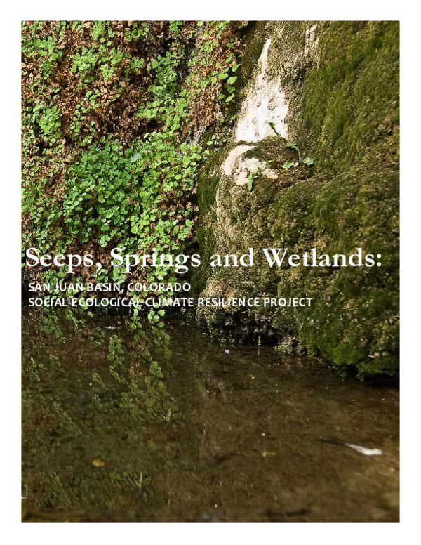
 Mark Bidwell