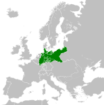
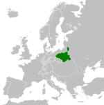
Dosya:North German Confederation 1870.svg

Tam çözünürlük (SVG dosyası, sözde 450 × 456 piksel, dosya boyutu: 705 KB)
Bu dosya Wikimedia Commons'ta bulunmaktadır. Dosyanın açıklaması aşağıda gösterilmiştir. Commons, serbest/özgür telifli medya dosyalarının bulundurulduğu depodur. Siz de yardım edebilirsiniz. |
Özet
Lisanslama
- Şu seçeneklerde özgürsünüz:
- paylaşım – eser paylaşımı, dağıtımı ve iletimi
- içeriği değiştirip uyarlama – eser adaptasyonu
- Aşağıdaki koşullar geçerli olacaktır:
- atıf – Esere yazar veya lisans sahibi tarafından belirtilen (ancak sizi ya da eseri kullanımınızı desteklediklerini ileri sürmeyecek bir) şekilde atıfta bulunmalısınız.
- benzer paylaşım – Maddeyi yeniden karıştırır, dönüştürür veya inşa ederseniz, katkılarınızı orijinal olarak aynı veya uyumlu lisans altında dağıtmanız gerekir.
Altyazılar
Bu dosyada gösterilen öğeler
betimlenen
31 Mayıs 2016
Dosya geçmişi
Dosyanın herhangi bir zamandaki hâli için ilgili tarih/saat kısmına tıklayın.
| Tarih/Saat | Küçük resim | Boyutlar | Kullanıcı | Yorum | |
|---|---|---|---|---|---|
| güncel | 02.58, 1 Haziran 2016 |  | 450 × 456 (705 KB) | Alphathon | Various corrections to the states of the North German Confederation |
| 05.22, 31 Mayıs 2016 |  | 450 × 456 (662 KB) | Alphathon | Uploaded wrong file | |
| 05.22, 31 Mayıs 2016 |  | 450 × 456 (725 KB) | Alphathon | Minor corrections (Tarasp and post-1818 German Confederation border change) | |
| 02.40, 31 Mayıs 2016 |  | 450 × 456 (662 KB) | Alphathon | == {{int:filedesc}} == {{Inkscape}} {{Information |Description={{en|A map of the en:North German Confederation within Europe circa 1870 CE.}} |Source= {{Derived from|Blank_map_of_Europe.svg|display=50}} |Date=2016-05-31 |Author=*[[:File:Bla... |
Dosya kullanımı
Bu görüntü dosyasına bağlantısı olan sayfalar:
Küresel dosya kullanımı
Aşağıdaki diğer vikiler bu dosyayı kullanır:
- ang.wikipedia.org üzerinde kullanımı
- ar.wikipedia.org üzerinde kullanımı
- azb.wikipedia.org üzerinde kullanımı
- bg.wikipedia.org üzerinde kullanımı
- cs.wikipedia.org üzerinde kullanımı
- en.wikipedia.org üzerinde kullanımı
- es.wikipedia.org üzerinde kullanımı
- eu.wikipedia.org üzerinde kullanımı
- fa.wikipedia.org üzerinde kullanımı
- fi.wikipedia.org üzerinde kullanımı
- fr.wikipedia.org üzerinde kullanımı
- he.wikipedia.org üzerinde kullanımı
- hr.wikipedia.org üzerinde kullanımı
- is.wikipedia.org üzerinde kullanımı
- it.wikipedia.org üzerinde kullanımı
- ko.wikipedia.org üzerinde kullanımı
- lt.wikipedia.org üzerinde kullanımı
- lv.wikipedia.org üzerinde kullanımı
- ms.wikipedia.org üzerinde kullanımı
- pl.wikipedia.org üzerinde kullanımı
- pt.wikipedia.org üzerinde kullanımı
- ru.wikipedia.org üzerinde kullanımı
- sv.wikipedia.org üzerinde kullanımı
- th.wikipedia.org üzerinde kullanımı
- vi.wikipedia.org üzerinde kullanımı
- zh.wikipedia.org üzerinde kullanımı
Meta veri
Bu dosyada, muhtemelen fotoğraf makinesi ya da tarayıcı tarafından eklenmiş ek bilgiler mevcuttur. Eğer dosyada sonradan değişiklik yapıldıysa, bazı bilgiler yeni değişikliğe göre eski kalmış olabilir.
| Kısa başlık | North German Confederation ca. 1870 |
|---|---|
| Resim başlığı | A map of the North German Confederation within Europe circa 1870.
Released under CreativeCommons Attribution-ShareAlike 4.0 (CC BY-SA 4.0; https://creativecommons.org/licenses/by-sa/4.0/) by Wikimedia Commons user Alphathon (https://commons.wikimedia.org/wiki/User:Alphathon) The map is based on https://commons.wikimedia.org/wiki/File:Blank_map_of_Europe.svg. The metadata description for that file is contained below: A blank Map of Europe. Every country has an id which is its ISO-3166-1-ALPHA2 code in lower case. Members of the EU have a class="eu", countries in europe (which I found turkey to be but russia not) have a class="europe". Certain countries are further subdivided the United Kingdom has gb-gbn for Great Britain and gb-nir for Northern Ireland. Russia is divided into ru-kgd for the Kaliningrad Oblast and ru-main for the Main body of Russia. There is the additional grouping #xb for the "British Islands" (the UK with its Crown Dependencies - Jersey, Guernsey and the Isle of Man) Contributors. Original Image: (http://commons.wikimedia.org/wiki/Image:Europe_countries.svg) Júlio Reis (http://commons.wikimedia.org/wiki/User:Tintazul). Recolouring and tagging with country codes: Marian "maix" Sigler (http://commons.wikimedia.org/wiki/User:Maix) Improved geographical features: http://commons.wikimedia.org/wiki/User:W!B: Updated to reflect dissolution of Serbia & Montenegro: http://commons.wikimedia.org/wiki/User:Zirland Updated to include British Crown Dependencies as seperate entities and regroup them as "British Islands", with some simplifications to the XML and CSS: James Hardy (http://commons.wikimedia.org/wiki/User:MrWeeble) Validated (http://commons.wikimedia.org/wiki/User:CarolSpears) Changed the country code of Serbia to RS per http://en.wikipedia.org/wiki/Serbian_country_codes and the file http://www.iso.org/iso/iso3166_en_code_lists.txt (http://commons.wikimedia.org/wiki/User:TimothyBourke) Uploaded on behalf of User:Checkit, direct complaints to him plox: 'Moved countries out of the "outlines" group, removed "outlines" style class, remove separate style information for Russia' (http://commons.wikimedia.org/wiki/User:Collard) Updated various coastlines and boarders and added various islands not previously shown (details follow). Added Kosovo and Northern Cyprus as disputed territories. Moved major lakes to their own object and added more. List of updated boarders/coastlines: British Isles (+ added Isle of Wight, Skye, various smaller islands), the Netherlands, Germany, Czech Republic, Denmark, Sweden, Finland, Poland, Kaliningrad Oblast of the Russian Federation (and minor tweaks to Lithuania), Ukraine, Moldova (minor), Romania, Bulgaria, Turkey, Greece, F.Y.R. Macedonia, Serbia, Bosnia and Herzegovina, Montenegro, Albania, Croatia, Italy (mainland and Sicily), Malta (http://commons.wikimedia.org/wiki/User:Alphathon). Added Bornholm (http://commons.wikimedia.org/wiki/User:Heb)Released under CreativeCommons Attribution ShareAlike (http://creativecommons.org/licenses/by-sa/2.5/). |
| Genişlik | 450 |
| Yükseklik | 456 |


