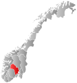
Bestand:Norway Counties Buskerud Position.svg
Uiterlijk

Afmetingen van deze voorvertoning van het type PNG van dit SVG-bestand: 562 × 600 pixels Andere resoluties: 225 × 240 pixels | 450 × 480 pixels | 719 × 768 pixels | 959 × 1.024 pixels | 1.918 × 2.048 pixels | 740 × 790 pixels.
Oorspronkelijk bestand (SVG-bestand, nominaal 740 × 790 pixels, bestandsgrootte: 54 kB)
Bestandsgeschiedenis
Klik op een datum/tijd om het bestand te zien zoals het destijds was.
| Datum/tijd | Miniatuur | Afmetingen | Gebruiker | Opmerking | |
|---|---|---|---|---|---|
| huidige versie | 2 jan 2024 01:57 |  | 740 × 790 (54 kB) | Jay1279 | update county borders for 2024 |
| 27 jan 2019 09:26 |  | 740 × 790 (67 kB) | Bjarkan | Border update (Rindal). | |
| 17 dec 2017 04:13 |  | 740 × 790 (67 kB) | Bjarkan | Improved version. | |
| 24 jan 2016 12:45 |  | 740 × 790 (81 kB) | Fleinn | Reverted to version as of 12:50, 16 August 2010 (UTC) | |
| 19 jan 2016 02:50 |  | 512 × 512 (82 kB) | Kingsocarso | Reverted to version as of 21:28, 21 September 2007 (UTC) | |
| 16 aug 2010 13:50 |  | 740 × 790 (81 kB) | Fleinn | Added gradient. | |
| 21 sep 2007 22:28 |  | 512 × 512 (82 kB) | Marmelad | {{Information |Description=Autogenerated locator map of norwegian county as named in filename. |Source=Based on Image:Norway counties blank.svg |Date=2007-09-21 |Author=Marmelad |Permission=Own work, share alike, attribution require |
Bestandsgebruik
Dit bestand wordt op de volgende 21 pagina's gebruikt:
Globaal bestandsgebruik
De volgende andere wiki's gebruiken dit bestand:
- Gebruikt op af.wikipedia.org
- Gebruikt op ar.wikipedia.org
- Gebruikt op ast.wikipedia.org
- Gebruikt op azb.wikipedia.org
- Gebruikt op bpy.wikipedia.org
- Gebruikt op br.wikipedia.org
- Gebruikt op bs.wikipedia.org
- Gebruikt op da.wikipedia.org
- Gebruikt op en.wikipedia.org
- Gebruikt op eo.wikipedia.org
- Gebruikt op eu.wikipedia.org
- Gebruikt op fa.wikipedia.org
- Gebruikt op fr.wikipedia.org
Globaal gebruik van dit bestand bekijken.