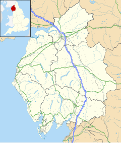
Shap Rural
| Shap Rural | |
|---|---|
| Civil parish | |
 | |
Location within Cumbria | |
| Population | 130 (2011)[1] |
| OS grid reference | NY5415 |
| District | |
| Shire county | |
| Region | |
| Country | England |
| Sovereign state | United Kingdom |
| Post town | PENRITH |
| Postcode district | CA10 |
| Dialling code | 01931 |
| Police | Cumbria |
| Fire | Cumbria |
| Ambulance | North West |
| UK Parliament | |
Shap Rural is a very large, but sparsely populated, civil parish in the Eden district of Cumbria in England, covering part of the Lake District National Park. It had a population of 119 in 2001,[2] 130 at the 2011 Census,[1] and 110 in 2021.[3]
Within the parish are the hamlets and settlements of Wet Sleddale, Hardendale and Swindale, most of the Shap Fells range and the reservoirs of Haweswater (part) and Wet Sleddale. The village of Mardale Green, which disappeared when Haweswater was converted into a reservoir in the 1930s, was in the parish.
The parish was created in 1904 with the splitting of the former civil parish of Shap into urban and rural parts.[4] Shap Urban, (since 1935 just Shap), was administered by an urban district council from 1905 to 1935.[5] Shap and Shap Rural today have a joint parish council.
Major landowners in the parish are the Lowther Family Estates and United Utilities.
Junction 39 of the M6 motorway lies within the parish.
Shapbeck Limestone quarry owned by Hanson plc is in the northern part of the parish though the Hardendale Corus limestone quarry and works and the famous Cemex (formerly RMC) Shap Granite quarries and works are within both Shap Rural and Shap parishes.
The cottage owned by Uncle Monty in the cult 1986 film Withnail & I is located by the reservoir at Wet Sleddale.[6]
See also
[edit]References
[edit]- ^ a b UK Census (2011). "Local Area Report – Shap Rural Parish (E04002569)". Nomis. Office for National Statistics. Retrieved 20 April 2021.
- ^ UK Census (2001). "Local Area Report – Shap Rural Parish (16UF060)". Nomis. Office for National Statistics. Retrieved 20 April 2021.
- ^ "Shap Rural custom area profile". ONS. Retrieved 4 March 2024.
- ^ "West Ward Registration District". UKBMD. Retrieved 12 January 2022.
- ^ "Relationships and changes Shap UD through time". A Vision of Britain through Time. Retrieved 6 November 2022.
- ^ Tyzack, Anna (21 January 2009). "Withnail's 'Horrible little shack' under the hammer". London: Telegraph.co.uk. Archived from the original on 23 January 2009. Retrieved 27 September 2011.
External links
[edit]- Cumbria County History Trust: Shap (nb: provisional research only – see Talk page)
- "Shap, Rural". British History Online. Retrieved 12 January 2022.
