Phagwara
This article has multiple issues. Please help improve it or discuss these issues on the talk page. (Learn how and when to remove these messages)
|
Phagwara | |
|---|---|
| Coordinates: 31°13′N 75°46′E / 31.22°N 75.77°E | |
| Country | |
| State | Punjab |
| District | Kapurthala |
| Founded by | Chaudhary Phaggu Mal Basra |
| Named for | Phagu Da Wara |
| Government | |
| • Type | Democracy |
| • Body | Government of Punjab, India |
| Area | |
• Total | 20 km2 (8 sq mi) |
| Elevation | 234 m (768 ft) |
| Population (2011) | |
• Total | 117,954 |
| • Rank | 288 |
| • Density | 6,117/km2 (15,840/sq mi) |
| Time zone | UTC+5:30 (IST) |
| PIN | 144401 144402 |
| Telephone code | 01824 |
| Vehicle registration | PB-36 |
| Post office | Phagwara H.O Satnampura S.O |
Phagwara is a city and municipal corporation in the Kapurthala district of Punjab, India. It is located 40 kilometers from Kapurthala, the district headquarter, 124 kilometres (77 mi) away from Chandigarh, 20 kilometres (12 mi) away from Jalandhar and 361 kilometres (224 mi) from New Delhi. The city is famous for sugar, glucose, starch, fine fabric textiles, and auto parts manufacturing for engines in Punjab. This place is also known for the Shri Hanuman Garhi Temple, which has statues of the Hindu God, Hanuman.
History
[edit]Phagwara started as a market town in the region, founded by Chaudhary Phaggu Mal Basra, a Hindu Jatt landlord of the area. The militarist Sikh Guru Hargobind Sahib visited the city in 1635.
Guru Ramdas sent Bhai Phaggu to Sasaram, Bihar to preach Sikhism and spend his whole life in Bihar. Once Guru Teg Bahadur visited Bhai Phaggu in Bihar and called him Chacha ji due to this Bhai Phaggu ji is also known as Chacha Phaggu.[1] When Guru Hargobind in 1635 visited Phagwara, he was not respected by the people of city completely opposite of the Bhai Phaggu's Nature at that time. As a result he said ‘Phagu Da Warra, Bahron Mitha Andra Khara’ Thus, Phagwara’s name originally comes from that phrase.[2]
The town's property originally belonged to him. From the early Mughal era till year 1803 Bhai Phaggu's family was the Most Powerful Chief family of Doaba at height they had 240 Villages in Phagwara and Banga Tehsils his Descendent Chaudhary Trilok Chand Basra who married Princess Rajinder Kanwar Grand daughter of Maharaja Ala Singh of Patiala[3] [4] he was later succeed by Chaudhary Chuhar Mal Basra who was the last Chief of family he was defeated and ejected by Maharaja Ranjit Singh in year 1803[5][6][4]

Geography
[edit]


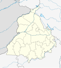
Phagwara is located on land between the Beas and Satluj rivers and is a typical Doaba city.[7] It has an average elevation of 767 feet (234 m). It is located in the Kapurthala district, in the Punjab province of India.
Demographics
[edit]As per provisional data of the 2011 census, the Phagwara urban agglomeration had a population of 117,954, with 62,171 males and 55,783 females. The literacy rate was 87.43 per cent.[8] The city of Phagwara had a population of 97,864, with 51,386 males and 46,478 females. Phagwara has an average literacy rate of 86%, higher than the regional average of 75%; male literacy is 89% and female literacy is 83%. In Phagwara, 10% of the population is under 6 years of age.[9]
The table below shows the population of different religious groups in Phagwara city, as of the 2011 census.
| Religion | Total | Female | Male |
|---|---|---|---|
| Hindu | 73,845 | 34,877 | 38,968 |
| Sikh | 20,635 | 9,988 | 10,647 |
| Muslim | 1,434 | 663 | 771 |
| Buddhist | 730 | 347 | 383 |
| Christian | 280 | 134 | 146 |
| Jain | 233 | 123 | 110 |
| Other religions | 64 | 27 | 37 |
| Not stated | 643 | 319 | 324 |
| Total | 97,864 | 46,478 | 51,386 |
Education
[edit]- Universities
- Colleges
- Guru Nanak College
- Pyramid college of business and technology
- Kamla Nehru college for women.
- Ramgarhia Institute of Engineering & Technology
- Ramgarhia Polytechnic College, First Polytechnic of United Punjab (Since 1950)
- Ramgarhia College of Education
- Ramgarhia College
- Schools
- Sant Sarwan Dass Model School Hadiabad,Phagwara
- G.D.R convent senior secondary school
- Government Senior Secondary School (Boys) known as J.J. School
- Government Senior Secondary School (Girls)
- Aman Public School
- Arya model senior secondary school
- St. Joseph's Convent School
- Kamla Nehru Public School
- Swami Sant Dass Public School
- Mele Singh Missionary School
- Cambridge International School
- Saffron Public School
- Tagore Public High School
- Jain Model Senior Secondary School
- Lord Mahavira Jain Public School
- St. Sai Ram Sunrise High School
- New Sunflower High School
- Guru Harkrishan National Model Senior Secondary School
- S.D. Model senior secondary School
- MAA Ambay girls Senior secondary School
- T.W.E.I. Senior Secondary School
- Ramgarhia Senior Secondary School
- Dehradoon international public school, Bhabiana
- Ramgarhia ITI, Rampur Khalyan
- Kanya Maha Vidaylaya School
- Apple Orchard School
Villages/Estates in Phagwara tehsil
[edit]- Bhabiana
- Nangal Majja
- Kotli Khakhian
- Madhopur
- Indna Kalaske
- Manawali
- Sapror
- Bhullarai
- Chachoki
- Brahampur, Phagwara
- Lakhpur
- Maheru
- Jagpalpur
- Ranipur
- Palahi
- Mayopatti
- Narur
- Panchhat, (A Parmar Rajput Estate)
- Gandhwan
- Athouli
- Nihalgarh (Nawa Pind)
- Jagat Pur Jattan
- Thakarki
- Pandwa
- Sangatpur
- Chak Prema
- Dhadday
- Dhadoli
- Bir Dhadoli
- Rawalpindi
- Khatti
- Rampur Sunra
- Malikhpur
- Domeli
- Babeli
- Prem Pura
- Khera, Nangal
- Bhanoki
- Bir Puadh
- Rehana Jattan
- Khangura
- Chak Hakim
- Virk
- Mouli
- Chaheru
- Ucha Pind
- Hadiabad
- Kotrani
- Khalwara
- Dhak Pandori
- Balaloan Pind
- Chak Hakim
- Drawesh Pind
- Balaloan Pind
- Thakarki
- Sahni
- Rampur Sunran
- Sadarpur
- Bazindowal
- Bir Khurampur [11]
References
[edit]- ^ "Gurdwara Sri Chacha Phaggu Mal | Discover Sikhism". www.discoversikhism.com. Retrieved 5 October 2024.
- ^ Kapurthala, District of. "Gov. Of Kapurthala". Gov. Of Punjab.
- ^ The Panjab Past and Present. Department of Punjab Historical Studies, Punjabi University. 1985.
- ^ a b www.DiscoverSikhism.com. History Of The Sikhs Vol. IV The Sikh Commonwealth Or Rise And Fall Of Sikh Misls.
- ^ Government of Punjab (1908). Punjab District Gazetteers, Volume XIV A. Jullundur District, with maps, 1904. Lahore, Civil and Military Gazette Press.
- ^ Rao, Ram Sukh (1980). Ram Sukh Rao's Sri Fateh Singh Partap Prabhakar (in Punjabi). J. Kaur.
- ^ "Falling Rain Genomics, Inc - Phagwara".
- ^ "Urban Agglomerations/Cities having population 1 lakh and above" (PDF). Provisional Population Totals, Census of India 2011. Retrieved 7 July 2012.
- ^ "Phagwara Town Population Census 2011 - 2023". Population Census.
- ^ https://censusindia.gov.in/nada/index.php/catalog/11389, India - C-01: Population by religious community, Punjab - 2011, Phagwara (M Cl), Row 77
- ^ "Google Maps".

