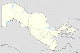
Ibrat
Appearance
Ibrat | |
|---|---|
Urban-type settlement | |
| Coordinates: 40°33′14″N 71°8′48″E / 40.55389°N 71.14667°E | |
| Country | |
| Region | Fergana Region |
| District | Buvayda District |
| Population (2016) | |
• Total | 8,500 |
| Time zone | UTC+5 (UZT) |
Ibrat (Uzbek: Ibrat/Ибрат, Russian: Ибрат, formerly Yangiqoʻrgʻon) is an urban-type settlement in Fergana Region, Uzbekistan. It is the administrative center of Buvayda District.[1] Its population was 7,502 people in 1989,[2] and 8,500 in 2016.[3]
References
[edit]- ^ "Classification system of territorial units of the Republic of Uzbekistan" (in Uzbek and Russian). The State Committee of the Republic of Uzbekistan on statistics. July 2020.
- ^ Всесоюзная перепись населения 1989 г. Численность сельского населения союзных республик - жителей сельских населенных пунктов - районных центров по полу Archived 2016-04-04 at the Wayback Machine(in Russian)
- ^ Soliyev, A.S. Shaharlar geografiyasi [Geography of cities] (PDF) (in Uzbek). p. 169.

