Foindle
Appearance
| Foindle | |
|---|---|
 Traigh Bad na Baighe The bay at close to high water. Foinaven and Arkle can be seen in the distance. | |
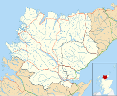
Location within the Sutherland area | |
| OS grid reference | NC189493 |
| Council area | |
| Lieutenancy area | |
| Country | Scotland |
| Sovereign state | United Kingdom |
| Postcode district | IV27 4 |
| Police | Scotland |
| Fire | Scottish |
| Ambulance | Scottish |
Foindle (Scottish Gaelic: An Fhionndail) is a village on the south shore of Loch Laxford in Lairg, Sutherland, Scottish Highlands and is in the Scottish council area of Highland.[1]
The village of Fanagmore is located 0.5 miles to the west, and sit in the same cove.
References
[edit]- ^ Warren Rovetch (2002). The Creaky Traveler in the North West Highlands of Scotland: A Journey for the Mobile But Not Agile. Sentient Publications. p. 91. ISBN 978-0-9710786-7-3.
