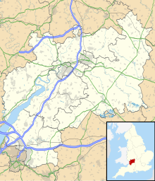
Edgehills Quarry
| Site of Special Scientific Interest | |
 Edgehills Quarry | |
| Location | Gloucestershire |
|---|---|
| Grid reference | SO660167 |
| Coordinates | 51°50′54″N 2°29′39″W / 51.848306°N 2.494261°W |
| Interest | Geological |
| Area | 0.4 hectare |
| Notification | 1974 |
| Natural England website | |
Edgehills Quarry (grid reference SO660167) is a 0.4-hectare (0.99-acre) geological Site of Special Scientific Interest in Gloucestershire, notified in 1974.[1][2]
The site is listed in the 'Forest of Dean Local Plan Review' as a Key Wildlife Site (KWS).[3]
Location and geology
[edit]The quarry is sited in the Forest of Dean and provides an easily accessible exposure through c.75 metres of Drybrook Sandstone. The sandstones include good sedimentary structures and fossil traces which indicate a shallow marine environment. The Drybrook Sandstone lies between the Chadian Whitehead Limestone and the overlying unconformable Coal Measures.[1]
The Quarry is near other similar sites and nature reserves being Merring Meend, Westbury Brook Pond, Fairplay Iron Mine and Plump Hill Dolomite Quarry.[4]
References
[edit]- ^ a b Natural England SSSI information on the citation
- ^ Forest of Dean District Local Plan Review, adopted November 2005, Appendix D 'Nature Conservation Site Designations Within the Forest of Dean District', Sites of Special Scientific Interest Archived October 29, 2013, at the Wayback Machine
- ^ Forest of Dean District Local Plan Review, adopted November 2005, Appendix D 'Nature Conservation Site Designations Within the Forest of Dean District', Key Wildlife Sites Archived October 29, 2013, at the Wayback Machine
- ^ Kelham, A, Sanderson, J, Doe, J, Edgeley-Smith, M, et al., 1979, 1990, 2002 editions, 'Nature Reserves of the Gloucestershire Trust for Nature Conservation/Gloucestershire Wildlife Trust'
SSSI Source
[edit]- Natural England SSSI information on the citation
- Natural England SSSI information on the Edgehills Quarry unit
External links
[edit]- Natural England (SSSI information)
