Chardonnières
Appearance
Chardonnières
| |
|---|---|
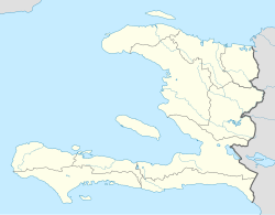
Location in Haiti[1] | |
| Coordinates: 18°16′0″N 74°10′0″W / 18.26667°N 74.16667°W | |
| Country | Haiti |
| Department | Sud |
| Arrondissement | Chardonnières |
| Area | |
• Total | 117.04 km2 (45.19 sq mi) |
| Elevation | 0 m (0 ft) |
| Population (March, 2015)[2] | |
• Total | 25,240 |
| • Density | 216/km2 (560/sq mi) |
| Demonym | Chardonnesien(ne) (fr) |
Chardonnières (Haitian Creole: Chadonyè) is a commune in the Chardonnières Arrondissement, in the Sud department of Haiti. Chardonnière is the largest producer of grapes in Haiti.[3] A Festival of the Grape (Festival du raisin des Chardonnières) is annually held.[4]
History
[edit]The town was originally named Chardonnières by buccaneers or filibusters.[3] In its colonial days, grapes had reached the tables of the kings of France. Today, grapes are used by the Chardonnesiens to welcome visitors to express their generosity and hospitality.[3]
Geography
[edit]Chardonnière is located about 72 kilometers from Les Cayes, and minutes from Port-à-Piment.[3]
Infrastructure
[edit]The Catholic parish of Chardonnière was erected in 1897 and consecrated to Saint Anne.[3]
Settlements
[edit]References
[edit]- ^ "National Geospatial-Intelligence Agency". GeoNames Search. Retrieved 29 August 2014.
- ^ "Mars 2015 Population Totale, Population de 18 ans et Plus Menages et Densites Estimes en 2015" (PDF). Institut Haïtien de Statistique et d’Informatique (IHSI). Archived from the original (PDF) on 6 November 2015. Retrieved 3 June 2017.
- ^ a b c d e Haiti Ministry of Tourism - Gastronomy
- ^ Press, ed. (19 July 2014). "Haiti - Social : 3rd Edition of the Festival of the Grape of Chardonnières". Haiti Libre. Retrieved 5 June 2017.

