Bjorkdale
Bjorkdale | |
|---|---|
| Village of Bjorkdale | |
| Motto: Village in the Valley[1] | |
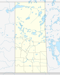
Location of Bjorkdale in Saskatchewan | |
| Coordinates: 52°42′25″N 103°37′19″W / 52.707°N 103.622°W | |
| Country | Canada |
| Province | Saskatchewan |
| Region | Central |
| Census division | 14 |
| Rural Municipality | Bjorkdale |
| Incorporated (Village) | 1968 |
| Government | |
| • Type | Municipal |
| • Governing body | Bjorkdale Village Council |
| • Mayor | James Majewski |
| • Administrator | Nicole Goldsworthy |
| Area | |
| • Total | 1.39 km2 (0.54 sq mi) |
| Population | |
| • Total | 201 |
| • Density | 145.1/km2 (376/sq mi) |
| Time zone | CST |
| Postal code | S0E 0E0 |
| Area code | 306 |
| Highways | |
| Railways | Abandoned |
| Website | villageofbjorkdale |
Bjorkdale /ˈbɜːrkdeɪl/ (2016 population: 201) is a village in the Canadian province of Saskatchewan within the Rural Municipality of Bjorkdale No. 426 and Census Division No. 14. The village is at the junctions of Highways 23, 679, and 776, approximately 78 kilometres (48 mi) east of the city of Melfort.
History
[edit]Bjorkdale incorporated as a village on April 1, 1968.[2]
Demographics
[edit]In the 2021 Census of Population conducted by Statistics Canada, Bjorkdale had a population of 147 living in 70 of its 88 total private dwellings, a change of -26.9% from its 2016 population of 201. With a land area of 1.36 km2 (0.53 sq mi), it had a population density of 108.1/km2 (279.9/sq mi) in 2021.[5]
In the 2016 Census of Population, the Village of Bjorkdale recorded a population of 201 living in 90 of its 101 total private dwellings, a 1% change from its 2011 population of 199. With a land area of 1.39 km2 (0.54 sq mi), it had a population density of 144.6/km2 (374.5/sq mi) in 2016.[6]
See also
[edit]- List of communities in Saskatchewan
- List of francophone communities in Saskatchewan
- Villages of Saskatchewan
References
[edit]- ^ Village in the Valley
- ^ "Urban Municipality Incorporations". Saskatchewan Ministry of Government Relations. Archived from the original on October 15, 2014. Retrieved June 1, 2020.
- ^ "Saskatchewan Census Population" (PDF). Saskatchewan Bureau of Statistics. Archived from the original (PDF) on September 24, 2015. Retrieved May 31, 2020.
- ^ "Saskatchewan Census Population". Saskatchewan Bureau of Statistics. Retrieved May 31, 2020.
- ^ "Population and dwelling counts: Canada, provinces and territories, census divisions and census subdivisions (municipalities), Saskatchewan". Statistics Canada. February 9, 2022. Retrieved April 1, 2022.
- ^ "Population and dwelling counts, for Canada, provinces and territories, and census subdivisions (municipalities), 2016 and 2011 censuses – 100% data (Saskatchewan)". Statistics Canada. February 8, 2017. Retrieved May 30, 2020.
External links
[edit]52°42′25″N 103°37′19″W / 52.707°N 103.622°W


