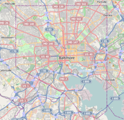
Berea, Baltimore
Appearance
Berea | |
|---|---|
neighborhood statistical area | |
 Baltimore Cemetery entrance at 2500 E. North Avenue in Berea, Baltimore | |
| Coordinates: 39°18′31″N 76°34′41″W / 39.308501°N 76.578076°W | |
| Country | United States |
| State | Maryland |
| City | Baltimore |
| Area | |
• Total | 0.439 sq mi (1.14 km2) |
| • Land | 0.439 sq mi (1.14 km2) |
| Population (2009)[1] | |
• Total | 4,597 |
| • Density | 10,000/sq mi (4,000/km2) |
| Time zone | UTC-5 (Eastern) |
| • Summer (DST) | UTC-4 (EDT) |
| ZIP code | 21213 |
| Area code | 410, 443, and 667 |
Berea is a neighborhood in the East District of Baltimore. Its boundaries are the south side of Sinclair Lane, the east side of Milton Avenue, the west side of Edison Highway, and the north side of Biddle Street. Berea lies between the neighborhoods of Broadway East (west) and Orangeville (east), north of the Biddle Street neighborhood and south of Four By Four.[1][2]
Though the area is considered middle class with African Americans being the majority of the population. The houses and lawns are well keep in this quiet clean neighborhood. A filming location for The Wire, a Baltimore-based HBO drama, [3]
See also
[edit]References
[edit]- ^ a b c "Berea neighborhood in Baltimore". City-data.com. Retrieved June 30, 2011.
- ^ "East District Maps". Baltimore City Neighborhoods Portal. City of Baltimore. Retrieved June 30, 2011.
- ^ Gus G. Sentementes and Annie Linskey (April 15, 2007). "Gang problem hemorrhaging". The Baltimore Sun.
External links
[edit]Wikimedia Commons has media related to Berea, Baltimore.
- Baltimore '68: Riots and Rebirth Overview. Langsdale Library Special Collections. University of Baltimore.
- Gadi Dechter (May 24, 2006). "Wish You Weren't Here: A Guided Tour Of The Wire's East Baltimore". Baltimore City Paper. Archived from the original on June 15, 2006.
- "Clifton-Berea" (PDF). Baltimore Neighborhood Indicators Alliance. Jacob France Institute. Archived from the original (PDF) on 2012-03-21.
