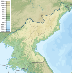
1810 North Korea earthquake
| Local date | 19 February 1810 |
|---|---|
| Magnitude | 7.3 Mw |
| Epicenter | 41°36′N 130°00′E / 41.6°N 130.0°E |
| Areas affected | Joseon (present-day North Korea) |
| Max. intensity | MMI IX (Violent) |
| Casualties | Unspecified number |
An earthquake struck present-day North Korea during the Joseon Dynasty. The earthquake had an estimated moment magnitude of 7.3 and affected present-day North Hamgyong Province.[1] The maximum Modified Mercalli intensity was assigned VIII to IX. Eighty-three homes collapsed and livestock were destroyed. A landslide killed at least two people while additional fatalities occurred during a stampede.[2]
Historical documents indicate it occurred in the early morning. The towns of Myeongcheon, Gyeongseong, and Hoeryeong were affected; fortresses and homes were razed, landslides occurre and people were killed. In Buryeongbu, 38 homes were destroyed and residents also died.[3]
The earthquake may have occurred on a section of the Yilan-Yitong Fault Zone in Shangzhi, China, through paleoseismology. The Yilan-Yitong Fault Zone is the northern branch of the larger Tanlu Fault. The Tanlu Fault is a 3,600 km (2,200 mi) long continental strike-slip fault extending from southern China through the country's northeast, into Bohai Bay and Russia. The Yilan-Yitong Fault Zone is located north of Bohai Bay. It is considered a major seismic hazard in the region as it represents an active boundary between the tectonics of north Asia. A paleoearthquake identified through trenching studied may correspond to historical records of an earthquake affecting Ning'an in 1810.[4]
References
[edit]- ^ "19 February 1810 [North Korea]". Global Historical Earthquake Archive. Retrieved 19 February 2024.
- ^ Lim, Hyunjee; Jeong, Rae-Yoon; Lee, Seongjun; Kim, Sohee; Son, Moon (2022). "Seismic landslide hazard assessment of the Busan city based on prediction of the Newmark displacement" (PDF). Journal of the Geological Society of Korea. 58 (4): 467–478. doi:10.14770/jgsk.2022.58.4.467.
- ^ Jong-oh, Jeong (23 September 2016). "[gyeongju jijin]joseonsidae "jib-i muneojigo salam-i jug-eossda"" [경주 지진]조선시대 "집이 무너지고 사람이 죽었다" [[Gyeongju Earthquake] Joseon Dynasty “Houses collapsed and people died”]. Asia Economy (in Korean). Retrieved 19 February 2024.
- ^ Yu, Zhongyuan; Zhang, Peizhen; Min, Wei; Wei, Qinghai; Liu, Yugang (2017). "Late Holocene slip rate and average recurrence interval of great earthquakes on the Shangzhi segment of the Yilan-Yitong Fault Zone, northeastern China: Constraints from paleo-earthquakes and historical written records: repeat times, slip rate, YYFZ". Island Arc. 27 (1). doi:10.1111/iar.12231.
