Trhová Kamenice: Difference between revisions
Appearance
Content deleted Content added
Rescuing 1 sources and tagging 0 as dead. #IABot (v1.6.1) (Balon Greyjoy) |
Zackmann08 (talk | contribs) Converting to use Template:Infobox settlement |
||
| Line 1: | Line 1: | ||
{{Infobox settlement |
|||
{{Geobox | Settlement |
|||
| ⚫ | |||
<!-- *** Heading *** --> |
|||
| |
| native_name = |
||
| other_name = |
| other_name = |
||
| |
| settlement_type = Market Town |
||
<!-- |
<!-- images, nickname, motto --> |
||
| |
| image_skyline = Trhová Kamenice, Zubří.jpg |
||
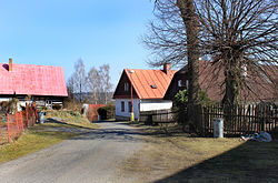
| image_caption = Trhová Kamenice, Zubří |
| image_caption = Trhová Kamenice, Zubří |
||
| ⚫ | |||
<!-- *** Symbols *** --> |
|||
| |
| image_shield = Znak_Trhová_Kamenice.png |
||
| |
| motto = |
||
| ⚫ | |||
| ⚫ | |||
| etymology = |
| etymology = |
||
<!-- location --> |
|||
| official_name = |
|||
| |
| subdivision_type = Country |
||
| |
| subdivision_name = Czech Republic |
||
| subdivision_type1 = |
|||
<!-- *** Country etc. *** --> |
|||
| |
| subdivision_name1 = |
||
| ⚫ | |||
| country_flag = 1 |
|||
| ⚫ | |||
| ⚫ | |||
| subdivision_type3 = [[Districts of the Czech Republic|District]] |
|||
| ⚫ | |||
| |
| subdivision_name3 = [[Chrudim District|Chrudim]] |
||
| subdivision_type4 = |
|||
| district = [[Chrudim District|Chrudim]] |
|||
| subdivision_name4 = |
|||
| ⚫ | |||
<!-- maps and coordinates --> |
|||
| commune = Hlinsko |
|||
| |
| image_map = |
||
| ⚫ | |||
<!-- *** Family *** --> |
|||
| |
| pushpin_map = Czechia |
||
| |
| pushpin_relief = |
||
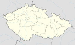
| pushpin_map_caption = Location in the Czech Republic |
|||
<!-- *** Locations *** --> |
|||
| ⚫ | |||
| ⚫ | |||
| |
| coordinates_footnotes = |
||
<!-- government type, leaders --> |
|||
| ⚫ | |||
| ⚫ | |||
| capital_coordinates = |
|||
| leader_name = Kábele Pavel |
|||
| mouth_coordinates = |
|||
<!-- established --> |
|||
| ⚫ | |||
| ⚫ | |||
| highest_elevation = |
|||
| |
| established_date = 1439 |
||
<!-- area --> |
|||
| lowest_elevation = |
|||
| |
| area_footnotes = |
||
| |
| area_total_km2 = 20.38 |
||
| ⚫ | |||
<!-- *** Population *** --> |
|||
| |
| area_land_sq_mi = |
||
| |
| area_water_sq_mi = |
||
<!-- elevation --> |
|||
| population_density = auto |
|||
| elevation_footnotes = |
|||
<!-- *** History & management *** --> |
|||
| |
| elevation_m = 535 |
||
| ⚫ | |||
| ⚫ | |||
<!-- population --> |
|||
| ⚫ | |||
| population_as_of = 2014-01-01 |
|||
| ⚫ | |||
| population_footnotes = |
|||
| timezone = [[Central European Time|CET]] |
|||
| |
| population_total = 915 |
||
| population_density_km2 = auto |
|||
| timezone_DST = [[Central European Summer Time|CEST]] |
|||
| population_density_sq_mi= |
|||
| utc_offset_DST = +2 |
|||
| |
| population_demonym = |
||
| ⚫ | |||
| ⚫ | |||
| |
| timezone1 = [[Central European Time|CET]] |
||
| utc_offset1 = +1 |
|||
<!-- *** Free frields *** --> |
|||
| |
| timezone1_DST = [[Central European Summer Time|CEST]] |
||
| utc_offset1_DST = +2 |
|||
| ⚫ | |||
<!-- postal codes, area code --> |
|||
| map = Czechia - outline map.svg |
|||
| |
| postal_code_type = Postal code |
||
| |
| postal_code = 539 01 - 539 52 |
||
| |
| area_code_type = |
||
| area_code = |
|||
<!-- *** Websites *** --> |
|||
| |
| geocode = |
||
| iso_code = |
|||
| statistics = [http://www.statnisprava.cz/ebe/ciselniky.nsf/i/572390 statnisprava.cz] |
|||
| website = [http://www.trhovakamenice.cz/ www.trhovakamenice.cz] |
<!-- website, footnotes --> |
||
| website = [http://www.trhovakamenice.cz/ www.trhovakamenice.cz] |
|||
| footnotes = |
|||
<!-- *** Footnotes *** --> |
|||
| ⚫ | |||
}} |
}} |
||
'''Trhová Kamenice''' is a [[market town]] in the [[Pardubice Region]] of the [[Czech Republic]]. It has around 850 inhabitants. |
'''Trhová Kamenice''' is a [[market town]] in the [[Pardubice Region]] of the [[Czech Republic]]. It has around 850 inhabitants. |
||
Revision as of 03:08, 2 November 2018
Trhová Kamenice | |
|---|---|
Market Town | |
 Trhová Kamenice, Zubří | |
| Coordinates: 49°47′19″N 15°49′1″E / 49.78861°N 15.81694°E | |
| Country | Czech Republic |
| Region | Pardubice |
| District | Chrudim |
| First mentioned | 1439 |
| Government | |
| • Mayor | Kábele Pavel |
| Area | |
| • Total | 20.38 km2 (7.87 sq mi) |
| Elevation | 535 m (1,755 ft) |
| Population (2014-01-01) | |
| • Total | 915 |
| • Density | 45/km2 (120/sq mi) |
| Time zone | UTC+1 (CET) |
| • Summer (DST) | UTC+2 (CEST) |
| Postal code | 539 01 - 539 52 |
| Website | www.trhovakamenice.cz |
Trhová Kamenice is a market town in the Pardubice Region of the Czech Republic. It has around 850 inhabitants.
Hamlets Hluboká, Kameničky, Petrkov 3rd part, Polom, Rohozná and Zubří are administrative parts of Trhová Kamenice. Parts of Petrkov are administered by three different villages.
External links
Wikimedia Commons has media related to Trhová Kamenice.

