[go: up one dir, main page]

Jump to content

Teruel, Huila

Coordinates: 2°45′N 75°34′W / 2.750°N 75.567°W / 2.750; -75.567
From Wikipedia, the free encyclopedia
The printable version is no longer supported and may have rendering errors. Please update your browser bookmarks and please use the default browser print function instead.
Teruel, Huila
Municipality and town
Flag of Teruel, Huila
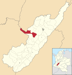
Location of the municipality and town of Teruel, Huila in the Huila Department of Colombia.
Country Colombia
DepartmentHuila Department
Elevation
910 m (2,990 ft)
Time zoneUTC-5 (Colombia Standard Time)

Teruel is a town and municipality in the Huila Department, Colombia.

2°45′N 75°34′W / 2.750°N 75.567°W / 2.750; -75.567