Rotten Island: Difference between revisions
Appearance
Content deleted Content added
No edit summary |
m Dating maintenance tags: {{Moresources}} |
||
| (11 intermediate revisions by 10 users not shown) | |||
| Line 1: | Line 1: | ||
{{moresources|date=April 2021}} |
|||
{{Use dmy dates|date=April 2021}} |
|||
{{Use Irish English|date=May 2019}} |
|||
{{Infobox islands |
{{Infobox islands |
||
| name = Rotten Island |
| name = Rotten Island |
||
| |
| image_name = Lighthouse on Rotten Island - geograph.org.uk - 1214797.jpg |
||
| |
| image_caption = The lighthouse |
||
| |
| map = island of Ireland |
||
| |
| map_caption = |
||
| |
| native_name = ''An tOileán Bréan'' |
||
| |
| native_name_link = Irish language |
||
| nickname = |
| nickname = |
||
| location = [[Atlantic Ocean]] |
| location = [[Atlantic Ocean]] |
||
| coordinates = {{coord|54|37|N|8|26|W|region:IE_type:isle_source:GNS-enwiki|display=inline,title}} |
| coordinates = {{coord|54|37|N|8|26|W|region:IE_type:isle_source:GNS-enwiki|display=inline,title}} |
||
| archipelago = |
| archipelago = |
||
| |
| area_km2 = |
||
| |
| area_footnotes = |
||
| |
| length_km = |
||
| |
| length_footnotes = |
||
| |
| width_km = |
||
| |
| width_footnotes = |
||
| coastline_km = |
| coastline_km = |
||
| |
| highest_mount = |
||
| elevation_m = |
| elevation_m = |
||
| |
| elevation_footnotes = |
||
| country = [[Republic of Ireland|Ireland]] |
| country = [[Republic of Ireland|Ireland]] |
||
| |
| country_admin_divisions_title = [[Provinces of Ireland|Province]] |
||
| |
| country_admin_divisions = [[Ulster]] |
||
| |
| country_admin_divisions_title_1 = [[Counties of Ireland|County]] |
||
| |
| country_admin_divisions_1 = [[County Donegal|Donegal]] |
||
| country_admin_divisions_title_2 = |
|||
| country admin divisions title 2 = |
|||
| |
| country_admin_divisions_2 = |
||
| |
| country_capital_city = |
||
| |
| country_largest_city = |
||
| country_largest_city_population = |
|||
| country largest city population = |
|||
| |
| country_leader_title = |
||
| |
| country_leader_name = |
||
| population = 0 |
| population = 0 |
||
| |
| population_as_of = |
||
| density_km2 = |
| density_km2 = |
||
| |
| ethnic_groups = |
||
| |
| additional_info = |
||
}} |
}} |
||
'''Rotten Island''' ({{lang-ga|An tOileán Bréan}}) is a small island close to the entrance of [[Killybegs]] |
'''Rotten Island''' ({{lang-ga|An tOileán Bréan}}) is a small island close to the entrance of [[Killybegs]] Harbour, an inlet of [[Donegal Bay]], in [[County Donegal]], [[Republic of Ireland|Ireland]]. |
||
==Features== |
==Features== |
||
[[File:Carntullagh Head and Rotten Island - geograph.org.uk - 1217158.jpg|thumb| |
[[File:Carntullagh Head and Rotten Island - geograph.org.uk - 1217158.jpg|thumb|right|Carntullagh Head and Rotten Island]] |
||
[[Rotten Island lighthouse]] was established in 1838 and is still operational. It has a white conical masonry tower with a red gallery and is operated by the [[Commissioners of Irish Lights]].<ref>{{cite web | title=Rotten Island Lighthouse | work=Lighthouse Depot | url=http://www.lighthousedepot.com/lite_explorer.asp?action=display_details&LighthouseID=1677&bhcd2=1214599048 | |
[[Rotten Island lighthouse]] was established in 1838 and is still operational. It has a white conical masonry tower with a red gallery and is operated by the [[Commissioners of Irish Lights]].<ref>{{cite web | title=Rotten Island Lighthouse | work=Lighthouse Depot | url=http://www.lighthousedepot.com/lite_explorer.asp?action=display_details&LighthouseID=1677&bhcd2=1214599048 | access-date=2008-06-27}}</ref> |
||
==Demographics== |
|||
{{Historical populations |
|||
| align = none |
|||
| cols = 3 |
|||
|footnote= Source: {{cite web |url= http://www.cso.ie/px/pxeirestat/Statire/SelectVarVal/Define.asp?Maintable=CNA17&Planguage=0 |title= CNA17: Population by Off Shore Island, Sex and Year |author= Central Statistics Office |website= CSO.ie |access-date=12 October 2016}} |
|||
|1841|11 |
|||
|1851|8 |
|||
|1861|6 |
|||
|1871|0 |
|||
|1881|0 |
|||
|1891|0 |
|||
|1901|0 |
|||
|1911|4 |
|||
|1926|8 |
|||
|1936|3 |
|||
|1946|0 |
|||
|1951|3 |
|||
|1956|2 |
|||
|1961|0 |
|||
|1966|0 |
|||
|1971|0 |
|||
|1979|0 |
|||
|1981|0 |
|||
|1986|0 |
|||
|1991|0 |
|||
|1996|0 |
|||
|2002|0 |
|||
|2006|0 |
|||
}} |
|||
==Other projects== |
|||
{{commonscat-inline|Rotten Island}} |
|||
==References== |
==References== |
||
| Line 52: | Line 89: | ||
[[Category:Islands of County Donegal]] |
[[Category:Islands of County Donegal]] |
||
[[Category:Uninhabited islands of Ireland]] |
[[Category:Uninhabited islands of Ireland]] |
||
{{Donegal-geo-stub}} |
{{Donegal-geo-stub}} |
||
Revision as of 02:58, 12 April 2021
This article needs additional citations for verification. (April 2021) |
Native name: An tOileán Bréan | |
|---|---|
 The lighthouse | |
| Geography | |
| Location | Atlantic Ocean |
| Coordinates | 54°37′N 8°26′W / 54.617°N 8.433°W |
| Administration | |
| Province | Ulster |
| County | Donegal |
| Demographics | |
| Population | 0 |
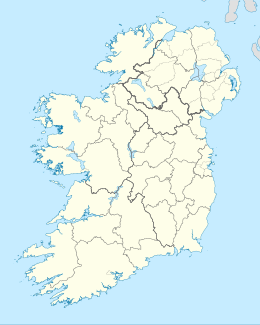
Rotten Island (Template:Lang-ga) is a small island close to the entrance of Killybegs Harbour, an inlet of Donegal Bay, in County Donegal, Ireland.
Features

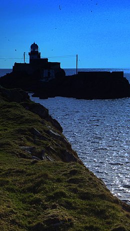
Rotten Island lighthouse was established in 1838 and is still operational. It has a white conical masonry tower with a red gallery and is operated by the Commissioners of Irish Lights.[1]
Demographics
|
|
| ||||||||||||||||||||||||||||||||||||||||||||||||||||||||||||||||||||||||||||||
| Source: Central Statistics Office. "CNA17: Population by Off Shore Island, Sex and Year". CSO.ie. Retrieved 12 October 2016. | ||||||||||||||||||||||||||||||||||||||||||||||||||||||||||||||||||||||||||||||||
Other projects
![]() Media related to Rotten Island at Wikimedia Commons
Media related to Rotten Island at Wikimedia Commons
References
- ^ "Rotten Island Lighthouse". Lighthouse Depot. Retrieved 27 June 2008.

