Bitan Aharon: Difference between revisions
Other tweaks |
Tom.Reding (talk | contribs) m +{{Authority control}} (1 ID from Wikidata); WP:GenFixes & cleanup on |
||
| Line 38: | Line 38: | ||
{{Hefer Valley Regional Council}} |
{{Hefer Valley Regional Council}} |
||
{{Nature reserves of Israel}} |
{{Nature reserves of Israel}} |
||
{{Authority control}} |
|||
[[Category:Jewish villages in Mandatory Palestine]] |
[[Category:Jewish villages in Mandatory Palestine]] |
||
Revision as of 21:57, 20 October 2023
Bitan Aharon
בִּיתַן אַהֲרֹן | |
|---|---|
 Bitan Aharon secretariat building | |
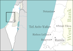
| Coordinates: 32°21′56″N 34°52′11″E / 32.36556°N 34.86972°E | |
| Country | |
| District | Central |
| Council | Hefer Valley |
| Affiliation | Agricultural Union |
| Founded | 1936 |
| Population (2022)[1] | 167 |
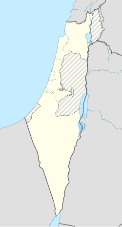
Bitan Aharon (Template:Lang-he) is a moshav in central Israel. Located in the Sharon plain between Hadera and Netanya, it falls under the jurisdiction of Hefer Valley Regional Council. In 2022 it had a population of 167.[1]
History
The moshav was founded in 1936. During its first years the members of the moshav hired workers to plant orange groves while its members lived in the cities. A decade later the village became more developed with new settlers joining. In 1947 it had a population of 100.[2] The village was named after Aharon (Archibald Jacob, "Archie") Freiman, a leader of the World Zionist Organization in Canada and an advisor to Yehoshua Hankin. The two were instrumental in raising the funds to purchase Emek Hefer (the Hefer valley) in the 1920s and to make it available for Jewish settlement.[3]

Bitan Aharon nature reserve

A 46-dunam nature reserve was declared in 1968,[4] just east of the moshav. The reserve covers part of the second (middle) Kurkar ridge that runs on a north-south axis in this part of the Israeli coastal plain, and therefore includes a number of ancient rock-hewn tombs and burial caves. Flora includes Ziziphus spina-christi and Pancratium parviflorum.[5]
Notable residents
- Hen Lippin (born 1965), basketball player
- Vadim Rabinovich (born 1953), former member of parliament in Ukraine
References
- ^ a b "Regional Statistics". Israel Central Bureau of Statistics. Retrieved 21 March 2024.
- ^ Jewish National Fund (1949). Jewish Villages in Israel. Jerusalem: Hamadpis Liphshitz Press. p. 191.
- ^ "Lillian Freiman - Jewish First Lady of the Land." Canadian Jewish News [Toronto] 8 September 2010: B36-B38
- ^ "List of National Parks and Nature Reserves" (PDF) (in Hebrew). Israel Nature and Parks Authority. Archived from the original (PDF) on 2009-10-07. Retrieved 2010-09-27.
- ^ "Bitan Aharon Nature Reserve" (in Hebrew). iNature.info. Retrieved 2010-09-27.

