

Berdavan, Armenia
You can help expand this article with text translated from the corresponding article in Armenian. (October 2021) Click [show] for important translation instructions.
|
41°12′10″N 45°00′12″E / 41.20278°N 45.00333°E
Berdavan
Բերդավան | |
|---|---|
 A view of Berdavan | |
 Berdavan  Berdavan | |
| Coordinates: 41°12′10″N 45°00′12″E / 41.20278°N 45.00333°E | |
| Country | Armenia |
| Province | Tavush |
| Municipality | Noyemberyan |
| Government | |
| Population | |
| • Total | 2,987 |
| Time zone | UTC+4 (AMT) |
| Berdavan, Armenia at GEOnet Names Server | |
Berdavan (Armenian: Բերդավան) is a village on the Kolb River in the Noyemberyan Municipality of the Tavush Province of Armenia. The village is located about 2 km north of the town of Noyemberyan, and near the villages of Dovekh, Koghb and Zorakan. Berdavan Fortress is located on a nearby hilltop.
Toponymy
Historically, the village was called Tkhadzor, then Ghalacha, and in 1978 it was renamed Berdavan.
History
The village of Ghalacha was relocated in 1893 – 1900. The relocation was due to the presence of mosquitos which were thought to bring malaria, but at the new site there were problems with access to drinking water.[citation needed] The school in Ghalacha was opened in 1906, after a period when there were no official schools in the area.[citation needed]
During the Second World War, Berdavan lost more than half of its male population, and during the First Nagorno-Karabakh War the village was heavily shelled. The village has a monument dedicated to the people who died in World War II.
Gallery
-
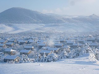 Berdavan in winter
 -
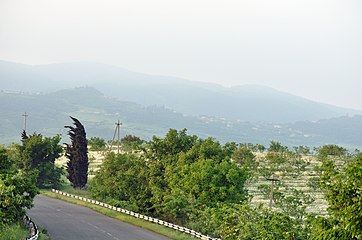 Scenery around the village
 -
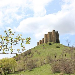 Berdavan Fortress
 -
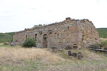 St. Nshan Church near Berdavan


References
External links
Capital: Ijevan | ||
| Urban settlements |  | |
| Berd Municipality | ||
| Dilijan Municipality | ||
| Ijevan Municipality | ||
| Noyemberyan Municipality | ||
This article about a location in Tavush Province, Armenia is a stub. You can help Wikipedia by expanding it. |