Altenheim
Altenheim
Àltene | |
|---|---|
 An old house in Altenheim | |
| Coordinates: 48°43′13″N 7°27′52″E / 48.7203°N 7.4644°E | |
| Country | France |
| Region | Grand Est |
| Department | Bas-Rhin |
| Arrondissement | Saverne |
| Canton | Saverne |
| Government | |
| • Mayor (2020–2026) | Laura Ritter[1] |
| Area 1 | 2.71 km2 (1.05 sq mi) |
| Population (2021)[2] | 228 |
| • Density | 84/km2 (220/sq mi) |
| Time zone | UTC+01:00 (CET) |
| • Summer (DST) | UTC+02:00 (CEST) |
| INSEE/Postal code | 67006 /67490 |
| Elevation | 187–254 m (614–833 ft) |
| 1 French Land Register data, which excludes lakes, ponds, glaciers > 1 km2 (0.386 sq mi or 247 acres) and river estuaries. | |
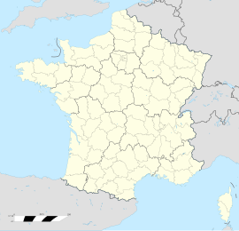
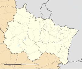
Altenheim (French pronunciation: [altənaim] ) is a commune in the Bas-Rhin department in the Grand Est region of north-eastern France. It should not be confused with the German village of the same name, part of the municipality Neuried in the state of Baden-Württemberg.
Geography
Altenheim is located some 10 km east by south-east of Saverne and 30 km north-west of Strasbourg. It can be accessed from five directions: from Furchhausen in the west by road D230, from Dettwiller in the north by road D112, from Littenheim in the east by road D151, from Saessolsheim in the south-east by road D230, and from Wolschheim in the south by road D112. All these roads intersect in the village. The commune consists entirely of farmland other than the village. The only waterway in the commune is the Drusenbach crossing the south-western corner and two small tributaries of this stream in the north of the commune.[3]
Neighbouring communes and villages
History
On 21 January 1945, an American B-17 bomber, the "Princess Pat" was hit by flak returning from a mission to Heilbronn and landed on its belly near the D230 road between Altenheim and Furchhausen.[citation needed]
Heraldry
 |
Blazon: Azure, a dove argent, in its beak a laurel branch Vert, perched on a hill of three hillocks the same in pile.
|
Administration

List of Successive Mayors of Altenheim[4]
| From | To | Name |
|---|---|---|
| 2001 | 2014 | Jean-Claude Hollner |
| 2014 | 2020 | Mickaël Vollmar |
| 2020 | 2026 | Laura Ritter |
Demography
The inhabitants of the commune are known as Altenheimois or Altenheimoises in French.[5]
|
| ||||||||||||||||||||||||||||||||||||||||||||||||||||||||||||||||||||||||||||||||||||||||||||||||||||||||||||||||||
| Source: EHESS[6] and INSEE[7] | |||||||||||||||||||||||||||||||||||||||||||||||||||||||||||||||||||||||||||||||||||||||||||||||||||||||||||||||||||

Culture and heritage
Civil heritage
The commune has a large number of buildings and structures that are registered as historical monuments:
- A House (4) (1837)
 [8]
[8] - A House (5)
 [9]
[9] - A House (7) (1825)
 [10]
[10] - A House (8)
 [11]
[11] - A House (11) (1716)
 [12]
[12] - A House (24) (1716)
 [13]
[13] - A House (33) (1732)
 [14]
[14] - A House (43) (1716)
 [15]
[15] - A Napoleonic Banc-Reposoir (1854)
 [16]
[16] - The Village (Prehistory to 8th century)
 [17]
[17] - Houses (18th-19th century)
 [18]
[18]
Religious heritage
The commune has several religious buildings and structures that are registered as historical monuments:
- A Wayside Cross at R.D. 112 (1698)
 [19]
[19] - A Wayside Cross at R.D. 112 / R.D. 151 (1824)
 [20]
[20] - A Wayside Cross at R.D. 112 (north) (19th century)
 [21]
[21] - A Wayside Cross at R.D. 112 (south) (1870)
 [22]
[22] - A Wayside Cross at R.D. 230 (1692)
 [23]
[23] - A Wayside Cross at R.D. 230 (1742)
 [24]
[24] - A Wayside Cross at R.D. 230 (1698)
 [25]
[25] - The Chapel of la-Fête-Dieu (19th century)
 [26]
[26] - The Church of Saint Lambert (18th century).
 [27] The Church contains many items that are registered as historical objects:
- A Funeral Monument of Marie-rose Schmitt and family (1829)
 [28]
[28] - A Funeral Monument of Maria Diss and Jean-Michel Klein (1824)
 [29]
[29] - A Funeral Monument of Marie-Odile Debs (1837)
 [30]
[30] - A Funeral Monument (19th century)
 [31]
[31] - A Chalice with Paten (19th century)
 [32]
[32] - A Statue: Saint Lambert (18th century)
 [33]
[33] - A Neo-Gothic Chalice (19th century)
 [34]
[34] - A Cross: Christ on the Cross
 [35]
[35] - 2 Confessionals (18th century)
 [36]
[36] - A Baptismal font (1690)
 [37]
[37] - A Tabernacle (18th century)
 [38]
[38]
- A Funeral Monument of Marie-rose Schmitt and family (1829)
- A Monumental Cross (1861)
 [39]
[39] - A Cemetery Cross (1882)
 [40]
[40]
Altenheim Picture Gallery
-
A street in Altenheim
-
The Church of Saint Lambert
-
Christ on the Cross
-
Stained Glass
-
Stained Glass
-
Stained Glass
-
Statue of Saint Lambert
-
The Monumental Cross
-
The Chapel of la-Fête-Dieu
See also
References
- ^ "Répertoire national des élus: les maires". data.gouv.fr, Plateforme ouverte des données publiques françaises (in French). 2 December 2020.
- ^ "Populations légales 2021" (in French). The National Institute of Statistics and Economic Studies. 28 December 2023.
- ^ a b Google Maps
- ^ List of Mayors of France (in French)
- ^ Le nom des habitants du 67 - Bas-Rhin, habitants.fr
- ^ Des villages de Cassini aux communes d'aujourd'hui: Commune data sheet Altenheim, EHESS (in French).
- ^ Population en historique depuis 1968, INSEE
- ^ Ministry of Culture, Mérimée IA00055644 House (4) (in French)
- ^ Ministry of Culture, Mérimée IA00055645 House (5) (in French)
- ^ Ministry of Culture, Mérimée IA00055646 House (7) (in French)
- ^ Ministry of Culture, Mérimée IA00055647 House (8) (in French)
- ^ Ministry of Culture, Mérimée IA00055648 House (11) (in French)
- ^ Ministry of Culture, Mérimée IA00055649 House (24) (in French)
- ^ Ministry of Culture, Mérimée IA00055650 House (33) (in French)
- ^ Ministry of Culture, Mérimée IA00055651 House (43) (in French)
- ^ Ministry of Culture, Mérimée PA00084580 Napoleanic Banc-Reposoir (in French)
- ^ Ministry of Culture, Mérimée IA00055834 Village (in French)
- ^ Ministry of Culture, Mérimée IA00055632 Houses (in French)
- ^ Ministry of Culture, Mérimée IA00055616 Wayside Cross at R.D. 112 (in French)
- ^ Ministry of Culture, Mérimée IA00055610 Wayside Cross at R.D. 112 / R.D. 151 (in French)
- ^ Ministry of Culture, Mérimée IA00055609 Wayside Cross at R.D. 112 (north) (in French)
- ^ Ministry of Culture, Mérimée IA00055613 Wayside Cross at R.D. 112 (south) (in French)
- ^ Ministry of Culture, Mérimée IA00055614 Wayside Cross at R.D. 230 (in French)
- ^ Ministry of Culture, Mérimée IA00055643 Wayside Cross at R.D. 230 (in French)
- ^ Ministry of Culture, Mérimée IA00055615 Wayside Cross at R.D. 230 (in French)
- ^ Ministry of Culture, Mérimée IA00055652 Chapel of la-Fête-Dieu (in French)
- ^ Ministry of Culture, Mérimée IA00055622 Church of Saint Lambert (in French)
- ^ Ministry of Culture, Palissy IM67003427 Funeral Monument of Marie-rose Schmitt and family (in French)
- ^ Ministry of Culture, Palissy IM67003426 Funeral Monument of Maria Diss and Jean-Michel Klein (in French)
- ^ Ministry of Culture, Palissy IM67003425 Funeral Monument of Marie-Odile Debs (in French)
- ^ Ministry of Culture, Palissy IM67003424 Funeral Monument (in French)
- ^ Ministry of Culture, Palissy IM67003423 Chalice with Paten (in French)
- ^ Ministry of Culture, Palissy IM67003422 Statue: Saint Lambert (in French)
- ^ Ministry of Culture, Palissy IM67003421 Neo-Gothic Chalice (in French)
- ^ Ministry of Culture, Palissy IM67003420 Cross: Christ on the Cross (in French)
- ^ Ministry of Culture, Palissy IM67003419 2 Confessionals (in French)
- ^ Ministry of Culture, Palissy IM67003418 Baptismal font (in French)
- ^ Ministry of Culture, Palissy IM67003417 Tabernacle (in French)
- ^ Ministry of Culture, Mérimée IA00055612 Monumental Cross (in French)
- ^ Ministry of Culture, Mérimée IA00055611 Cemetery Cross (in French)
External links
- Altenheim on the old IGN website (in French)
- Altenheim on Géoportail, National Geographic Institute (IGN) website (in French)
- Altenheim on the 1750 Cassini Map


