Brosseau, Alberta: Difference between revisions
m Fixed a red link to Saint-Paul-des-Métis |
Rescuing 1 sources and tagging 0 as dead. #IABot (v1.5beta) |
||
| Line 1: | Line 1: | ||
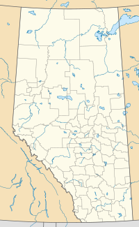
{{Location map|Canada Alberta|lat= 53.7917|long=-111.6869|width=200|caption=Location of Brosseau [[Alberta]]|label=Brosseau}} |
{{Location map|Canada Alberta|lat= 53.7917|long=-111.6869|width=200|caption=Location of Brosseau [[Alberta]]|label=Brosseau}} |
||
'''Brosseau''' is a [[hamlet (place)|hamlet]] in [[central Alberta]], [[Canada]] within the [[County of Two Hills No. 21]].<ref>{{Cite web|url=http://municipalaffairs.gov.ab.ca/documents/msb/2010-ruralmun.pdf |title= |
'''Brosseau''' is a [[hamlet (place)|hamlet]] in [[central Alberta]], [[Canada]] within the [[County of Two Hills No. 21]].<ref>{{Cite web |url=http://municipalaffairs.gov.ab.ca/documents/msb/2010-ruralmun.pdf |title=Specialized and Rural Municipalities and Their Communities |author=Alberta Municipal Affairs |authorlink=Alberta Municipal Affairs |date=2010-04-01 |accessdate=2010-07-05 |deadurl=yes |archiveurl=https://web.archive.org/web/20120229060335/http://municipalaffairs.gov.ab.ca/documents/msb/2010-ruralmun.pdf |archivedate=2012-02-29 |df= }}</ref> It is located on the north bank of the [[North Saskatchewan River]] along the [[Alberta Highway 29|Highway 29]] / [[Alberta Highway 36|Highway 36]] [[Concurrency (road)|concurrency]], {{convert|50|km|mi|abbr=on}} southwest of [[St. Paul, Alberta|St. Paul]]. The hamlet of [[Duvernay, Alberta|Duvernay]] is located immediately across the river along the south bank. |
||
The hamlet has the name of Edmond Brosseau, an early settler.<ref>{{cite book|title=Place-names of Alberta|url=https://babel.hathitrust.org/cgi/pt?id=mdp.39015070267029;view=1up;seq=29|year=1928|publisher=Geographic Board of Canada|location=Ottawa|page=25}}</ref> |
The hamlet has the name of Edmond Brosseau, an early settler.<ref>{{cite book|title=Place-names of Alberta|url=https://babel.hathitrust.org/cgi/pt?id=mdp.39015070267029;view=1up;seq=29|year=1928|publisher=Geographic Board of Canada|location=Ottawa|page=25}}</ref> |
||
Revision as of 13:51, 26 July 2017
Brosseau is a hamlet in central Alberta, Canada within the County of Two Hills No. 21.[1] It is located on the north bank of the North Saskatchewan River along the Highway 29 / Highway 36 concurrency, 50 km (31 mi) southwest of St. Paul. The hamlet of Duvernay is located immediately across the river along the south bank.
The hamlet has the name of Edmond Brosseau, an early settler.[2]
Before Brosseau existed, a previous settlement had been created on the same site. Founded by Father Lacombe as Saint-Paul-des-Cris, it was a Catholic mission to the Cree which was established in 1865 and abandoned in 1874 due to Cree reluctance to adopt an agricultural lifestyle and several crop failures. Lacombe would try again nearby in 1896 with a new settlement called Saint-Paul-des-Métis, which also struggled until it was opened to white Francophones in 1909.[3]
See also
References
- ^ Alberta Municipal Affairs (2010-04-01). "Specialized and Rural Municipalities and Their Communities" (PDF). Archived from the original (PDF) on 2012-02-29. Retrieved 2010-07-05.
{{cite web}}: Unknown parameter|deadurl=ignored (|url-status=suggested) (help) - ^ Place-names of Alberta. Ottawa: Geographic Board of Canada. 1928. p. 25.
- ^ http://oblatesinthewest.library.ualberta.ca/eng/order/pauldescris.html
