Category:Mohnenfluh
Zur Navigation springen
Zur Suche springen
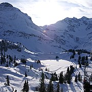
Deutsch: Die Mohnenfluh ist ein 2.542 Meter hoher Berg im österreichischen Bundesland Vorarlberg.
Berg des Lechquellengebirges in Vorarlberg | |||||
| Medium hochladen | |||||
| Ist ein(e) | |||||
|---|---|---|---|---|---|
| Ort | Vorarlberg, Österreich | ||||
| Gebirgszug |
| ||||
| Schartenhöhe |
| ||||
| Dominanz |
| ||||
| Höhe über dem Meeresspiegel |
| ||||
| Bezugsberg | |||||
 | |||||
Unterkategorien
Es werden 2 von insgesamt 2 Unterkategorien in dieser Kategorie angezeigt:
In Klammern die Anzahl der enthaltenen Kategorien (K), Seiten (S), Dateien (D)
B
G
Medien in der Kategorie „Mohnenfluh“
Folgende 53 Dateien sind in dieser Kategorie, von 53 insgesamt.
-
360° Mohnenfluh Oberlech Panorama.jpg 7.331 × 2.578; 12,33 MB
-
360° Mohnenfluh Panorama.jpg 9.023 × 2.119; 11,97 MB
-
40 Mohnenfluh und Juppenspitze.jpg 3.648 × 2.736; 1,72 MB
-
ANTONY GORMLEY Kriegersattel.JPG 2.848 × 4.288; 6,53 MB
-
Berbigenvorsäß 1.JPG 3.008 × 2.000; 1,53 MB
-
Berngat4.JPG 2.673 × 1.851; 2,19 MB
-
Bregenzerwaldgebirge Panorama.jpg 6.219 × 2.137; 1,55 MB
-
Brüggelekopf Juppenspitze.JPG 3.570 × 2.541; 1,5 MB
-
Brüggelekopf Kanisfluh.JPG 4.020 × 2.494; 1,59 MB
-
Butzensee Mohnenfluh, Panorama.jpg 4.503 × 3.546; 3,38 MB
-
Butzenspitze 2547m Panorama.jpg 4.729 × 2.328; 2,37 MB
-
Feldkreuz Hochtannbergpass 1.JPG 1.839 × 2.656; 818 KB
-
Fellbachtal Mohnenfluh.jpg 6.752 × 2.851; 6,52 MB
-
Halde Schoppernau 1.JPG 4.272 × 2.848; 3,22 MB
-
Hochgletscheralpe Juppenspitze Mohnenfluh 1.JPG 4.272 × 2.848; 3,09 MB
-
Hochgletscheralpe Juppenspitze Mohnenfluh.jpg 5.065 × 3.272; 6,13 MB
-
Holdamoos 1.JPG 4.272 × 2.848; 3,3 MB
-
Hopfreben.JPG 3.008 × 2.000; 1,1 MB
-
Hotel Tannberg Schröcken.jpg 2.653 × 2.829; 1,85 MB
-
Kriegeralpe Mohnenfluh.JPG 4.288 × 2.848; 7,78 MB
-
Kriegeralpe Panorama.jpg 5.923 × 2.491; 11,64 MB
-
Kriegeralpe.JPG 4.288 × 2.848; 8,31 MB
-
KörberseeJuppenspitze.JPG 2.000 × 2.000; 882 KB
-
Madlochjoch Panorama.jpg 9.766 × 2.153; 15,9 MB
-
Mohnenfluh Aufstieg.jpg 7.296 × 5.472; 13,73 MB
-
Mohnenfluh Blick.jpg 5.184 × 3.456; 6,15 MB
-
Mohnenfluh Juppenspitze.jpg 3.161 × 2.106; 1,26 MB
-
Mohnenfluh mit Fellealpe in Schröcken.JPG 5.056 × 3.501; 9,31 MB
-
Mohnenfluh Spitze.jpg 5.184 × 3.456; 7,06 MB
-
Mohnenfluh.JPG 4.288 × 2.848; 7,38 MB
-
Mohnenfluh011.JPG 3.008 × 2.000; 1,24 MB
-
Mohnenfluh1.JPG 2.000 × 3.008; 957 KB
-
MohnenfluhAu.JPG 1.384 × 1.998; 389 KB
-
Mohnenfluhsattel Panorama.jpg 8.649 × 2.054; 13,84 MB
-
Oberdiedams-& Breitenalpe Panorama.jpg 7.808 × 3.615; 20,92 MB
-
Panorama Butzensee Mohnenfluh.jpg 13.535 × 6.194; 69,32 MB
-
Schalzbach Vorsäss 2020 Böhringer.jpg 5.349 × 3.863; 13,6 MB
-
SchoppernauKünzelspitze.JPG 3.008 × 2.000; 2,05 MB
-
Schröcken Butzensee Schrägluftbild.jpg 5.000 × 3.333; 17,24 MB
-
Schröcken Panorama 0.jpg 6.691 × 2.411; 10,06 MB
-
Schröcken1.JPG 2.857 × 1.899; 934 KB
-
Schröcken1a.jpg 4.430 × 3.685; 9,02 MB
-
Schröcken2.JPG 2.789 × 1.855; 860 KB
-
Schwarzenberg Bersbuch Panorama 1.jpg 5.856 × 2.819; 1,85 MB
-
Schwarzenberg Bregenzerwald Panorama.jpg 8.680 × 1.894; 4,42 MB
-
Schwarzenberg Bregenzerwald Panorama1.jpg 6.829 × 1.870; 2,57 MB
-
SonderdachBezau1.JPG 3.008 × 2.000; 2,11 MB
-
SonderdachBezau4.JPG 3.008 × 2.000; 2,21 MB
-
Sonnenaufgang Felletal 1.JPG 4.272 × 2.848; 6,72 MB
-
Steinmäderbahn 36126.JPG 4.032 × 3.024; 3 MB
-
Thomas Praßler Weg Butzenspitze.jpg 7.807 × 2.127; 4,29 MB
-
Villa Maund Mohnenfluh.JPG 2.846 × 4.110; 2,2 MB
-
Wald 19 Schröcken.JPG 3.794 × 2.846; 1,29 MB


