Uploads by Algkalv
For Algkalv (talk · contributions · Move log · block log · uploads · Abuse filter log)
This special page shows all uploaded files that have not been deleted; for those see the upload log.
| Date | Name | Thumbnail | Size | Description |
|---|---|---|---|---|
| 08:46, 6 September 2010 | Denmark-Strait-pack-ice.jpg (file) |  |
4.87 MB | == {{int:filedesc}} == {{Information |Description=Pack sea ice in Denmark Strait. Aerial view. |Source={{Own}} |Date=2010-02-20 |Author= Algkalv (talk) }} == Licensing == {{self|cc-by-sa-3.0}} [[Category:Denmark St |
| 08:49, 5 September 2010 | Timilersua-Island.jpg (file) |  |
3.61 MB | == {{int:filedesc}} == {{Information |Description=Timilersua Island, Sugar Loaf Bay, Upernavik Archipelago, Greenland. Photographed from the ridge of Nuussuaq Peninsula, from the north. |Source={{Own}} |Date=2010-08-03 |Author= Algkalv ([ |
| 08:46, 5 September 2010 | Timilersua-aerial.jpg (file) |  |
1.41 MB | {{Information |Description=Aerial view of Timilersua Island, Sugar Loaf Bay, Upernavik Archipelago, Greenland. Photographed in poor visibility conditions from the Air Greenland Bell 212 helicopter during the Upernavik-Kullorsuaq flight. |Source={{Own}} |D |
| 13:06, 4 September 2010 | Qallunaat-Island.jpg (file) | 961 KB | {{Information |Description=Aerial view of Qallunaat Island, Tasiusaq Bay, Upernavik Archipelago, Greenland. Photographed in very poor visibility conditions from the Air Greenland Bell 212 helicopter during the Upernavik-Kullorsuaq flight. |Source={{Own}} | |
| 12:59, 4 September 2010 | Ikerasaarsuk-Qallunaat-Island.jpg (file) | 784 KB | {{Information |Description=Former settlement of Ikerasaarsuk, and Qallunaat Island behind, Tasiusaq Bay, Upernavik Archipelago, Greenland. Photographed from a hunting boat. |Source={{Own}} |Date=2010-08-05 |Author= Algkalv ([[User talk:Al | |
| 12:31, 4 September 2010 | Hotel-Arctic.jpg (file) |  |
601 KB | {{Information |Description=Hotel Arctic, Ilulissat, Greenland. |Source={{Own}} |Date=2010-07-22 |Author= Algkalv (talk) }} Category:Hotel Arctic == Licensing == {{self|cc-by-sa-3.0}} |
| 11:19, 4 September 2010 | Mernoq.jpg (file) | 730 KB | {{Information |Description=Aerial view of Mernoq Island and Mernup Tunua Strait, Tasiusaq Bay, Upernavik Archipelago, Greenland. Photographed in very poor visibility conditions from the Air Greenland Bell 212 helicopter during the Upernavik-Kullorsuaq fli | |
| 01:27, 4 September 2010 | Nuussuaq-dogsleds.jpg (file) |  |
5.03 MB | {{Information |Description=Dogsleds in Nuussuaq, Sugar Loaf Bay, Upernavik Archipelago, Greenland. |Source={{Own}} |Date=2010-07-30 |Author= Algkalv (talk) }} Category:Dogsleds Category:Nuussuaq == Licensin |
| 22:53, 3 September 2010 | Nuussuaq-inlet.jpg (file) |  |
2.51 MB | {{Information |Description=Aerial view of Nuussuaq Peninsula, and the inlet of Sugar Loaf Bay near the Nuussuaq settlement, Upernavik Archipelago, Greenland. Photographed from the Air Greenland Bell 212 during the Kullorsuaq-Nuussuaq flight. |Source={{Own |
| 22:51, 3 September 2010 | Nuussuaq-Qallunaat-Arnaq.jpg (file) |  |
2.39 MB | == {{int:filedesc}} == {{Information |Description=Nuussuaq, Sugar Loaf Bay, Upernavik Archipelago, Greenland. The strait between two rock spurs off Nuussuaq Peninsula protecting the inner inlet: the eastern spur with the heliport, and the western spur (Qa |
| 04:33, 3 September 2010 | Saqqarlersuaq-from-kullorsuaq.jpg (file) |  |
2.59 MB | {{Information |Description=Saqqarlersuaq Island seen from Kullorsuaq, a settlement on Kullorsuaq Island in Melville Bay, Upernavik Archipelago, Greenland. |Source={{Own}} |Date=2010-07-30 |Author= Algkalv ([[User talk:Algkalv|<span class= |
| 04:31, 3 September 2010 | Saqqarlersuaq-Island.jpg (file) |  |
1.09 MB | {{Information |Description=Aerial view of Saqqarlersuaq Island, Sarrarlersuup Sullua strait, and Kiatassuaq Island. Melville Bay, Upernavik Archipelago, Greenland. Photographed from the Air Greenland Bell 212 during the Kullorsuaq-Nuussuaq flight. |Source |
| 04:40, 2 September 2010 | Illulissuaq-Peninsula.jpg (file) | 922 KB | {{Information |Description=Aerial view of Illulissuaq Peninsula, Upernavik Archipelago, Greenland. Photographed from the Air Greenland Bell 212 during the Kullorsuaq-Nuussuaq flight. Ikermiut island on the first plane, |Source={{Own}} |Date=2010-07-30 |Au | |
| 04:08, 2 September 2010 | Illoorfik.jpg (file) |  |
2.41 MB | {{Information |Description=Aerial view of Illoorfik Island and Nuussuaq Peninsula, Inussulik Bay, Upernavik Archipelago, Greenland. Photographed from the Air Greenland Bell 212 during the Kullorsuaq-Nuussuaq flight. |Source={{Own}} |Date=2010-07-30 |Autho |
| 02:36, 2 September 2010 | Nunatakassak.jpg (file) |  |
1.37 MB | {{Information |Description=Aerial view of Ikerasaa strait (center) between Kullorsuaq Island (left) and Saqqarlersuaq Island (right), Nunatakassak nunataq (behind), and Sermersuaq, the Greenland icesheet. Melville Bay, Upernavik Archipelago, Greenland. Ph |
| 14:07, 1 September 2010 | Kittorsaq.jpg (file) |  |
1.96 MB | {{Information |Description=Aerial view of Kittorsaq Island, Sugar Loaf Bay, Upernavik Archipelago, Greenland. Photographed in poor visibility conditions from the Air Greenland Bell 212 helicopter during the Upernavik-Kullorsuaq flight. |Source={{Own}} |Da |
| 12:37, 1 September 2010 | Anoritooq.jpg (file) |  |
2.63 MB | {{Information |Description=Anoritooq mountain (1,108m), Upernavik Archipelago, Greenland. |Source={{Own}} |Date=2010-08-03 |Author= Algkalv (<span class="signature-talk">talk</span>) }} Category:Anoritooq == Li |
| 12:35, 1 September 2010 | Nuussuup-Kangia.jpg (file) | 1.12 MB | {{Information |Description=Nuussuup Kangia fjord, an inlet of Inussulik Bay, Upernavik Archipelago, Greenland. Anoritooq mountain on the left side, last plane. |Source={{Own}} |Date=2010-08-03 |Author= Algkalv ([[User talk:Algkalv|<span c | |
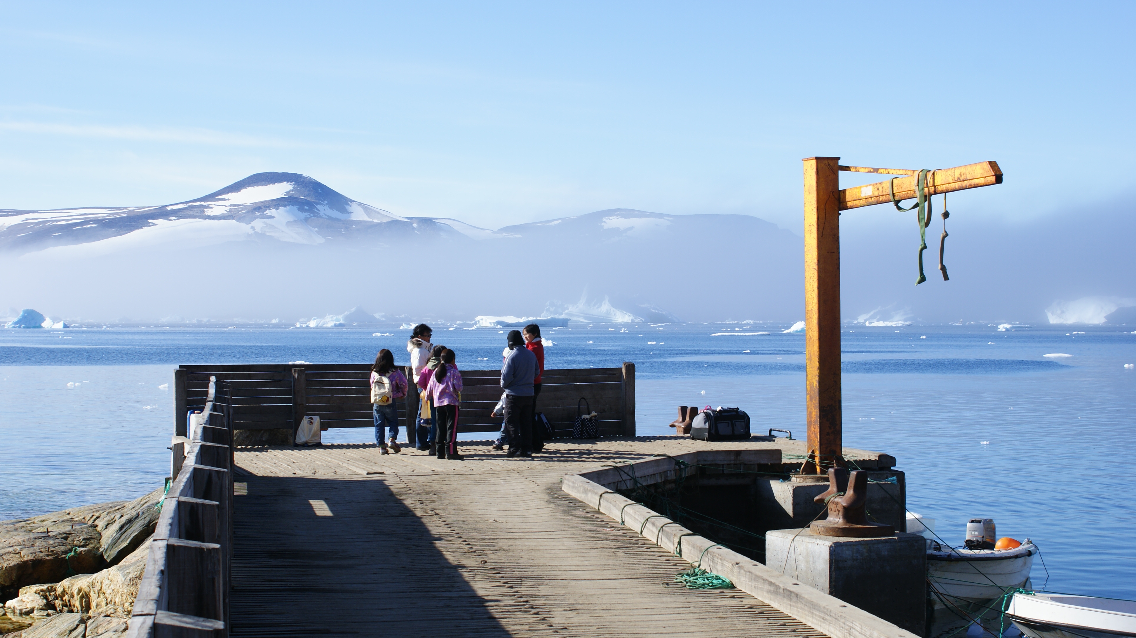
| 03:36, 31 August 2010 | Kullorsuaq-harbor.jpg (file) |  |
2.63 MB | {{Information |Description=Kullorsuaq Harbor, Greenland. |Source={{Own}} |Date=2010-07-30 |Author= Algkalv (<span class="signature-talk">talk</span>) }} Category:Kullorsuaq Harbor == Licensing == {{self|cc-by-sa |
| 02:03, 31 August 2010 | Kullorsuaq-Island.jpg (file) |  |
5.9 MB | {{Information |Description=Kullorsuaq Island, Melville Bay, Upernavik Archipelago, Greenland. |Source={{Own}} |Date=2010-07-30 |Author= Algkalv (<span class="signature-talk">talk</span>) }} [[Category:Kullorsuaq Isl |
| 03:35, 29 August 2010 | Sugar-Loaf-Island.jpg (file) |  |
1.94 MB | == {{int:filedesc}} == {{Information |Description=Sugar Loaf Island, Upernavik Archipelago, Greenland. Photographed from the ridge of Nuussuaq Peninsula. Nuussuaq settlement on the coast. |Source={{Own}} |Date=2010-08-03 |Author= Algkalv |
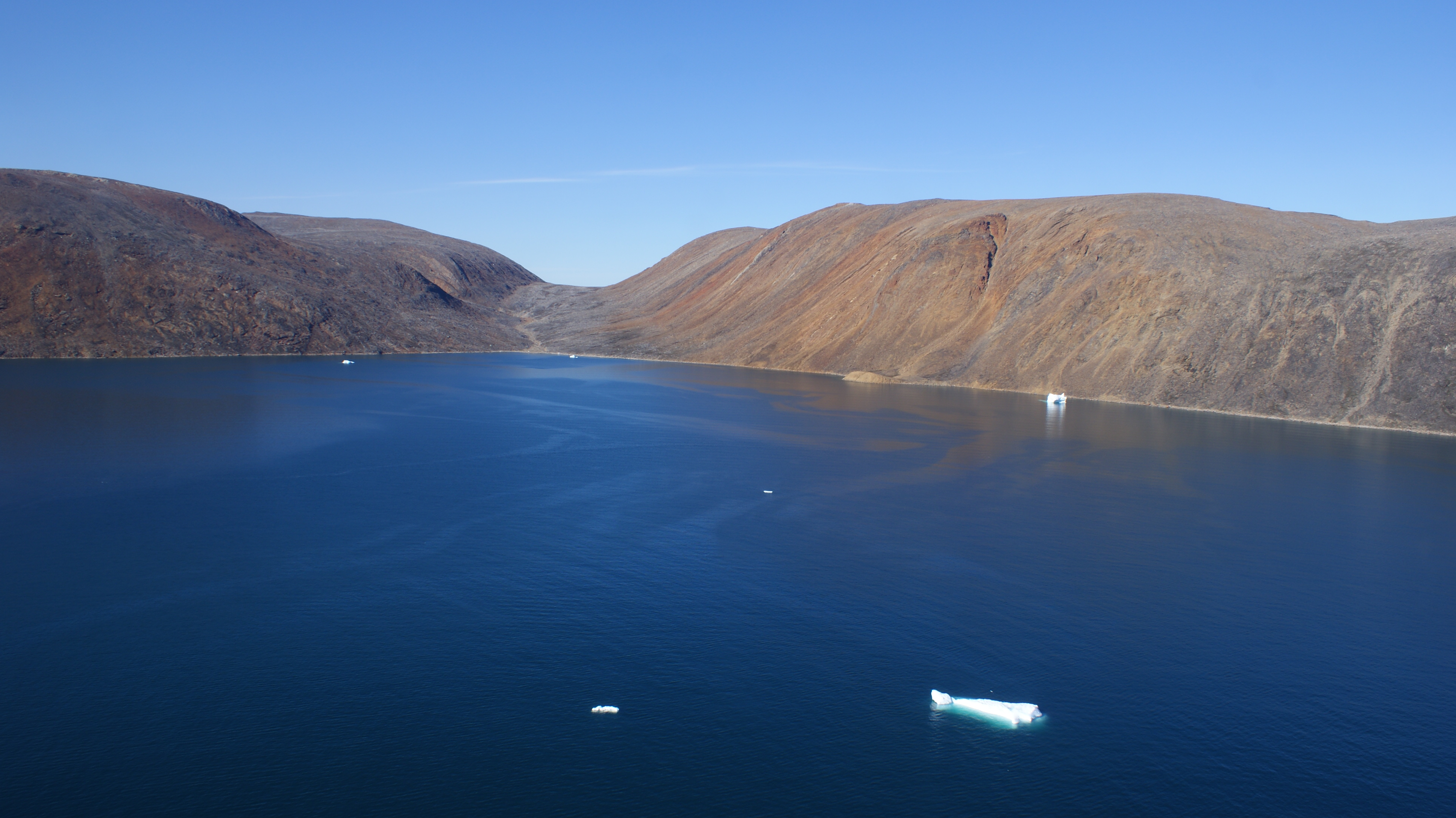
| 03:22, 29 August 2010 | Sugar-Loaf-Bay-inner.jpg (file) |  |
2.31 MB | == {{int:filedesc}} == {{Information |Description=Inner (eastern) Sugar Loaf Bay, Upernavik Archipelago, Greenland. Photographed from the ridge of Nuussuaq Peninsula. Greenland Icesheet in the background. |Source={{Own}} |Date=2010-08-03 |Author= [[User:A |
| 03:15, 29 August 2010 | Sugar-Loaf-Bay.jpg (file) | 1.14 MB | == {{int:filedesc}} == {{Information |Description=Sugar Loaf Bay, Upernavik Archipelago, Greenland. Photographed from the ridge of Nuussuaq Peninsula. Nuussuaq settlement on the coast. |Source={{Own}} |Date=2010-08-03 |Author= Algkalv ([[ | |
| 01:30, 29 August 2010 | Qullikorsuit-island-saffioorsuaq-cape.jpg (file) |  |
3.54 MB | {{Information |Description=Aerial view of the Saffioorsuaq cape on Qullikorsuit Island, Upernavik Archipelago, Greenland. Photographed in poor visibility conditions from the Air Greenland Bell 212 helicopter during the Upernavik-Kullorsuaq flight. |Source |
| 01:28, 29 August 2010 | Qullikorsuit-island-appaalissiorfik-cape.jpg (file) |  |
2.89 MB | {{Information |Description=Aerial view of the Appaalissiorfik cape on Qullikorsuit Island, Upernavik Archipelago, Greenland. Photographed in poor visibility conditions from the Air Greenland Bell 212 helicopter during the Upernavik-Kullorsuaq flight. |Sou |
| 01:21, 29 August 2010 | Qullikorsuit.jpg (file) |  |
3.57 MB | {{Information |Description=Aerial view of the southwestern shore of Qullikorsuit Island, Upernavik Archipelago, Greenland. Photographed in poor visibility conditions from the Air Greenland Bell 212 helicopter during the Upernavik-Kullorsuaq flight. |Sourc |
| 23:59, 28 August 2010 | Akuliaruseq-island.jpg (file) |  |
961 KB | == {{int:filedesc}} == {{Information |Description=Aerial view of Akuliaruseq Island, Eqalugaarsuit Sulluat Fjord, and Kangeq Peninsula. Upernavik Archipelago, Greenland. Photographed from the Air Greenland Bell 212 helicopter during the Upernavik Kujalleq |
| 15:41, 28 August 2010 | Pisiffik.jpg (file) |  |
1.32 MB | {{Information |Description=Pisiffik supermarket in Ilulissat, Greenland. |Source={{Own}} |Date=2010-07-22 |Author= Algkalv (<span class="signature-talk">talk</span>) }} Category:Ilulissat Category:Pisiffik |
| 14:15, 28 August 2010 | Nuussuaq-polar-bear-skins.jpg (file) |  |
1.17 MB | {{Information |Description=Polar bear skins drying on the verandah of a hunter's house. Nuussuaq, Upernavik Archipelago, Greenland. |Source={{Own}} |Date=2010-08-04 |Author= Algkalv ([[User talk:Algkalv|<span class="signature-talk">talk</ |
| 14:14, 28 August 2010 | Nuussuaq-fish-processing-factory.jpg (file) |  |
3.52 MB | {{Information |Description=Upernavik Seafood fish processing factory under construction. Nuussuaq, Upernavik Archipelago, Greenland. |Source={{Own}} |Date=2010-07-30 |Author= Algkalv ([[User talk:Algkalv|<span class="signature-talk">talk< |
| 03:12, 28 August 2010 | Greenland-dog-puppies-eating-muskox.jpg (file) |  |
2.41 MB | == {{int:filedesc}} == {{Information |Description=Greenland dog puppies eating muskox scraps in Upernavik Kujalleq, Upernavik Archipelago, Greenland. |Source={{Own}} |Date=2010-06-28 |Author= Algkalv ([[User talk:Algkalv|<span class="sign |
| 21:03, 27 August 2010 | Ilulissat-gas-station.jpg (file) |  |
3.46 MB | {{Information |Description=A gas station in Ilulissat, Greenland. |Source={{Own}} |Date=2010-07-22 |Author= Algkalv (<span class="signature-talk">talk</span>) }} Category:Ilulissat [[Category:Petrol stations in |
| 03:20, 27 August 2010 | Akia-aerial.jpg (file) |  |
4.81 MB | == {{int:filedesc}} == {{Information |Description=Aerial view of Akia Island, Upernavik Archipelago, Greenland. |Source={{Own}} |Date=2010-07-22 |Author= Algkalv (<span class="signature-talk">talk</span>) }} == Lice |
| 03:17, 27 August 2010 | Akia.jpg (file) |  |
3.98 MB | {{Information |Description=Akia Island, Upernavik Archipelago, Greenland. Photographed in the evening from Upernavik Island (from the north). |Source={{Own}} |Date=2010-07-23 |Author= Algkalv ([[User talk:Algkalv|<span class="signature-ta |
| 01:57, 27 August 2010 | Sandersons-Hope.jpg (file) |  |
3.23 MB | {{Information |Description=Sandersons Hope (1042m), the highest mountain on Qaarsorsuaq Island, Upernavik Archipelago, Greenland. |Source={{Own}} |Date=2010-07-22 |Author= Algkalv ([[User talk:Algkalv|<span class="signature-talk">talk</s |
| 23:19, 26 August 2010 | Kingittorsuaq-island.jpg (file) |  |
2.37 MB | {{Information |Description=Aerial view of Kingittorsuaq Island, Upernavik Archipelago, Greenland. This is where Kingittorsuaq Runestone was found. Photographed in poor visibility conditions from the Air Greenland Bell 212 helicopter during the Upernavik-K |
| 19:28, 19 August 2010 | Alison-bay-kiatassuaq-island-wandel-land.jpg (file) |  |
3.06 MB | {{Information |Description=Aerial view of the confluence of Alison Bay and Melville Bay, Upernavik Archipelago, Greenland. Photographed from the Air Greenland Bell 212 during the Kullorsuaq-Nuussuaq flight. Left to right: Saqqarlersuaq Island, Sermersuaq |
| 18:46, 19 August 2010 | Ikerasaa-strait-qaqqasungnarsuaq-nunataq.jpg (file) |  |
2.43 MB | {{Information |Description=Aerial view of Ikerasaa Strait, Upernavik Archipelago, Greenland. Photographed from the Air Greenland Bell 212 during the Kullorsuaq-Nuussuaq flight. Left to right: Kiatassuaq Island with Tasersuaq Lake, Alison Bay (behind), Ike |
| 05:03, 19 August 2010 | Saninngassorsuaq.jpg (file) |  |
2.18 MB | {{Information |Description=Aerial view of northern Saninngassorsuaq Peninsula, Upernavik Archipelago, Greenland. Photographed from the Air Greenland Bell 212 during the Kullorsuaq-Nuussuaq flight. Ikerasaa Strait on the left, Greenland Icesheet on the hor |
| 18:32, 18 August 2010 | Illullip-Sermia-inussulik-bay.jpg (file) |  |
2.61 MB | {{Information |Description=Aerial view of inner (eastern) Inussulik Bay, Upernavik Archipelago, Greenland. Photographed from the Air Greenland Bell 212 during the Kullorsuaq-Nuussuaq flight. Illullip Sermia, the glacier tongue of ice with which Greenland |
| 18:30, 18 August 2010 | Inussulik-bay-ikermiut.jpg (file) |  |
2.56 MB | {{Information |Description=Aerial view of southern Inussulik Bay, Upernavik Archipelago, Greenland. Photographed from the Air Greenland Bell 212 during the Kullorsuaq-Nuussuaq flight. Ikermiut island on the first plane, Nuussuaq Peninsula on the horizon. |
| 18:18, 18 August 2010 | Inussulik-bay.jpg (file) |  |
2.25 MB | {{Information |Description=Aerial view of northern Inussulik Bay, Upernavik Archipelago, Greenland. Photographed from the Air Greenland Bell 212 during the Kullorsuaq-Nuussuaq flight. Left to right: Kiatassuaq Island (with Tasersuaq Lake at the far end), |
| 17:08, 18 August 2010 | Wilcox-Head.jpg (file) |  |
2.56 MB | {{Information |Description=Wilcox Head, the western promontory of Kiatassuaq Island. Most commonly defined as the southern limit of Melville Bay. Photographed in poor visibility conditions from the Air Greenland Bell 212 helicopter during the Upernavik-Ku |
| 07:52, 18 August 2010 | Kiatassuaq-island-interior.jpg (file) |  |
4.02 MB | {{Information |Description=Aerial view of the interior (partially glaciated central ridge) of Kiatassuaq Island, Upernavik Archipelago, Greenland. Photographed from the Air Greenland Bell 212 during the Kullorsuaq-Nuussuaq flight. |Source={{Own}} |Date=20 |
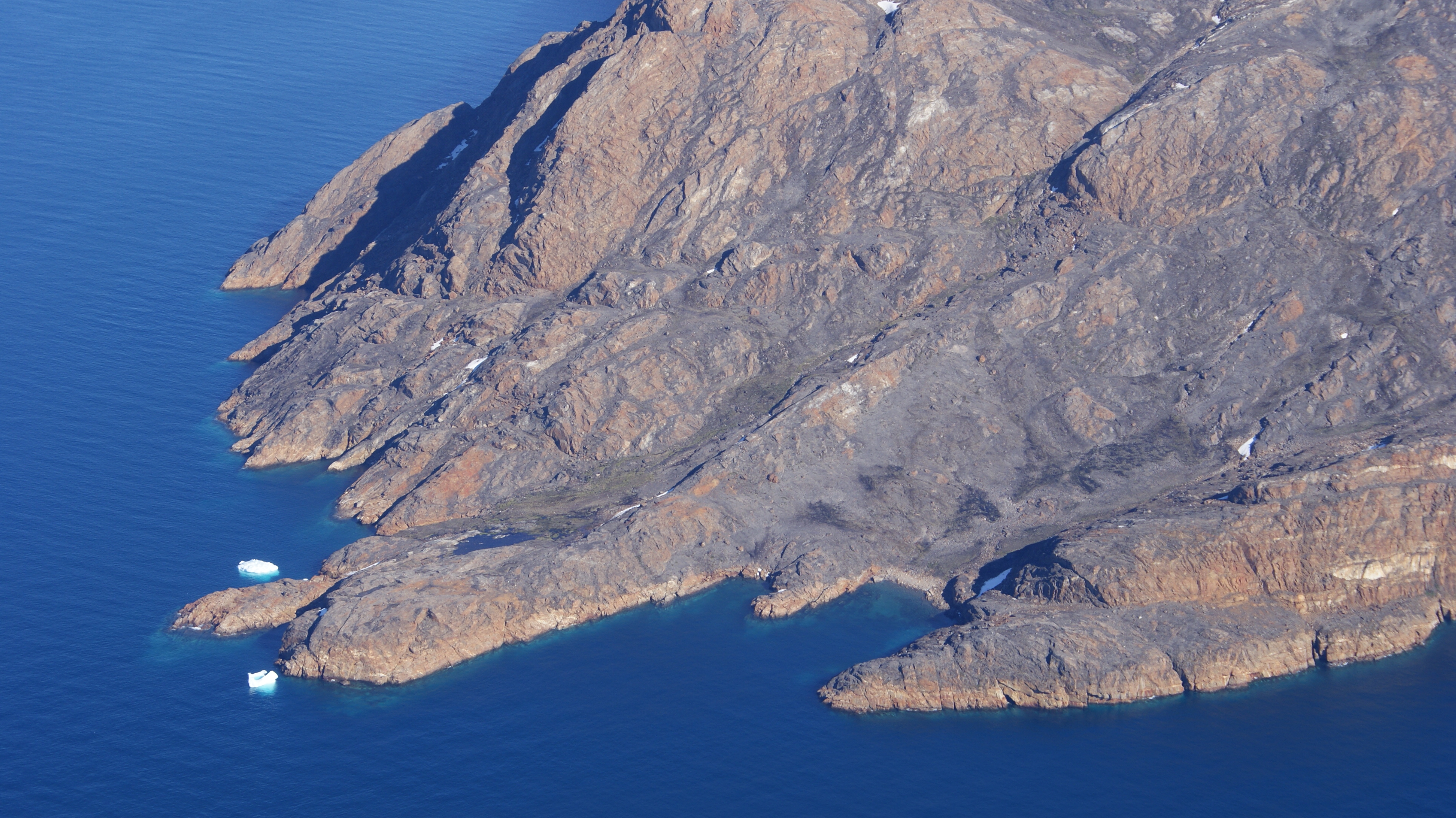
| 07:47, 18 August 2010 | Kiatassuaq-island-southern-coast.jpg (file) |  |
3.52 MB | {{Information |Description=Aerial view of the southern coast of Kiatassuaq Island, Upernavik Archipelago, Greenland. Photographed from the Air Greenland Bell 212 during the Kullorsuaq-Nuussuaq flight. |Source={{Own}} |Date=2010-07-30 |Author= [[User:Algka |
| 07:44, 18 August 2010 | Kiatassuaq-island.jpg (file) |  |
2.8 MB | {{Information |Description=Aerial view of the northern coast of Kiatassuaq Island, Upernavik Archipelago, Greenland. Photographed from the Air Greenland Bell 212 during the Kullorsuaq-Nuussuaq flight. |Source={{Own}} |Date=2010-07-30 |Author= [[User:Algka |
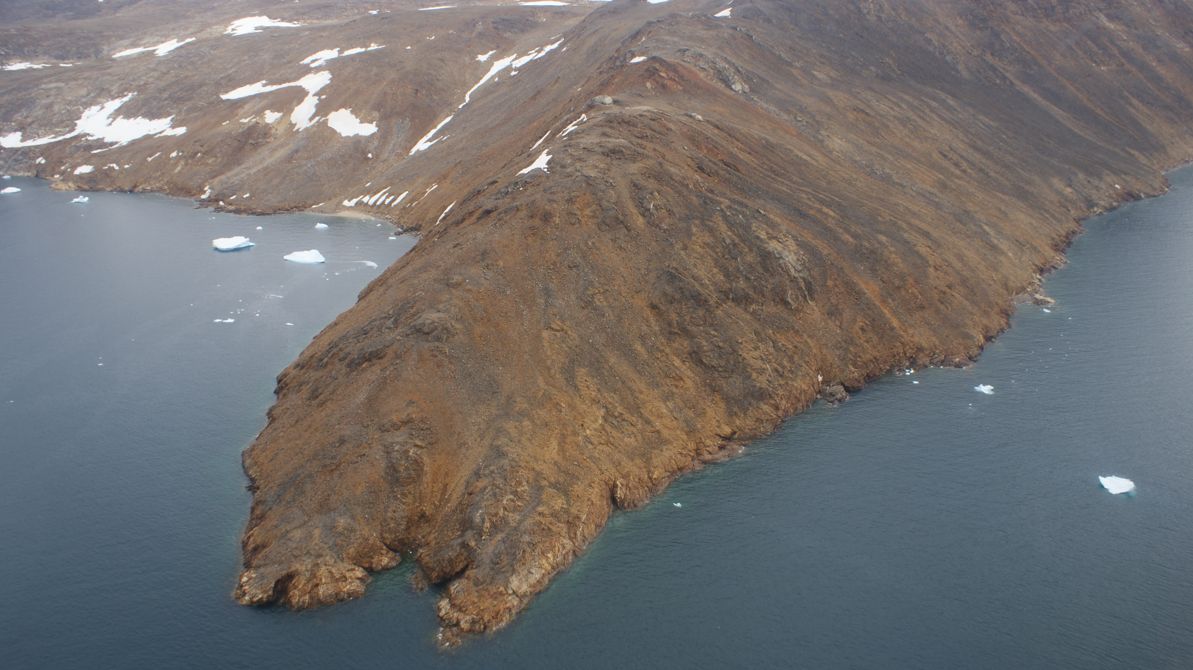
| 06:38, 18 August 2010 | Inussullissuaq-eastern-cape.jpg (file) |  |
3.79 MB | {{Information |Description=Aerial view of Inussullissuaq Island, Upernavik Archipelago, Greenland. Eastern cape photographed from the Air Greenland Bell 212 during the Kullorsuaq-Nuussuaq flight. |Source={{Own}} |Date=2010-07-30 |Author= [[User:Algkalv|Al |
| 06:36, 18 August 2010 | Inussullissuaq-western-cape.jpg (file) |  |
4.17 MB | {{Information |Description=Aerial view of Inussullissuaq Island, Upernavik Archipelago, Greenland. Western cape photographed from the Air Greenland Bell 212 during the Kullorsuaq-Nuussuaq flight. |Source={{Own}} |Date=2010-07-30 |Author= [[User:Algkalv|Al |
| 06:29, 18 August 2010 | Inussullissuaq-island.jpg (file) |  |
2.34 MB | {{Information |Description=Aerial view of Inussullissuaq Island, Upernavik Archipelago, Greenland. |Source={{Own}} |Date=2010-07-30 |Author= Algkalv (<span class="signature-talk">talk</span>) }} [[Category:Inussulli |
| 14:23, 17 August 2010 | Location-map-upernavik-archipelago.png (file) |  |
114 KB | {{Information |Description=Upernavik Archipelago. Geographic limits of the map: * N: 74.8027778 * S: 72.05 * W: -57.85 * E: -54.083 |Source=OpenStreetMap |Date=2010-08-17 |Author= Algkalv ([[User talk:Algkalv|<span |